In the 20th century, the Queen Elizabeth Islands tended to retain sea ice throughout the summer. As the Arctic Ocean moves toward being ice free in the next 20 years, the Queen Elizabeth Islands may be one of the last refuges of summer sea ice.
The High Arctic Tundra ecoregion includes all the islands north of Parry Channel and Lancaster Sound, as well as northern Prince of Wales Island and Somerset Island. The Middle Arctic Tundra ecoregion includes Banks Island, Victoria Island, southern Prince of Wales and Somerset Islands, and the Boothia Peninsula.
High Arctic Tundra ecoregion
Ramsar Site
Polar Bear Pass National Wildlife Area, Nunavut Territory (N75o35’ W98o51’), is 263,648 ha on Bathurst Island. Habitats are lakes, tundra ponds, meadows of grass, sedge, moss, and lichens. The area is important for breeding shorebirds such as sanderling and red phalarope, king eider snow geese, gulls, jaegars, sanderlings, Atlantic brant. A research station is on the property. Adjoining the area on the north is Quasuittuq National Park.
National sites
Beechey Island Sites National Historic Site, Nunavut Territory (N74o43’ W91o51’) includes four archaeological sites on Beechey Island and one offshore shipwreck. Beechey Island is off the southwestern tip of Devon Island. In May 1845, Sir John Franklin left London (Greenhithe) on an expedition to find the Northwest Passage. He entered Lancaster Sound. On Beechey Island is his wintering camp during 1845-1846. Also on Beechey Island are Northumberland House, Cape Riley, and message cairns associated with the expedition. The expedition and its two ships, the HMS Erebus and HMS Terror, left the island in 1846 and headed south. By September 1846, both ships were stuck in ice off King William Island. By 1848, 24 men were dead, including Franklin. The remainder of the crew attempted to cross overland in present-day Nunavut but were not found. The two shipwrecks were found in 2014 and 2016 (Pringle, 2019). The HMS Breadalbane National Historic Site (N74o41’ W91o50’) is one mile south of Beechey Island in 100 m of water. The ship was crushed by ice and sank in 1853. The waters surrounding Beechey Island are part of Tallurutiup Imanga National Marine Conservation Area.
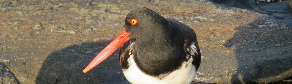
Prince Leopold Island Migratory Bird Sanctuary (N74o3’ W90o4’) is 307 km2 in the Parry Channel northeast of Somerset Island. Vertical cliffs rise 250 m above sea level, providing ledges where 200,000 pairs of seabirds nest. Seabirds protected are northern fulmer, Atlantic black-legged kittiwake, thick-billed murre, black guillemot. Also present are brant, eider, jaeger, raven, and snow bunting. It is an Important Bird and Biodiversity Area.
Quasuittuq National Park, Nunavut (N76o 0’ W100o0’), is 11,000 km2 on Bathurst Island, Helena Island (N76o20’ W100o3’), Vanier Island (N76o9’ W103o25’), Massey Island (N76o0’ W103o2’), Marc Island (N75o52’ W103o36’), and Alexander Island (N75o52’ W102o46’). The park protects habitat for endangered Peary caribou and muskoxen. It includes marine areas of May Inlet and Young Inlet. The park is cooperatively managed with the Qitiqtani Inuit Association. Adjoining the park on the south is the Polar Bear Pass National Wildlife Area.
Seymour Island Migratory Bird Sanctuary (N76o48’ W101o16’) is 5,302 ha 30 km north of Bathurst Island. On the island is an ivory gull breeding area. It is an Important Bird and Biodiversity Area.
Tallurutiup Imanga National Marine Conservation area is located in Lancaster Sound and includes the waters to the south of Devon and Cornwallis Island, the waters surrounding Griffith Island, and water to the north of Somerset Island. Beechey Island National Historic Site and Prince Leopold Island Migratory Bird Sanctuary are within the marine conservation area. The marine area protects narwhals and seabirds. Cape Liddon Important Bird Area (N74o40’ W91o10’) is on Devon Island adjacent to the marine conservation area. Vertical cliffs rise 300 m, providing nesting areas for northern fulmer, common eider, and black guillemot. Nearby Caswall Tower is a sea stack and also part of the IBA.
Other sites
The Advanced Modular Incoherent Scatter Radar (AMISR), a project of the National Science Foundation, is in Resolute (N74o42’ W94o50’) on Cornwallis Island. The science project is focused on studying global climate trends. Data collected from the atmosphere and ionosphere at polar latitudes provides an opportunity for early detection of climate change phenomena. At this latitude, coupling occurs between the solar wind and Earth’s magnetic field, atmosphere, and thermosphere. One radar points both north, deep into the polar ice cap, and a second points south. Both radars provide measurements of ionospheric parameters. AMISR also monitors space weather, which can potentially damage and disrupt power grids and satellite communications (www.amisr.com).
Cheyne Islands, Nunavut Territory (N76o20’ W97o30’) are 3 small islands off the eastern coast of Bathurst Island. These islands are an Important Bird Area for breeding Ross’ gull; and are one of only two known breeding areas.
North Kent Island (N76o40’ W90o6’) and Calf Island (N76o27’ W89o31’), Nunavut Territory, make up an Important Bird Area for black guillemot and common eider. He steep cliffs offer nesting areas. A nearby polynya attracts marine mammals.
Eastern Prince Patrick Island Coast, Northwest Territories (N76o W119o) is an Important Bird Area and includes the lowlands at Wooley Bay, Walker Inlet, Mould Bay, Green Bay, and Intrepid Inlet, along with Eglinton Island. A large percentage of the population of the West Arctic Brant uses this area.
Washington Point-Baille Hamilton Island, Nunavut Territory (N75°50’ W94°20’) has 200-m coastal cliffs offering nesting sites for black-legged killiwake, glaucus gull, and black guillemot.
Middle Arctic tundra ecoregion
National Site
Aulavik National Park, Northwest Territories, is 12,274 km2 on Banks Island and home to muskoxen and Peary caribou. The park includes Thomsen River, the northernmost navigable river by canoe. Habitats are a broad valley and low hills with deeply cut badlands. Dwarf willows and wet sedge meadows are along the river. The Thomsen River and surroundings are part of the Banks Island Migratory Bird Sanctuary, an Important Bird Area for molting lesser snow geese and black brant. In the park, Mercy Bay (N74o4’ W119o0’) is the resting place of the wreck HMS Investigation, which was trapped in ice in 1851.
Other sites:
Creswell Bay, Nunavut Territory (N72o40’ W93o20’) is a large bay with mudflats on Somerset Island and an Important Bird Area for breeding shorebirds such as white-rumped sandpiper, red phalarope, black-bellied plover,and sanderling. Also, snow geese and king eider are present.
Reference
Pringle, Heather. 2019. Uncovering an Arctic Mystery. National Geographic 236(3):100-103.