Arctomys Cave, Burgess Shale, and Spiral Tunnels
The southern parts of this ecoregion in Montana and along the US-Canadian border were included in an earlier post. This focus is north of the 50th parallel. The western slopes of the Rocky Mountains from the Fraser River headwaters to the Cariboo, Monashee, Selkirk, and Purcell Mountains are included in this ecoregion. The Columbia River begins south of Kootenay National Park and flows north, then completes a U-turn and heads south, all in this ecoregion. Major features are Glacier, Kootenay, and Yoho National Parks of Canada. The ecoregion continues south into Montana including the U.S.’s Glacier National Park, which was the subject of an earlier post. Sites are classified according to the mountain range in which they are found.
· Continental Divide ranges extend along the Alberta-British Columbia border and include the High Rock, Kootney, Mitchell, Opell, and Livingstone Ranges, bordered on the west by the Rocky Mountain Trench. This includes the upper Columbia and Fraser Rivers.
· Purcell Ranges are between the Rocky Mountain Trench and the Kootenay Lake trench, including the Duncan River. Bugaboo Provincial Park and Purcell Wilderness Conservancy are in this area.
· Selkirk Ranges are between Kootenay Lake and the south-flowing Columbia River, including the Upper and Lower Arrow Lakes. Major features are Glacier and Mount Revelstoke National Parks, Goat Range Provincial Park.
· Monashee Ranges are west of the Columbia River and extend to the North Thompson River.
· Cariboo Ranges are north of the North Thompson River and west of the Fraser River. Major features are the Wells-Gray, Cariboo Mountains, and Bowron Lakes Provincial Parks.
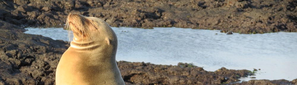
Coniferous forest is the dominant vegetation, and it benefits from Pacific moisture. Hemlock, yew, larch, and western red cedar, lodgepole pine, and Douglas-fir are common. There are many remnant old growth forests as noted in the site descriptions. In addition to coniferous forest, mountain meadows and low elevation foothill grasslands are found. Glaciers are noted in site descriptions in this northern area. Large carnivores such as the wolf and grizzly, as well as caribou, mountain goat and waterfowl use the intact forests, which are interrupted by only a few road corridors.
World Heritage Site
The World Heritage Site in this section of the North-Central Rockies forests is the Canadian Rocky Mountain Parks. It consists of seven parks chosen for classic illustrations of glacial geologic processes—icefields, remnant valley glaciers, canyons, alpine meadows, lakes, and waterfalls. Six of the seven parks in this designation are all or partially in the North-Central Rockies forests ecoregion: Mount Assiniboine, Banff, Hamber, Kootenay, Mount Robson, and Yoho. In addition, there are six national historic sites within these parks and therefore within the boundaries of the world heritage site.
Mount Assiniboine Provincial Park, British Columbia, is known as the Matterhorn of the Canadian Rockies. The park is accessible only on foot from the end of a gravel road from Banff to Sunshine Valley or from the Spray River south of Canmore in British Columbia. Included in the park are Mount Assiniboine Lodge (1928) and the Magog Lake Fossil Beds (N50˚54’ W115˚38’), Mount Assiniboine (N50˚52’ W115˚39’), and Sunshine Meadows (N51˚4’ W115˚47’), the largest alpine meadow in the Canadian Rockies.
Athabasca Pass National Historic Site, Alberta-British Columbia (N52˚23’ W118˚11’), commemorates the major fur transportation route traversed by early adventurers in the early 1800s. The first white man to cross the Rockies, David Thompson, used the pass in 1811, and it was a fur trade route to the Oregon territory for the next 50 years afterward. The site is accessed from Jasper National Park via the 7-km-long road to Moab Lake south of Route 93A, then by trail for 49 km along the Whirlpool River, a three-day hike.
Banff National Park, Alberta, is primarily in the Alberta Mountain forests ecoregion; however, the Bow River Valley from Banff downstream to the park boundary is within the North Central Rockies forests ecoregion. The Rocky Mountain Legacy Bike Trail extends from west of Banff (N51˚10’ W115˚40’) downstream to Canmore (N51˚5’ W115˚21’), outside of the park. There are two National Historic Sites in the North Central Rockies forests ecoregion of Banff National Park. Banff Springs Hotel National Historic Site (N51˚10’ W115˚34’) was built between 1911 and 1928 by the Canadian Pacific Railroad and is still operated today. Banff Park Museum National Historic Site (N51˚11’ W115˚35’) is a natural history museum housed in a 1903 log building.
Hamber Provincial Park, British Columbia (N52˚22’ W117˚46’) is a 24,000-ha wilderness park accessed by a 22-km-long trail from Sunwapta Falls in Jasper National Park. At the end of the hike along the Athabasca River is Fortress Lake. Vegetation includes spruce, balsam, and rhododendron.
Kootenay National Park, British Columbia, extends from semi-arid grasslands of the Rocky Mountain trench to the glaciers of the Canadian Rockies, and is along Route 93 between Radium Hot Springs and Banff. The northernmost point is in the Tokumm Creek headwaters (N51°19’ W116°17’) and the southernmost point is east of Invermere on Stoddart Creek (N50°35’ W115°57’). The visitor center is in Radium Hot Springs. At the west gate of the park is Sinclair Canyon and the Redwall Fault, a deep canyon just outside of Radium Hot Springs on Route 93. To the east, Radium Hot Springs (N50°38’ W116°2’) are the largest hot springs pool in Canada. Restoration Area (N50°37’ W116°3’), located at the Redstreak Campground at Radium Hot Springs, is viewed from an interpretive loop trail which discusses the role of prescribed fire.
The Paint Pots (N51°10’ W116°9’) were a location used by the Ktunaxa people for the collection of ochre for ceremonies and trade. A trail accesses the site from Route 93. The Rockwall (N51°6’ W116°12’) is a vertical limestone wall that stretches for 55 km along the northwestern boundary of the park. Across from the Marble Campground, Marble Canyon (N51°11’ W116°8’) is the deep gorge of Tokumm Creek upstream of its confluence with the Vermillion River. A trail provides numerous scenic overlooks. The hike to Stanley Glacier (N51°12’ W116°5’) is 10 km round trip and includes waterfalls as well as Burgess Shale fossils at the base of Mount Stanley.
Mount Robson Provincial Park, British Columbia, is 275,800 ha including Mount Robson, the highest point in the Canadian Rockies at 3,954 m. The park protects the headwaters of the Fraser River, the deepest cave in North America north of Mexico, 530-m-deep Arctomys Cave (N53°4’ W118°54’), Precambrian fossils of the earliest life with hard shells, and 800-year-old whitebark pines. The westernmost point is in the Swiftcurrent Creek watershed (N53°3’ W119°26’), the northernmost point is Whiteshield Mountain (N53°18’ W119°21’), and the southeasternmost point is at Fraser Pass (N52°31’ W118°19’). The Ramparts formation is along the eastern border of the park, separating it from Jasper National Park. Park facilities are along Route 16 which extends from Yellowhead Pass west across the park, following the Fraser River. From the Visitor Center (N53°2’ W119°14’), Berg Lake (N53°9’ W119°10’) is accessible by a 22-km hike through the Valley of a Thousand Falls. A short 1.5-km walk along the Fraser River from the Visitor Center leads to Overlander Falls. From Yellowhead Lake (N 52°52’ W118°32’), the Mount Fitzwilliam Trail leads to alpine lakes in a 14-km hike.
Yellowhead Pass National Historic Site, Alberta-British Columbia (N52˚53’ W118˚27’) is on Route 16 in Mount Robson Provincial Park. This major highway and rail crossing was also an early fur trade route across the Rockies from the 1820s to the 1850s.
Yoho National Park, British Columbia is 1,300 km2 and is known for its towering rock walls, waterfalls, and paleontology. Kootenay National Park is to the south and Banff National Park is to the east. The Burgess Shale Fossil Beds (N51°26’ W116°29’) are between Mount Field and Wapta Mountain north of Field and accessible only by a guided tour. Between 520 and 530 million years ago, hard-bodied animals first entered the fossil record. We know that because of the fossils found in Yoho National Park at the Burgess Shale. This fossil deposit is the best record of the diversity of life that first appeared in the Cambrian explosion. Many of the fossils are believed to be arthropods, although there is a chordate and many other fossils are as yet unclassifiable into phyla, or represent phyla that no longer exist. Burgess shale fossils may also be seen on the Mount Stephens guided hike, which leaves from the visitor center in Field.
Emerald Lake (N51°27’ W116°32’) is a scenic alpine lake at the end of the Emerald Lake Road, which begins south of Field. Kicking Horse River Canadian Heritage River consists of the 49 km within Yoho National Park from Wapta Lake (N51°26’ W116°21’) downstream to the park boundary (N51°14’ W116°39’) as well as 18.5 km of the tributary Yoho River from its headwaters near Twin Falls to confluence with the Kicking Horse River (N51°35’ W116°31’).
Lake O’Hara (N51°21’ W116°20’) is a hiking area accessible by bus leaving from the Wapta Lake parking lot 13 km east of Field. The area is noted for its hanging valleys and extensive trail network, with 34 maintained trails. A lodge and campground are at the lake.
Natural Bridge (N51°23’ W116°32’) is across the Kicking Horse River southwest of Field. Wapta Falls (N51°11’ W116°35’) is on the Kicking Horse River south of Field and is 30 m high by 150 m wide, accessible by a 2.3-km trail. From the Yoho Valley Road, trails lead to Takkakaw Falls (N51°31’ W116°29’), 254 m in height, Laughing Falls on the Little Yoho River, and Twin Falls.
There are two national historic sites within Yoho National Park:
Kicking Horse Pass National Historic Site (N51°27’ W116°17’) commemorates the completion of the first railroad across Canada in 1885, unifying the country. It is the highest point on the Canadian Pacific Railway, at 5,538 feet. The historic site also includes the Spiral Tunnels (N51°26’ W116°25’), visible from a viewpoint and hiking trails leaving Route 1 between Field and Kicking Horse Pass. These switchbacks were completed in 1909 to relieve the steep grade to Kicking Horse Pass. An eastbound train first spirals to the left in a tunnel for 891 m, exiting 15 m higher and then crossing the river. On the south side of the river, it spirals 991 m inside the mountain and exits 17 m higher.
Twin Falls Tea House National Historic Site (N51°33’ W116°32’) overlooks the spectacular twin falls in Yoho National Park. Constructed between 1908 and 1928, it is an example of the Rustic Design Tradition utilized in early national park architecture and is also recognized for its role in recreation and tourism in Canada. The site is at the end of an 8.5-km one-way hike from the Takkakaw Falls trailhead on Yoho Valley Road. There are rooms available for rent.
Ramsar Site
The Ramsar Site (Wetlands of International Importance) in the North Central Rocky Mountain forests is in the Rocky Mountain trench. The Columbia Wetlands Ramsar site consists of the Columbia National Wildlife Area and Columbia Wildlife Management Area, British Columbia. These properties are within a 180-km-long area in the Rocky Mountain trench from Fairmont Hot Springs (N50°20’ W115°53’) north to Mica Reservoir (N51°30’ W117°9’). It is a key site on the Pacific Flyway. Wetlands along the Columbia River provide habitat for waterfowl such as ducks and swans. The Ramsar site includes the 17,000-ha Columbia Wildlife Management Area and Burges James Gadsden Provincial Park (N51°24’ W117°3’), a 400-ha area that includes the Moberly Marsh, is on Route 1 (Trans-Canada Highway) north of Golden. It also includes four Canadian Wildlife Service properties which constitute the national wildlife area. These are at Harrogate (N50°57’ W116°24’), Spillamacheen (N50°54’ W116°23’), Brisco (N50°49’ W116°17’), and Wilmer Marsh (N50°33’ W116°4’), all along Route 95 between Windermere and Golden.
Other National Sites
Nationally designated lands in the North-Central Rocky Mountain forests include Kootenay and Yoho National Parks, described above under World Heritage Sites.
Barkerville National Historic Site (53°4’ W121°31’), is a 457-ha property heritage property and park owned by the Province of British Columbia and managed by the Barkerville Heritage Trust in the Cariboo Mountains. In 1862, the town was the site of the largest creek-side placer gold deposit ever discovered. Today, it is the largest living history museum in western North America, with 125 heritage buildings. Even today, the site is remote, reached deep in the Cariboo Mountains at the end of Route 26 about 85 km east of Quesnel.
Glacier National Park, British Columbia, is 1,350 km2 on the Trans-Canada Highway between Mount Revelstoke and Yoho National Parks in the Selkirk Mountains. It includes Rogers Pass National Historic Site, described separately. The northwestern-most point is in the Mountain Creek watershed (N51˚28’ W117˚53’), the easternmost point is on Grizzly Creek (N51˚20’ W117˚12’), the southeastern-most point is at the Beaver River headwaters (N51˚4’ W117˚16’), and the southwestern-most point is on the Incomappleux River (N51˚6’ W117˚36’). The park features a hemlock-cedar rainforest at Hemlock Grove on the Illecillewaet River (N51˚15’ W117˚40’), Glacier House (N51˚17’ W117˚31’), a Victorian-era hotel site, and Rogers Pass visitor center. From Glacier House, trails lead to the foot of glacier and to alpine meadows. An old growth forest is along the Beaver River.
Kootenae House National Historic Site, British Columbia (N50°32’ W116°3’) is at the confluence of Toby Creek and the Columbia River between Invermere and Wilmer in the Rocky Mountain trench. The site of a fur trading post established by David Thompson in 1806 is interpreted. The post facilitated trade with the Ktunaxa people and served as a base of exploration of the northwestern Rocky Mountains.
Mount Revelstoke National Park, British Columbia, is 260 km2 on the Trans-Canada Highway (Route 1) in the Selkirk Mountains. The approximate boundaries are Revelstoke in the southwest (N51˚0’ W118˚12’), Illecillewaet River in the east (N51˚7’ W117˚53’), and Maunder Creek in the north (N51˚11’ W117˚59’). The major features are the 2,000-m climb by road or trail to Mount Revelstoke (N51˚3’ W118˚9’) and an old growth cedar and hemlock rainforest along the Illecillewaet River in the eastern portions of the park (N51˚5’ W117˚55’). Large skunk cabbage plants are along the trails in the rainforest. The 26-km roadway to the 1,835-meter Mount Revelstoke is known as the Meadows in the Sky Parkway.
Rogers Pass National Historic Site, British Columbia (N51˚17’ W117˚31’) is on the Trans-Canada Highway in Glacier National Park of Canada and includes early railroad history sites, including the Glacier House Hotel site. The site commemorates the completion of the first trans-continental rail link across Canada. The pass was discovered in 1881 as part of an effort to survey alternative rail lines across Canada. When chosen as the preferred railroad route, Canadian Pacific needed to use new technologies to cope with a 12-m annual snowfall and avalanche danger. A system of sheds was built along the route. Completion of a railroad fulfilled the Canadian confederation’s promise to connect British Columbia with the rest of the provinces. In 1917, the railroad over the pass was replaced by a tunnel. A visitor center and trails interpret the historic sites.
to be continued