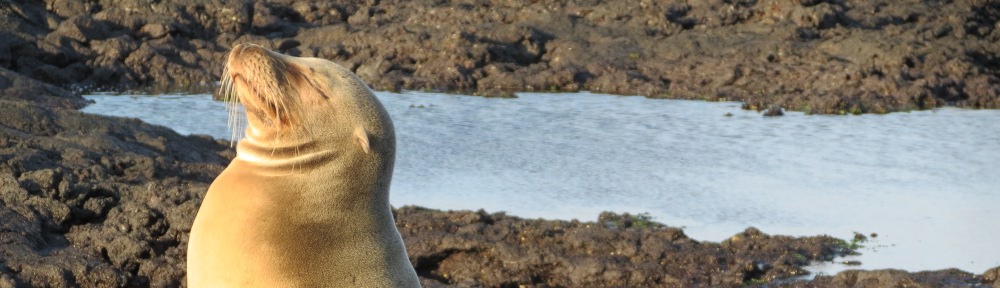
This ecoregion includes the Rocky Mountain trench, the Hart Range, Muskwa Range, Omineca Mountains, and Skeena Mountains. At low elevations, western red cedar, western hemlock, lodgepole pine, quaking aspen, white spruce, and black spruce are present. At higher elevations, Engelmann spruce and alpine fir are characteristic of the ecoregion. Animals include woodland caribou, elk, moose, black-tailed deer, black bear, and grizzly. There are large wetlands in valleys near the Hart Range. There is no shortage of mountain and glacial scenery, with a river gorge at Fort George Canyon and 50-km-long Mackinnon Esker. Limestone caves and fossils are common in the Hart Range, including one of the deepest caves in the world. At Wapiti Lakes is the most important site for Triassic marine reptile fossils in the world. Middle River is an Important Bird Area for trumpeter swans. Early trading posts are preserved at Fort McLeod and Fort St. James. An historic portage between the Pacific and Arctic watersheds is at Giscome. In the Rocky Mountain trench is Williston Lake of BC Hydro, backed up by a dam (N56⁰1’ W122⁰12’) on the Peace River, creating the third largest artificial lake in North America.
Geopark
Tumbler Ridge Global Geopark, British Columbia, is 782,200 ha along the former edge of the Western Interior Seaway. The site, administered by the Tumbler Ridge Museum, includes Cretaceous-age dinosaur tracks and dinosaur bone beds, waterfalls, caves, and canyons. The park includes Bearhole Lake Provincial Park (Alberta-British Columbia Foothills Forests ecoregion), Gwillim Lake Provincial Park, Monkman Provincial Park, Wapiti Lake Provincial Park, and additional public lands. The westernmost point is Mount Palsson (N55°6’ W121°48’), the northernmost point is near Skunk Falls (N55°23’ W120°56’), the southernmost point is at Mount Bully Glacier Peak (N54°27’ W120°56’), and the easternmost point is the Alberta border between Mistanusk Creek (N54°35’ W120°0’) and Windsor Creek (N55°7’ W120°0’). There are 22 trails to mountain summits, caves, canyons, waterfalls, and dinosaur trackways. Visitor sites outside the provincial parks include Quality Canyon (N55°11’ W120°57’), Teepee Falls (N55°19’ W120°56’), Bergeron Falls (N55°13’ W120°58’), Flatbed Falls and Cabin Pool dinosaur tracks (N55°6’ W120°58’), Boulder Gardens and Babcock Falls (N54°55’ W120°57’), Nesbitt’s Knee Falls and Barbour Falls (N54°57’ W121°7’), Wapiti Falls (N54°37’ W120°38’), and Red Deer Falls (N54°30’ W120°38’). All coordinates are approximate.
Gwillim Lake Provincial Park, British Columbia (N55°25’ W121°15’), is 32,326 ha in size and accessed via Route 29 about 60 km south of Chetwynd. Lakeside recreation, canoeing, and hiking opportunities are offered. The park extends from the Murray River in the north to Mount Merkle in the south. Vegetation is white spruce, aspen, and lodgepole pine. It is part of the Tumbler Ridge Global Geopark.
Monkman Provincial Park, British Columbia, is 62,867 ha on the Murray River and Monkman Creek. It is reached by the Murray River Road, which ends at the park 60 km south of Tumbler Ridge. The park has alpine meadows, old growth spruce, mountain peaks, fossil beds, and waterfalls. There are nine consecutive waterfalls on Monkman Creek (N54°41’ W121°9’) downstream of Monkman Lake. In addition, Canary Falls, Stone Corral karst area, and 60-m-tall Kinuseo Falls (N54°46’ W121°12’) are within the park. From the road end, the 63-km-long Monkman Pass Memorial trail crosses the Rockies and can be hiked in five to six days. It is part of the Tumbler Ridge Global Geopark.
Wapiti Lake Provincial Park, British Columbia (N54°32’ W120°46’), is 16,809 ha in size and includes the watershed of the upper Wapiti River on the east side of the Rockies. Access is via Ojay Road, then by a 14-km hike from the trailhead to the park boundary, passing Wapiti Falls. The Wapiti Onion Trail continues into the park, passing Wapiti Lake at 19 km and contining to Onion Lake at 30 km. Onion Lake is in an alpine setting. It is part of the Tumbler Ridge Global Geopark and is known as the world’s most important site for Triassic marine reptile fossils (Mikkelsen 2007).
National Sites
Fort McLeod National Historic Site (N55⁰0’ W123⁰2’) was the first trading post west of the Rocky Mountains, dating to 1805. It is off Route 97 south of Mackenzie.
Fort St. James National Historic Site (N54°26’ 124°15’) is on the eastern shore of Stuart Lake. The historic park contains a large group of original wooden buildings from a Hudson’s Bay Company trading post. The site was a center of the fur trade in the 19th century.
Other state and local sites
Aleza Lake Ecological Reserve (N54°5’ W122°6’) is 240 ha on a former glacial lake bed between the Fraser and Bowron Rivers off old Route 16. Forests are of white spruce and a number of small bogs are included within the boundaries.
Arctic Pacific Lakes Provincial Park (N54⁰23’ W121⁰33’) is 13,887 ha about 90 km northeast of Prince George. There are three small lakes straddling the Continental Divide, with Arctic Lake draining to the Parsnip River, and Pacific and Portage Lakes draining to the Fraser River.
Babine Lake Marine Provincial Park consists of six sites totaling 334 ha. All provide boat anchoring and scenic lakeshore views for exploring the large remote lake west of Fort St. James. From southeast to northwest, these sites are Pinkut Creek (N54⁰27’ W125⁰27’), Pendleton Bay (N54⁰31’ W125⁰42’) on the Babine Forest Service Road, Hook Bay (N54⁰34’ W125⁰42’) on the east side of the lake, Pierre Creek (N54⁰38’ W125⁰51’), Sandpoint (N54⁰41’W125⁰53’), and Smithers Landing (N55⁰4’ W126⁰32’).
Bednesti Lake Ecological Reserve (N53⁰52’ W123⁰27’) is 139 ha surrounding a disjunct larch stand. There are two small boggy lakes and floating mats of sedge.
Bijoux Falls Provincial Park is a 40-ha day use area on the Misinchinka River, 44 km north of McLeod Lake on Route 97.
Blackwater Creek Ecological Reserve (N55⁰34’ W123⁰39’) is 243 ha, 43 km northwest of Mackenzie. The area is a sub-boreal forest and bogland on an outwash plain west of Williston Lake.
Mount Blanchet Provincial Park (N55⁰17’ W125⁰52’) is a 24,774-ha tract on Takla Lake, bordering the lake and its Northwest Arm. The park is spring range for caribou and mountain goat.
Bocock Peak Provincial Park (N55⁰52’ W122⁰55’) is 1,143 ha on the Continental Divide and Eleven Mile Creek, 70 km west of Hudson’s Hope. There are three caves in the park, one of which is 253 m deep and the 9th deepest in Canada.
Butler Ridge Provincial Park (N56⁰10’ W122⁰17’) is 6,024 ha on Williston Lake. A 15-km-long hiking trail follows Butler Ridge. Access is via Forest Service Road.
Carp Lake Provincial Park is 38,149 ha, 32 km west of McLeod Lake via a gravel road. The park is known for rainbow trout rather than carp. An 8-km waterway for canoeing or power boating connects War Lake to Carp Lake. Trails lead to Rainbow Lake and War Falls. The south end of the park is along the Muskeg River (N54⁰38’ W123⁰23’) and the north end is at War Falls (N54⁰52’ W123⁰15’).
Chase Provincial Park is 36,226 ha, 70 km north of Germansen Landing. The park protects a caribou herd and contains mixed boreal forest in the Tomias Lake (N56⁰34’ W125⁰3’) and Carina Lake (N56⁰30’ W124⁰59’) areas. The southern boundary is along he Meslinka River (N56⁰23’ W125⁰2’).
Chunamon Creek Ecological Reserve (N56⁰13’ W124⁰27’) is 344 ha of white spruce and Engelmann spruce-subalpine fir in the Butler Range, overlooking Williston Lake.
Close-to-the-Edge Provincial Park and Protected Area (N54⁰4’ W121⁰2’) is 702 ha in the Dezaiko Range, 160 km east of Prince George. Close-to-the-Edge Cave is one of the 50 deepest in the world, with the deepest shaft (255 m) and third deepest (472 m) overall cave in Canada. Other caves in the park are Twin Falls Resurgence and Bluebell.
Mount Blanchet Provincial Park (N55⁰17’ W125⁰52’) is a 24,774-ha tract on Takla Lake, bordering the lake and its Northwest Arm. The park is spring range for caribou and mountain goat. The northern portion of the park along the western shore of Takla Lake is in the Central British Columbia Mountain Forests ecoregion and the southern portion is in the Fraser Plateau and Basin ecoregion. In addition to Mount Blanchet, Boling Peak and Spite Peak are included.
Cinema Bog Ecological Reserve (N53⁰15’ W122⁰26’) is a 68-ha raised bog surrounded by a black spruce forest. Many plants in the bog are at the southern limit of their distribution. The bog is adjacent to Route 97 about 28 km north of Quesnel.
Cottonwood House Provincial Historic Site, British Columbia (N53°3’ W122°9’), is 12 ha on Route 26 about 26 km east of Quesnel. The site is one of the last remaining roadhouses in British Columbia, built in 1864 to serve the gold rush traffic to Barkerville. It is managed by the Barkerville Heritage Trust. There are a number of heritage buildings, a living history farm, four trails, and accommodations.
Cottonwood River Provincial Park (N53⁰10’ W122⁰29’) is 66 ha north of Quesnel. Facilities were destroyed in a flood and not rebuilt.
Crooked River Provincial Park (N54⁰29’ W122⁰41’) is 963 ha with four lakes,70 km north of Prince George on Route 97. Livingstone Springs on the Crooked River provides winter habitat for trumpeter swan. Bear Lake is beach-fringed. The former sand dune complex is forested with white spruce, lodgepole pine, and other boreal trees. There are trails leading to Square Lake along willow-lined Crooked River. Other lakes are Hart Lake and Skeleton Lake.
Dahl Lake Provincial Park (N53⁰47’ W123⁰18’) is a 1,583-ha day-use park 40 km southwest of Prince George.
Eskers Provincial Park (N54⁰4’ W123⁰10’) is 4,044 ha of aspen and lodgepole pine forests with 15 km of trails about 40 km northwest of Prince George. The trails access the 40-km-long Stuart River Eskers complex, a series of long, sinuous gravel ridges.
Evanoff Provincial Park (N54⁰5’ W121⁰20’) is 1,473 ha of limestone pinnacles and major caves 121 km east of Prince George. Fang Cave is the 9th largest in Canada, extending for 2,845 m. Other caves are Tooth Decave and Window on the West. Also present are alpine lakes and glacial features. Trails lead to the cave entrances.
Fraser River Provincial Park (N53⁰28’ W122⁰45’) is a 4,900-ha wilderness preserve on the west side of the Fraser River about 35 km south of Prince George. The park includes the Jacks Creek watershed and protects a sub-boreal spruce forest.
Fort George Canyon Provincial Park (N53⁰41’ W122⁰43’), is 178 ha accessible via a 5-km hiking trail from West Lake Road (N53⁰41’ W122⁰48’), 24 km from Prince George. The park is on the Fraser River, and the trail overlook provides views of a canyon with whirlpools, jagged rocks, and islands. These features presented a formidable obstacle to paddlewheel boats on the otherwise tranquil Fraser River. At this point in the early 1900s, passengers disembarked and portaged while the boat was winched through the narrow canyon.
Giscome Portage Trail Protected Area (N54⁰15’ W122⁰35’) is a 160-ha linear park following an 8.5-km trail between the Pacific and Arctic watersheds, used as a portage by First Nations and later by miners during the gold rush. It is 40 km north of Prince George on Route 97. Adjacent is the Giscome Portage Regional Park on the Fraser River, managed by the Regional District of Fraser-St. George and containing the Huble Homestead.
Graham-Laurier Provincial Park is 99,982 ha accessible on foot from the Halfway Graham Forest Service Road, 145 km northwest of Fort St. John. A 22-km trail along the Graham River leads to Christina Falls (N56⁰33’W123⁰6’) at the eastern boundary. Another trail follows Needham Creek to the south of the park (N56⁰26’ W123⁰3’). and Horn Creeks. Lady Laurier Lake (N56⁰42’W123⁰45’) is a scenic alpine lake in the west of the park. In the southeast of the park is an old growth black and white spruce forest near the Graham River (N56⁰28’ W122⁰54’). Elsewhere is Engelmann spruce and subalpine fir. In the north of the park, Mount Laurier (N56⁰47’ W123⁰29’) is in the Northern Cordillera forests ecoregion.
Heather-Dina Lakes Provincial Park is 5,786 ha on Williston Lake at Cut Thumb Creek, 25 km north of Mackenzie on Parsnip West Forest Service Road. The park features are Healther Lake (N55⁰30’ W123⁰15’) and Dina Lakes (N55⁰31’ W123⁰18’), the latter of which include five small lakes which can be toured by canoe circuit. Trails are also available.
Heather Lake Ecological Reserve (N55⁰31’ W123⁰15’) is 284 ha protecting a trembling aspen stand and white spruce on a productive site.
Hole-in-the-Wall Provincial Park (N55⁰9’ W121⁰51’) is 137 ha on the Sukunka River, 45 km south of Chetwynd. The major feature is a spring emerging from a limestone rock wall.
Kakwa Provincial Park is 170,890 ha in size, at the junction of three ecoregions (Alberta Mountain forests, Central British Columbia Mountain forests, and North Central Rockies forests) 70 km north of McBride. Access is by foot from the end of Walker Creek Forest Service Road, 85 km from Route 16. A continuous chain of national and provincial parks begins at Kakwa and extends southward to Don Getty Wildland Provincial Park in Alberta. The park is also the northern terminus of the Great Divide Trail, which extends 1,200 km south to Waterton Lakes National Park and continues in the United States as the Continental Divide National Scenic Trail to Mexico. The park includes two peaks over 10,000 feet, Narraway waterfall, caves, Triassic fish fossils, and dinosaur track sites. Forests are sub-boreal. The headquarters is at Kakwa Lake (N54⁰0’ W120⁰11’). The northern extent is along the Narraway River (N54⁰16’ W120⁰15’), the western extent is at McGregor River at Jarvis Creek (N53⁰59’ W120⁰42’), and the southeastern extent is at Intersection Mountain (N53⁰49’ W120⁰0’).
Klin-se-za Provincial Park (N55⁰48’ W122⁰34’) is 2,740 ha of rugged topography southwest of Hudson’s Hope, off Johnson Creek Forest Service Road.
Mackinnon Esker Ecological Reserve (N54⁰50’ W123⁰34’) is 545 ha 38 km southwest of McLeod Lake. A segment of the esker is over 50 km long, the longest in the province. It is 150 m wide. Other glacial features in the park are drumlins and kettle holes. Forests are of lodgepole pine and blueberry.
Middle River upstream of Trembleur Lake (N55⁰0’ W125⁰23’ downstream to N54⁰52’ W125⁰8’) is part of the Stuart, Tachie, and Middle Rivers Important Bird Area and Key Biodiversity Area for wintering trumpeter swans. The IBA includes a 30-km river reach.
Moscovite Lakes Provincial Park (N55⁰59’ W124⁰8’) is a 5,708-ha tract on the western edge of Williston Lake, 135 km north of McKenzie on the Finley Forest Service Road from McLeod Lake. The park consists of sub-boreal spruce forests and contains kettle lakes that are fish-free.
Mudzenchoot Provincial Park (N55⁰2’ W124⁰27’) is 644 ha, 90 km west of Fort St. James. Features are high elevation grasslands and shrub meadows with Engelmann spruce and subalpine fir forests. The park hosts a rare sedge and Jacob’s ladder (Polemonium).
Nation Lakes Provincial Park consists of 19,398 ha. Tsayta Lake (N55⁰27’ W125⁰27’) and Indata Lake (N55⁰20’ W125⁰15’) are within the park. Park sites on Tchentlo Lake are Progress Point (N55⁰11’ W125⁰6’) and Ahdatay Creek (N55⁰13’W125⁰51’). Park sites on Chuchi Lake are Jean Marie Creek (N55⁰10’ W124⁰40’) and Indian Point (N55⁰11’ W124⁰27’).
Nechako River Ecological Reserve (N53⁰56’ W123⁰14’) is 133 ha about 30 km west of Prince George. The site protects the most vigorous larch stands west of the Rocky Mountains.
Omineca Provincial Park and Protected Area (N55⁰54’ W124⁰22’) is 135,000 ha in the Wolverine Range. The park includes the Omineca River upstream from its confluence in Williston Lake. The park provides important caribou and mountain goat habitat.
Ospika Cones Ecological Reserve (N57⁰1’ W124⁰15’) is 1,282 ha featuring a cold-water tufa terrace and pools. The limestone mineral formations on the Ospika River are surrounded by sedge fens. Access is by air only.
Paarens Beach Provincial Park (N54⁰25’ W124⁰23’) is a camping park on the south shore of Stuart Lake about 11 km west of Fort St. James.
Patsuk Creek Ecological Reserve (N55⁰38’ W123⁰23’) is 554 ha, 38 km northwest of Mackenzie. The area is a paper birch forest. Mountain bladder fern is associated with blue clay soils.
Pine-Le Moray Provincial Park is 43,245 ha 50 km northeast of McLeod Lake on the Continental Divide at Route 97. The park includes Pine Pass (N55⁰25’ W122⁰39’) and Mount Le Moray (N55⁰29’ W122⁰39’). The Hart Ranges are known for karst topography. There are also alpine areas and Engelmann spruce forests. Major streams are Link Creek, Mountain Creek, and the Pine River. The northern extent is on the Pine River (N55⁰31’ W122⁰44’) and the southern extent is near Milborn Peak (N55⁰15’ W122⁰23’).
Pinnacles Provincial Park (N52⁰59’ W122⁰34’) is 8 km west of Quesnel. The park features a one-km trail to unique hoodoos overlooking Baker Creek.
Mount Pope Provincial Park (N54⁰29’ W124⁰20’) is a 2,030-ha day use park. A 6-km trail leads to Mount Pope, a 1,472-m isolated peak with a view of the Omineca Mountains.
Purden Lake Provincial Park (N53°55’ W121°55’) is 2,520 ha on Route 16 about 60 km east of Prince George. There is a lake, campground, and forests of white spruce and lodgepole pine.
Raspberry Harbour Ecological Reserve (N56⁰6’ W124⁰15’) is 143 ha, 144 km west of Hudson’s Hope, between Omineca and Finley Reaches of Willliston Lake. Lodgepole pine and bog are found, as is sub-boreal spruce at its northern limit. The trees are noted as being unusually tall.
Rubyrock Lake Provincial Park (N54⁰40’ W125⁰23’) encompasses 41,221 ha about 70 km northwest of Fort St. James. Vegetation is mostly sub-boreal spruce forest with Douglas-fir on the shorelines of Trembleur (N54⁰46’ W125⁰24’), Cunningham (N54⁰36’ W125⁰21’), and Stuart (N54⁰37’ W125⁰4’) Lakes.
Sochea Bay Provincial Park (N54⁰25’ W124⁰27’) is a 13-ha camping park on the south shore of Stuart Lake about 20 km west of Fort St. James.
Stuart Lake Marine Provincial Park includes three sites intended to be part of the 300-km Stuart-Trembleur-Takla Lake wilderness boatway. These are the 70-ha Jus K’etl’o Bay site (N54⁰39 W125⁰0’), the 23-ha North Arm site (N54⁰40’W125⁰9’), and the 134-ha Two Islands site (N54⁰36’ W124⁰38’).
Stuart Lake Provincial Park (N54⁰38’ W124⁰39’) is 32-ha on the east shore of Stuart Lake.
Stuart River Provincial Park is 20,984 ha in two tracts encompassing 83 km of the river corridor. The 40-km upstream section (upper end N54⁰20’ W124⁰15’; lower end N54⁰11’ W123⁰43’) is part of the Stuart, Tachie, and Middle Rivers Important Bird Area and Key Biodiversity Area for wintering trumpeter swan. The downstream section (lower end N53⁰59’ W123⁰33’; upper end N 54⁰9’ W123⁰31’) is not part of the IBA.
Sukunka Falls Provincial Park (N55⁰20’ W121⁰43’) is 360 ha encompassing three sets of waterfalls on the Sukunka River at the confluence with the Burnt River, south of Chetwynd. White spruce forests are present.
Sutherland River Provincial Park and Protected Area encompasses 18,394 ha 30 km west of Fort St. James. Included are Babine Lake (N54⁰29’ W125⁰22’) and Tetzalto Mountain (N54⁰29’ W125⁰0’), a hiking destination. The protected area is further to the south (N54⁰19’ W124⁰47’).
Tacheeda Lakes Ecological Reserve (N54⁰40’ W122⁰31’) is 526 ha of Douglas-fir at the northern limit of the species for this longitude. Other transitional mature forests are of sub-boreal spruce, Engelmann spruce, and subalpine fir.
Tachie River between Trembleur Lake (N54⁰49’ W124⁰57’) and Stuart Lake (N54⁰39’ W124⁰47’) is a 20-km river corridor portion of the Stuart, Tachie, and Middle Rivers Important Bird Area and Key Biodiversity Area for wintering trumpeter swans.
Takla Lake Ecological Reserve (N55⁰20’ W125⁰48’) is a 240-ha tract surrounded by Mount Blanchet Provincial Park. It contains the most northerly stand of Douglas-fir.
Takla Lake Marine Provincial Park consists of three sites on Takla Lake, intended to be part of the 300-km Stuart-Trembleur-Takla Lake wilderness boatway. The Sandy Point site (N55⁰8’ W125⁰40’) is 550 ha overlooking the lake. The 31-ha Takla West site (N55⁰34’ W126⁰7’) and the 349-ha White Bluff site (N55⁰32’ W126⁰1’) are further up the lake. Takla Lake is the upper lake in the chain, drained by the 22-km Middle river which empties into Trembleur Lake.
Ten Mile Lake Provincial Park (N53⁰4’ W122⁰26’) is a 343-ha park on Route 97. There are 10 km of trails leading past a series of beaver dams within a white spruce-Douglas fir forest.
Three Sisters Lakes Provincial Park, British Columbia (N53°32’ W122°31’) is 970 ha southeast of Prince George. In addition to three lakes in a circular pattern, there is a canyon along Government Creek.
Trembleur Lake Provincial Park (N54⁰50’ W125⁰14’) is a 57-acre site intended to be a part of the 300-km Stuart-Trembleur-Takla Lake wilderness boatway. Trembleur Lake is the middle lake in the chain, and is drained by the 26-km Tachie River which empties into Stuart Lake.
Tudyah Lake Provincial Park (N55⁰4’ W123⁰2’) is 56 ha on Route 97, 9 km north of McLeod Lake. This is the site of Melville Lodge, purchased as part of the Williston Lake project.
West Lake Provincial Park (N53⁰44’ W122⁰52’), is 256 ha about 22 km southwest of Prince George on Blackwater Road. The lakeside recreation park has lodgepole pine, aspen, and white spruce vegetation.
Whiskers Point Provincial Park (N54⁰54’ W122⁰56’) is a 116-ha peninsula in McLeod Lake with a sandy beach and old-growth spruce forest. It is on Route 97 south of Mackenzie.
Ethel F. Wilson Memorial Provincial Park (N54⁰25’ W125⁰41’) is a 33-ha site 24 km north of Burns Lake on Augier Forest Service Road. Trout fishing is available on Pinkut Lake.
Mikkelsen, Alana. 2007. From Feet to Flippers: Searching for Ancient Roots in Marine Reptile’s Family Tree. University of Calgary Magazine, Spring 2007. Viewed on March 28, 2017, at www.ucalgary.ca/news/uofcpublications/umagazine/spring2007/feet-flippers.