Human coprolites, a notch in a glacier-carved gorge, and a refuge for two-thirds of Pacific waterfowl
There are several distinct areas of the Snake-Columbia shrub-steppe ecoregion. For the purposes of this discussion, the ecoregion is subdivided into four sections, based on biological or geographic criteria. The first and second areas were discussed in Parts I and II. The third area is the Harney Basin and High Desert Lakes area, distinguished by internal drainage but also having lava plains. This area includes Steens Mountain and Harney Basin in Oregon, both areas characterized by volcanic activity and marked by numerous unusual volcanic features. The vast sagebrush steppe is punctuated by the partly forested Steens Mountains; glacial lake basins, now mostly dry; wetlands along the Malheur and Silvies River, Warner Basin, Honey Lake, and Lake Abert; and barren playas surrounding Summer Lake, Silver Lake, and the Alvord Desert. The wetlands and lakes are Important Bird Areas (IBAs) for migratory waterfowl and shorebirds.
One of the biggest and most intense archeological disputes involves the timing of the first human migration into North America and South America. Evidence for settlement up to 30,000 years ago has been presented, but it is in dispute. The most widely accepted dates for occupation relate to the Clovis complex, which is dated about 11,000 years before present (BP). The Paisley Caves (site 1), Oregon (N42˚46’ W120˚33’) have the oldest directly dated human remains in the Western Hemisphere, with initial human occupation at least 12,300 BP (Jenkins et al. 2012; Gilbert et al. 2008). The direct dating is from human DNA, and the DNA is from 65 coprolites which were left in caves on the shore of an ice age lake, which is today Summer Lake in Oregon. The caves contain Western Stemmed projectile points, which are considered by archaeologists to be the oldest New World lithic technology. They are distinct from the Clovis points, and based on dating at the Paisley Caves, are believed to overlap or precede Clovis technology. The conditions in the caves are believed to be near-ideal for preservation, with extremely dry conditions sheltered from moisture. Deposits in the caves include threads of sinew and plant fibers, basketry, rope, and wooden pegs, as well as animal bones and feces.
Fossil Lake (2), Oregon (N43˚20’ W120˚30’), is one of the most significant sites for Pleistocene-age fossils, perhaps rivaling Rancho La Brea in Los Angeles. Martin et al. (2005) found that fossil deposits ranged in age from more than 646,000 years ago to 23,000 years ago.
The National Landscape Conservation System in the Harney Basin is represented by the Black Rock Desert and Steens Mountain areas; in addition, National Wilderness Preservation System areas are considered part of the NLCS and are described separately. Black Rock Desert-High Rock Canyon Emigrant Trails National Conservation Area (NCA), Nevada, is known mostly for the Burning Man Festival, held in the Black Rock Desert Playa. However, this 800,000-acre area preserves 120 miles of remnants of historic trails to California and Oregon. From Rye Patch Reservoir on the east, the Applegate Trail extends west to Willow Springs, Antelope Pass, Kamma Pass, and Rabbithole Spring, where the Nobles Trail heads southwest. The Applegate Trail continues west to Black Rock Springs, Double Hot Springs, Lassen/Clapper Burial Site, and Fly Canyon Wagon Slide to High Rock Canyon. Other features are the Hanging Rock Petrified Forest, site 3 on the map (N41˚30’ W119˚28’) and Soldier Meadows, located near High Rock Canyon. Soldier Meadows is a complex of hot springs harboring desert dace, four endemic springsnails, and basalt cinquefoil. The ten wilderness areas are Black Rock Desert, Calico Mountains, East Fork High Rock Canyon, High Rock Canyon, High Rock Lake, Little High Rock Canyon, North Black Rock Range, North Jackson Mountains, Pahute Peak, and South Jackson Mountains.
Steens Mountain Cooperative Management and Protection Area (CMPA), Oregon, is 496,000 acres, including Steens Mountain, the largest fault block north of the Great Basin rising one mile above the Alvord Desert to the east. The highest point of Steens Mountain, 9,700 feet (N42˚38’ W118˚35’) is accessible by a one-mile hike. The Donner und Blitzen River and all its tributaries in the Steens Mountain CMPA are designated Wild Rivers, for a total of 87.5 miles. In addition, Kiger and Wildhorse Creeks and their tributaries add another 14 river miles of Wild Rivers. There are four immense glacier-carved U-shaped gorges along Kiger Creek, Little Blitzen, Big Indian, and Wildhorse creeks, all of which have been designated wild rivers. A distinctive notch (site 4) in the east ridge of Kiger Gorge (N42˚44’ W118˚33’) is from a tributary glacier along Mann Creek Canyon. The area is an IBA for black rosy-finch and sage grouse. The Kiger Wild Horse Management Area (site 5) (N42˚57’ W118˚36’) is the home of 50 to 80 horses descended from the original Spanish horses brought to North America. The Blitzen River Trail extends from Page Campground upstream to Fish Creek and is part of the Desert Trail. Big Indian Gorge Trail and Little Blitzen Gorge Trails both extend eight miles from the South Steens Campground to the heads of glaciated valleys. A trail to Wildhorse Lake (N42˚38’ W118˚35’) starts at the road to Steens Mountain high point off of Steens South Loop Road. The Riddle Brothers Ranch (N42˚41’ W118˚46’) is on the Little Blitzen River and preserves rural Oregon ranch life as it was in the early 1900s. About 170,000 acres of the NCA is also included in the Steens Mountain Wilderness Area.
The following areas are included in Steens Mountain CMPA.
- Alvord Peak (N42˚21’ W118˚42’)
- Red Mountain (N42˚19’ W118˚42’)
- Mann Lake (N42˚46’ W118˚27’), home of Lahontan cutthroat trout
- Fifteen Cent Lake, Ten Cent Lake, and Five Cent Lake (N42˚58’ W118˚18’)
- Burnt Flat (N43˚2’ W118˚-21’)
- Krumbo Butte (N42˚55’ W118˚45’)
- McCoy Ridge (N42˚48’ W118˚37’)
- Solomon Canyon (N42˚45’ W118˚56’)
- Kueny Canyon (N42˚42’ W118˚58’)
- Home Creek Butte (N42˚33’ W118˚53’)
- Donner und Blitzen River, from Blitzen Crossing (site 6, N42˚38’ W118˚46’) on Steens South Loop Road to Page Springs (N42˚48’ W118˚52’) in the Blitzen Valley; all 17 miles are a Wild river; the Desert Trail follows the river from Big Indian Creek to Page Springs
- Fish Creek, from its source on Steens North Loop Road (N42˚42’ W118˚37’) to its confluence with the Donner und Blitzen River (N42˚46’ W118˚51’); the entire stream is a Wild river
- Little Blitzen River, from its source (N42˚41’ W118˚35’) to its confluence with the Donner und Blitzen River (N42˚40’ W118˚48’); the entire stream is a Wild River
- Big Indian Creek, from its source (N42˚39’ W118˚36’) to its confluence with the Donner und Blitzen River (N42˚38’ W118˚46’); the entire stream is a Wild River; the Desert Trail follows Big Indian Gorge
- Little Indian Creek, from its source (N42˚38’ W118˚37’) to its confluence with Big Indian Creek (N42˚39’ W118˚41’)
- South Fork Donner und Blitzen River, from Blitzen Crossing upstream to headwaters at (N42˚32’ W118˚44’); the entire stream is a Wild River
- Mud Creek, from its source (N42˚37’ W118˚38’) to its confluence with South Fork Donner und Blitzen River (N42˚36’ W118˚43’); the entire stream is a Wild River
- Ankle Creek, from its source (N42˚37’ W118˚39’) to its confluence with the South Fork Donner und Blitzen River (N42˚36’ W118˚43’); the entire stream is a Wild River
- South Fork Ankle Creek, from its source at Penland Meadow (N42˚32’ W118˚39’) to its confluence with Ankle Creek (N42˚36’ W118˚40’); the entire stream is a Wild River
- Kiger Creek, from its source (N42˚43’ W118˚34’) to the boundary of Steens Mountain Wilderness Area (N42˚46’ W118˚34’) is a four-mile Wild River
- Wildhorse Creek, from its source (N42˚38’ W118˚35’) to the mouth of Wildhorse Canyon (N42˚32’ W118˚36’) is a Wild River; the Desert Trail follows the Wildhorse Canyon upstream Little Wildhorse Creek
- Little Wildhorse Creek, from its source at Little Wildhorse Lake (N42˚38’ W118˚36’) to the confluence with Wildhorse Creek (N42˚36’ W118˚36’) is a Wild River; the Desert Trail follows Little Wildhorse Creek
Reservoirs in the Harney Basin include theChickahominy Reservoir (7), BLM, Oregon (N43˚33’ W119˚37’), which provides reservoir recreation and trout fishing, and Moon Reservoir (8), BLM, Oregon (N43˚25’ W119˚25’), which provides reservoir recreation.
The National Trail System in the Harney Basin includes two branches of the California National Historic Trail (NHT), the Applegate and Nobles Trails. The Applegate Trail crosses the southern part of the area in Nevada and California. The Applegate Trail in the NCA is part of the Desert Trail between High Rock Lake and Cottonwood Canyon. Sites along the Applegate Trail include:
- Lassen/Clapper Burial Site, NCA, Nevada (N41˚13’ W119˚3’) is the site where Peter Lassen and Edward Clapper were shot while camping in 1859. The identity of the killer is unknown.
- Mud Meadows (9), NCA, Nevada (N41˚20’ W119˚11’) was a green well-watered area and a welcome sight after crossing the Black Rock Desert.
- Fly Canyon Wagon Slide, NCA, Nevada (N41˚19’ W119˚16’) was where wagons had to be lowered down a steep slope.
- High Rock Canyon (10), NCA, Nevada, (south end N41˚18’ W119˚18’; north end N41˚30’ W119˚31’) was a narrow passageway on the trail.
- Bruff’s Singular Rock , near Massacre Ranch in the NCA (N41˚34’ W119˚35’) was a unique rock formation and landmark for travelers.
- Painted Point, BLM, Nevada (N41˚36’ W119˚42’) was a trail landmark.
- Fortynine Lake, Nevada (N41˚35’ W119˚49’) was in Long Valley
- Fortynine Rock (11), Nevada (N41˚36’ W119˚56’) was a trail landmark.
- Surprise Valley (12), California (N41˚37’ W120˚8’) was crossed between upper and Middle Lake.
There is one site on the Nobles Trail in the Harney Basin and High Desert Lakes, Deep Hole Springs (13),Nevada (N40˚43’ W119˚29’)
The National Wild and Scenic River System in the Harney Basinincludes the following streams within the Steens Mountain CMPA: Ankle Creek, South Fork Ankle Creek, Donner und Blitzen River, South Fork Donner und Blitzen River, Fish Creek, Big Indian Creek, Little Indian Creek, Kiger Creek, Little Blitzen River, Mud Creek, Wildhorse Creek, and Little Wildhorse Creek. These are described under the CMPA description.
National Wilderness Preservation System areas in the Harney Basin include areas in the NCA and CMPA, along with Oregon Badlands in the northwestern portion on the boundary with the Deschutes River watershed.
Calico Wilderness (14), NCA, Nevada, is a 65,000-acre area noted for colorful rock layers overlooking the Black Rock Desert. Sites include Morman Dan Peak (N40˚58’ W119˚10’), South Donnelly Peak (N41˚2’ W119˚13’), Division Peak (N41˚6’ W119˚16’), and Sheep Buttes (N41˚9’ W119˚16’).
North Black Rock Range Wilderness (15), NCA, BLM, Nevada (N41˚27’ W119˚4’), is a 31,000-acre area adjoining and overlooking the Summit Lake Indian Reservation. It is composed of volcanic cliffs and vegetated with sagebrush, willows, cottonwoods, and aspens. The headwaters of Colman Creek are noted for rock formations. Other features are Slumgullion Creek and Red Mountain.
High Rock Canyon Wilderness (3), Nevada (N41˚22’ W119˚28’) is 46,000 acres. The Applegate Trail runs on the eastern border of this wilderness, which consists of volcanic uplands dissected by High Rock, Yellow Rock, Grassy, and Mahogany Canyons. Vegetation is sagebrush with willows in the canyons. Raptors nest along canyon walls.
East Fork High Rock Canyon Wilderness (10), NCA, Nevada (N41˚26’ W119˚22’) is 53,000 acres. Broad volcanic uplands are cut by East Fork, also shown as Pole Canyon on maps. The western boundary is the Applegate Trail. Vegetation is sagebrush with willows. Raptors nest along canyon walls. Other features are Hanging Rock Canyon, Yellow Hills, Butcher Flat, and Cottonwood Creek.
Little High Rock Canyon Wilderness (16), NCA, Nevada (N41˚15’ W119˚23’) covers 48,000 acres of broad volcanic uplands dissected by Little High Rock and McConnell Canyons. Vegetation is sagebrush with willows in the canyons. Raptors nest along canyon walls. A petrified forest is located in McConnell Canyon, which is likely an extension of the George W. Lund Petrified Forest across Route 34 wilderness.
High Rock Lake Wilderness (9), NCA, Nevada (N41˚13’ W119˚14’) is 59,000 acres and contains generally dry High Rock Lake. Applegate Trail is in the northwestern corner. The sagebrush-covered northern Calico Mountains are within the wilderness. A rockslide 14,000 years BP filled Box Canyon and formed the lake, which now drains through Fly Canyon to the north. Fly Canyon is noted for its potholes or scour holes.
Oregon Badlands Wilderness (17), BLM, Oregon (N44˚0’ W121˚0’) is 29,000 acres to the north of US Route 20 east of Bend. A collection of volcanic features flowed out of the top of a lava tube in all directions. The vent is 1,500 feet north of milepost 15 on US 20. Dry River flows between two volcanoes.
Pahute Peak Wilderness (15), NCA, Nevada (N41˚16’ W119˚1’) is a 56,900-acre area including the central Black Rock Range. Features include Pahute Peak, Little Big Mountain, Indian Creek, and badlands. Vegetation is aspen, mountain mahogany, white bark pine on the north face of the peak; otherwise it is sagebrush.
Steens Mountain Wilderness (18), CMPA, Oregon (N42˚39’ W118˚33’) is a 170,000-acre area within the Steens Mountain CMPA, containing the Donner und Blitzen, Fish Creek, Little Blitzen, Kiger Gorge, Ankle Creek, and Indian Creek wild rivers. Other features are Cold Springs Canyon, Devine Rock, Steens Mountain, Big Alvord Creek, Carlson Creek, Whisky Hill, Alvord Peak, Catlow Rim, and Eusabio Ridge.
The National Wildlife Refuge System in the Harney Basin includes three extensive areas. Hart Mountain National Antelope Refuge (19), Oregon (N42˚28’ W119˚45’) is 278,000 acres, set aside as the last refuge of the pronghorn antelope when established in the 1930s. Other prominent species are bighorn sheep and sage grouse. Hart Mountain and Poker Jim Escarpment form a massive fault block that rises sharply from the Warner Valley. On top of the escarpment and to the east are a number of lakes, a natural hot spring, and petroglyphs. A separate small unit of the refuge to the south contains the North Lakes. The refuge is an IBA for greater sage grouse and has high quality sage-steppe habitat.
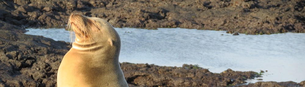
Malheur NWR, Oregon, which encompasses Malheur (site 20, N43˚20’ W118˚48’), Mud, and Harney Lakes, was one of the original national wildlife refuges, set aside in 1908 by Theodore Roosevelt to protect white herons from plume hunters. Today is it 187,000 acres and is a crucial stop on the Pacific flyway, hosting up to 66 percent of the migratory waterfowl in the flyway. Also included is the entire Blitzen Valley (site 21, N42˚55’ W118˚53’), which allows the refuge to manage water received from the Donner und Blitzen River, and the Double-O Ranch (N43˚17’ W119˚21’), which protects the Silver Creek floodplain upstream of Harney Lake. The property provides habitat for 320 species of birds and 58 mammals. Waterfowl using the Pacific flyway stop at the refuge and the Silvies River floodplain, an IBA to the north around Burns. Migratory waterfowl includes greater and lesser sandhill crane and snow and Ross’s geese. Nesting waterfowl include sandhill cranes, trumpeter swans, ducks, and shorebirds. The refuge is an IBA because it hosts 20 percent of the world’s population of white-faced ibis, the highest known density of willow flycatcher, as well as half the world population of Ross’ geese. Harney Lake (site 22, N43˚14’ W119˚8’) is a 30,000-acre body of shallow water on an alkali flat and is a Research Natural Area. Upstream from Harney Lake is the Stinking Lake RNA, which is a small spring-fed alkaline lake used by shorebirds. The Desert Trail crosses part of the Blitzen Valley area of the refuge along the East Canal.
Sheldon NWR (23), Nevada-Oregon (N41˚41’ W119˚5’), is a 575,000-acre area of high desert habitat on the Nevada-Oregon border. Prominent species are pronghorn, bighorn sheep, and sage grouse. Some waterfowl are attracted to lakes in wet years. There are geothermal hot springs in the center of the refuge, and privately operated opal mines in the Virgin Valley. A number of flat-topped mountains dominate the refuge, including Big Spring Table, Rock Spring Table, North Rock Spring Table, Gooch Table, and Fish Creek Table. The Guano Rim escarpment is in the northwest. The intact desert shrub habitat makes this an IBA for sagebrush obligates such as sage grouse, vesper sparrow, and sage sparrow.
Other federal sites in the Harney Basin are listed below:
Lake Abert (24), BLM, Oregon (N42˚38’ W120˚14’), known as the Great Salt Lake of Oregon, is located on US Route 395 north of Valley Falls and is an IBA for American avocet, phalaropes, and snowy plover.
Camp Gap Ranch (25), BLM, Oregon (N43˚32’ W119˚46’) is 40 miles west of Burns on US Route 20. This was a CCC camp in the 1930s focusing on rangeland improvements. It is maintained as a historic area.
Crack in the Ground (26), BLM, Oregon (N43˚20’ W120˚40’, is a linear two-mile-long, 70 foot deep, geologic feature north of Christmas Valley formed by volcanic action.
Desert Trail, Nevada-Oregon, is sponsored by the Desert Trail Association, and is envisioned to extend from Mexico to Canada. In the map area it extends across the NCA, Sheldon NWR, Pueblo Mountains, Alvord Lake and Desert, CMPA, Malheur NWR, and Diamond Craters Outstanding Natural Area, then passes Warm Springs Reservoir before heading north into the Blue Mountains.
Devils Garden (26),BLM, Oregon (N43˚30’ W120˚56’) is an area of lava tubes, collapses, and cinder cones just south of the Deschutes NF.
Diamond Craters Outstanding Natural Area (27), BLM, Oregon (N43˚6’ W118˚47’) is a 17,000-acre area adjacent to Malheur NWR containing one of the best volcanic feature collections in the U.S., including craters, vents, cinder cones, spatter cones, and lava tubes. Eruptions took place from 25,000 to 1,000 years BP.
Fossil Lake (2), BLM, Oregon (N43˚20’ W120˚30’) is to the east of Christmas Valley. It is a Pleistocene-era fossil site; remains of sabre-toothed cats, mamoths, and small mammals have been found here. The animals apparently were stuck as they crossed a mud flat. It is considered one of the most significant sites for Pleistocene-age fossils, perhaps rivaling Rancho La Brea in Los Angeles.
Gridley Lake (28), BLM, Nevada (N41˚45’ W118˚51’) is located between McGee Mountain on the Sheldon NWR and the Pine Forest Range. This alkaline playa supports brine flies and brine shrimp, along with American avocet and snowy plover. It is an IBA.
Lahontan Cutthroat Trout Natural Area (29), BLM, Nevada ( N41˚32’ W118˚58’), is a 12,316-acre area established to protect spawning habitat for the threatened Lahontan cutthroat trout. The area includes the watershed of Mahogany Creek upstream from Summer Camp Creek and is vegetated with quaking aspen, willow, and mountain mahogany in addition to sagebrush-steppe.
Lost Forest Research Natural Area (30),BLM, Oregon (N43˚22’ W120˚19’) is a relic ponderosa pine forest on a 9,000-acre site to the east of Christmas Valley. It is considered relic because the precipitation would not normally support the forest; however, the pumice soils apparently store water below the surface without losing it to evaporation.
George W. Lund Petrified Forest (16),BLM, Nevada (N41˚10’ W119˚24’) is a Miocene-aged fossil bed containing large numbers of conifers and hardwoods. There are up to 250 petrified wood types, located 35 miles north of Gerlach along County Road 34 opposite Little High Rock Canyon Wilderness. Giant sequoias or metasequoias were among the species found at the site, with one tree having a circumference of 15 feet (Murbarger 1953). The upright stumps have well-preserved annual growth rings.
Mickey Hot Springs (31), BLM, Oregon (N42˚41’ W118˚21’) are dangerously hot springs located to the east of Steens Mountain CMPA.
Northern Great Basin Experimental Range (32), Eastern Oregon Agricultural Research Center, Agricultural Research Service, Oregon (N43˚30’ W119˚43’) is a 16,000-acre area at Squaw Butte in the Harney Basin used for research on grazing exclosures, and effects of fire on shrub-steppe vegetation. Rain-out shelters look at the effects of rain at different times of the year on vegetation. The focus is maintaining agricultural and natural resource strategies that maintain or enhance shrub-steppe ecosystems.
Oregon Canyon Mountains (N42˚11’ W118˚3’) and Trout Creek Mountains (33), BLM, Oregon (N42˚4’ W118˚19’) are to the west of US Route 95 and the Quinn River Valley, supporting aspen and mountain mahogany woodlands, which in turn support gray-headed junco, Virginia’s warbler, and goshawk, making the area an IBA.
Oregon Desert Trail, Oregon, sponsored by the Oregon Natural Desert Association, is envisioned to extend from Bend to Lake Owyhee, passing through the Deschutes NF, around the Christmas Valley, through Paisley, Fremont NF, Valley Falls, Plush, Warner Basin, Steens Mountain CMPA, Pueblo Mountains, Trout Creek Mountains, and eastward into the Owyhee drainage.
Picture Rock Pass (34), BLM, Oregon (N43˚3’ W120˚48’) is a petroglyph area located on Route 31 between Summer Lake and Silver Lake.
Pueblo Mountains (35), BLM, Nevada-Oregon (N42˚6’ W118˚39’), are south of Steens Mountain. This range provides meadows and aspen groves, and is known for rock art. The Desert Trail crosses the area.
Sierra Army Depot (36), Department of Defense, California (N40˚12’ W120˚8’) located on Honey Lake, a transition area between the Great Basin and Sierra Nevada. It supports shorebirds, gulls, terns, burrowing owl, and sage grouse and is an IBA. All of Honey Lake is within the boundaries of the military property.
Upper 12-Mile Creek (37), BLM, Oregon (N42˚19’ W118˚3’) is a riparian area in the Oregon Canyon Mountains supporting aspen, willow, and mountain mahogany and is an IBA for broad-winged hummingbird, white crowned sparrow, and fox sparrow.
Warner Basin Area of Critical Environmental Concern (38), BLM, Oregon (N42˚38’ W119˚44’) hosts over 90,000 acres of lakes, meadows, and wetlands supporting sandhill crane and nesting waterfowl.
State and local sites in the Harney Basin are listed below:
Bass Hill Wildlife Area (39), California, (N40˚20’ W120˚32’), contains Bass Hill and Shugru Hill, just southeast of Susanville on US Route 395, providing winter habitat for the Bass Hill deer herd.
Biscar Wildlife Area (40), California (N40˚33’ W120˚20’) is located 35 miles northeast of Susanville on Karlo Road, in Snowstorm Creek Canyon.
Honey Lake Wildlife Area (39), California (N40˚18’ W120˚23’) is north of Honey Lake. It is managed for tundra swans.
J. Dow, Sr. Wetlands (41), University of Nevada-Reno, California (N40˚8’ W120˚14’), on US 395 at Herlong Junction, is a 1,360-acre site on the south side of Honey Lake consisting of ponds with 84 islands. Part of the Honey Lake IBA, it is an important stop on the Pacific flyway (Hartman and Oring 2004).
Frenchglen Hotel State Heritage Site (42), Oregon (N42˚50’ W118˚55’), is at the upper end of the Blitzen Valley adjacent to Malheur NWR. This hotel served stagecoach travelers to the largest ranch in Oregon. The site also includes the Pete French Round Barn, located 35 miles to the northeast (N43˚8’ W118˚39’), a 100-foot diameter structure which protected livestock in winter.
Honey Lake Wildlife Area (39), California (N40˚18’ W120˚23’) is a 6,700-acre tract of sagebrush on the northwest side of Honey Lake which supports tundra swans. It is part of the Honey Lake IBA. The area consists of two units southeast of Standish.
Surprise Valley Wildlife Area (43), California (N41˚24’ W120˚8’) is south of Cottonwood Creek and provides winter range for the Warner Mountain deer herd.
Summer Lake Wildlife Management Area (44), Oregon (N42˚57’ W120˚45’) is a migratory waterfowl area at the north end of Summer Lake. Wetlands and mudflats are an IBA for snowy plover and American avocet.
Private sites in the Harney Basin and High Desert Lakes region include large alkali lakes providing important bird habitat.
Alvord Lake and Basin (45), Oregon (N42˚23’ W118˚36’) is a large alkali lake on the east side of Steens Mountain. It is an IBA for snowy plover, shorebirds, waterfowl, and black-throated sparrow. Alvord Hot Springs (N42˚33’ W118˚32’) provides pools for soaking. Nearby Borax Lake (N42˚20’ W118˚36’) is a hot spring wetland owned by the Nature Conservancy and supporting the threatened Borax Lake chub. The Desert Trail crosses the Alvord Desert from Fields to Frog Springs at the base of Steens Mountain.
Catlow Valley (46), Oregon (N42˚30’ W119˚0’) is to the south of Frenchglen along State Route 209. This level former Pleistocene lake valley, now privately owned and sparsely irrigated, is sandwiched between mountains. Archaeological sites are found at former freshwater lake shorelines dating to 15,000 years BP. The valley supports redband trout and is an IBA.
Chewaucan Marsh (47), Oregon (N42˚.6 W120˚.4) is a 30,000-acre privately owned wet meadow bordering State Route 31 between Valley Falls and Paisley. It is an IBA for tule white-fronted geese, snow geese, ducks, waterbirds, and sandhill crane to the west of Lake Abert.
Silvies River Floodplain (48), Oregon (N43˚30’ W118˚54’) is a private site along State Route 205 to the north of Malheur NWR supporting nesting sandhill cranes and egrets. It is important in goose migration. A five-mile stretch of the West Fork Silvies River is being restored to a more natural channel and native grassland by the Oregon Habitat Joint Venture, a bird conservation effort.
Surprise Valley (43), California and Nevada (N41˚30’ W120˚5’) is a 60-mile-long private area containing three alkaline lakes and hot springs centered on Cedarville. It is an IBA for raptors, curlew, cranes, and the yellow rail.
References
Gilbert, M. Thomas P. et al. 2008. DNA from Pre-Clovis Human Coprolites in Oregon, North America. Science 320:786-789.
Hartman, C. Alex, and Lewis W. Oring. 2004. Long-term Waterbird Use of a Constructed Wetland in the Honey Lake Basin. Great Basin Birds 7:25-33.
Jenkins, Dennis L. et al. 2012. Clovis Age Western Stemmed Projectile Points and Human Coprolites at the Paisley Caves. Science 337:223-228.
Martin, James E. et al. 2005. Lithostratigraphy, Tephrochronology, and Rare Earth Element Geochemistry of Fossils at the Classical Pleistocene Fossil Lake Area, South Central Oregon. Journal of Geology113:139-155.
Murbarger, Nell. 1953. Our Largest Petrified Tree. Natural History LXII:466-471.