In northern Alberta and British Columbia, two boreal forest ecoregions occupy the landscape. The Muskwa-Slave Lake Forests include the area east of the Rocky Mountains and east to Wood Buffalo National Park. The Northern Cordillera forests are in the northern Rocky Mountains.
Muskwa-Slave Lake Forests
The Muskwa-Slave Lake Forests ecoregion is in northern Alberta and British Columbia and includes the Caribou Mountains, Cameron Hills and Hay and Fort Nelson River drainages. Vegetation consists of closed stands of quaking aspen, spruce, and balsam fir with lesser amounts of balsam poplar and black spruce. Sporadic permafrost, wetlands, and bogs cover up to one-half of the land. The ecoregion supports large-scale mammal migrations of woodland caribou, moose, lynx, grizzly bear, black bear, wolf, and elk. The summer range of the whooping crane and the Peace-Athabasca delta are in this ecoregion.
World Heritage Sites in Muskwa-Slave Lake Forests
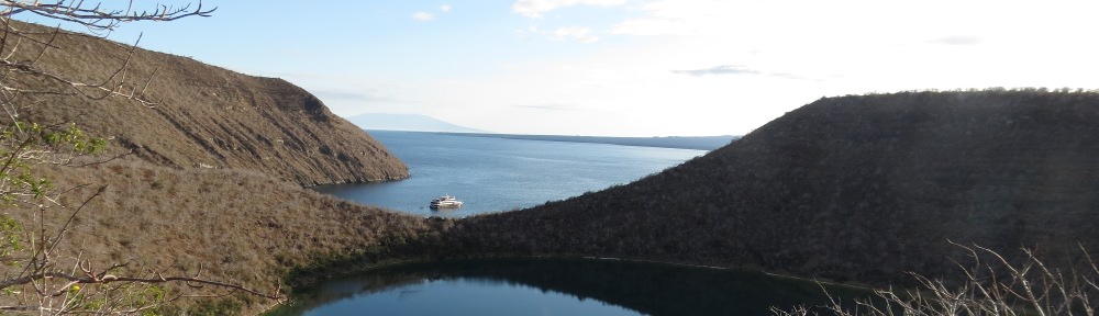
Wood Buffalo National Park, the largest national park in Canada at 44.8 million ha, is in Alberta and Northwest Territories. Established to protect the last remaining herds of the wood bison subspecies, it was later found to be the only remaining nesting ground of the whooping crane. Vegetation is the largest undisturbed grass and sedge meadows in North America, with a patterned landscape of muskeg, shallow lakes, coniferous and mixed forest. The park is also a Dark Sky Preserve.
Wood bison calving grounds are in the Peace-Athabasca Delta (N58ᵒ50’ W112ᵒ0’) and in the Darrow Creek meadows area (N59ᵒ25’ W111ᵒ37’) of the park, both in the eastern areas of the park. Wood bison are North America’s largest land mammal. In this park, the predator-prey relationship between wolves and wood bison has continued, unbroken, over time. The whooping crane nesting grounds (N60ᵒ15’ W113ᵒ15’), a Key Biodiversity Area and Important Bird Area, are in the northeastern portion of the park. Extensive salt plains (N59ᵒ50’ W112ᵒ10’) are accessible from Route 5. Other park sites in the Mid-Continental Canadian forests ecoregion are the Birch River (N58ᵒ15’ W113ᵒ25’), Garden River (N58ᵒ43’ W113ᵒ48’), and Peace Point (N59ᵒ8’ W112ᵒ27’).
Wood Buffalo National Park contains the finest example of gypsum karst in North America (N60ᵒ20’ W114ᵒ15’). Other sites are Buffalo Lake (N60ᵒ15’ W115ᵒ20’) and an area of upland tundra (N59ᵒ35’ W114ᵒ50’).
Ramsar Sites in Muskwa-Slave Lake Forests
Hay-Zama Lakes Wildland Provincial Park, Alberta, is a 48,6000-ha wetland complex which provides habitat for up to 1 million waterfowl, including 200,000 ducks and the same number of geese. It is also an Important Bird Area and Key Biodiversity Area. Hay Lake (N58˚50’ W118˚49’) and Zama Lake (N58˚45’ W119˚5’) are the major attractions. There is limited road access from High Level.
Peace-Athabasca Delta (N58˚50’ W112˚0’), within Wood Buffalo National Park, is the largest freshwater delta in the world’s boreal forests, spanning 3 river deltas (Athabasca, Birch, and Peace) and four large freshwater lakes. An Important Bird Area and Key Biodiversity Area, the delta is one of the most important nesting, resting and feeding areas for waterfowl in North America, and is also a wood bison calving ground. Vegetation is open grass and sedge meadows. The delta provides thousands of miles of shoreline for nesting waterfowl from all four flyways. Breeding species include Canada goose, mallard, gadwall, American wigeon, northern pintail, green-winged teal, blue-winged teal, northern shoveler, canvasback, whooping crane, bald eagle, and osprey.
Whooping Crane Summer Range (N60ᵒ15’ W113ᵒ15’), is within Wood Buffalo National Park and is the only remaining nesting area for whooping crane. The thousands of marshes, shallow ponds, streams, lakes, and bogs within this area provide habitat at the northern limit of boreal forest. It is an important Bird Area and Key Biodiversity Area.
The Trans-Canada Trail system includes the Alaska Highway from Pink Mountain to the Muskwa River in this ecoregion.
Other provincial and local sites in the Muskwa-Slave Lake forests
Buckinghorse River Wayside Provincial Park, British Columbia (N57⁰23’ W122⁰50’) is 55 ha campground on the Alaska Highway (Route 97) northwest of Fort St. John.
Caribou Mountains Wildland Provincial Park, Alberta (northeast extent N59⁰28’ W114⁰0’; southeast extent N58⁰52’ W114⁰21’; southwest extent N58⁰52’ W115⁰42’; northwest extent N59⁰28’ W115⁰53’) is 591,008 ha adjacent to Wood Buffalo National Park, encompassing 80 percent of the range of a woodland caribou herd and providing habitat for 120 wood bison at Wentzel Lake (N59⁰1’ W114⁰28’). The mountains are nesting habitat for species of birds normally found further north. Large rivers within the park are the Buffalo, Wentzel, Whitesand, and Yates.
Ekwan Lake Protected Area (N58⁰30’ W120⁰40’) is 1,892 ha, 175 km southeast of Fort Nelson. White and black spruce forests are on a tributary to the Pontes River, which drains to the Fort Nelson River. Access is by ice road or float plane.
Goguka Creek Protected Area (N58⁰30’ W122⁰41’) is 435 ha on the Alaska Highway south of Fort Nelson. The protected area provides habitat for a wild calla lily and pitcher plant in a stunted black spruce forest.
Hay River Protected Area (N58⁰41’ W120⁰19’) is 2,325 ha of river corridor downstream from the Shekilie River confluence. The area has meadows with black spruce and wetlands, providing habitat or moose and waterfowl. Access is by air only.
Jackpine Remnant Protected Area (N59⁰14’ W123⁰20’) is 148 ha west of Route 77 at the Fort Nelson River crossing. Old growth jack pine is found at the western edge of the species range.
Klua Lakes Protected Area (N58⁰7’ W122⁰20’) is 28,018 ha on unique flat-topped plateaus east of Prophet River and the Alaska Highway. The Klua Lakes are in a basin below a rim of bluffs. The cuesta topography includes lush spruce forests, providing habitat for grizzly bear and trumpeter swan. Access is via trail up Adsett Creek from Prophet River.
Kotcho Lake Ecological Reserve (N59⁰4’ W121⁰6’and N59⁰4’W121⁰5’) is 64 ha on two islands, 100 km northeast of Fort Nelson, featuring nesting areas for three species of gulls and migratory waterfowl. Kotcho Lake (N59⁰4’ W121⁰10’) is an Important Bird Area for canvasbacks, diving and puddle ducks, and tundra and trumpeter swans.
Kotcho Lake Village Site Provincial Park (N59⁰1’ W121⁰5’) is 34 ha at the Kotcho River outlet of Kotcho Lake. Access is via the Helmet Oilfield Road. There are no facilities.
Maxhamish Lake Provincial Park and Protected Area (N59⁰51’ W123⁰20’) is 27,516 ha about 125 km north of Fort Nelson and 12 km west of Route 77. The area provides fishing and wildlife viewing, but there is no road access. The lake is on a tributary to the Petitot River (d”Easum Creek).
Fort Nelson River Ecological Reserve (N58⁰58’ W122⁰31’) is 121 ha in the floodplain of the Fort Nelson River, containing a mature cottonwood forest. It is on the west bank of the Fort Nelson River, 20 km northeast of Fort Nelson. Access is by boat.
Parker Lake Ecological Reserve (N58⁰49’ W122⁰54’) is 259 ha west of Fort Nelson and south of the Alaska Highway, containing a bog with rare plants including Mackenzie’s water hemlock, a lousewort, and pitcher plants.
Prophet River Wayside Provincial Park, British Columbia (N57⁰59’ W122⁰47’) is a 115-ha tract on the Alaska Highway (Route 97). There are no facilities.
Rainbow Lake Provincial Recreation Area, Alberta (N58⁰17’ W119⁰18’), is a 25-ha camping lake on the Hay River, 145 km west of High Level on Route 58, then 45 km south.
Northern Rocky Mountains Provincial Park and Protected Area is 666,472 ha in the eastern Muskwa Range south and west of the Alaska Highway, 90 km southwest of Fort Nelson. It borders Kwadacha and Stone Mountain Provincial Parks. Given the immense size, access to most of the park is by boat, aircraft, or foot. Most of the park is in the Northern Cordillera forests ecoregion (NA 613). A small portion of the park, along the Tuchodi River at its confluence with the Muskwa (N58⁰20’ W123⁰43’), is in the Muskwa-Slave Lake forests ecoregion.
Scatter River Old Growth Provincial Park (N59⁰38’ W124⁰41’) is 1,178 ha on the Liard River where the river leaves the Northern Cordillera forests ecoregion and descends into the Muskwa-Slave Lake forests ecoregion. Old growth spruce grows in the river bottom at this point. Access is via the road to Norquist Lake. The park adjoins Liard River Corridor Provincial Park.
Sikanni Chief Canyon Provincial Park (N57⁰29’ W122⁰7’) is 4,641 ha in the canyons of the Sikanni Chief and Buckinghorse Rivers. Mountain goats may be seen on the steep cliffs of the canyon.
Sikanni Chief Falls Protected Area, British Columbia (N57⁰15’ W123⁰0’) is 606 ha surrounding a 30-m falls on the Sikanni Chief River. The viewpoint is 15 km west of the Alaska Highway on a four-wheel-drive road, 200 km northwest of Fort St. John. The trail from the end of the road to the viewpoint is 1.5 km.
Sikanni Old Growth Provincial Park (N58⁰14’ W121⁰43’) is 1,440 ha,100 km southeast of Fort nelson on the Sikanni Chief River at the confluence with the Fontas River. The old growth forests are white spruce. No summer road access is available.
Thinahtea North Protected Area is 3,674 ha along the corridor of Thinahtea Creek (north end N59⁰50’ W120⁰7’; south end at Thinahtea Lake, N59⁰44’ W120⁰15’). Forests are of white and boreal spruce and jack pine. The larger Thinahtea South Protected Area adjoins the park to the south. There is no road access.
Thinahtea South Protected Area is 16,705 ha 170 km northeast of Fort Nelson including Thinahtea Lake (N59⁰44’ W120⁰15’) and Thinahtea Creek south to its confluence with the Petitot River (N59⁰35’ W120⁰15’). The mix of white and black spruce along with wetlands provides habitat for moose and trumpeter swans. There is no road access.
Northern Cordillera Forests
Forests consist of boreal, subalpine, and alpine vegetation. Boreal forests are of white and black spruce, lodgepole pine, paper birch, and aspen. Higher elevation subalpine forests are of alpine fir, black spruce, and white spruce. The tundra alpine vegetation is of ericaceous shrubs, birch, and willow. There is discontinuous permafrost on north-facing slopes. An intact predator-prey ecosystem of wolves, grizzly bear, caribou, and moose is present.
Trans-Canada Trail system includes the Alaska Highway through this ecoregion from the Muskwa River to Liard River.
Provincial and Local Sites in the Northern Cordillera Forests
Ed Bird-Estella Lakes Provincial Park is 5, 587 ha on the northern tip of Willliston Lake, 67 km south of Fort Ware on the Russel Forest Service Road. The park lakes are a unique milky turquoise color because of marl or calcium carbonate deposition. This includes the several Estella Lakes (N56⁰57’ W125⁰6’) and Ed Bird Lake (N56⁰54’ W125⁰2’).
Chase Provincial Park is 36,226 ha, 70 km north of Germansen Landing. The park protects a caribou herd and contains mixed boreal forest in the Tomias Lake (N56⁰34’ W125⁰3’) and Carina Lake (N56⁰30’ W124⁰59’) areas.
Dune Za Keyih Provincial Park and Protected Area is 346,833 ha in the Rocky Mountain trench along the river corridors of the Kechika (south end N58⁰12’ W126⁰31’; north end N58⁰37’ W127⁰0’), Frog (south end N58⁰15’ W127⁰2’; confluence with Kechika N58⁰30’ W126⁰52’), Gataga (east boundary N58⁰9’ W125⁰30’; confluence with Kechika N58⁰35’ W126⁰55’), and South Gataga (N57⁰52’ W125⁰44’) Rivers. Boreal black and white spruce forests are typical of the area. Access is by air.
Finlay-Russel Provincial Park and Protected Area is 122,771 ha around an 85-km river corridor. Along the corridor is a population of stone sheep. The east end is at the Finlay-Fox River confluence (N57⁰26’ W125⁰41’), the southeast end is along Pelly Creek (N57⁰6’ W125⁰51’), the west end is at Mount Cushing (N57⁰39’ W126⁰51’), and the southwest portion is at the Toodoggone River-Finlay confluence (N57⁰23’ W126⁰33’).
Graham-Laurier Provincial Park is 99,982 ha accessible on foot from the Halfway Graham Forest Service Road, 145 km northwest of Fort St. John. Most of the park is in the Central British Columbia mountain forests ecoregion. However, in the north of the park, Mount Laurier (N56⁰47’ W123⁰29’) is in the Northern Cordillera forests ecoregion.
Grayling River Hot Springs Ecological Reserve (N59⁰37’ W125⁰33’) is 1,421 ha, 67 miles northeast of Muncho Lake. On the Grayling River 50 km upstream of its confluence with the Liard River, this hot spring is known as the best in Canada. The tufa formation formed by the springs creates a 20-m cliff at the river. A bat cave in the reserve harbors little brown myotis. The remote area has no road access.
Kwadacha Wilderness Provincial Park is 130,279 ha adjoining the southwest side of Northern Rocky Mountains Provincial Park. Access is via a 150-km trail from Trutch on the Alaska Highway. The park is known for waterfowl, bears, and lemmings. The eastern side is at the Muskwa River (N57⁰46’ W124⁰38’) and the west side includes Quentin Lake (N57⁰50’ W125⁰17’). The park also includes the Lloyd George Glacier (N57⁰52’ W125⁰0’).
Liard River Corridor Provincial Park and Protected Area is 87,952 ha including the 30-km-long Grand Canyon of the Liard River. Within the canyon are the Rapids of the Drowned and Hells Gate rapids. The park extends from the Deer River confluence with the Liard (N59⁰27’ W125⁰49’) downstream to the Scatter River confluence (N59⁰36’ W124⁰41’). The Grayling (N59⁰21’ W125⁰2’) and the Toad (N59⁰22’ W124⁰55’) Rivers also confluence with the Liard in the park. Access is from Route 97 through Liard River West Corridor Provincial Park, which it adjoins on the west. Adjoining the park on the downstream end is Scatter River Old Growth Provincial Park.
Liard River West Corridor Provincial Park is 1,903 ha from the Trout River confluence (N59⁰24’ W126⁰0’) downstream to the Deer River (N59⁰27’ W125⁰49’). The park also includes the Deer River corridor (N59⁰32’ W125⁰58’). A herd of wood bison frequents the park, which is on the Alaska Highway (Route 97) north of Muncho Lake Provincial Park.
Muncho Lake Provincial Park is 88,420 ha on the Alaska highway. In the southeast portion, the Folded Mountains (N58⁰51’ W125⁰26’) tower above the Alaska Highway. The southern portion of the park is along the Toad River (N58⁰44’ W125⁰44’) and the north end is along the Trout River (N59⁰14’ W125⁰59’). Features of the park are Muncho Lake boat tours, stone sheep viewing, hoodoos, and a mineral lick on the Trout River.
Pink Mountain Provincial Park (N57⁰4’ W122⁰53’) is 92 ha, 180 km northwest of Fort St. John via Route 97 and Road 192. A road allows a rough drive to the top of the mountain. The spruce and lodgepole pine forest is noted as an observation spot for Arctic butterflies at the southern edge of their range. The park was the site of the largest ichthyosaur fossil ever found, a 32-m-long, 220-million-year-old fossil that was a filter feeder like some whales of today (Mikkelsen 2007).
Prophet River Hot Springs Provincial Park (N57⁰39’ W124⁰1’) is 184 ha of hot springs and tufa mounds accessible by foot, 60 km west of the Alaska Highway.
Redfern-Keily Provincial Park includes 80,712 ha of alpine meadows, serrated peaks, glaciers, waterfalls, and natural arches. Ithaca and Achaen Glaciers are within the park. Trails are along Nevis Creek and the Besa River. Major features are Redfern Lake (N57⁰21’ W123⁰53’), Trimble Lake (N57⁰16’ W123⁰35’), and Keily Creek (N57⁰30’ W124⁰0’).
Northern Rocky Mountains Provincial Park and Protected Area is 666,472 ha in the eastern Muskwa Range south and west of the Alaska Highway, 90 km southwest of Fort Nelson. It borders Kwadacha and Stone Mountain Provincial Parks. Access to most of the park is by boat, aircraft, or foot. The eastern slopes of the Muska Range are steep and covered with boreal white and black spruce. The north end of the park is along the Alaska Highway (N58⁰40’ W124⁰27’), the northwest portion in the Wokkpash Valley (N58⁰28’ W124⁰53’), the southeast portion at Milliken Creek (N57⁰43’ W123⁰23’), and the southwest portion on a Muska River tributary (N57⁰36’ W124⁰23’). The major lake area is at Tuchodi Lakes N58⁰13’ W124⁰30’). Rivers include the Chischa, Muskwa, Tetsa, and Tuchodi Rivers. A small portion of the park, along the Tuchodi River at its confluence with the Muskwa, is in the Muskwa-Slave Lake forests ecoregion.
Scatter River Old Growth Provincial Park (N59⁰38’ W124⁰41’) is 1,178 ha on the Liard River where the river leaves the Northern Cordillera forests ecoregion and descends into the Muskwa-Slave Lake forests ecoregion. Old growth spruce grows in the river bottom at this point. Access is via the road to Norquist Lake. The park adjoins Liard River Corridor Provincial Park.
Sikanni Chief River Ecological Reserve (N57⁰17’ W124⁰7’) is 2,401 ha, 190 km northwest of Hudson’s Hope. Access is by float plane. The park is in the alpine zone and features jagged peaks, cliffs, talus slopes, cirque basins, and moraines. Hoodoos are on the Besa River near Mount Dopp.
Stone Mountain Provincial Park (N58⁰39’ W124⁰43’) is 25,690 ha at the highest point on the Alaska Highway 140 km west of Fort Nelson. The park centers on MacDonald Valley, a U-shaped glaciated valley. From the valley a 70 km loop trek extends south to the Wokkpash Valley in Northern Rocky Mountains Provincial Park. At the head of the North Tetsa River are glacial outwash features. The park also features hoodoos, alpine lakes, and wildflowers.
Toad River Hot Springs Provincial Park (N58⁰56’ W125⁰5’) is 423 ha, 160 km west of Fort Nelson, at the confluence of the Toad River and Racing Rivers. Access is by river boat.