National Historic Trail Sites
Lewis and Clark National Historic Trail
River Bluff Park (N35o6’30” W94o35’28”) is on Beardsley Road between 4th Street and the I-70 underpass on the Riverfront Heritage Trail. A public art display includes two dugout canoes moored to an island and a wayfinding marker. The shape of the stairs at the overlook is designed to resemble a waterfall. At the 4th Street end of the park are quartz stone pavers that were part of the first paved street in the town of Kansas.
Santa Fe, Oregon, and California National Historic Trails
Westport Landing, listed on the National Register of Historic Places as Town of Kansas Site, is at the north end of Main Street at the Town of Kansas bridge (approximate location N39o6’40” W94o35’0”),. The French visited and described the area as early as 1713. In 1790, Auguste Chouteau was given trading rights in the area with the Kanza Indians. Lewis and Clark passed by the area in 1804 and 1806. They gathered pawpaw on their return trip in 1806. Chouteau’s Landing, a fir trading post on the Kansas River from 1818 to 1838, Kit Carson and John James Audubon passed through the area. Chouteau’s wife, Berenice Chouteau, lived in the town of Kansas until her death in 1888.
Settlement began in 1832 when Francois Chouteau built a warehouse to store westbound steamboat goods. In 1833, the Town of Westport was founded. In 1834, Westport Landing was established to receive steamboat deliveries. Westport landing was the beginning of the Santa Fe Trail beginning in the late 1830s. It was also used later as a starting point for the California and Oregon trails. Westport Landing is a site on the California, Oregon, Santa Fe, and Lewis and Clark National Historic Trails. At the site, a rock ledge was used for riverboat landing.
Other Parks and Historic Sites
Bellefontaine Avenue Historic District, 500-524 Bellefontaine Avenue between Independence Boulevard and Thompson Avenue (N39o6’25” W94o32’50”), consists of 10 houses dating to 1889. They are an example of speculative middle-class residential construction in the 1880s. All were constructed by a single builder and repeated a similar Queen Anne design. To the east is Scarritt Point South Historic District, which includes structures on the east side of Bellefontaine Avenue; and the Kansas City Parks and Boulevards Historic District (Kessler Park), which is to the rear of the houses.
Belmont Boulevard Bikeway is 0.8 miles from Saida Avenue at Indian Mound (N39⁰7’4” W94⁰30’33”) south to Independence Avenue (N39⁰6’18” W94⁰30’52”).
Benton Boulevard between Gladstone/St. John Avenue and Linwood Boulevard (2.9 miles) is part of the Kansas City Parks and Boulevards Historic District.
Berkley Riverfront, 1298 Riverfront Road (N39o7’5” W94o34’17”) is a development project of PortKC, a state agency. The 17-acre park component is between the Kit Bond Bridge and the Heart of America Bridge, featuring hiking trails, an esplanade, sand volleyball courts, fitness courts, a wetland restoration, and picnic tables. West of the ASB Bridge, Riverfront West includes the Town of Kansas Bridge and an elevator and stairs provide access to the City Market area. The Armour-Swift-Burlington (ASB) Bridge on the BNSF Railroad is 1.2 miles long and was constructed in 1911. It is one of only a few multimodal vertical lift truss bridges in the world. There are two decks, one for freight railroads and another for vehicles (no longer used for vehicles). To allow river traffic to pass, the lower deck raises through the use of 25-ton counterweights. The Riverfront Heritage Trail passes under the ASB bridge and contains an exhibit about the bridge at a viewpoint west of the bridge. To the west of the ASB bridge is a 10-acre prairie restoration.
Budd Park (N39⁰6’42” W94⁰31’21”) is 26 acres on St. John Avenue at Brighton Avenue. The park dates to 1891. It was part of the original George Kessler 1906 Parks and Boulevard System plan. There is a playground, shelters, tennis courts, rogue courts, small swimming pool, and 0.7-mile loop trail circling the park. The Budd Park Explanade extends for two blocks west of the park to Van Brunt Boulevard and contains the American Legion Memorial Fountain, dedicated in 1921. An inscription on the monument is attributed to Theodore Roosevelt: “All daring and courage, all iron endurance, of misfortune, all devotion to the ideal of honor and the glory of the alliances, for a finer and nobler type of manhood.”
Phillip E. Chappell House, 1836 Pendleton Avenue (N39o6’47” W94o33’30”), dates to 1888. It was listed on the NRHP as an intact representative of the Queen Anne Style of architecture, using brick instead of wood. Chappell was a former mayor of Jefferson City, State Treasurer, and President of Citizen’s National Bank.
Chestnut Parkway Bikeway is designated for a 0.8-mile section of street between Independence Boulevard (N39⁰6’23” W94⁰32’54”) and Kessler Park (N39⁰6’47” W94⁰32’54”).
Cliff Drive and Spirit of KC Scenic Byways Trail is 1.8 miles, from Paseo at Missouri Avenue (N39⁰6’34” W94⁰33’46”) to the City Market at Holmes Street and 3rd Street (N39⁰6’40” W94⁰34’34”). It is partly in Kessler Park. The trail begins in Kessler Park along Paseo and passes Garrison Square Park before ending at 3rd Street four blocks east of the City Market. The trail passes Garrison Square Park and the National Register-listed Joe Vaccaro Soda Water Manufacturing Company Building at 5th and Harrison Streets.
Columbus Square Park (N39⁰6’29” W94⁰34’28”) is 4 acres bordered by Missouri Avenue, Charlotte Street, Holmes Street, and Cherry Street. I-70 is to the south. There is a memorial garden at the east entrance. Features include bocce ball courts, picnic tables, a playground, and trails. Trees include Siberian elms, redbud, ash, pines, and red cedars.
The Concourse (N39⁰6’44” W94⁰32’44”) is 6 acres on Benton at St. John Avenue. It is on the NRHP as part of the Kansas City Parks and Boulevards Historic District. The Concourse and the stone comfort station east of Gladstone Boulevard are contributing structures to the historic district. West of Gladstone Boulevard is the Concourse Hill Slide, playground, exercise equipment, tennis courts, and basketball courts.
Garrison Square (N39⁰6’41” W94⁰34’8”) is 3 acres bordered by East 4th Street, East 5th Street, Forest Avenue, and Troost Avenue. The park includes the Garrison Community Center, a soccer field, and playground. The Cliff Drive and KC Scenic Byways Trail passes adjacent to the park on 5th Street.
Gladstone Boulevard between Indian Mound and Independence Boulevard (2.1 miles) is part of the Kansas City Parks and Boulevards Historic District. It was part of the original George Kessler 1906 Parks and Boulevard System plan. The Gladstone Boulevard bridge over Anderson Avenue (N39o6’42” W94o32’45”), dating to 1897, is a contributing feature to the Parks and Boulevards historic district. It is a 60-foot iron arch span with massive stone masonry abutments. Exterior arches and handrails are also iron. The Thomas Hart Benton Memorial in the traffic circle at St. John Avenue and Benton Boulevard (N39o6’47” W94o32’42”), dating to 1915, is also a contributing feature. Between Walrond Avenue and Askew Avenue, Gladstone Boulevard is within the Scarritt Point North Historic District. Between the Anderson Avenue Bridge and Independence Boulevard, Gladstone Boulevard is within the Scarritt Point South Historic District.
Harrison Street Skate Park is at 4th and Harrison Streets (N39o6’41” W94o34’24”).
Ferd. Heim Brewing Company Bottling Plant, 507 North Montgall Avenue, between Guinotte and Rochester Avenues (N39o7’12” W94o32’56”) dates to 1901. The Heim family initially operated a brewery in East St. Louis beginning in 1869, then purchased a brewery in Kansas City in 1884, after selling the East St. Louis brewery. They operated a brewery in Kansas City from 1884 until 1918, when the company closed due to the coming prohibition. Only the bottling plant is on the National Register. The bottling plant was originally connected to the brewery by a 300-foot-long tunnel east of Chestnut Street Trafficway, no longer extant. Heim was the largest brewery west of St. Louis before prohibition. Today J. Reiger and Company, another casualty of prohibition, has been resurrected by new owners and operates a whiskey, gin, and vodka distillery in the building. Tours are available.
Heim Electric Park (N39⁰7’20” W94⁰32’51”) is 4 acres bordered by Chestnut Trafficway, Rochester Avenue, and Chestnut Avenue. A football field with goalposts, playground, and picnic tables are present. Parking is on Chestnut Avenue south of Nicholson Avenue. An underpass under Chestnut Trafficway leads to Montgall Avenue.
Holy Rosary Historic District (N39o6’32” W94o34’23”) is an Italian immigrant neighborhood dating to 1898, including 17 buildings on Campbell Street and East Missouri Avenue in Columbus Park, centered on Holy Rosary Roman Catholic Church.
Independence Boulevard between Paseo and Benton Boulevard (0.8 miles) is part of the Kansas City Parks and Boulevards Historic District. 7th Street east from West Terrace Park, including Admiral Boulevard, Highland, and Independence Avenue to Benton Boulevard was part of the original George Kessler 1906 Parks and Boulevard System plan. Along Independence Boulevard is the National Register-listed Independence Boulevard Christian Church, 606 Gladstone Avenue at Independence (N39o6’21” W94o32’47”), dates to 1904. The church is a significant example of the Beaux Arts style of architecture; and was the first example of this style constructed in Kansas City. The style focuses on formality, symmetry, and lavish ornament as taught at the Ecole des Beaux-Arts in Paris. Independence Plaza (N39⁰6’24” W94⁰33’19”) is a 2-acre city park on both sides of Independence Boulevard between Park Avenue and Brooklyn Avenue. It was part of the original George Kessler 1906 Parks and Boulevard System plan.
Indian Mound Park (N39⁰7’6” W94⁰30’34”) is 12 acres on Gladstone Boulevard and Belmont Boulevard, anchoring the east end of Kessler Park. It is listed on the NRHP as part of the Kansas City Parks and Boulevards Historic District. Indian Mound is a contributing feature to the historic district. An overlook looks east to the Blue River valley industrial area. There are picnic tables in the park.
Kansas City Cold Storage Company Building, 500 East 3rd Street at Heart of America Bridge, State Route 9 (N39o6’40” W94o34’42”), dates to 1922. This company took advantage of Kansas City’s status as a rail hub to build the largest cold storage business in the world. This building was where ice was made, and fruits and vegetables stored for national distribution. It is now the Cold Storage Lofts.
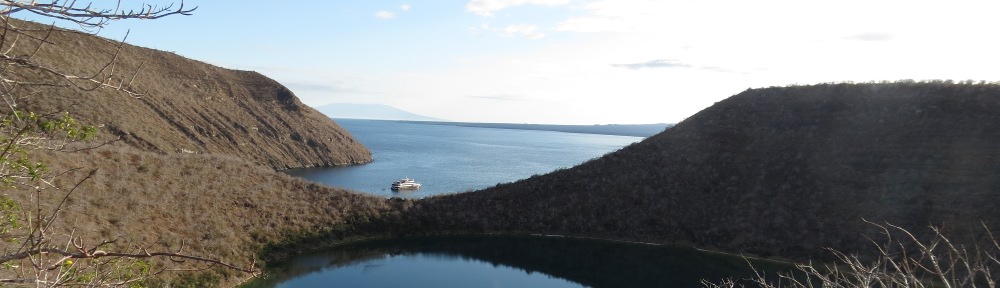
Kessler Park is 303 acres, extending from Paseo at I-29/35) (N39⁰6’48” W94⁰33’51”) to Belmont Boulevard (N39⁰7’8” W94⁰30’29”) and encompassing north-facing bluffs overlooking the Missouri River floodplain. It was formerly North Terrace Park; and is part of the Kansas City Parks and Boulevards Historic District and was part of the original George Kessler 1906 Parks and Boulevard System plan. Cliff Drive State Scenic Byway is 3.8 miles, extending from Gladstone Boulevard at Elmwood Avenue (N39⁰6’52” W94⁰31’33”) west to Paseo/Lexington Avenue (N39⁰6’47 W94⁰33’39”). The road contains overlooks to the north with views of the Missouri River floodplain. Overlooks are at Prospect Point (N39o7’2” W94o32’57”) and Scarritt Point (N39o7’3” W94o32’45”) among other places. Rock bluffs along Cliff Drive add scenery and are used by rock climbers. The road is currently open only to bicycle and pedestrian traffic. Cliff Drive is a contributing feature to the Kansas City Parks and Boulevards Historic District, as is the Cliff Drive Arch Bridge over Chestnut Trafficway (N39o6’45” W94o32’54”). Other roads within the park contributing to the historic district are East Outlook Point Drive, Cliff Drive (N39o6’53” W94o33’24”) to St. John Avenue (N39o6’49” W94o33’8”); and East Reservoir Drive, East Outlook Point Drive (N39o6’53” W94o33’14”) to Lexington (N39o6’40” W94o33’8”). North Terrace Lake (N39o6’44” W94o32’58”), a 2-acre fishing lake on Cliff Drive and Water Works Reservoir (N39o6’52” W94o33’6”) are contributing features to the historic district. At the junction of Gladstone Boulevard and St. John Avenue (N39o6’49” W94o32’44”) are the Colonnade and JFK Memorial, also contributing features to the historic district. At the east end of Kessler Park, a stone parapet wall on North Belmont Boulevard (N39o7’8” W94o30’31”) is a contributing feature. The Kessler Park Trail system, suitable for mountain biking and hiking, is 5 miles of trails between Lexington/Paseo east to Indian Mound. Cliff Drive and Spirit of KC Scenic Byways Trail, a paved shared-use path, begins in Kessler Park at Paseo and Missouri Avenue, follows Paseo Avenue to the Cliff Drive entrance at Lexington Avenue, then turns north to descend the bluff and connect with Dora Street just east of I-35. It continues west under I-35 to Lydia, then south to 5th Street. It continues west to the Old Town Historic District. The Gladstone Boulevard Trail extends 1.7 miles between The Concourse (N39⁰6’48 W94⁰32’40”) and Belmont Boulevard (N39⁰7’3” W94⁰30’32”).
Maple Park (N39⁰6’41” W94⁰33’34”) is 16 acres on Lexington Avenue between the Paseo, Missouri Avenue, and Maple Boulevard, adjoining Kessler Park. It is on the National Register of Historic Places as part of the Kansas City Parks and Boulevards Historic District. The park contains a soccer field and volleyball court. Adjacent is the Pendleton Heights local historic district, which is the oldest surviving neighborhood in Kansas City, featuring intact pre-1900 houses. The local landmark Tiffany Castle is on Garfield Avenue within Pendleton Heights.
Nicholson Park (N39⁰7’25” W94⁰32’15”) is 2 acres at 3601 East Nicholson Avenue at North Monroe, in the East Bottoms. A constructed wetland is circled by a walking trail.
Northeast Athletic Fields Park (N39⁰6’49” W94⁰30’21”) is 19 acres at 6500 East St. John Avenue at Bennington. There are a playground and three ballfields.
Old Town Historic District (N39o6’30” W94o34’55”) consists of 80 buildings, including the Public Market (City Market). It is the original Kansas City town site. Boundaries are Second Street to the north, Missouri Avenue on the south, Delaware Street on the west, and Locust Lane on the east. Contributing structures are on 2nd Street, 3rd Street, 4th Street, 5th Street, Delaware Street, Grand Boulevard, Main Street, Missouri Avenue, Oak Street, and Walnut Street. Delaware Street provides a street scene reminiscent of the 19th century, with several pre-1890 structures. The Pacific House Hotel, 401 Delaware, housed Union troops during the Civil War. The original town square of 1846 became the City Market in 1857. In the 1870s this area famously hosted Wild Bill Hickok, Wyatt Earp, Bat Masterson, and Doc Holliday. Also in this area were the original city hall and county courthouse buildings. East of Delaware between 3rd Street and 5th Street is the City Market, owned by the City of Kansas City. City Market Park is on 3rd Street east of Delaware. It contains benches, under shingle oak and honey locust trees. Since the city’s founding, the area has been a farmer’s market and continues the function today. Beginning in 1888, the city constructed brick market buildings; however, the current buildings were constructed in the 1930s. On the east side of the district on Oak, 3rd, and 4th Streets are several buildings associated with Muehlebach Brewing Company. Today the Kansas City Streetcar provides access to the district, with a loop running along 5th Street, Grand Boulevard, 3rd Street, and Delaware Street within the district. Kansas City Water Department Building, 201 Main Street (N39o6’39” W94o35’0”) is separately listed on the National Register. It operated from 1904 until 1923 and was the earliest extant public works building of the city water department. Studna Garage, 415-419 Oak Street (N39o6’34” W94o34’45”), is separately listed on the National Register and dates to 1922. It was a public parking garage for autos and trucks, also offering repair and fuel services. The garage provided services for a railroad freight area of the city. It is on the NRHP and is currently occupied by the offices of Tetra Tech. Townley Metal and Hardware Company Building, 200-210 Walnut Street (N39o6’38” W94o34’58”), is separately listed on the National Register and dates to 1895. It is representative of the wholesale hardware jobbers trade and was one of the nation’s largest wholesale hardware distributors. The company went on to become one of the founders of the Sentry Hardware brand in the 1960s. The company was sold in 1982. The building is used for the Old Townley Lofts. The Steamboat Arabia Museum (N39o6’34” W94o34’53”) is in a non-contributing structure within the historic district. It is expanding and may move elsewhere by 2026. The Helping Hand Institute Building, 523 Grand Boulevard at Missouri Avenue (N39o6’29” W94o34’48”), dates to 1915. Founded in 1894, the Helping Hand Institute provided food, shelter, medical care, personal aid, counseling, and employment for homeless men. From 1915 to 1950, it served 435,000 people. Businesses affiliated with the institute were the Industrial Paper Stock Company and a quarry business for paving streets. Its benefactor was Kansas City’s wealthiest businessman, William Volker, who donated $10 million over 36 years. It merged with Goodwill Industries in 1978. The Riverfront Heritage Trail passes through the historic district on Main Street between 2nd and 3rd Streets and along West 3rd Street from Main Street west to Wyandotte Street.
Prospect Avenue from Lexington Avenue south to Independence Avenue was part of the original George Kessler 1906 Parks and Boulevard System plan.
Richards and Conover Hardware Company Building, 200 West 5th Street at Wyandotte (N39o6’29” W94o35’8”), dates to 1902. It was built to house the inventory of the nation’s oldest and largest wholesale hardware company. The company operated from 1857 until 1999. Today the building is used for residential lofts. The Riverfront Heritage Trail passes the building on Wyandotte Street.
River Bluff Park (N35o6’30” W94o35’28”) is on Beardsley Road between 4th Street and the I-70 underpass on the Riverfront Heritage Trail. A public art display includes two dugout canoes moored to an island and a wayfinding marker. The shape of the stairs at the overlook is designed to resemble a waterfall. At the 4th Street end of the park are quartz stone pavers that were part of the first paved street in the town of Kansas. It is a site on the Lewis and Clark National Historic Trail.
Riverfront Heritage Trail is a 15-mile bicycle and pedestrian trail connecting Berkley Riverfront Park of Port KC (N39⁰7’5” W94⁰34’20”), Old Town Historic District (N39⁰6’35” W94⁰34’57”), Westside (N39⁰5’15” W94⁰35’34”), Huron Park in Kansas City Kansas (N39⁰6’51” W94⁰37’31”), and the West Bottoms (N39⁰6’35” W94⁰36’50”). The trail is managed by Kansas City River Trails, Inc. (kcrivertrails.org). The trail passes
Riverfront Park (N39⁰8’15” W94⁰32’19”) is 955 acres extending from North Olive Street at East Front Street to the Union Pacific Railroad east of I-435. A boat ramp on the Missouri River is on Riverfront Road west of North Choteau Trafficway.
River Market Dog Park is on East 5th Street at Locust Lane (N39o6’35’ W94o34’40”).
Scarritt Point North Historic District (N39o6’55” W94o32’30”) includes the finest houses of early Kansas City, with Corinthian Hall (1910), home of the Kansas City Museum, 3218 Gladstone Boulevard, being one of the jewels. The Kansas City Museum is separately listed on the National Register as the R.A. Long House. There are 63 contributing buildings, dating to 1887. The district boundaries are Kessler Park on the north and west, Windsor Avenue on the south, and Askew Avenue on the east. Houses on Askew Avenue, Bales Avenue, Gladstone Boulevard, Indiana Avenue, Norledge Avenue, and Windsor Avenue are included in the historic district. The Edward Lucky Scarritt House (1898), 3500 Gladstone Boulevard (N39o6’56” W94o32’24”), Edward A. Stevens House (1902), and the William Chick Scarritt House (1888), 3240 Norledge Avenue (N39o7’2” W94o32’33”) are separately listed on the NRHP. Gladstone Boulevard through the District is part of the Kansas City Parks and Boulevards Historic District, as is Kessler Park (North Terrace Park, which adjoins the district on the north and west.
Scarritt Point South Historic District (N39o6’32” W94o32’42”) includes Judge’s Row along Gladstone Boulevard south of The Concourse city park. There are 121 buildings contributing, dating to 1887. It is generally bordered by Bellefontaine Avenue on the west, Independence Boulevard on the south, Benton Boulevard on the East, and Anderson Avenue on the north. Houses on Anderson Avenue, Benton Boulevard, Gladstone Boulevard, Lexington Avenue, Smart Avenue, and Thompson Avenue are within the historic district. It adjoins the Bellefontaine Avenue Historic District. Gladstone Boulevard and Benton Boulevard within the Historic District are part of the Kansas City Parks and Boulevards Historic District, as are the adjacent Concourse Park and Anderson Avenue Bridge.
Town of Kansas Site is at the north end of Main Street at the Town of Kansas bridge (approximate location N39o6’40” W94o35’0”), north of 2nd Street, on the Riverfront Heritage Trail. The town site was between the river and 2nd Street between Delaware and Grand Streets. A historic marker at the north end of Main Street describes the founding of Kansas City at the site.
The French visited and described the area as early as 1713. In 1790, Auguste Chouteau was given trading rights in the area with the Kanza Indians. Lewis and Clark passed by the area in 1804 and 1806. They gathered pawpaw on their return trip in 1806. Chouteau’s Landing, a fir trading post on the Kansas River from 1818 to 1838, Kit Carson and John James Audubon passed through the area. Chouteau’s wife, Berenice Chouteau, lived in the town of Kansas until her death in 1888.
Settlement began in 1832 when Francois Chouteau built a warehouse to store westbound steamboat goods. In 1833, the Town of Westport was founded. In 1834, Westport Landing was established to receive steamboat deliveries. Westport landing was the beginning of the Santa Fe Trail beginning in the late 1830s. It was also used later as a starting point for the California and Oregon trails. Westport Landing is a site on the California, Oregon, Santa Fe, and Lewis and Clark National Historic Trails. At the site, a rock ledge was used for riverboat landing.
The town prospered with the Mexican War from 1846 to 1848. In 1848, thousands went through Westport Landing on the way to the California gold rush. Beginning in 1855, the town of Kansas began taking down the bluff and by the 1870s, Main Street, Delaware, Walnut, and Market Streets had cut through the bluffs to the riverfront. Also in the 1850s, hordes of people rushed through the city to establish the state of Kansas as either pro-slavery or abolitionist. The Gillis House Hotel, built in 1850 between Delaware and Wyandotte Streets on the bluff, housed many travelers after they disembarked at Westport Landing. In 1850, the Town of Kansas was chartered by Jackson County. Just west of Westport Landing was the first railroad bridge across the Missouri River. The Hannibal railroad bridge was completed in 1869. In 1889, the name was changed to Kansas City.
Traber Lafayette Garden (N39⁰6’46” W94⁰33’35”) is 1 acre on Pendleton Avenue, adjacent to and south of Kessler Park and north of Maple Park. This area is not currently being maintained as a garden (2020).
Joe Vaccaro Soda Water Manufacturing Company Building, 918-922 East 5th Street at Harrison Street (N39o6’38” W94o34’21”) dates to 1921. The building was part of the Kansas City Italian immigrant “colony.” In the building, the Vaccaro meeting hall provided a social gathering place and became the largest and most active reception hall in the Italian community of Kansas City. The Cliff Drive and Spirit of KC Scenic Byways Trail passes the building on 5th Street. The building is used for the Soda Lofts.