Alberta-British Columbia Foothills Forests, Part B

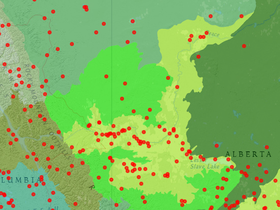
This entry describes the northern parts of the Alberta-British Columbia Foothills Forests, drained by the North Saskatchewan, Athabasca, and Peace Rivers. Parks in this ecoregion include waterfalls, canyons, and glacial features. Cultural features include trading post sites and Sudeten heritage.

North Saskatchewan River Area

To the west and north of Rocky Mountain House, public lands in the Alberta-British Columbia foothills forest are along tributaries to the North Saskatchewan River.

Alexo Natural Area (N52⁰28’ W115⁰47’) is 33 ha on Route 11 west of Saunders. It is at the site of a former coal mine.

Aurora Natural Area (N52°40’ W115°45’) is a 923-ha north-facing escarpment with devil’s club, mountain ash, and red elderberry vegetation, located east of Grey Owl Creek.

Aylmer Provincial Recreation Area (N52⁰24’ W116⁰4’) is a 7-ha site used for hiking and camping on Route 734 at the North Saskatchewan River. There is a canoe launch at the site. It is part of the Kiska-Wilson Public Land Use Zone.

Beaverdam Provincial Recreation Area (N52⁰30’ W116⁰0’) is south of Route 11 near Nordegg. Trails lead to Coliseum Mountain and Fish Lake Provincial Recreation Area.

Bighorn Dam and Lake Abraham (N52⁰19’ W116⁰20’) is a 120-Megawatt hydroelectric facility on the North Saskatchewan River on Route 11 just to the north of Banff National Park. The reservoir is operated by TransAlta.

Blackstone Provincial Recreation Area (N52°37’ W116°20’) is a 3-ha camping park and canoe launch on Chango Road at the Blackstone River, at the northern end of Wapiabi Provincial Park.

Blue Rapids Provincial Recreation Area, managed by the Eagle Point-Blue Rapids Parks Council, is 3,623 ha along the North Saskatchewan River south of Drayton Valley. The park extends into the Canadian aspen forests and parklands ecoregion in the northeastern areas. The north end is at route 22 (N53⁰12’ W115⁰3’) and the south end is west of the Rose Creek confluence (N53⁰3’ W115⁰6’). River terraces and old river channels dominate the river corridor park.

Brazeau Canyon Wildland Provincial Park protects a 25-km reach of the Brazeau River from the Alberta Mountain forests ecoregion to the Alberta-British Columbia foothills forests ecoregion. The park is 5,039 ha in extent. The lower end of the canyon (N52°51’ W116°37’) is in the foothills forests.

Brazeau Reservoir Provincial Recreation Area includes three tracts on the 355-Megawatt Brazeau hydroelectric development of TransAlta Corporation. The utility diverts water into the 16-km Brazeau Canal which then feeds the hydroelectric turbines on the Brazeau River. The utility plans to operate the canal and reservoir as a pumped storage facility in the future by construction of a lower reservoir on the Brazeau River. The park includes a campground on the reservoir near the dam (N52°58’ W115°36’), a group camp facility (N52°57’ W115°36’), and a canal campground (N52°57’ W115°32’). The reservoir is a good bird-watching site for tree swallows, goldeneyes, and ospreys.

Brazeau River Provincial Recreation Area (N52°53’ W116°33’) is 10 ha used for camping and hiking on the Brazeau River downstream from the canyon and wildland park. Access is from Route 40.

Brown Creek Provincial Recreation Area (N52⁰46’ W116⁰22’) is an 8-ha camping park on Route 40 in the Brazeau River watershed.

Buck Lake Natural Area is 110 ha in two tracts (N53⁰1’ W114⁰45’; and N52⁰57’ W114⁰45’), featuring willow shrubland, sedge meadows, and black spruce-larch-sphagnum vegetation.

Calhoun Bay Provincial Recreation Area (N52⁰59’ W114⁰44’) is 374 ha on Buck Lake, featuring camping and lakeside recreation. The park is off Route 13 on the east side of the lake.

Chambers Creek Provincial Recreation Area (N52⁰27’ W115⁰19’) is 39 ha on Route 11 west of Rocky Mountain House, offering camping and hiking.

Crescent Falls Provincial Recreation Area (N52⁰23’ W116⁰21’) is a 262-ha park at a two-tiered waterfall on the Bighorn River. A hiking trail leads to Bighorn Gorge lookout.

Crimson Lake Provincial Park (N52⁰27’ W115⁰2’) is 3,209 ha north of Rocky Mountain House, offering camping and water recreation.

Cow Lake Natural Area includes 392 ha in two tracts. The east tract (N52⁰18’ W115⁰1’) is on the north shore of the lake and accessible by Route 752. The west tract (N52⁰18’ W115⁰7’) is on Cow Creek. The lake is stocked with trout. Forests are mature mixed forest; there are sedge meadows and black spruce-larch wetlands.

Dry Haven Provincial Recreation Area (N52⁰26’ W116⁰12’) is a 2-ha campground on Route 11.

Eagle Point Provincial Park, managed by the Eagle Point-Blue Rapids Parks Council, is 1,962 ha along the North Saskatchewan River at Drayton Valley. The park extends into the Canadian aspen forests and parkland ecoregion in the north portions. The north end of the river corridor park is near Mishoe Creek (N53⁰20’ W114⁰49’) and the south end is at Route 22 (N53⁰12’ W114⁰56’). The park contains hills, river terraces, and rare plants accessible via 35 km of trails.

Elk Creek Provincial Recreation Area (N52⁰3’ W115⁰39’) is 16 ha in two units on Route 734 southwest of Rocky Mountain House.

Elk River Provincial Recreation Area (N52°57’ W116°6’) is 33 ha on the Lodgepole-Lovett Forestry Road used for camping. Elk River is a tributary to Brazeau Reservoir.

Fish Lake Provincial Recreation Area (N52⁰28’ W116⁰8’) is 409 ha near Nordegg south of Route 11. Trails lead to Nordegg, Coliseum Mountain, and to Goldeye and Beaverdam Provincial Recreation Areas.

Goldeye Lake Provincial Recreation Area (N52⁰27’ W116⁰11’) is 51 ha on Route 11. The Goldeye Conference Center, used for youth and corporate meetings, is within the park. Trails lead to Fish Lake Provincial Recreation Area and Beaverdam Provincial Recreation Area.

Harlech Provincial Recreation Area (N52⁰30’ W115⁰55’) is 14 ha on Route 11 west of Rocky Mountain House.

Horburg Provincial Recreation Area (N52⁰24’ W115⁰19’) is 13 ha on the North Saskatchewan River west of Rocky Mountain House.

Horseshoe Creek Natural Area (N52⁰52’ W114⁰54’) is on Route 22 south of Alder Flats.

Jackfish Lake Provincial Recreation Area (N52⁰30’ W115⁰34’) is 203 ha west of Rocky Mountain House on Route 11.

Lloyd Creek Natural Area (N52⁰56’ W114⁰20’) is 558 ha including two glacial meltwater channels with white spruce and lodgepole pine vegetation. It is southeast of the junction of Routes 20 and 13 at Winfield.

Mill Island Natural Area (N52⁰29’ W114⁰59’) is 80 ha north of Rocky Mountain House off Route 22. The area includes the floodplain of the North Saskatchewan River. Vegetation is aspen and spruce; calcareous marsh is present.

Mitchell Lake Provincial Recreation Area (N52⁰12’ W115⁰0’) is 22 ha near Prairie Creek, south of Rocky Mountain House, and west of Route 22 on Township Road 380.

O’Chiese Natural Area (N52°46’ W115°23’) is 376 ha with a diversity of habitats including paper birch, black spruce peatland, and sedge meadows. It is south of Brazeau Reservoir, between the Nordegg and Baptiste Rivers.

Peppers Lake Provincial Recreation Area and Peppers Lake Staging Provincial Recreation Area (N52⁰3’ W115⁰42’) are 16 ha and 14 ha, respectively, along Peppers Lake Road off of Route 734 near the Clearwater River.

Phyllis Lake Provincial Recreation Area (N52°6’ W114°58’) is 109 ha on Route 591 west of Caroline and Route 22.

Prairie Creek Provincial Recreation Area (N52⁰15’ W115⁰19’) is 38 ha southwest of Rocky Mountain House on Route 752.

Ram Falls Provincial Recreation Area (N52⁰5’ W115⁰50’) is 410 ha surrounding a scenic waterfall and a viewing platform for the Ram River valley. The park is on Route 734. Trails lead upstream on the Ram River to the Hummingbird area.

North Ram River Provincial Recreation Area (N52⁰17’ W116⁰0’) is 14 ha on Route 734 at the confluence of the North Ram River and Joyce River.

Rocky Rapids Natural Area (N53⁰16’ W114⁰59’) is a 65-ha tract on Route 22 north of Drayton Valley. The area features aspen and white spruce in undulating terrain.

Round Valley Natural Area (N53⁰21’ W115⁰3’) is a 130-ha area in two tracts west of Rocky Rapids Natural Area. The aspen and white spruce forests are accessible by Range Road 80A at Township Road 505. Both tracts are west of Route 22, north of Drayton Valley.

Saunders Provincial Recreation Area (N52⁰27’ W115⁰46’) is 9 ha on the North Saskatchewan River west of Rocky Mountain House.

Seven Mile Provincial Recreation Area (N52⁰0’ W115⁰21’) is 37 ha on Route 734 south of Nordegg between the Clearwater River and Corkscrew Mountain. The area is used for camping and hiking.

Shunda Viewpoint Provincial Recreation Area (N52⁰29’ W115⁰45’) is 16 ha on Shunda Road north of Route 11, between Nordegg and Rocky Mountain House.

Snow Creek Provincial Recreation Area (N52⁰26’ W116⁰15’) is a 64-ha site near Gonika Creek used for hiking. It is in the Kiska-Wilson Public Land Use Zone. It is off Route 11 between Nordegg and Lake Abraham.

Strachan Provincial Recreation Area (N52⁰16’ W115⁰10’) is 32 ha on Route 752 and Prairie Creek, southwest of Rocky Mountain House.

Swan Lake Provincial Recreation Area (N52°7’ W115°11’), is 249 ha south of Rocky Mountain House on Swan Lake Road. The turnoff is from Route 591 west of the Tay River crossing.

Tay River Provincial Recreation Area (N52°3’ W115°6’) is 2 ha at the confluence of the Tay River and Clearwater River, providing a campground on Route 591 west of Route 22 at Caroline.

Wapiabi Provincial Recreation Area is northwest of Nordegg and includes in a 4,033-ha tract the valley of the Wapiabi Creek from the Wapiabi Gap (N52°30’ W116°24) to the Blackstone River (N52°37’ W116°20’). It is a wildlife corridor used by moose, elk, wolves, and grizzly bear. The park also includes the Sturrock Creek valley (N52°29’ W116°17’).

Washout Creek Natural Area (N53⁰1’ W114⁰58’) is 129 ha in two tracts west of Buck Lake off Township Road 470 west of Route 22. Forests are mature mixed aspen-white spruce-balsam poplar.

Athabasca River Area

To the east of Jasper National Park, public lands in the Alberta-British Columbia Foothills forests are along tributaries to the Athabasca River.

Big Berland Provincial Recreation Area (N53°46’ W118°22’) is 173 ha on Route 40 at the Berland River. The site is a staging area for Willmore Wilderness Park.

Bighorn Recreation Trail (N53°18’ W117°29’) follows High Divide Ridge for 20 km between Gregg Road (N53°15’ W117°22’) and Cold Creek Road (N53°22’ W117°34’) near Hinton. The trail is maintained by the Foothills Recreation Management Association.

Bigoray Natural Area (N53⁰24’ W115⁰4’) is 65 ha north of Rocky Rapids and west of Route 22. The rolling hills contain aspen-balsam poplar forests.

Carson-Pegasus Provincial Park (N54°18’ W115°39’) is 1,210 ha on Route 32 north of Whitecourt. A trail system leads through mixed woods, bogs, and marshes and to a beach on McLeod Lake.

Chrystina Lake Provincial Recreation Area (N54⁰47’ W115⁰11’) is a 27-ha camping area on Windy Lake and the Coutts River, operated by the Town of Swan Hills. It is off Route 33 northeast of Swan Hills.

Easyford Natural Area (N53⁰15’ W115⁰5’) is 113 ha west of Drayton Valley. Habitats are black spruce-larch muskeg and paper birch forests.

Easyford Creek Natural Area (N53⁰16’ W115⁰5’) is 113 ha of pine-aspen-white spruce forests and a black spruce/sphagnum bog.

Edith Lake Provincial Recreation Area (N54⁰48’ W115⁰23’) is 58 ha off Route 33 north of Swan Hills. It is operated by the Town of Swan Hills.

Fairfax Lake Provincial Recreation Area (N52°58’ W116°35’), is a 130-ha hiking and camping area on Route 40 on a tributary to the Pembina River.

Fickle Lake Provincial Recreation Area (N53°27’ W116°47’) is 1,152 ha southwest of Edson off Route 47. Included are an interpretive trail, camping and fishing. Vegetation is lodgepole pine, aspen, and white spruce.

Freeman River Provincial Recreation Area (54⁰34’ W115⁰24’) is a 10-ha tract on the Freeman River at the Route 32 crossing south of Swan Hills. It is operated by the Town of Swan Hills.

Goose Mountain Ecological Reserve (N54⁰45’ W115⁰57’) is 1,247 ha in the Swan Hills, which rise 600 m above the surrounding terrain. Vegetation is balsam-subalpine fir. Access is via the Swan Hills fire tower road.

Grizzly Ridge Wildland Provincial Park (north end N55⁰14’W114⁰56’; south end N55⁰1’W115⁰8’) includes 10,706 ha of remote ridgetop forests of white spruce, balsam fir, and jack pine south of Lesser Slave Lake in the Swan Hills. There are also mineral springs and wetlands. Some western Rocky Mountain plants like Devil’s club and mountain ash are also noted as present.

Hard Luck Canyon (N54⁰0’ W115⁰47’) is a Woodland County Park with a waterfall and scenic canyon near the McLeod River. It is on Range Road 125 south of Whitecourt.

Highway Natural Area (N53°48’ W115°27’) is 360 ha with two ridges dissected by streams and including vegetation communities of aspen, spruce, and sedge meadow. The site is north of Chip Lake.

Hornbeck Creek Provincial Recreation Area (N53°34’ W116°41’) is a 5-ha camping and fishing park on Route 16 at Sundance Creek west of Edson.

Eric S. Huestis Demonstration Forest (N54°15’ W115°41’), Alberta Sustainable Resource Development, is 1,000 ha located 13 km north of Whitecourt on Route 32 in the Swan Hills. The site contains a hiking trail and arboretum.

Lovett River Provincial Recreation Area (N53°4’ W116°49’) is 38 ha on Route 40 at the Lovett River used for camping and hiking.

McLeod River Provincial Recreation Area (N53°18’ W117°17’) is 32 ha at the confluence of the Gregg and McLeod Rivers. The camping park is 25 km southeast of Hinton on Robb-Hinton Road.

Minnow Lake Provincial Recreation Area (N53°22’ W116°3’) is 360 ha used for camping and boating. It is southeast of Edson on Range Road 150a south of Route 16.

Nojack Provincial Recreation Area (N53°37’ W115°35’) is a 3-ha camping and day-use area at the junction of Routes 16 and 751 operated by Yellowhead County municipal district.

Obed Lake Provincial Park (N53°33’ W117°7’) is 3,401 ha on Route 16 about 30 km northeast of Hinton. The fishing and camping park contains wetland and uplands, with black spruce-larch fens and lodgepole pine forests. Trumpeter swans are known to nest near the park.

Paddle River Natural Area (N53°49’ W115°18’) is a 64-ha tract of rolling upland aspen forest accessed from Township Road 562 southwest of Mayerthorpe.

Pembina Forks Provincial Recreation Area (N52°56’ W116°34’) is a 111-ha camping park on the Pembina River on Route 40.

Pembina River-Moon Lake Natural Area is 98 ha in two tracts on both sides of Route 22 south of Evansburg on Route 16. The northeast tract (N53⁰30’ W114⁰57’) is in an upland area and the southwest tract (N53⁰27’ W115⁰2’) is on the Pembina River. The natural area includes river terraces and rolling uplands with aspen-balsam poplar, wetlands, and sedge meadows.

Pinto Creek Canyon Natural Area (N53°47’ W117°50’) is 1,233 ha in the Pinto, Hightower, and Wroe Creek Valleys, tributaries to the Wildhay River. Cliffs and hoodoos line the stream corridor. The natural area protects the only population of mountain goats outside of the Rocky Mountains.

Sundance Provincial Park is a linear park protecting the Sundance Creek stream corridor from Route 16 west of Edson north to its headwaters. The two tracts of the park encompass 3,712 ha. The park has sandstone cliffs and old-growth spruce-fir forest. The Wild Sculpture Trail winds among sandstone hoodoos. Marl Bog contains 12 orchid species and carnivorous plants. The south end of the Sundance Creek section is at Route 16 (N53°34’ W116°45’) and the north end is at Emerson Creek Road (N53°45’ W117°1’). The Emerson Lakes section is to the west along the Athabasca River at the Emerson Creek Road crossing (N53°43’ W117°8’).

Little Sundance Creek Provincial Recreation Area (N53°41’ W116°48’) is a 24-ha group camping area west of Edson reached from Route 16 via Swanson Road.

William A. Switzer Provincial Park (N53°29’ W117°49’) is 6,123 ha and includes a chain of 5 lakes in meadow and wetlands complexes. Access is 21 km northwest of Hinton on Highway 40. A park visitor center provides information on an interpretive canoe route and three nature trails as well as a trail to a lookout. From south to north, the lakes are Jarvis, Blue, Cache, Graveyard, and Greggs.

Weald Provincial Recreation Area (N53°23’ W116°47’) is 30 ha on Route 47 at the McLeod River south of Edson, used for group camping.

Whitecourt Mountain Natural Area (N54°2’ W115°43’) is a 544-ha site on isolated 1,170-m House Mountain south of Whitecourt. There are stony terraces, slumps and seeps, and white birch and aspen vegetation.

Wildhay Glacial Cascades Natural Area (N53°41’ W117°43’) is 1,233 ha north of Hinton, 8 km northeast of William A. Switzer Provincial Park via Hay River Road. The park includes diverse upland and wetland habitats in the Wildhay River corridor.

Wildhorse Lake Provincial Recreation Area (N53°16’ W117°47’) includes 85 ha in two sections where lakeside recreation is offered. The southernmost section is at Wildhorse Lake and the northern area is at Kinky Lake. Both areas are off Route 16 between Hinton and Jasper.

Wolf Lake West Provincial Recreation Area (N53°13’ W116°4’) is 37 ha on the Minnow Lake Forestry Road south of Edson used for camping and boating.

Yates Natural Area (N53°36’ W116°17’) is 191 ha in three tracts east of Edson on Wolf Creek. The black spruce-larch muskeg habitat is noted for orchid species.

Peace River Area

To the north of Jasper National Park, public lands in the Alberta-British Columbia foothills forests are along tributaries to the Peace River.

Chinchaga Wildland Provincial Park is an 80,270-ha area of boreal forest and extensive marshlands not accessible by road. The foothills wetlands complexes are considered unique and provide habitat for woodland caribou, grizzly, and nesting trumpeter swans. The northern boundary is the Chinchaga River (N57⁰19’ W119⁰24’) and the southern boundary is near Mearon Creek (N56⁰58’ W119⁰32’).

Pierre Grey’s Lakes Provincial Park (N53°54’ W118°36’) is a 633-ha site on Route 40 east of Grande Cache on a tributary to the Muskeg River. It was the site of an 1880s fur trading post and includes McDonald Lake, Moberly Lake, and Desjalais Lakes for trophy fishing, as well as camping and hiking.

Kakwa River Provincial Recreation Area (N54⁰26’ W118⁰33’) is a 7-ha camping site on Route 40 at the Kakwa River north of Grande Cache.

Milligan Hills Provincial Park (N57⁰29’ W120⁰13’) is 7,226 ha, 150 km northeast of Fort St. John, in British Columbia, providing habitat for a woodland caribou herd. There is no road access.

Musreau Lake Provincial Recreation Area (N54⁰33’ W118⁰38’) is a camping and hiking park of 1,804 ha located south of Grande Prairie between the Cutbank and Kakwa Rivers, 5 km east of Route 40.

One Island Lake Provincial Park (N55⁰18’ W120⁰17’) is 61 ha, 60 km southwest of Dawson Creek off Route 52. The lakeside recreation park is forested with white and black spruce and lodgepole pine.

Running Lake Provincial Recreation Area (N56⁰40’ W119⁰2’) is a 107-ha camping area in the Clear Hills reached by Range Road 72 north of Worsley, operated by the Eureka River Agricultural Society, providing lakeside recreation opportunities.

Smoke Lake Provincial Recreation Area (N54°22’ W116°55’) is a 103-ha tract with a campground operated by the Town of Fox Creek. It is reached from Route 43 west of Whitecourt.

Southview Provincial Recreation Area (N54⁰11’ W118⁰41’) is a 3-ha day use area on Route 40 south of Grande Prairie overlooking the Smoky River gorge.

Stoney Lake Provincial Recreation Area (N56⁰30’ W118⁰28’) is a 174-ha camping area northeast of the settlement of Eureka River near the Montagneuse River, providing lakeside recreation opportunities.

Sudeten Heritage Provincial Park (N55⁰32’ W120⁰4’) is 5 ha, 31 km southeast of Dawson Creek on Route 2 in British Columbia. The park commemorates the Sudeten people who migrated here from the Czech Republic in 1938.

Sulphur Lake Provincial Recreation Area (N56⁰42’ W118⁰19’) is 151 ha north of Peace River on Route 689 west of Route 35 at Dixonville.

Swan Lake Provincial Park (N55⁰32’ W120⁰2’) is 82 ha on Route 2, 35 km south of Dawson Creek, British Columbia, used for lakeside recreation. The park contains a noted archaeological site and is a good bird watching site. Forests are of aspen, balsam poplar, and white spruce.

Twin Lakes Provincial Recreation Area (N57⁰27’ W117⁰32’) is a 5-ha park with a loop trail between two lakes. It is 65 km north of Manning on Route 35 in the Hawk Hills.


Alberta-British Columbia Foothills Forests, Part A

This ecoregion is delineated as transitional between boreal forests and Rocky Mountain vegetation. There are linear ridges, rolling plateaus, and broad valleys to the east of the Alberta Mountain forests and Central British Columbia Mountain forests ecoregions. There are three discontinuous sections. The southernmost and smallest is south of the Bow River and west of Calgary. The middle section stretches from the Bow River north to Dawson Creek, BC; an extension is eastward to the Swan Hills south of Lesser Slave Lake. The northern section is the Clear Hills of BC and Alberta. To the east, this ecoregion grades into the grasslands of Alberta; and to the north, into the boreal forest. On wetter sites, black spruce and larch are common, while on drier sites, aspen and lodgepole pine are present. Prominent animals are beaver, black bear, moose, muskrat, and wolf. Halfway Valley is noted as a sandhill crane stopover, and the Chinchauga Hills harbor two subspecies of caribou—the mountain and woodland caribou. Unless otherwise indicated, sites are in Alberta.

Global Geopark in Alberta-British Columbia Foothills Forests

Tumbler Ridge Global Geopark, British Columbia, is 782,200 ha along the former edge of the Western Interior Seaway. The site, administered by the Tumbler Ridge Museum, includes Cretaceous-age dinosaur tracks and dinosaur bone beds, waterfalls, caves, and canyons. The park includes Bearhole Lake Provincial Park, Gwillim Lake Provincial Park, and additional areas in the Central British Columbia Mountain Forests ecoregion. The westernmost point is Mount Palsson (N55°6’ W121°48’), the northernmost point is near Skunk Falls (N55°23’ W120°56’), the southernmost point is at Mount Bully Glacier Peak (N54°27’ W120°56’), and the easternmost point is the Alberta border between Mistanusk Creek (N54°35’ W120°0’) and Windsor Creek (N55°7’ W120°0’). There are 22 trails to mountain summits, caves, canyons, waterfalls, and dinosaur trackways. Visitor sites outside the provincial parks include Quality Canyon (N55°11’ W120°57’), Teepee Falls (N55°19’ W120°56’), Bergeron Falls (N55°13’ W120°58’), Flatbed Falls and Cabin Pool dinosaur tracks (N55°6’ W120°58’), Boulder Gardens and Babcock Falls (N54°55’ W120°57’), Nesbitt’s Knee Falls and Barbour Falls (N54°57’ W121°7’), Wapiti Falls (N54°37’ W120°38’), and Red Deer Falls (N54°30’ W120°38’). All coordinates are approximate.

Bearhole Lake Provincial Park, British Columbia (N55°3’ W120°33’), is 17,460 ha including Bearhole Lake and the Kiskatinaw River. It offers lakeside recreation and is known for wildlife such as moose and trumpeter swan. It is part of the Tumbler Ridge Global Geopark.

Gwillim Lake Provincial Park, British Columbia (N55°25’ W121°15’), is 32,326 ha in size and accessed via Route 29 about 60 km south of Chetwynd. Lakeside recreation, canoeing, and hiking opportunities are offered. The park extends from the Murray River in the north to Mount Merkle in the south. Vegetation is white spruce, aspen, and lodgepole pine.  It is part of the Tumbler Ridge Global Geopark.

National Sites in the Alberta-British Columbia Foothills Forests

Nordegg National Historic Site (N52˚28’ W116˚4’) is located at Nordegg on Route 11 between Banff National Park and Rocky Mountain House. Also known as Brazeau Collieries, this coal mining landscape dates from 1911 to 1955 and includes two original mine entries, a coal processing plant, and coal loading facilities. Nordegg played a role in steam coal development between the end of the First World War and the 1950s. A museum is on site. Tours are offered by the Nordegg Historical Society. Trails connect the site with Fish Lake Provincial Recreation Area and Beaverdam Provincial Recreation Area.

Jasper National Park extends into this ecoregion at its eastern edge at Jasper House National Historic Site (N53˚14’ W117˚52’). Jasper House is a fur trading post built in 1813 on the north side of the Athabasca River off Route 16.

Rocky Mountain House National Historic Site (N52˚22’ W115˚1’) is 6 km west of the town of Rocky Mountain House at the confluence of the North Saskatchewan River and Clearwater River. Access is via Route 11A. The site commemorates the historic fur trace, the life and times of David Thompson, the Canadian explorer and mapmaker of the West, and the relationship of Canada with the Blackfoot Nation and other First Nations who traded at the post. The site protects the archaeological remains of four trading posts, which were rediscovered by archaeologists between 1958 and 1975. In 1799, the Hudson’s Bay Company and the North West Company built competing trading posts at the site. Both locations are now known. David Thompson used Rocky Mountain House as a base for exploration of the Pacific Northwest west of the Rocky Mountains. He was able to map the Columbia River from its source to its outlet at the Pacific Ocean in today’s Washington and Oregon. When the two companies later merged, the successor Hudson’s Bay Company maintained two additional trading posts at the site, one built in 1835 and the last one built in 1868. Rocky Mountain House trading post was used until 1875.

Trans-Canada Trail traverses the Alberta-British Columbia Foothills forests via the Kananaskis Country Trail east from Bow Valley. The West Bragg Creek Trail (N50⁰57’ W114⁰35’) also is part of the TCT corridor. This is in the Jumpingpound Area (N51⁰2’ W114⁰45’). From Bragg Creek, the trail turns north to Cochrane and enters the Canadian Aspen forests and parkland ecoregion. Trans-CanadaTrail segments are also north of the Peace River in the foothills ecoregion. This includes the CANFOR Trail from Jack Creek (N56⁰18’ W118⁰34’) to Worsley (N56⁰34’ W119⁰7’), the St. John’s Trail (N56⁰34’ W119⁰10’), and Ike’s Hill Trail (N56⁰34’ W119⁰7’). Continuing westward into British Columbia, the trail follows the Alaska Highway, which extends through the foothills forests between Dawson’s Creek and Pink Mountain (N57⁰30’ W122⁰30’).

Provincial and Local Parks in the Alberta-British Columbia Foothills Forests

Additional public lands of note in the Alberta-British Columbia Foothills Forests are grouped by watershed. In the south and east, areas are along or adjacent to tributaries of the Bow and Red Deer Rivers.  To the north are the North Saskatchewan River, Athabasca River, and Peace River, with parks grouped under the watershed where they are located.

Bow-Red Deer Rivers Area

The area west of Calgary features two parks with extensive trail systems, Bluerock Wildland Provincial Park and Sheep River Provincial Park, as well as four groupings of parks along roads or river corridors, those in Elbow Valley, Ghost-Waiparous, Jumpingpound, and McLean Creek. Diverse habitats include fens, beaver wetland complexes,  moraines, and grassland as well as spruce, larch, and aspen forests.

Anderson Natural Area (N52⁰50’ W114⁰33’) is 130 ha west of Hoadley on Route 611. Amidst white spruce and lodgepole pine, there are large beaver wetland complexes.

Bentz Lake Natural Area (N51°48’ W114°52’) is 65 ha of fens surrounding islands of glacial till forested with aspen and white spruce. It is on Route 584 west of Sundre.

Bluerock Wildland Provincial Park is 12, 720 ha surrounding the Sheep River Provincial Park, which maintains the trailheads of the Sheep River trails system and Sandy McNab trails system. The easternmost point is on the Sheep River at Long Prairie Creek (N50°38’ W114°28’), the southernmost point is near Junction Mountain (N50°33’ W114°41’), the westernmost point is at Bluerock Mountain (N50°41’ W114°50’), and the northernmost point is on Death Valley Creek (N50°42’ W114°33’). Major park trails are the Bluerock Creek Trail, Gorge Creek Trail, Mount McNabb Trail, Price Camp trail, Green Mountain, Sheep Trail, Long Prairie trail, and Death Valley Trail.

Brown-Lowery Provincial Park (N50°48’ W114°25’) is 278 ha of grasslands, forests and foothills southwest of Calgary between Routes 762 and 22. There are 12 km of trails.

Cartier Creek Provincial Recreation Area (N51°42’ W114°52’) is 44 ha on the Red Deer River west of Sundre.

Deer Creek Provincial Recreation Area (N51°39’ W115°8’) is a horse and off-highway vehicle staging area on the Red Deer River east of Route 734.

Elbow Valley Provincial Parks group includes 10 sites along Route 66 west of Calgary in the Rocky Mountain front. Five sites are in the North-Central Rockies forests and five are in the Alberta-British Columbia Foothills Forests. The visitor center for the park is at Gooseberry. The following are in the Alberta-British Columbia Foothills Forests:

  • Bragg Creek Provincial Park (N50°54’ W114°48’) is 128 ha north of Route 66 and west of Route 22.
  • West Bragg Creek Provincial Recreation Area (N50°57’ W114°42’) is 25 ha on Township Road 232, providing access to the West Bragg Creek trail system and the Trans-Canada Trail.
  • Elbow River Launch Provincial Recreation Area (N50°52’ W114°45’) is 15 ha on Route 66 below Elbow Falls.
  • Elbow River Provincial Recreation area (N50°54’ W114°48’) is 252 ha providing on Route 66 and the Elbow River providing a trailhead for the Fullerton Loop Trail, West Bragg Creek trail system, and Elbow Valley trail system.
  • Gooseberry Provincial Recreation Area (N50°55’ W114°38’) is 42 ha on Route 66 and the Elbow River, providing a visitor center for Elbow Valley.

Fallen Timber Provincial Recreation Area (N51°37’ W114°44’) is a 3-ha site on Fallentimber Creek, a tributary to the Red Deer River, south of Sundre off Township Road 310.

Ghost/Waiparous Provincial Recreation Area group includes eight sites north of Ghost Lake along Route 40. There are six sites in the Alberta-British Columbia Foothills forest ecoregion.

  • Burnt Timber Provincial Recreation Area (N51°35’ W115°10’) is 33 ha along route 734 at the Burnt Timber Creek crossing.
  • Fallen Timber South Provincial Recreation Area (N51°30’ W115°4’) is a 50-ha recreation area on Fallentimber Creek along Route 734 north of Route 579.
  • Ghost Airstrip Provincial Recreation Area (N51°24’ W115°2’) is a 162-ha snowmobile and ski recreation area on Waiparous Creek.
  • Waiparous Creek Provincial Recreation Area (N51°22’ W114°59’) is 102 ha on Waiparous Creek off Route 40, providing trailheads and camping.
  • Waiparous Creek Group Camp Provincial Recreation Area (N51°22’ W114°59’) is a 17-ha site on Route 40 along Waiparous Creek.
  • Waiparous Valley Viewpoint Provincial Recreation Area (N51°25’ W115°2’) is a 3-ha day-use site along Route 40 north of the Waiparous Valley.

James-Wilson Provincial Recreation Area (N51°49’ W115°11’) is 16 ha on Route 734 on the James River at the Wilson Creek confluence west of Sundre.

Jumpingpound Provincial Recreation Area group is a collection of nine sites along Route 68 east of the Kananaskis Valley. There are five sites in the Alberta-British Columbia Foothills forests ecoregion.

  • Dawson Provincial Recreation Area (N51°1’ W114°53’) is a 2-ha equestrian campground on Powderface Trail off Route 68, providing a trailhead for the Sibbald area trail system.
  • Pine Grove Provincial Recreation Area (N51°2’ W114°46’) is a 27-ha group campground providing access to the Sibbald area trail system.
  • Pinetop Provincial Recreation Area (N51°2’ W114°44’) is a 5-ha day-use area and trailhead for the Jumpingpound Loop Trail.
  • Sibbald Lake Provincial Recreation Area (N51°3’ W114°52’) is a 72-ha aspen forest and meadow area with an interpretive trail on camel hunting 11,000 years ago and an Assiniboine campsite 200 years ago. Trailheads provide access to the Sibbald trail system.
  • Sibbald Viewpoint Provincial Recreation Area (N51°3’ W114°51’) is an 8-ha day-use area and trailhead providing access to the Sibbald trail system.

McLean Creek Provincial Recreation Area group includes five sites south of Route 66 and southwest of Calgary which provides access to an off-highway vehicle trail system.

  • Fisher Creek Provincial Recreation Area (N50°47’ W114°35’) is 11 ha on Route 549, providing access to the southern portions of the McLean Creek Off-Highway Vehicle area.
  • McLean Creek Provincial Recreation Area (N50°53’ W114°41’) is 245 ha south of Route 66 on Route 549, providing campgrounds for the McLean Creek Off-Highway Vehicle area.
  • Mesa Butte Provincial Recreation Area (N50°46’ W114°34’) is 10 ha on Route 549, serving equestrian users of the Sheep Valley trail system.
  • North Fork Provincial Recreation Area (N50°45’ W114°32’) is 17 ha on Route 549 at Gorge Creek Road, serving users of the Sheep Valley trail system.
  • Ware Creek Provincial Recreation Area (N50°44’ W114°36’) is 4 ha on Gorge Creek Road, serving as a trailhead for the Sheep Valley trail system.

Medicine Lake Provincial Recreation Area (N52⁰45’ W114⁰45’) is 40 ha on Medicine Lake Road east of Route 22 south of Buck Lake.

Ole Buck Mountain Natural Area (N51°6’ W114°48’) is a 357-ha site of mixed aspen, spruce, and pine south of Ghost Lake, overlooking the Bow River valley.

Red Deer River Provincial Recreation Area (N51°39’ W115°16’) is a 117-ha park on Route 734 at the Red Deer River, offering a site for canoeing, rafting, and off-highway vehicle use of the surrounding area.

Sheep River Provincial Park consists of 6,192 ha along the Sheep River in the Rocky Mountain foothills. Access is from Route 546 west from Turner Valley. The main section of the park provides bighorn sheep habitat along the river gorge. Several outlying sections provide recreational campgrounds and trailheads for the Sheep Valley Trail system. The park is surrounded by the Bluerock Wildland Provincial Park. Major sites in the Alberta-British Columbia foothills forests are the R.B. Miller Field Station of the University of Calgary (N50°39’ W114°39’), Gorge Creek Trailhead (N50°40’ W114°41’), Sandy McNabb trail system (N50°38’ W114°32’), and Visitor Centre (N50°38’ W114°30’).

Town Creek Natural Area (N52⁰54’ W114⁰21’) is 259 ha on Route 20 south of Winfield, featuring a moraine with black spruce fen vegetation.

Welch Creek Natural Area (N52⁰36’ W114⁰37’) is 65 ha south of Route 53 and west of Rimbey. There are black spruce-larch wetlands, patterned fen, and insectivorous plants on a tributary to the Medicine River.

Wildhorse Provincial Recreation Area (N50°46’ W114°42’) is a 16-ha campground at the intersection of Wildhorse, Threepoint, and Volcano trails, part of the Sheep Valley Trail system and accessible from Little Elbow Provincial Recreation Area.

Wild Horse Provincial Recreation Area (N51°39’ W115°21’) is a 5-ha site near the confluence of the Red Deer River and Panther Rivers southwest of Sundre, providing access to hiking trails to Bighorn Falls and Eagle Lake.

Wilson Creek Natural Area (N52⁰46’ W114⁰33’) is 65 ha west of Bluffton on Range Road 45. There are beaver pond complexes, white spruce forests, and colonial nesting colonies of great blue heron. The creek is a tributary of the Medicine River.

to be continued with the North Saskatchewan River, Athabasca River, and Peace River sites.

Mid-Canadian Boreal Forests, Part B: Athabasca, Lac La Biche, and Oil Sands Areas

This article describes features of the boreal forests north of Edmonton in Alberta. The area is drained by the Athabasca and North Saskatchewan Rivers, and these are used to group the parks and public lands described. In addition to the boreal jack pine and spruce forests, natural features include transverse dunes, floating sedge mats, orchid fen, habitat for colonial nesting waterbirds, gorges,and the Grand Rapids of the Athabasca River.

Athabasca-Pembina River Area

Fort Assiniboine Sandhills Wildland Provincial Park is 7,903 ha on the Athabasca River. It contains upland dunes and riparian forests, along with Pemmican Island in the Athabasca River. In the sandhills are jack pine and fens. An extensive trail system has been developed. The north end of the park is at Athabasca Viewpoint (N54⁰26’ W114⁰31’) and the south end is at the Klondike Trail staging area (N54⁰21’ W114⁰39’). An additional southern tract (N54⁰19’ W114⁰40’) is on the Athabasca River. The Klondike Trail was an 1824-1825 historic route.

Bear Lake Natural Area (N54⁰14’ W114⁰52’) is a 94-ha tract of forested peatlands and aspen-balsam poplar uplands.

Bridge Lake Natural Area (N54⁰11’ W113⁰29’) is a 120-ha tract east of Clyde on Route 18. It is noted for waterfowl production. The topography is sandhills with jack pine, aspen, and sedge meadows.

Carnwood Modeste Natural Area (N53⁰10’ W114⁰39’) is 65 ha on Poplar Creek, with steep embankments and aspen-spruce-balsam poplar forests. It is on Range Road 53.

Centre of Alberta Natural Area (N54⁰30’ W115⁰0’) is 325 ha off Route 33. Mixed wood forests are found along Clearwater Creek, which flows through the tract.

Chain Lakes Provincial Recreation Area (N54⁰58’ W113⁰30’) is a 21-ha camping area on Range Road 235a north of Athabasca.

Clear Lake Natural Area (N54⁰14’ W114⁰47’) is 94 ha on township Road 605a off Route 763. Uplands include aspen, birch, and balsam poplar in the forests, while there is a floating sedge mat in the lake.

Crippsdale Natural Area (N54⁰6’ W113⁰7’) is 65 ha of aspen-balsam poplar forest on Township Road 592.

Cross Lake Provincial Park (N54⁰39’ W113⁰48’) is a 2,076-ha park with hiking trails. There is a fish ladder and weir at Steele Lake. It is northeast of Fawcett on Route 801 off Route 663.

Fawcett Lake Provincial Recreation Area (N55⁰19’ W114⁰4’) is 48 ha available for camping and lakeside recreation. It is north of Hondo on Range Road 12a.

Halfmoon Lake Natural Area is 331 ha in two tracts (N54⁰3’ W113⁰21’; N54⁰3’ W113⁰23’). Both are covered with sandy terrain with jack pine and black spruce peatlands.

Halfway Lake Natural Area is 130 ha in two tracts off Route 18 east of Clyde. The north tract (N54⁰8’ W113⁰27’) is a wetland with black spruce, dwarf birch and willow on Range Road 240. The south tract (N54⁰6’ W113⁰21’) is an aspen-jack pine upland on Township Road 592a.

Holmes Crossing Sandhills Ecological Reserve (N54⁰17’ W114⁰52’) is a 1,983-ha tract protecting the best occurrence of transverse dunes in Canada. The dunes are stabilized with jack pine-lichen forests.

Hondo Natural Area (N55⁰6’ W114⁰8’) is a 389-ha area on Route 2 west of Hondo. It is noted for sand ridges and wet depressions including black spruce-sphagnum patterned fens.

Hubert Lake Wildland Provincial Park (N54⁰34’ W114⁰14’) is 9,665 ha on the Athabasca River and Pembina Rivers west of Route 44 at Fawcett. Sand dunes with jack pine vegetation and fens are present. Nesting great blue herons and sandhill cranes have been noted.

Lawrence Lake Provincial Recreation Area (N55⁰1’ W113⁰42’) is 267 ha on Route 2 east of Hondo.

Mystery Lake Natural Area (N54⁰8’ W114⁰57’) is 49 ha of rolling topography south of the Athabasca River.

Newton Lake Natural Area (N54⁰0’ W114⁰12’) is 34 ha west of Route 777, providing good waterfowl habitat adjacent to the lake.

Lac La Nonne Natural Area (N53ᵒ58’ W114ᵒ21’) is 57 ha of balsam poplar, white spruce, white birch, and sedge wetlands on Route 651 off Route 33.

Noel Lake Natural Area (N54⁰21’ W115⁰2’) is 267 ha on Route 658. There is a trail system around the lake, which has sedge wetlands. Elsewhere are mature white spruce and aspen-balsam-poplar forests.

Otauwau Natural Area (N55⁰11’W114⁰21’) is on Route 2 east of Slave Lake. There are black spruce fens and white spruce uplands. The 256-ha tract is noted as being used for botany research.

Otter-Orloff Lakes Wildland Provincial Park (N55⁰22’ W113⁰33’) is 6,948 ha west of Route 813 and north of Calling Lake. The roadless area is accessible by a 4-km trail from the end of the road. The park features white spruce and aspen forests, and a great blue heron colony on Orloff Lake.

Paddle River Dam Provincial Recreation Area (N53ᵒ54’ W115ᵒ4’) is 70 ha off Route 43 at Evansburg used for day use reservoir recreation. It is operated by Lac Ste. Anne County municipal district.

Park Court Natural Area (N53⁰45’W114⁰54’) is 143 ha in two tracts west of Route 757 on the Pembina River. Uplands are of aspen or balsam poplar; the natural area includes a deep ravine.

Pembina River Natural Area is 80 ha west of Birch Cove in two tracts. There are aspen and sedge wetlands. The north tract on the Pembina River (N53ᵒ57’ W114ᵒ30’) has steep topography while the southern tract is flatter and near Majeau Lake (N53ᵒ56’ W114ᵒ27’).

Pembina River Provincial Park (N53⁰36’ W115⁰0’) is a 167-ha tract on Route 16A between Entwistle and Evansburg. The major scenic feature is the Pembina Gorge, with 60-m-high cliffs. There are 4 km of trails along the river and in uplands.

Roselea Natural Area (N54⁰5’ W114⁰43’) is 261 ha on Route 18. The rolling glacial outwash area has aspen, balsam poplar and paper birch vegetation.

Saulteaux Natural Area (N55⁰9’ W114⁰12’) is a 259-ha tract on Route 2 west of Hondo.  It is noted as being used for botany research.

Lesser Slave Lake Provincial Park (N55⁰30’ W114⁰55’) is 7,617 ha on the east shore of Lesser Slave Lake. Within the park, Marten Mountain, which soars 450 m above the lake, is in the Mid-Canadian forests ecoregion.

Spruce Island Lake Natural Area (N54⁰30’ W113⁰47’) is 648 ha east of Route 801. It includes Spruce island and Horseshoe Lakes and surrounding wetlands.

Tawatinaw Natural Area is 842 ha in two tracts (N54⁰17’ W113⁰19’; N54⁰16’ W113⁰22’). There are extensive peatlands.

Taylor Lake Natural Area (N54⁰6’ W113⁰20’) is a 42-ha black spruce-larch peatland accessed via Township Road 592.

Thunder Lake Provincial Park (N54⁰8’ W114⁰43’) is 208 ha on Route 18 west of Barrhead. Camping and lakeside recreation are available.

Utikuma Lake (N55⁰50’ W115⁰25’) and Utikumasis Lake (N55⁰55’W115⁰42’) make up an Important Bird Area for canvasback duck, double-crested cormorant, white pelican, common tern, Franklin’s gull, and western grebe. Utikuma Lake has 3 islands and is 1/5 covered with emergent vegetation. On the east side is a sphagnum bog and forested fen. The lake is on Route 88 north of Slave Lake.

Vega Natural Area (N54⁰25’ W114⁰31’) is 101 ha across the Athabasca River from Fort Assiniboine Sandhills Wildland Provincial Park. The terraces along the Athabasca River and sandy uplands are vegetated with aspen and jack pine.

Winagami Wildland Provincial Park is 12,667 ha in two units. The southern part, in the Heart River valley (N55⁰32’ W116⁰33’) consists of jack pine-dominated sand dunes. The northern part (N55⁰42’ W116⁰38’) surrounds the Heart River dam, and contains the McLennan sloping fen of sphagnum peat, small circular mounds, garter snake hibernacula, and white pelican, heron, and eagle habitat.

Lac La Biche-Smoky Lake Area

Bellis Lake Natural Area (N54⁰7’ W112⁰10’) is 62 ha south of Route 28. The dune complex is forested with jack pine.

Bellis North Natural Area (N54⁰8’ W112⁰12’) is 1,088 ha on Route 28 east of Smoky Lake. Jack-pine dominated sand dunes, wetlands, and patterned fen are notable features.

La Biche River Wildland Provincial Park (N55⁰0’ W112⁰35’) is a 17,314-ha undisturbed boreal forest of poplar, aspen, spruce, birch, and fir. It is off Route 63 north of Atmore and borders the Athabasca and La Biche Rivers. The area is large enough to provide good habitat for black bear, lynx, wolverine, woodland caribou, moose, and beaver. The Athabasca River through the park is a water route of the Trans-Canada Trail system.

North Bruderheim Provincial Recreation Area (N53⁰52’ W112⁰56’) is 443 ha on Beaverhill Creek south of Route 38. Sand dunes are covered with jack pine, and there are wetlands in depressions.

Northwest of Bruderheim Natural Area (N53⁰52’ W113⁰1’) is 259 ha on Township Road 562 west of Route 830. Sandy areas are covered with jack pine, while wetlands are of black spruce-larch-Labrador tea.

North Buck Lake Provincial Recreation Area (N54⁰40’ W112⁰31’) is 111 ha on Route 855 north of Caslan. It is noted as a bird nesting area.

Sir Winston Churchill Provincial Park includes 662 ha of islands in Lac La Biche. The island with facilities is called Big Island (N54⁰50’ W111⁰59’), which is reached by a 2.5-km-long causeway and features trails and a 300-year-old forest. Other islands in the park are High Island (N54⁰52’ W112⁰5’), noted for grassland vegetation and white pelican habitat; Black Fox Island (N54⁰51’ W112⁰4’), noted as a historic site for Grey Nuns in the Riel Rebellion; Current Island (N54⁰51’ W111⁰57’); Birch Island (N54⁰52’ W111⁰59’); and Red Fox Island (N54⁰53’ W111⁰57’). Lac La Biche is an Important Bird Area for concentrations of colonial waterbirds, including nesting California gull, western grebe, and double-crested cormorant.

Garner Orchid Fen Natural Area (N54⁰51’ W112⁰23’) is 166 ha east of Atmore off Route 55. Vegetation is black spruce-aspen. However, iron mineral springs feed fens which harbor 11 orchid species.

Long Lake Provincial Park (N54⁰26’ W112⁰46’) is a 764-ha park east of Route 831. It features a glacial meltwater channel through a boreal forest. From the park, the White Earth Trail leads south into White Earth Valley Natural Area.

Opal Natural Area is 372 ha in two tracts off Route 28 north of Edmonton (N53⁰59’ W113⁰15’; N53⁰59’ W113⁰19’). Sandy ridges are covered with jack pine, while wet areas are sedge or black spruce fen.

Poacher’s Landing Provincial Recreation Area (N54⁰58’ W112⁰53’) is 1,750 ha on the Athabasca River west of La Biche River Wildland Provincial Park.

Redwater Provincial Recreation Area (N53⁰55’ W112⁰57’) is 2,225 ha on the Redwater River off Route 38 east of the town of Redwater. Sand dunes are covered with jack pine, while intervening wetlands contain muskeg and fens.

Redwater River Natural Area (N54⁰5’ W113⁰18’) is 65 ha on Range Road 230 south of Route 18. Sand dunes are vegetated with jack pine; intervening wetlands are covered with willow/sedge shrublands.

Victoria Settlement Natural Area (N54⁰2’ W112⁰22’) is 14 ha on an island and on the north shore of the North Saskatchewan River. The area is southeast of Smoky Lake.

Oil Sands Area

Birch Mountains Wildland Provincial Park is a 144,505-ha tract with peatlands, a California gull colony, and free-roaming wood bison. Fly-in fishing lodges are available at Namur Lake and Island Lake. The northeast end of the park is at Sand Lake (N57⁰40’ W112⁰18’), the southeast end is at Namur Lake (N57⁰22’ W112⁰43’), and the southwest end is at Sputina River (N57⁰23’ W113⁰44’).

Buffalo Tower Provincial Recreation Area (N57⁰57’ W116⁰13’) is a 20-ha mountain top site on Buffalo Hill operated by Mackenzie County. The 2,500-foot hill offers views to the north of the Buffalo Head Prairie area.

Calling Lake Provincial Park (N55⁰11’ W113⁰16’) is 738 ha on Route 813 north of Athabasca. It is noted for nesting waterfowl, white pelicans and great blue herons.

Crow Lake Ecological Reserve (N55⁰47’ W112⁰7’) is 938 ha of old growth white spruce and balsam fir on Route 63 south of Fort McMurray.

Crow Lake Provincial Park (N55⁰48’ W112⁰10’) is 786 ha on Route 63 south of Fort McMurray. Steep valley sides are forested with white spruce and aspen; some trees are 150 years old. Bald eagles nest on the lake.

Grand Rapids Wildland Provincial Park is 26,332 ha of river corridor (north end N56⁰40’ W111⁰37’; south end N56⁰13’ W112⁰31’) including the rapids of the Athabasca River. The rapids include a 60-foot drop, with extensive rock outcrops and slump blocks. The park is reached by a five-hour boat ride north from the town of Athabasca. Grand Rapids Wilderness Adventures, a lodge and outfitter, is in the south of the park. The Athabasca River through the park is a water route of the Trans-Canada Trail.

Harper Creek Natural Area (N58⁰11’ W114⁰15’) is 2,620 ha just southwest of Wood Buffalo National Park. The area is noted for limestone caves, sulfur springs, oxbow lakes, and rapids in an aspen-spruce forest.

Pelican Lake (N55⁰48’ W113⁰15’) is an Important Bird Area noted for American white pelicans, double-crested cormorant, and California gull. This is the second largest breeding colony of white pelicans in Alberta.  There is no road access.

Mid-Canadian Boreal Forests, Part A: Central Alberta Lakes

Mid-Canadian Boreal Forests is new ecoregion established in the 2017 ecoregion delineation. It combined parts of the Canadian Aspen Forests and Parkland ecoregion with the Mid-Continental Canadian forests. The sites listed here include the former Mid-Continental Canadian forests as well as that portion of the Mid-Canadian Boreal forests that were formerly in the Canadian Aspen Forests and Parkland ecoregion. Most of these sites have a predominance of boreal forest features or jack pine vegetation on sand dunes rather than aspen forests alone. Along the Athabasca River are the Athabasca Oil Sands, which contain an estimated 1.7 trillion barrels of oil, comparable in magnitude to the world’s total proven reserves of conventional petroleum.

National Sites

Fort Assiniboine National Historic Site (N54⁰20’ W114⁰46’) commemorates a 1923 fur trading post built by the Hudson’s Bay Company. The post was a crucial stopping point on the Klondike gold rush trail. It closed in 1807 and burned. There are no above-ground remains, but a museum and reconstructed fort is operated by Woodlands County. The site is on Route 661 off Route 33.

Lac La Biche Mission/Notre Dame des Victoires National Historic Site, Alberta (N54˚50’ W112˚5’), is northwest of Lac La Biche via Range Road 141A and 142A. The site is operated by the Lac La Biche Historical Society. In 1853, Hudson’s Bay Company established the exchange site for the Native, Metis, French, and British population. A Roman Catholic mission was also established here. A convent, church and farm outbuildings remain at the site. The site was designated a national historic site because it was the most important western mission and it had an important place in the fur trade as a hub of trade routes from the Athabasca-Mackenzie areas.

Meanook National Wildlife Area (N54⁰35’ W113⁰21’) is 214 ha southwest of Athabasca on Route 2, hosting boreal songbirds. The Meanook Biological Research Station of the University of Alberta is on site.

Rundle’s Mission National Historic Site (N53⁰5’ W114⁰9’) is on Pigeon Lake at the 1847 site of the first Protestant (Methodist) mission to the Cree people in the Rockies. The site operated until 1906. Today the Rundle’s Mission Society maintains a log lodge and interpretive boardwalk trail.

Lac Ste. Anne Pilgrimage National Historic Site (N53⁰41’ W114⁰26’) commemorates an event that takes place every year at a mission built in 1844 by the Hudson’s Bay Company. Beginning in 1889, the first pilgrimage was organized. The bare-foot walk is penance to the miracle of healing. Lac Ste. Anne pilgrimage is a place of spiritual, cultural and social rejuvenation for indigenous peoples.

The Trans-Canada Trail traverses the Mid-Continental Canadian Forests ecoregion between Athabasca (N54⁰43’ W113⁰17’) west to Smith (N55⁰14’ W113⁰49’). The Athabasca River from Athabasca downstream to the Northwest Territories boundary is a designated water route of the Trans-Canada Trail. From Fort Saskatchewan, the Trans-Canada Trail extends north and west to British Columbia and east to Saskatchewan. The Trail to British Columbia includes the Athabasca Landing Trail from Fort Saskatchewan to Athabasca (N54⁰43’ W113⁰17’) and the Peace River Trail from Athabasca to Smith (N55⁰14’ W113⁰49’). East of Fort Saskatchewan, the Trans-Canada Trail system includes the Sturgeon County Trail from Fort Saskatchewan to Redwater Provincial Recreation Area (N53⁰56’ W112⁰55’) and the Iron Horse Trail from Waskatenau (N54⁰4’ W112⁰48’) to Vilna (N54⁰7’ W112⁰0’) and on to Saskatchewan.

Victoria District National Historic Site (N54˚0’ W112˚28’) including Victoria Settlement Provincial Historic Site, commemorates a unique cultural landscape illustrating major themes in the development of the Canadian prairies—the fur trade, Metis settlement, missions, agricultural development, and Ukranian immigration.  The site was first established as a Methodist Mission in 1862 for the Cree Nation. The site was a traditional aboriginal river crossing. In 1864, Victoria Fort was built for the Hudson’s Bay Company. In addition to the mission site, the site interprets the contributions of the Metis people to the nation. The Metis were born of intermarriages of the Cree, Ojibwa, Salteau, French, and Scottish peoples. The settlement pattern consisted of long river lots fronting the Saskatchewan River. The river lots are still intact for 12 km along the river. Finally, there is a church and schoolhouse associated with Ukranian settlement in 1906. The site is on Route 855 at the North Saskatchewan River.

Provincial and Local Sites

The parks and natural areas designated by the province are grouped into rough geographical groupings for the purposes of the lists below. These groupings are for convenience and do not necessarily imply subdivisions of this ecoregion based on ecological characteristics. The southern extension includes a Central Alberta Lakes region to the west and south of Edmonton. Other groupings are the Athabasca-Pembina Rivers area to the north of Edmonton, the Lac La Biche-Smoky Lake Area to the northeast of Edmonton, and the northernmost Oil Sands area.

The Mid-Canadian Boreal Forests ecoregion includes a southern extension, which is a narrow transition area just to the east of the Rocky Mountain foothills near Wabamun, Pigeon, Gull, and Sylvan Lakes.

Alsike Bat Lake Natural Area is 115 ha in two tracts (west tract N53ᵒ14’ W114ᵒ32’; east tract N53ᵒ13’ W114ᵒ30’) on Township Road 492. Habitats are small marshy lakes, sedge meadows, cattails, and sphagnum bogs.

Battle Lake Natural Area (N52⁰56’ W114⁰12’) is 65 ha of upland aspen, white spruce, and balsam poplar mixed with wetlands of paper birch-Labrador tea and sphagnum moss habitats. It is on Range Road 22 at Township Road 460 south of Route 13.

Bilby Natural Area (N53ᵒ42’ W114ᵒ6’) is a 126-ha mostly upland tract with aspen, balsam, and hazelnut. It is east of Onoway and south of Route 37, on Kilini Creek.

Blue Rapids Provincial Recreation Area, managed by the Eagle Point-Blue Rapids Parks Council, is 3,623 ha along the North Saskatchewan River south of Drayton Valley. The park extends into the Alberta-British Columbia foothills forests ecoregion in the southern and western areas. The north end is at route 22 (N53⁰12’ W114⁰56’) and the south end is west of the Rose Creek confluence (N53⁰3’ W115⁰6’). River terraces and old river channels dominate the river corridor park.

Buck Lake Provincial Recreation Area (N53⁰1’ W114⁰48’) is 47 ha at the north end of Buck Lake, at the end of Township Road 470, providing lake recreation activities.

Buck Lake Creek Natural Area (N53⁰10’ W114⁰48’) is 170 ha of black spruce-Labrador tea peatland with aspen forests. There are steep terraces along Bucklake Creek, and the natural area is off Township Road 484.

Burtonsville Island Natural Area (N53⁰19’ W114⁰31’) is 328 ha of islands in the North Saskatchewan River, with old-growth balsam-poplar and white spruce.

Butcher Creek Natural Area (N51°58’ W114°25’) is 205 ha of riparian habitat in the floodplain with spruce and aspen vegetation. It is on the Red Deer River north (downstream) of Sundre.

Mount Butte Natural Area (N53⁰0’ W114⁰16’) is 64 ha on Township Road 464, including part of the Battle Lake shoreline. Vegetation is black spruce/larch fen and dwarf birch/willow shrubs.

Chedderville Natural Area (N52⁰11’ W114⁰45’) is 229 ha east of Route 22 along the Clearwater River. A braided floodplain complex is present.

Clearwater Ricinus Natural Area, Alberta (N52°5’ W114°51’), is 86 ha of aspen and poplar on the Clearwater River. The site is on Routes 22-54 west of Caroline.

Coyote Lake Natural Area is 321 ha in four tracts. It is the only known Alberta location of ducksmeal, a floating plant. Habitats include larch-black spruce-sphagnum peatland. The west tract is on Range Road 45 (N53ᵒ15’ W114ᵒ30’), the middle two tracts are on Township Road 494 (N53ᵒ15’ W114ᵒ32’), and the east tract is not accessible by road (N53ᵒ15’ W114ᵒ28’).

Dussault Lake Natural Area (N53⁰38’W114⁰50’) is a 56-ha tract east of Route 757 on Township Road 540. Vegetation includes black spruce-paper birch peatlands and sedge wetlands.

Eagle Point Provincial Park, managed by the Eagle Point-Blue Rapids Parks Council, is 1,962 ha along the North Saskatchewan River at Drayton Valley. The park extends into the Alberta-British Columbia foothills forest ecoregion in the south portions. The north end of the river corridor park is near Mishoe Creek (N53⁰20’ W114⁰49’) and the south end is at Route 22 (N53⁰12’ W114⁰56’). The park contains hills, river terraces, and rare plants accessible via 35 km of trails.

Lily Lake Natural Area (N53⁰43’ W114⁰39’) is 172 ha of rolling topography with aspen-balsam poplar-white spruce vegetation and wetlands with larch, Labrador tea, and dwarf birch.

Majeau Lake Natural Area (N53ᵒ56’ W114ᵒ23’) is 130 ha of upland aspen, balsam-poplar, willow shrubland, and black spruce/Labrador tea peatland.

Matthews Crossing Natural Area (N53⁰39’ W114⁰55’) is 311 ha on the Pembina River. Forests are of aspen and balsam poplar.

Modeste Creek Natural Area is 389 ha in 4 tracts north of Route 39. The rolling uplands include forests of aspen and balsam poplar. Creek banks have exposures of plant fossils. The north tract is on Bucklake Creek (N53⁰16’ W114⁰41’), the middle tract is on Poplar Creek (N53⁰14’ W114⁰42’), and the two southern tracts are near Carnwood on Poplar Creek (N53⁰13’ W114⁰41’).

Modeste Saskatchewan Natural Area is 403 ha in 5 tracts near the North Saskatchewan River. Forests are aspen, balsam poplar, paper birch, and white spruce.  The easternmost 2 tracts (N53⁰18’ W114⁰37’) and the northernmost tract (N53⁰20’ W114⁰39’) are east of Route 759. The western 2 tracts (N53⁰18’ W114⁰43’) are on Bucklake Creek.

Open Creek Natural Area (N52⁰39’ W114⁰36’) is 65 ha on Route 53 west of Rimbey. Vegetation is larch-black spruce patterned muskeg.

Pigeon Lake Provincial Park is 443 ha in two tracts. The southern tract (N53⁰1’ W114⁰9’) features a campground and trails, while the northern Zeiner Campground (N53⁰4’ W114⁰10’) is a small campground on the lake.

Poplar Creek Natural Area consists of 4 tracts totaling 324 ha, with rolling upland aspen forest and wetlands with black spruce peatland and larch-birch fens. The northwest (N53⁰9’ W114⁰41’) and northeast tracts (N53⁰9’ W114⁰38’) are near Range Road 54. The central tract (N53⁰8’ W114⁰37’) is on Township Road 482, and the south tract (N53⁰4’ W114⁰41’) is south of Road 482.

Prefontaine-Brock Lakes Natural Area (N53⁰49’ W114⁰50’) is 190 ha on Range Road 63 east of Route 757. The rolling uplands and willow shrub wetlands make good moose and deer habitat. Nesting colonies of heron and cormorants are found on Lake Prefontaine.

St. Francis Natural Area (N53ᵒ19’ W114ᵒ33’) is 48 ha on the North Saskatchewan River.

Schrader Creek-Red Deer River Natural Area, Alberta (N51°57’ W114°26’), is downstream from Sundre on the Red Deer River.

Sundance Natural Area (N53⁰29’ W114⁰37’) is a coal lease area south of Wabamun Lake. The 129-ha tract contains aspen and white spruce forest.

Sundre Natural Area, Alberta (N51°46’ W114°42’), is 47 ha on the Red Deer River upstream of Sundre. Mature white spruce is found among braided river channels.

Sundre Red Deer Natural Area, Alberta (N51°46’ W114°38’)  is 14 ha of white spruce on steep slopes and flats upstream of Sundre.

Sylvan Lake Natural Area (N52⁰24’W114⁰14’) is 13 ha on Range Road 24 south of Route 12. This site is the location of three woodland boreal ferns which grow here at their southern limits. Excellent birdwatching is present on a levee and in a section of old growth trees, where pileated woodpecker may be seen.

Sylvan Lake Provincial Park (N52⁰19’ W114⁰6’) is 67 ha serving as the waterfront for the town of Sylvan Lake. The park is on Lakeshore Drive. A sandy beach and ice skating rink are part of the park.

Wabamun Lake Provincial Park (N53⁰34’ W114⁰26’) is a 231-ha tract on Route 16 about 65 km west of Edmonton. Outside of the park, coal deposits in this area have been mined for power plants on the lake, which use lake water for cooling. This warm water has been attractive to waterfowl, herons, and kingfishers as there is open water in the winter. The park includes boardwalks for hiking and birdwatching.

Welch Creek Natural Area (N52⁰36’ W114⁰37’) is 65 ha south of Route 53. There are black spruce-larch wetlands, patterned fen, and insectivorous plants.

to be continued with Athabasca-Pembina Rivers area

Peace River Parklands

This ecoregion is found in Alberta and British Columbia. The Peace River parklands were lumped into the Mid-Canadian Boreal Forests ecoregion in the 2017 delineation. These sites were formerly part of the Canadian Aspen Forests and Parklands ecoregion and the separation is maintained here because of their distinctive grassland characteristics and local distinction as the Peace River Parklands.

National Sites in the Peace River Parklands

Dunvegan National Historic Site, Alberta (N55˚55’ W118˚36’) is operated by the province of Alberta as Historic Dunvegan Provincial Park and Historic Site. The North West Company fur trading post of 1805 was taken over by the Hudson’s Bay Company and operated until 1918. It was also an early mission site and a starting point for travel to British Columbia. The 9-ha site includes a historic church and living history interpreters, with riverside walking trails. The location is 26 km south of Fairview on Route 2 at the Peace River.

Fort Fork National Historic Site (N56⁰8’ W117⁰28’) is on the Peace River 10 km upstream from the mouth of the Smoky River. This North West Company Trading Post was established in 1792 and abandoned in 1805. It was the starting point for the Alexander Mackenzie expedition to the Pacific in 1793. The Peace River Wildland Provincial Park is adjacent. There are no facilities.

Saskatoon Lake Migratory Bird Sanctuary (N55⁰13’ W119⁰5’) is 1,149 ha, and Saskatoon Island Provincial Park (N55⁰12’ W119⁰5’) is 101 ha on a peninsula between Saskatoon Lake and Little Lake. The park has camping and 4 km of trails, weaving through a mosaic of forest, wetland, and prairie. Although established to protect Saskatoon berry bushes, the park quickly became known for trumper swan nesting. Both areas are part of the Grande Prairie-Trumpeter Swan Important Bird Area, an important breeding and staging area for trumpeter swans and ducks. Other lakes included in the Important Bird Area are Bear Lake (N55⁰15’ W118⁰59’), Clairmont Lake (N55⁰16’ W118⁰46’), Lac La Glace (N55⁰23’ W119⁰4’), Gummer Lake (N55⁰22’ W119⁰0’), Valhalla Lake (N55⁰23’ W119⁰27’), and Wilken Lake (N55⁰17’ W119⁰20’).

Trans-Canada Trail: Entering the Peace River Parkland, trail segments in the Canadian Aspen forests and parkland include Mirror Landing Trail from Slave Lake (N55⁰18’ W114⁰46’)to Marten Creek (N55⁰30’ W114⁰55’), the Grouard to Peace Trail from Lesser Slave Lake (N55⁰30’ W115⁰26’) to Grouard Mission (N55⁰31’W116⁰9’), and the Friendship Trail from Peace River (N56⁰14’ W117⁰18’) to Grimshaw (N56⁰11’ W117⁰36’). In British Columbia, the trail extends from the Alces River (N56⁰9’ W120⁰3’) to Dawson’s Creek (N55⁰45’ W120⁰9’), where is connects with the Alaska Highway.

Fort Vermilion National Historic Site (N58⁰24’ W116⁰0’) was established on the Peace River in 1828.The 1908 Old Bay House is the only Hudson’s Bay Company factor’s house on the original location in Alberta. The Old Bay House is 2½ stories at the junction of River Road and 45th Street in Fort Vermilion.

Provincial and Local Sites in the Peace River Parklands

Dunvegan Provincial Park is described under Dunvegan National Historic Site. Saskatoon Island Provincial Park is described under National sites in the description of the Saskatoon Lake Migratory Bird Sanctuary.

Beatton River Provincial Park (N56⁰6’ W120⁰23’) is 186 ha at the confluence of the Beatton and Peace Rivers. Amid the old growth cottonwood forest is the site of 1806 Fort D’Epinette, built by the Northwest Company. The park is managed as a day use park.

Big Mountain Creek Provincial Recreation Area (N54⁰54’ W118⁰42’) is a 13-ha group camp 10 km east of Route 40 at the confluence of Big Mountain and Bald Mountain Creeks, providing access to forest trails south of Grande Prairie.

Caribou River Natural Area (N58⁰29’ W115⁰52’) is a 195-ha grassland on the Peace River at the confluence with the Caribou River. The area is accessed from Route 58. The park provides winter range for animals, and is on the migration corridor between the Peace River and Caribou Mountains.

Cecil Lake Ecological Reserve (N56⁰24’ W120⁰31’) is a 129-ha Important Bird Area 20 km northeast of Fort St. John. Aspen, sedge fen, and bog ecosystems are present. The bog forest is of black spruce, Labrador tea, cloudberry, and lichens. Breeding eared grebes and other waterbirds are attracted to the lake.

Child Lake Meadows Natural Area (N58⁰25’ W116⁰32’) is 388 ha south of Route 58 between High Level and Fort Vermilion. Salt meadows are uncommon this far north. The saline soils support aspen and wetlands.

Clayhurst Ecological Reserve, British Columbia (N56⁰8’ W120⁰2’) is 316 ha on the Peace River, adjoining Alberta’s Dunvegan West Wildland Provincial Park. Grassland and aspen grove communities are present.

Demmitt Provincial Recreation Area (N55⁰28’ W119⁰57’) is a 2-ha roadside park on Route 43, 88 km west of Grande Prairie.

Dunvegan West Wildland Provincial Park includes 20,968 ha in 11 units, all along the south bank of the Peace River between Dunvegan and British Columbia. Features include grasslands, aspen forests, cacti, hoodoos, and fossil beds. The park adjoins Silver Valley Ecological Reserve. General locations are as follows:

  • Western unit (N56⁰7’ W119⁰53’)
  • Pouce Coupe River (N56⁰3’ W119⁰50’)
  • Sneddon Creek (N56⁰8’ W119⁰41’)
  • Silver Valley (N56⁰11’ W119⁰32’ and N56⁰12’ W119⁰26’)
  • Middle unit (N56⁰15’ W119⁰14’)
  • Fourth Creek (N56⁰3’ W119⁰1’ south end to N56⁰15’ W118⁰58’ north end)
  • Hamelin Creek (N56⁰0’ W118⁰54’)
  • Eastern units (N55⁰57’ W118⁰48’ and N55⁰56’ W118⁰43’)
  • Ksituan River (N55⁰53’ W118⁰45’)

Queen Elizabeth Provincial Park (N56⁰13’ W117⁰42’) is an 86-ha park west of Grimshaw on Lac Cardinal. The park includes diverse forest habitats, a bird viewing platform, and network of hiking trails. Lac Cardinal is an Important Bird Area, globally significant for staging and molting ducks. Other birds are Canada, greater, white-fronted, and snow geese; tundra and trumpeter swans, red-necked and western grebes, and Barrows goldeneye.

Figure Eight Lake Provincial Recreation Area (N56⁰18’ W117⁰54’) is 90 ha on Route 737 west of Lac Cardinal. The park includes a campground and lakeside recreation.

Frank Lake (N55⁰54’ W116⁰54’) is a small isolated lake 20 km southeast of Nampa. It is not accessible by road. The lake was designated an Important Bird Area because it hosts tundra swans in continentally significant numbers. Also, Canada geese, surf and white-winged scoters, bufflehead, and red-necked grebe are found on the lake.

Greene Valley Provincial Park consists of 3,131 ha along the corridor of the Heart River south of Peace River. The northern end is at Route 2 (N56⁰14’ W117⁰17’) and the southern end (N56⁰4’ W117⁰10’) is along the Heart River. The forested corridor is used by moose and mule deer.

Heart River Dam Provincial Recreation Area (N55⁰41’ W116⁰36’) is an 18-ha campground on a reservoir, surrounded by the Winagami Wildland Provincial Park.

Hilliard’s Bay Provincial Park (N55⁰30’ W116⁰0’) is 2,325 ha on Lesser Slave Lake. There is camping, a sandy beach, and the Boreal Forest Nature Trail. Nesting great horned and great gray owls have been noted in the park. The park is part of the Lesser Slave Lake Important Bird Area (see Lesser Slave Lake Provincial Park).

Kleskun Hill Natural Area (N55⁰16’ W118⁰31’) is a 65-ha tract operated by the County of Grande Prairie No. 1 for camping. The area features hills rising 100 m above the surrounding prairie, with grassland plants, prickly pear cactus, and badlands of clay, sandstone, and coal exposed. The site is the northernmost badland in Alberta. Adjacent is the Kleskun Hill Historical Village, restored to the early 20th century, operated by the Bezanson community.  The sites are on Township Road 724 off of Range Road 41 north of Route 43.

Isoegun Lake Provincial Recreation Area (N54ᵒ27’ W116ᵒ49’) is 116 ha 11 km north of Fox Creek. It is operated by the Town of Fox Creek for camping and lakeside recreation.

Kimiwan Lake (N55⁰45’ W116⁰55’) is a 5,176-ha Important Bird Area on Route 2 at McLennan. The lake attracts shorebirds, including pectoral sandpiper and dowitcher, geese, swan, and Franklin’s gull. Habitat is marsh, mudflats, agricultural land, and boreal forest. The Kimiwan Birdwalk Interpretive Center (N55⁰43’ W116⁰55’) is operated by the Kimiwan Lake Naturalists, and includes 12 km of trails. The lake is considered a potential Western Hemisphere Shorebird Reserve Network site.

Kiskatinaw Provincial Park, British Columbia (N55⁰58’ W120⁰34’) is 58 ha on the Kiskatinaw River at the Old Alaska Highway, 28 km north of Dawson Creek. The park includes a 190-foot historic wooden curved tressel, built during World War II with a banked curve.

Kiskatinaw River Provincial Park, British Columbia (N56⁰5’ W120⁰9’) is 154 ha at the confluence with the Peace River. Mule deer may be seen in the grasslands above the Peace River.

Machesis Lake Provincial Recreation Area (N58⁰20’ W116⁰35’) is 78 ha north of the Peace River and west of Fort Vermilion, providing camping and lakeside recreation.

Moberly Lake Provincial Park (N55⁰48’ W121⁰31’) is 98 ha, 25 km northwest of Chetwynd on Route 29. Trails lead through the white spruce and aspen forests.

Moonshine Lake Provincial Park (N55⁰53’ W119⁰13’) is 1,103 ha of boreal mixed wood and wetland complexes on Route 725, north of Route 49 between Rycroft and Dawson Creek. An extensive trail network has been constructed north and west of Moonshine Lake. Jack Bird Pond within the park is noted for waterfowl viewing.

Notikewin Provincial Park (N57⁰14’ W117⁰8’) is 9,697 ha on the Peace River at the confluence with the Notikewin River. Access is via Route 35 at Hawk Hills. The park provides wildlife viewing opportunities.

O’Brien Provincial Park (N55⁰4’ W118⁰49’) is 65 ha on Route 666 at the junction with Route 40. There are large poplars along the Wapiti River and 4 km of trails.

Ole’s Lake Provincial Recreation Area (N56⁰19’ W119⁰54’) is 81 ha on Route 64 just east of British Columbia. The camping and day use area provides habitat for moose, beaver, loon, osprey, and great blue heron.

Otauwau Natural Area (N55⁰11’W114⁰21’) is on Route 2 east of Slave Lake. There are black spruce fens and white spruce uplands. The 256-ha tract is noted as being used for botany research.

Peace River Provincial Recreation Area (N56⁰14’ W117⁰17’) is a 5-ha tract on Route 2 east of Peace River, not open to the public.

Peace River Wildland Provincial Park is a 24,563-ha river corridor park extending along the Peace, Saddle, and Smoky Rivers, providing a corridor for deer, elk, and bear movement. The northeast end is at the Smoky River-Peace River confluence (N56⁰12’ W117⁰18’), the west end is on the Peace River near Dunvegan (N55⁰54’ W118⁰25’), the southwest end is along the Saddle River (N55⁰49’ W118⁰22’), and the south end is along the Smoky River (N55⁰55’ W117⁰31’). The Fort Fork National Historic Site is adjacent to the park on the Peace River 10 km upstream from the mouth of the Smoky River.

Peace River Corridor Provincial Park, British Columbia, is 2,014 ha in three sections along the Peace River east of Fort St. John. The Alces River unit (N56⁰8’ W120⁰3’) provides a scenic viewpoint overlooking the Peace River. The Wak’anaahtaah unit (N56⁰7’ W120⁰6’) provides hoodoos and a rare Lomatium species. The largest section, centered on Raspberry Island (N56⁰6’ W120⁰13’) provides camping and hiking along the river.

East Pine Provincial Park, British Columbia (N55⁰43’ W121⁰14’) is 14 ha, 30 km east of Chetwynd on Route 97. The day use area is at the Pine and Murray Rivers confluence. Balsam poplar and white spruce forest is present.

Pine River Breaks Provincial Park, British Columbia (N55⁰41’W121⁰22’) is 615 ha south of Route 97 between Chetwynd and Dawson Creek. The grasslands on the Pine River are accessible by foot from Sundance Pit Road. Features are eskers, kettles, fossil sites, and limestone cascades used for mineral licks.

Pines Provincial Recreation Area (N54ᵒ28’ W116ᵒ56’) is 19 ha on Route 43. There are no facilities.

Police Point Natural Area (N55⁰34’ W116⁰8’) is 370 ha on Route 750 near the western end of Lesser Slave Lake. The property fronts the Buffalo Bay, part of the South Heart River. Wetlands with black spruce fens, along with uplands with white spruce and aspen, are present.

Rolla Canyon Ecological Reserve, British Columbia (N55⁰53’ W120⁰0’) is 43 ha on the bank of the Pouce Coupe River, accessible by foot only. The reserve is a paleontological site, known for ammonite fossils.

Sand Lake Natural Area (N56⁰10’ W118⁰36’) is 2,844 ha of sand dunes and wetlands under forested ridges. The site is off Route 64 west of Fairview.

Saskatoon Mountain Natural Area (N55⁰13’ W119⁰17’) is 723 ha 30 km west of Grande Prairie and north of Route 43. The mountain rises 150 m above surrounding lands and is noted for aspen, balsam poplar, white spruce, and birch forests with views of the Rocky Mountains.

Shuttler Flats Provincial Recreation Area (N54⁰46’ W119⁰34’) is a 13-ha group use area 70 km from Grande Prairie on Route 666 at Nose Creek.

Silver Valley Ecological Reserve (N56⁰13’ W119⁰29’) is 1,805 ha adjoining Dunvegan West Wildland Provincial Park. The aspen forest includes habitat for 6 plant species found here beyond their normal range.

Simonette River Provincial Recreation Area (N55⁰8’ W118⁰11’) is a 54-ha scenic riverside park with a large sandy beach located 10 km south of Route 43 on Route 734 between Grande Prairie and Valleyview.

Lesser Slave Lake Provincial Park is 7,617 ha on the east shore of Lesser Slave Lake. Within the park, Marten Mountain soars 450 m above the lake. The park is noted for natural white sand beaches, a sand dune complex and beach ridge that is 1,500 years old, and balsam fir and lodgepole pine forests. The park is an Important Bird area for migrating tundra swans, and nesting waterfowl. Common goldeneye, mallard, common merganser, bufflehead, and three species of terns are known to nest, as well as 20 species of warblers. The Boreal Center for Bird Conservation and the Lesser Slave Lake Bird Observatory maintain facilities in the park. In addition, the Trans-Canada Trail traverses the park for 25 km along the shoreline of Lesser Slave Lake. The south end of the park is Devonshire Beach (N55⁰19’ W114⁰46’) and the north end of the park is at the Marten River (N55⁰30’ W114⁰55’).

Lesser Slave Lake Wildland Provincial Park (N55⁰30’ W115⁰30’) is 3,581 ha of moose habitat and bald eagle nesting habitat on the north shore of Lesser Slave Lake. It is part of the Lesser Slave Lake Important Bird Area.

Little Smoky River Provincial Recreation Area (N55⁰27’ W117⁰10’) is 2 ha on Route 49 just south of Route 2A.

Sturgeon Lake Natural Area (N55⁰6’ W117⁰40’) is a 28-ha island used by great blue heron and bald eagle. The lake is west of Valleyview.

Taylor Landing Provincial Park, British Columbia (N56⁰8’ W120⁰40’) is 2 ha on the Peace River on Route 97 south of Fort St. John. The day use area is forested with balsam poplar and trembling aspen.

Fort Vermilion Provincial Recreation Area (N58⁰24’ W116⁰8’) is 5 ha on Route 88 at the Peace River, providing camping opportunities.

Williamson Provincial Park (N55⁰5’ W117⁰34’) is a 17-ha day-use facility on Sturgeon Lake, just north of Route 43.

Winagami Lake Provincial Park (N55⁰37’ W116⁰44’) is a lakeside recreation area and birdwatching area on Township Road 770, with nesting grebes, sandpipers, gulls, and ducks. A trail is on the west shore of the lake.

Winagami Wildland Provincial Park is 12,667 ha in two units. The southern part, in the Heart River valley (N55⁰32’ W116⁰33’) consists of jack pine-dominated sand dunes. The northern part (N55⁰42’ W116⁰38’) surrounds the Heart River dam, and contains the McLennan sloping fen of sphagnum peat, small circular mounds, garter snake hibernacula, and white pelican, heron, and eagle habitat.

Young’s Point Provincial Park (N55⁰8’ W117⁰34’) is 3,202 ha on the north shore of Sturgeon Lake, just off Route 43. There are trails and an observation deck at a beaver pond.


Canadian Aspen Forests and Parklands, Part 2

Provincial and Local sites in the Canadian Aspen Forests and Parklands ecoregion subsection are described below. They are generally organized according to the river drainages that cross this grassland transition ecoregion. From north to south, these are the North Saskatchewan River (Edmonton area), Battle River (Wetaskiwin area), Red Deer River, and Bow River (Calgary area). The following are previously described sites included in nationally designated areas. Beaverhill Lake Heritage Rangeland and Beaverhill Natural Area are described under Ramsar sites. Cooking Lake-Blackfoot Provincial Recreation Area, North Cooking Lake Natural Area, Miquelon Lake Provincial Park, and Parkland Natural Area are described under Beaver Hills Biosphere Reserve.

North Saskatchewan River Area

University of Alberta Botanic Garden (N53ᵒ24’ W113ᵒ45’) is 240 acres located 5 km north of Devon on Route 60. There is an extensive trail system, a Japanese garden, alpine garden, and native people’s garden.

Boisvert’s Green Woods Conservation Lands (N53⁰52’ W113⁰34’) are 80 acres which appear as an island of forest in an agricultural landscape near Morinville. The site is managed by the Edmonton and Area Land Trust.

Coates Conservation Lands (N53⁰19’ W113⁰57’) are 80 acres near Calmar. The parkland forest of aspen, poplar, birch, and spruce are on Willow Creek, reached from Range Road 280 off Township Road 502. The site is also known for its dinosaur fossils of hadrosaur footprints and Albertosaurus skin impressions and bones. The site is managed by the Edmonton and Area Land Trust.

Fort Edmonton City Park (N53˚30’ W113˚35’) is a living history park operated by the City of Edmonton. The reconstructed 1846 fort is on the Saskatchewan River at Route 2. The park also contains living history exhibits for the Settlement Era (1885), Municipal Era (1905), and Metropolitan Era (1920). Adjacent is the John Janzen Nature Centre.

Gallagher Park, City of Edmonton (N53⁰32’ W113⁰29’) is part of the river park system along the North Saskatchewan River. The Muttert Botanical Garden Conservancy, with striking glass pyramids, is adjacent.

Genesee Natural Area (N53⁰21’ W114⁰24’) is 179 ha on the North Saskatchewan River, featuring aspen-dominated forest and deer and moose habitat.

George Lake Natural Area consists of two tracts (north tract N53ᵒ58’ W114ᵒ6’; south tract N53ᵒ55’ W114ᵒ7’) totaling 129 ha in area. It is an aspen forest area on Range Road 15 south of Route 651.

Glory Hills Conservation Lands (N53⁰38’ W114⁰1’) are 110 acres of dense aspen forest and open grassland near Stony Plain. The site is reached by turning off Route 779 on Township Road 540. The site is managed by the Edmonton and Area Land Trust.

Lois Hole Centennial Provincial Park (N53⁰36’ W113⁰41’) is 1,800 ha including Big Lake and its shoreline southwest of St. Albert. Trails connect with the Red Willow Trail System of the city of St. Albert. There is a boardwalk through emergent wetlands on the east shore—the John E. Poole Wetland. Big Lake is an Important Bird Area for nesting Franklin’s gulls, waterfowl such as ducks and tundra swans, and shorebirds.

Isle Lake Natural Area (N53⁰37’ W114⁰43’) is 106 ha off He Ho Ha Road north of Route 16. Vegetation includes upland forest, reed grass wetlands, and larch muskeg.

Kakina Lake Natural Area (N53ᵒ51’ W114ᵒ12’) is 65 ha of a hummocky moraine with balsam-poplar forest. It is on Township Road 563a south of Nakamun Park and north of Route 43 at Onoway.

Father Lacombe Chapel Provincial Historic Site (N53⁰38’ W113⁰38’) is on St. Vital Avenue in St. Albert, off Route 2 northwest of Edmonton. The 1861 structure is Alberta’s oldest building, built to serve a French-speaking Metis settlement.

Larch Sanctuary (N53⁰27’ W113⁰33’) is 59 acres on 23rd Avenue in Edmonton. The site includes an oxbow lake and mixed forests on Whitemud Creek. The site is a project of the Edmonton and Area Land Trust.

Clifford E. Lee Nature Sanctuary (N53ᵒ25’ W113ᵒ47’) is 348 acres of marshland, aspen parkland, and pine forest west of Route 60 on Range Road 264 (Sanctuary Road). It is owned by the Canadian Nature Federation. The provincial-owned Clifford E. Lee Natural Area is 11 ha adjacent to the site.

Louise McKinney Riverfront Park, City of Edmonton (N53⁰31’ W113⁰33’), is on the north bank of the North Saskatchewan River in downtown Edmonton. It contains the Trans-Canada Trail Pavilion and is a link in the cross-Canada trail.

Mill Creek Ravine Park, City of Edmonton (N53⁰31’ W113⁰28’) contains a trail system between Conners Road and Argyll Road, which connects to the City’s River Park greenways.

Riverlot 56 Natural Area (N53⁰40’ W113⁰35’) is north of St. Albert. The 108-ha aspen forested area is connected to the St. Albert trail system.

Rutherford House Provincial Historic Site (N53⁰32’ W113⁰31’) is on Saskatchewan Drive in Edmonton near the University of Alberta. The 1911 brick mansion was built by the first premier of Alberta.

Sherwood Park Natural Area (N53⁰28’ W113⁰17’) is 68 ha on Range Road 231 south of Township Road 522 (Whitemud Freeway). A 2.7-km loop trail winds through an aspen forest and willow sedge wetlands. The area is administered by Strathcona County.

Strathcona Science Provincial Park (N53⁰34’ W113⁰22’) is a 109-ha ski area along the North Saskatchewan River in Edmonton. A bridge connects the park with Edmonton’s River Valley Trail, which is part of the Trans-Canada Trail.

Terwillegar Park, City of Edmonton (N53⁰29’ W113⁰37’0, is 186 ha along the North Saskatchewan River and the southernmost of the River Valley Parks, part of the Trans-Canada Trail system.

Thorsby Natural Area (N53ᵒ17’ W114ᵒ6’) is 65 ha of flats, floodplains, and meander scars associated with Strawberry Creek south of the North Saskatchewan River. Access is via Route 622. Uplands are a dense aspen and white spruce forest.

Wagner Natural Area (N53⁰33’ W113⁰51’) is 219 ha known for orchids and carnivorous plants. These rare plants grow in calcium-rich, spring-fed wetlands. The Marl Pond Trail passes by some of these features. The natural area is south of Route 16 at the Route 44 interchange, east of Spruce Grove.

White Earth Valley Natural Area (N54⁰22’ W112⁰44’) is 2,055 ha of marshes and wildflower-covered hillsides and meadows. The 17-km White Earth Trail traverses the park, with a trailhead in Long Lake Provincial Park.

Whitemud Park and Whitemud Ravine Park, City of Edmonton (N53⁰29’ W113⁰35’) are part of the river park trail system along the North Saskatchewan River. Whitemud Park includes an equine trail and the ravine park has a trail system south of Fox Drive.

Whitford Lake (N53⁰51’ W112⁰15’) and Rush Lake (N53⁰49’ W112⁰12’) are a 6,905-ha combined Important Bird Area east of Andrew and south of Route 45. An area on the south side of Whitford Lake is owned by the Alberta Conservation Association. Both lakes are a staging area for waterfowl. Western grebe, eared grebe, and Franklin’s gull find nesting habitat on the lakes.

Battle River Area

Bearhills Lake (N52⁰56’ W113⁰37’), is a duck staging area and Important Bird Area 13 km west of Wetaskiwin and southeast of the junction of Routes 2 and 13. The habitat improvement is via a Ducks Unlimited Canada project.

Big Knife Provincial Park (N52⁰29’ W112⁰13’) is 295 ha off Route 855 south of Forestburg. There are trails along the Battle River and to hoodoos.

Coal Lake North Provincial Recreation Area (N53⁰8’ W113⁰22’) is a 6-ha day-use area on Route 616 at Cloverlawn.

J.J. Collett Natural Area (N52⁰34’ W113⁰39’) is a 635-ha tract of aspen parkland over sand dunes east of Route 2. It is managed by the J.J. Collett Natural Area Foundation (www.jjcollett.com), which maintains 18 km of trails. The entrance is on Township Road 414 east of Morningside.

Magee Lake Natural Area (N52⁰34’ W113⁰25’) is 65 ha of aspen-covered uplands with wetlands, linked to the Chain Lakes drainage system.

Pipestone Creek Conservation Lands (N53⁰1’ W113⁰15’) are 104 acres near Coal Lake on Range Road 231. The spruce and aspen parklands mixed with grassland are preserved by the Edmonton and Area Land Trust.

Wavy Lake (N52⁰52’ W112⁰4’) is a 4,000-ha provincially owned duck staging area and Important Bird Area noted for greater white-fronted geese, snow geese, and sandhill cranes. It is east of Daysland and north of Route 3.

Red Deer River Area

Aspen Beach Provincial Park (N52⁰28’ W113⁰59’) is 214 ha on Route 12 at Gull Lake. Trails wind among the forests and campground areas. Ski trails are maintained in winter.

Buffalo Lake Moraine Conservation Area (N52⁰30’ W112⁰43’) is 1,120 acres on Route 56. There is an interpretive walking trail and spring on the property, managed by the Alberta Conservation Association.

Buffalo Lake Provincial Recreation Area (N52⁰31’ W112⁰47’) is on Boss Hill on the east side of Buffalo Lake. The 2-ha site provides viewing area for waterfowl and shorebirds, and hosts a campground.

Dry Island Buffalo Jump Provincial Park is 1,598 ha in two tracts on the Red Deer River. The day-use area (N51°57’ W112°57’) with the flat-topped mesa and buffalo jump cliffs rising 200 m above the river is east of Route 21 at Huxley. Also part of the park are the Tolman Campgrounds (N51°50’ W113°0’) on Route 585 at the Red Deer River crossing. The Red Deer River canoe route passes the park and extends from the Route 21 Content Bridge downstream to Dinosaur Provincial Park, a distance over 240 km.

Ewing Lake (N52⁰19’ W112⁰53), Erskine Lake, Goose Lake, Postill Lake, and Shuckburgh Slough (N52⁰19’ W112⁰45’) together make up an Important Bird Area southwest of Stettler. These lakes and marshes are a waterfowl staging area and are used by marsh birds.

Gadsby Lake Natural Area (N52⁰31’ W113⁰17’) is 65 ha of hummocky moraine topography with an aspen-balsam poplar-paper birch forest.

Glennifer Reservoir Provincial Recreation Area (N52°1’ W114°17’) is south of Dickson and west of Innisfail on the Red Deer River. There are six lakeside tracts for a total of 137 ha. The Cottonwood area (N52⁰0’ W114⁰19’) includes picnic sites on Township Road 352 on the reservoir shoreline. The Dickson Point area (N52⁰1’ W114⁰18’) is on the north shore and offers camping and hiking and a rainbow trout pond. The North Dyke Campground (N52⁰2’ W114⁰16’) provides hiking and mountain bike facilities on Range road 225 south of Route 54. The South Dyke Campground is a hiking and mountain biking area on Route 590 west of Innisfail. In the dam area North Valley and South Valley day use areas (N52⁰3’ W114⁰13’) are on the Red Deer River off of Township Roads 360 and 360a. The reservoir is operated by the Ministry of Environment and Water and there is a 15-MW hydroelectric facility.

Heatburg Natural Area (N52⁰19’ W113⁰7’) is 32 ha off Routes 21 and 11 west of Nevis. There are badlands along the Red Deer River and upland aspen and sedge-grass vegetation.

Innisfail Natural Area (N52°2’ W113°46’), is 64 ha on Route 590 east of Innisfail. Vegetation consists of upland poplar and meadows.

Jarvis Bay Provincial Park (N52⁰21’ W114⁰5’) is an 86-ha camping park on Sylvan Lake, on Route 20 north of the town of Sylvan Lake.

Markerville Natural Area (N52°5’ W114°9’) is 52 ha of balsam poplar and willow in the floodplain of the Red Deer River, south of Route 54 west of Innisfail.

Medicine Lodge Hills Natural Area (N52⁰29’ W114⁰18’) is 65 ha north of Route 12 on Range Road 31. The steeply rolling topography includes important ungulate habitat, and aspen and paper birch vegetation.

The Narrows Provincial Recreation Area (N52⁰27’ W113⁰3’) is 24 ha of shoreline reeds on the west side of Buffalo Lake. The site is known for yellow lady slipper orchids.

Fort Normandeau (N52⁰16’ W113⁰53’) is a City of Red Deer historic site at the end of Township Road 382. It interprets the Red Deer Crossing, an important point on the road from Edmonton to Calgary.

Red Lodge Provincial Park (N51°57’ W114°14’) is a 129-ha site on the Red Deer River west of Bowden on Route 587.

Rochon Sands Provincial Park (N52⁰28’ W112⁰53’) is 119 ha on the south shore of Buffalo Lake, operated by the village of Rochon Sands. Buffalo Lake is noted as a birdwatching area with waterfowl on the lake the main attraction.

Rumsey Ecological Reserve (N51⁰57’ W112⁰40’) is 3,432 ha east of Route 56 and south of Route 589. The area is the last remaining undisturbed aspen parkland in Alberta. Topography is knob and kettle, also known as hummocky moraine.

Snakes Head Natural Area (N51°51’ W114°37’) is a floodplain forest with aspen and balsam poplar downstream from Sundre on the Red Deer River.

Stephansson House Provincial Historic Site (N52°10’ W114°12’) is on Township Road 371 west of Range Road 22 north of Markerville. This site was the home of Stephan G. Stephansson from 1889 to 1927, the poet of the Rockies and considered to be the greatest poet in the western world. Stephansson was a full-time farmer and wrote at night after work. The poems were written in Icelandic and are mostly unknown to English-centric readers.

Sundre North Natural Area (N51°49’ W114°37’) is 10 ha of shrubland, floodplain, aspen, poplar, and spruce along the Red Deer River downstream of Sundre.

Tolman Badlands Heritage Rangeland Natural Area is 5,945 ha in five tracts along the Red Deer River downstream of Dry Island Buffalo Jump Provincial Park. Three tracts are in the Canadian Aspen Forests and Parklands ecoregion; one is north of Route 585 (N51°53’ W113°0’), and two are south of Route 585 (N51°50’ W113°2’) and (N51°47’ W112°58’).

Bow River Area

Bearspaw Dam (N51⁰6’ W114⁰17’) is a 17-Megawatt hydroelectric facility operated by TransAlta on the Bow River just west of Calgary on Bearspaw Dam Road.

Big Hill Springs Provincial Park (N51°15’ W114°23’) is a 32-ha park featuring a large spring with waterfalls on rocky terraces. It is off Route 567 northeast of Cochrane.

Chain Lakes Provincial Park (N50°12’ W114°11’) is 409 ha of willow and open grassland habitats, along with hiking trails and camping areas. It is on Route 22 south of Bar U Ranch National Historic Site.

Cochrane Historic Ranche, Town of Cochrane (N51⁰12’ W114⁰28’), is the site of Alberta’s first large-scale livestock operation, dating to 1881. Interpretive displays and a trail are on-site. It is off Route 22 north of the junction with Route 1A.

Emerson Creek Natural Area (N50°25’ W114°24’) is 194 ha at the ecological transition zone from the Rocky Mountains to grasslands, with limber pine on the ridgetops and grassland and aspen on Emerson Creek.

Fish Creek Provincial Park (N51°10’ W114°22’) is 1,356 ha in southern portion of the Calgary urban area along Fish Creek and the Bow River. It is in the Alberta Aspen Forests and Parklands and Northern Mixed Grasslands ecoregions. Trails wind throughout the park. The Environmental Learning Center portion of the park on Fish Creek (N50°56’ W114°8’) is in the Alberta Aspen Forests and Parklands ecoregion.

Glenbow Ranch Provincial Park (N51°10’ W114°22’) is a 1,300-ha park between Calgary and Cochrane on the Bow River. The day-use area, operated as a working ranch by the Glenbow Ranch Park Foundation, contains trails through the prairie habitats. The trails in the park are part of the Trans-Canada Trail.

Griffith Woods Park, City of Calgary (N51⁰1’ W114⁰13’) is 93 ha on Discovery Ridge Boulevard along the banks of the Elbow River, featuring a white spruce forest. A trail system is maintained.

Highwood Provincial Recreation Area group, Alberta, consists of 13 sites along Routes 40, 541, and 940 between Cataract Creek and Mist Creek. Most sites offer camping, picnicking, and hiking, with equestrian uses also at selected sites. One site in the Canadian Aspen Forests and Parkland ecoregion is the Greenford Provincial Recreation Area (N50°28’ W114°25’), 2 ha on the Highwood River adjacent to Route 541 as it leaves the Rocky Mountains.

Nose Hill Park, City of Calgary (N51⁰7’ W114⁰7’), is 1,129 ha of native grassland with vistas of the Rockies, Bow River Valley, and vast plains of Alberta. Glacial erratics are on site. Trails lead across the area.

OH Ranch Heritage Rangeland consists of two operating ranches partly under conservation easement and partly under public ownership.  Public ownership is 4,277 ha. The sites protect native grassland, aspen, and willow shrub ecosystems grazed by large native and introduced herbivores. The Longview Ranch site (N50°34’ W114°24’) is west of Longview on Route 22 and the Pekisko Ranch site (N50°28’ W114°18’) is north of Bar U Ranch National Historic Site.

Okotoks Erratic (N50⁰42’ W114⁰5’) is the largest known glacial erratic east of the Rockies. The quartzite rock weighs 16,500 tonnes and is off Route 7 and 48th Street southwest of Okotoks.

Sheep Creek Natural Area, Alberta (N50°43’ W114°8’) is a 5-ha riverine successional community in the Sheep River floodplain. It is north of Route 7 east of Black Diamond.

Threepoint Creek Natural Area (N50°44’ W114°12’), is 52 ha at the confluence of the Sheep River and Threepoint Creek. It is north of Route 7 east of Black Diamond.

Twelve Mile Coulee Park, City of Calgary (N51⁰7’ W114⁰14’), is 190 ha of grassland and shrub vegetation along Tuscany Boulevard at Stoney Trail NW.  Hiking trails are maintained in the area.

Weaselhead Flats Park, City of Calgary (N50⁰59’ W114⁰9’), is 237 ha on the upper end of Glenmore Reservoir within the City of Calgary. It contains the Elbow River delta and a stand of white spruce. The trails are part of the Trans-Canada Trail system.


Canadian Aspen Forests and Parklands, Part 1

Canadian Aspen Forests and Parklands

This ecoregion is characterized by a vegetation of quaking aspen with balsam poplar. It is the most extensive boreal-grassland transition in the world and is the northernmost breeding area for many warbler species and hosts extenesive waterfowl breeding habitat. As mapped in 2001 and amended in 2017, there are four parts. The first area, described in parts 1 and 2, is centered on Edmonton and drained by the North Saskatchewan River. It extends to the south of Calgary adjacent to the eastern Rocky Mountains. In the 2017 ecoregion map, this ecoregion was reduced and the northwestern portions around Lac La Biche added to the Mid-Canada Boreal Plains forests. Those areas originally classified in NA 802 (2001) and now classified in the Mid-Canada Boreal Plains (2017) are to be published in 2018.

A second northern portion of the Canadian Aspen Forests and Parkland was mapped along the Peace River drainage and includes the area of British Columbia around Dawson Creek, Lesser Slave Lake, and the Peace River corridor to Wood Buffalo National Park.  This area, known as the Peace River Parkland, was also merged into the Mid-Canada Boreal Plains in the 2017 ecoregion delineation. Because of its distinctiveness from the boreal forest, in this description the Peace River Parkland is maintained as a separate subregion of the Canadian Aspen Forests and Parklands. Sites in this ecoregion subsection will be published in 2018.

Canadian Aspen Forests and Parklands subsection

There is one Biosphere Reserve in the Canadian Aspen Forests and Parkland ecoregion. Beaver Hills Biosphere Reserve, established in 2016, includes the core areas of Elk Island National Park and Miquelon Lake Provincial Park. The moraine landscape (made of debris deposited and hills formed after the melting or retreat of ancient glaciers) of the Beaver Hills is just east of Edmonton. The Beaver Hills are a mosaic of forest and native wetlands. The extensive natural cover provides optimal habitat for bison, deer, elk and moose, as well as diverse and abundant waterfowl. The biosphere reserve includes the following facilities:

Elk Island National Park is on the Yellowhead Highway (Route 16) east of Edmonton and is a core area of the Beaver Hills Biosphere Reserve. The park was established as a refuge for the plains bison and elk. Elk were in the area at the time of establishment. The bison came in 1907 from Montana. Most of today’s plains bison are descended from this herd. Later introduction and breeding programs were established for the wood bison and trumpeter swan. The fenced 194-km2 park periodically supplies animals to support bison reintroduction programs in the U.S. and Russia. North of Route 16, plains bison are found, while to the south, wood bison herds are maintained. Visitor activities center around the visitor center (N53⁰35’ W112⁰50’), the bison loop drive, which winds through herds of bison (N53⁰36’ W112⁰50’), and Astotin Lake (N53⁰41’ W112⁰50’), where campgrounds and recreational facilities are found. There are 11 trails with a cumulative distance of 80 km which wind among aspen forest, sedge meadows, spruce bogs, and lakes. One of these trails is south of Route 16 and circles Flyingshot Lake (N53⁰33’ W112⁰50’), and others go to Oster Lake (N53⁰38’ W112⁰55’), where there is a walk-in campground.

Miquelon Lake Provincial Park (N53⁰14’ W112⁰54’) is 1,299 ha of aspen hills, ponds, and marshes off Route 833 east of Hay Lake and is a core area of the Beaver Hills Biosphere Reserve. The water features are shallow and saline with emergent vegetation. Trails lead from the visitor center. The lake is an Important Bird Area for breeding California and ring-necked gulls and American wigeon.

Antler Lake Island Natural Area (N53⁰29’ W112⁰59’) is a small 0.65-acre island covered with dense shrubs, birch, poplar, and cattails. It is located east of Uncas.

Beaver Hills Dark Sky Preserve, designated by the Royal Astronomical Society of Canada, includes Elk Island National Park and Cooking Lake-Blackfoot Provincial Recreation Area, both described individually. The total area of the preserve is 293 km2 and this dark sky preserve is the only site in western Canada so designated.

Cooking Lake-Blackfoot Provincial Recreation Area (N53⁰30’ W112⁰50’) is a 97 km2 area east of Edmonton with 85 km of trails for multiple trail uses. The area is noted for trumpeter swans. Activity areas and trailheads are at Blackfoot Lake, Central, Islet Lake, and Waskehegan (headquarters).

North Cooking Lake Natural Area (N53⁰29’ W112⁰59’) is 164 ha on Route 630 at Uncas. Hiking is available in the knob and kettle topography, and vegetation included aspen and willow shrublands in wetlands.

Golden Ranches Conservation Land (N53⁰27’ W112⁰57’) is reached from Range Road 210A north of Route 14. The property is 1,400 acres on Cooking Lake, including 8 km of shoreline. Vegetation is aspen and grassland. This is a property of the Edmonton and Area Land Trust.

Hastings Lake Islands Natural Area (N53⁰25’ W112⁰56’) consists of 5 small islands with an area of 4 ha on the west side of Hastings Lake. The islands are of hardwood forest and are used by colonial nesting birds. The area is off Route 14.

Hicks Conservation Land (N53⁰23’ W112⁰54’) is 149 acres on Range road 204 south of Route 14. This is a property of the Edmonton and Area Land Trust.

Edgar T. Jones Natural Area (N53⁰25’ W112⁰53’) is 92 ha of upland habitat on Hastings Lake, which is a waterfowl area.

Ministik Lake Game Bird Sanctuary (N53⁰20’ W113⁰2’) is 7,349 ha southeast of Edmonton. It includes Ministik Lake, Oliver Lake, Larry Lake, and part of Joseph Lake, along with trails. The shorelines, marshes, islands, and mudflats are an Important Bird Area for dabbling ducks, waterfowl, tundra swans, white pelicans, and double-crested cormorants. Ministik, Joseph, and Oliver Lakes are a designated Important Bird Area.

Ministik Conservation Land (N53⁰17’ W113⁰1’), is 160 acres which adjoins the game bird sanctuary on the south. Trails are accessible from the game bird sanctuary. This is a property of the Edmonton and Area Land Trust.

Parkland Natural Area (N53⁰23’ W112⁰51’) is 250 ha off Route 14 near Lindbrook. The vegetation is aspen and grasslands, rounded hills, and kettle ponds on a moraine.

Strathcona Wilderness Centre (N53⁰32’ W113⁰0’), administered by Strathcona County, is located on Range Road 212 south of Township Road 530 east of Sherwood Park. A 15-km trail system is maintained on the north side of Bennett Lake.

Ukranian Cultural Heritage Village Provincial Historic Site (N53⁰34’ W112⁰48’) is on Route 16, 50 km east of Edmonton east of Elk Island National Park. The living history facility includes 35 structures.

There is a Ramsar and Western Hemisphere Shorebird Reserve Network site in the Canadian Aspen Forests and Parklands ecoregion. Beaverhill Lake Heritage Rangeland and Natural Area, Alberta (N53˚27’ W112˚32’) is a 17,534-ha natural area including a 14,000-ha natural alkaline lake northeast of Tofield and south of the Yellowhead Highway (Route 16) which is shallow throughout, reaching only two to three meters in depth. The shoreline contains mudflats, beaches, and areas of emergent vegetation. The site is known for migratory waterfowl and pelicans and is a site on the Western Hemisphere Shorebird Reserve Network as well as being an Important Bird Area. Among the birds found here are snow geese, greater whitei-fronted geese, mallards, pintails, sandhill cranes, piping plover, and numerous shorebirds including phalarope, sandpiper, dowitcher, and avocet. An area of the south shoreline (N53°22’ W112°31’) and two islands (N53°30’ W112°31’) and (N53°31’ W112°30’), a total of 410 ha, are designated the Beaverhill Natural Area by the province.

There are ten Nationally Designated sites in the Canadian Aspen Forests and Parkland ecoregion subsection.

Fort Augustus and Fort Edmonton National Historic Site (N53⁰43’ W113⁰13’) is the site of rival fur trading posts built by the North West Company and Hudson’s Bay Company in 1795 and 1796 just above the confluence of the North Saskatchewan and Sturgeon River. The site is across the river from the modern-day town of Fort Saskatchewan. No above-ground evidence remains of the sites.

Bar U Ranch National Historic Site, Alberta (N50˚25’ W114˚15’) is on Pekisko Creek on Route 22 south of Longview. Historic ranch buildings including a blacksmith shop, cookhouse, stables, and hog barn commemorate ranching history. Established in 1882, the 148-ha Bar U Ranch site was one of many large ranches that dominated society in the 1890s. A hard winter in 1906 marked the beginning of decline of the large ranch society, but Bar U survived until 1991. It was established as a national historic site to protect the cultural landscape of a large ranch society.

Fort Edmonton III National Historic Site (N53⁰32’ W113⁰30’) is the last site of Fort Edmonton, a Hudson’s Bay Company trading post dating to the 1830s. The site on 97th Avenue is now the location of the Alberta Legislature.

Elk Island National Park is described under Beaver Hills Biosphere Reserve.

Leduc-Woodbend Oilfield National Historic Site, Alberta (N53˚20’ W113˚44’), is the site of a petroleum discovery that revolutionized the Canadian oil industry in 1947. After this discovery, oil production shifted to the north from the Calgary area. The site is 2 km south of Devon on Route 60 just south of Route 19. The visitor center is the Leduc #1 Energy Discovery Centre. The site is interpreted by the Devon/Leduc Oilfield Historical Society.

Red Deer Migratory Bird Sanctuary (N52⁰17’ W113⁰47’) is 129 ha on two oxbow lakes. It is operated by the City of Red Deer as Gaetz Lake Sanctuary. The migratory waterfowl area has five km of trails.

Trans-Canada Trail traverses the Canadian Aspen forest and parklands ecoregion west of Calgary, between Calgary and Edmonton, and northwest and northeast of Edmonton. West of Calgary, trail segments pass through Cochrane (N51⁰1’ W114⁰27’) and Glenbow Ranch Provincial Park (N51⁰10’ W114⁰23’). Trail segments in Calgary pass the Glenmore Reservoir (N50⁰59’ W114⁰7’) and Weaselhead Park (N50⁰59’ W114⁰9’). North of Calgary, the Destiny Trail (N52⁰2’ W113⁰57’) passes sites in Innisfail including the historical village. In Red Deer, the Waskasoo Park Trail system passes the Gaetz Lakes Sanctuary (N52⁰17’ W113⁰47’). The Bluebird Trail passes through Blackfalds (N52⁰23’ W113⁰48’), Lacombe (N52⁰28’ W113⁰44’), and Penoka (N52⁰41’ W113⁰34’). The Wetaskiwin Trail (N52⁰58’ W113⁰23’), Leduc Multi-Way (N53⁰16’ W113⁰32’), and Devon Trail (N53⁰22’ W113⁰43’) are south of Edmonton. West of Wetaskiwin, the Kiskayo Trail encircles Pigeon Lake from Pipestone (N53⁰3’ W113⁰51’), Poplar Bay (N53⁰1’ W114⁰7’), and Mulhurst (N53⁰4’ W114⁰0’).[MCBP] In Edmonton, the River Valley Trail provides 30 km of the Trans-Canada trail from Terwillegar Park (N53⁰29’ W113⁰37’) to the Strathcona Science Provincial Park (N53⁰34’ W113⁰22’). North of Edmonton, the Trans-Canada Trail uses the Strathcona County Trail (N53⁰34’ W113⁰17’) to extend to connect with the Fort Saskatchewan Trail (N53⁰42’ W113⁰15’).

Turner Valley Oilfield National Historic Site (N50⁰40’ W114⁰16’) is the site of oil discoveries in 1914, at the time the largest in the British Commonwealth. The site established Calgary as an oil and gas boomtown. Peak production was in 1936, and the site is still producing.

Turner Valley Gas Plant National Historic Site (N50⁰40’ W114⁰16’) contains 22 buildings from the 1920s to the 1970s associated with processing of petroleum. The site on the north bank of the Sheep River illustrates the evolution of petroleum technology.

Wetaskiwin Court House National Historic Site (N52⁰58’ W113⁰22’) is on 50th Avenue at 47th Street in a park-like setting in Wetaskiwin. The 1909 classical revival structure commemorates the growth of the justice system as Alberta changed from a territory to a province. This involved the creation of judicial districts and legal institutions as the territory shifted to provincial government. The courthouse is typical in design for western Canada.

to be continued

Alberta Grasslands

The shortgrass prairies of the northern Great Plains were mapped in 2001 into three ecoregions–the Montana Valley and Foothill Grasslands,the Northern Mixed Grasslands, and the Northern Short Grasslands. In 2017, the Northern Mixed Grasslands and the Northern Short Grasslands were merged. I maintained the 2001 split below. This is part 2 of an earlier post in August 2014.

Montana Valley and Foothill Grasslands (NA808)

National sites in the Montana Valley and Foothill Grasslands include the national historic sites of Calgary, Trans-Canada Trail, and national wildlife areas.

Beaulieu (Beautiful Place) National Historic Site (N51⁰2’ W114⁰5’) is a 3-ha estate located at 707 13th Avenue SW at 6th Street SW in Calgary. The 1891 mansion for Senator James Alexander Lougheed is the earliest example of a mansion on the prairies. The house has Victorian eclectic design and is considered the finest sandstone residence in Alberta. The house is managed by the Lougheed House Conservation Society. Adjacent terraced formal gardens are a Calgary city park.

Calgary City Hall National Historic Site (N51⁰3’W114⁰3’) is on 716 Macleod Trail SE at 7th Avenue SE. The 1911 structure is the only surviving example of monumental city halls erected in prairie cities before 1930. There is a lofty clock tower, prominent arched entry, and Romanesque Revival decorations, creating an imposing symbol of community progress.

Fort Calgary National Historic Site (N51˚2’ W114˚3’) is operated by the City of Calgary at 750 9th Avenue SE. The wooden fort was built by the North West Mounted Police in 1875 at the confluence of the Elbow and Bow Rivers. A river walk leads to the confluence. The fort is on the Trans-Canada Trail.

Heritage Hall National Historic Site (N51⁰4’ W114⁰5’) is on the campus of the Southern Alberta Institute of Technology, accessed from 14th Street Northwest east from the junction of 14th Avenue Northwest. The 1922 three-story Collegiate Gothic style building commemorates the establishment of the first post-secondary technical college in western Canada.

Inglewood Migratory Bird Sanctuary (N51⁰2’ W114⁰0’) is 111 ha in the city of Calgary on the Bow River. It is a riverine forest extending south from Route 2 and Route 1A junction. It is noted for songbirds and waterfowl. The bird sanctuary is on the Trans-Canada Trail.

Mewata Drill Hall National Historic Site (N51⁰3’ W114⁰5’) is at 801 11th Street SW in Calgary. Still in use, the large, Tudor revival structure was used by the military during the Boer War (South Africa) and in World War I.

Palace Theatre National Historic Site (N51⁰3’ W114⁰4’) is at 211 8th Avenue SW in Calgary. Still in use, it is one of four surviving neoclassical movie theaters in western Canada. It is also associated with early radio broadcasts. The building was designed by architect H. Howard Crane in 1921.

Stephen Avenue National Historic Site (N51⁰3’ W114⁰4’) is along 8th Avenue SW in Calgary between 1st and 4th Streets SW. The well-preserved retail street, now a pedestrian mall, was built between 1880 and 1930 and contains Victorian, Art Deco, and Beaux-Arts elements. It interprets the processes of prairie urban development and the rising importance of the retail sector in the Canadian economy.

Trans-Canada Trail segments within the Montana valley and foothill grasslands ecoregion are in Calgary along the Elbow River and Bow River. Along the Elbow River, the trail passes Fort Calgary National Historic Site (N51˚2’ W114˚3’), Calgary Stampede (N51⁰2’ W114⁰3’), Glenmore Reservoir, and Weaselhead Natural Environment Park within the Canadian Aspen Forests and parkland ecoregion. On the Bow River, the trail passes the Bow Habitat Station and Sam Livingston Fish Hatchery (N51⁰2’ W114⁰1’), Inglewood Migratory Bird Sanctuary (N51⁰2’ W114⁰0’), Beaverdam Flats Park (N51⁰0’ W114⁰2’), Carburn Park (N50⁰58’ W114⁰2’), and Fish Creek Provincial Park (N51°10’ W114°22’). On Nose Creek, the trail passes the Calgary Zoo (N51⁰3’ W114⁰1’) and West Nose Creek Confluence Park (N51⁰8’ W114⁰3’).

Women’s Buffalo Jump National Historic Site (N50⁰28’ W113⁰53’) is 3 km northwest of Cayley. In use for 2,000 years, the site contains archaeological deposits 6 m deep at the base of a cliff.

Provincial and local sites in the Montana Valley and Foothills Grasslands include provincial and city parks of note.

Bigelow Reservoir Provincial Recreation Area (N51°53’ W113°28’), is 12 ha on Threehills Creek south of Route 587, west of Huxley, available for day-use reservoir activities.

Beaverdam Flats Park, City of Calgary (N51⁰0’ W114⁰2’) is a 43-ha park on the eastern bank of the Bow River, noted for waterfowl watching. The trails are part of the Trans-Canada Trail system.

Bow Habitat Station and Sam Livingston Fish Hatchery, Province of Alberta (N51⁰2’ W114⁰1’) are on the Bow River in Calgary at the end of 17A Street Southeast, north of Blackfoot Trail. The 21-ha site contains a visitor center, trout hatchery, and wetland restoration area in the city of Calgary’s Pearce Estate Park.

Carburn Park, City of Calgary (N50⁰58’ W114⁰2’) is a 135-ha tract along the Bow River featuring a riverine deciduous forest. The trails are part of the Trans-Canada Trail system.

Fish Creek Provincial Park, Alberta, (N51°10’ W114°22’) is 1,356 ha in southern portion of the Calgary urban area along Fish Creek and the Bow River. It is in the Alberta Aspen Forests and Parklands (NA 802) and Northern Mixed Grasslands (NA 808) ecoregions. Trails wind throughout the park. The visitor centre at Bow Valley Ranch (N50°55’ W114°1’), Mallard Point (N50°56’ W114°0’), and Rotary Nature Park (N50°53’ W114°0’) are in the Northern Mixed Grasslands ecoregion. The Trans-Canada Trail crosses the park.

West Nose Creek Confluence Park, City of Calgary (N51⁰8’ w114⁰3’) is 73 ha on Beddington Trail NE. It features native grasslands and glacial erratic boulders. It is included in the Trans-Canada Trail system.

Willow Creek Provincial Park, Alberta (N50°7’ W113°47’), is 194 acres along Willow Creek in the grasslands of the Porcupine Hills.

Wyndham-Carseland Provincial Park, Alberta (N50°50’ W113°26’) consists of 178 ha of riparian areas and a camping area on the Bow River southeast of Calgary at the Route 24 river crossing. A nature trail winds along the Bow River.

An important private site in the Montana Valley and Foothill Grasslands is Frank Lake (N50°34’ W113°44’), a 3,100-acre wetland 6 km east of High River. This is the most important wetland in southwestern Alberta for breeding water birds and is designated an Important Bird Area. It is noted for trumpeter swans, tundra swans, pintails, and shorebirds. The water supply was secured by a pipeline from the Highwood River funded by Ducks Unlimited. A viewing blind is on Route 23.

Northern Mixed Grasslands (NA810)

National Areas in the Northern Mixed Grasslands include Atlas Coal Mine, Blackfoot Crossing, and Spiers Lake.

Atlas No. 3 Coal Mine National Historic Site (N51˚20’ W112˚29’) is managed by the Atlas Coal Mine Historical Society. The site commemorates the early 20th century Drumheller Valley coal field and the central role is played in the Canadian coal industry. The site operated from 1936 to 1956. The surface plant is well-preserved. There is an eight-story wooden tipple, washhouse, and blacksmith shop. The tipple is the best surviving example of that type of preparation facility in Canada. The site is on Route 10 at East Coulee.

Blackfoot Crossing Historical Park includes three national historic sites: Blackfoot Crossing, Earthlodge Village, and Treaty No. 7 Signing Site (N50˚48’ W112˚52’). The park, operated by Siksika Nation at a ford on the Bow River, on Route 842 south of Cluny. Blackfoot Crossing National Historic Site is a cultural, educational and entertainment center for the Siksika Nation language, culture and traditions. Earthlodge Village National Historic Site is a complex of earthworks on the north bank of the Bow River built in 1740 by an unidentified people from the Missouri River region of the Dakotas. It is the only structure of its type on the Canadian prairies. Treaty No. 7 National Historic Site commemorates the signing of the treaty of 1877 with the tribes of the Blackfoot Confederacy, which surrendered 50,000 square miles of Alberta to white settlement.

Spiers Lake National Wildlife Area (N51°55’ W112°15’) is 65 ha south of Route 589 near Endiang. The uncultivated plains fescue grassland is on a hummocky moraine and includes an alkaline lake. The lake is a breeding spot for piping plover and is also used by other shorebirds and ducks. The grassland is used by prairie songbirds and is habitat for three rare plants. Spiers Lake is part of the Chain Lakes Important Bird Area for piping plover.

Provincial and local sites in the Northern Mixed Grasslands include provincial parks on reservoirs, important native habitat preserves, and the Royal Tyrrell Museum, one of the most important dinosaur fossil museums in the world.

Little Bow Provincial Park (N50°14’ W112°55’) is on the north shore of Travers Reservoir and provides reservoir recreation. It is an Important Bird Area for the peregrine falcon. It is part of the McGregor Lake and Travers Reservoir Important Bird Area.

Little Bow Reservoir Provincial Recreation Area (N50°12’ W112°40’) is a reservoir recreation area but is also important for American white pelican and colonial waterbirds. It is part of the McGregor Lake and Travers Reservoir Important Bird Area.

Eagle Lake (N51⁰0’ W113⁰19’), Namaka Lake (N50⁰56’ W113⁰13’), Ballina Lake (N50⁰56’ W113⁰12’), and Stobart Lake (N50⁰54’ W113⁰11’) make up an Important Bird Area that is globally significant for migrating waterbirds, including western grebe, tundra swan, and mallards, as well as nesting gulls. The area is southeast of Strathmore and south of Route 1. Eagle Lake is privately owned while Namaka Lake is provincial-owned. Stobart Lake is part of the Siksika Nation.

Hand Hills Ecological Reserve (N51°24’ W112°17’) is 2,229 ha adjacent to Little Fish Lake. Foot access is from Route 573. The site is an Important Bird Area for ferruginous hawk and piping plover. Prairie long-tailed weasels also occur.

Little Fish Lake Provincial Park (N51°22’ W112°12’), is 61 ha on the shore of Little Fish Lake, available for lakeside recreation. Little Fish Lake is an Important Bird Area for piping plover.

Midland Provincial Park (N51°29’ W112°47’) is 599 ha on Route 838 west of Drumheller. Paths wind through willows and cottonwoods. Within the park is the Royal Tyrrell Provincial Museum, the most extensive display of dinosaur fossils in the world.

Rumsey Natural Area (N51⁰51’ W112⁰37’) is 14,922 ha east of Route 56. The area is the last remaining undisturbed aspen parkland in Alberta. Topography is knob and kettle (hummocky moraine).

Tolman Badlands Heritage Rangeland Natural Area is 5,945 ha in five tracts along the Red Deer River downstream of Dry Island Buffalo Jump Provincial Park. Two tracts are in the Northern Mixed Grasslands (NA 810) ecoregion; one is north of Route 27 (N51°42’ W112°56’), and one is south of Route 27 (N51°38’ W112°54’).
Travers Reservoir Provincial Recreation Area, Alberta (N50°15’ W112°49’), is a camping and day use area at the Travers Dam. It is part of the McGregor Lake and Travers Reservoir Important Bird Area.

Private sites in the Northern Mixed Grasslands include lakes important for migratory waterfowl.
Chain Lakes (N51⁰52’ W112⁰13’) are a complex of eight shallow alkali lakes with grassy meadows that are an Important Bird Area for piping plover and waterbirds. Spiers Lake National Wildlife Area is included in the IBA.

Dowling Lake (N51⁰44’ W112⁰1’) is a large alkaline lake with no outflow northwest of Hanna. The lake and surrounding area are an Important Bird Area for piping plover colonial waterbirds, waterfowl, Baird’s sparrow, and Sprague’s pipit.

Handhills Lake (N51⁰29’ W112⁰8’) is noted for mudflats and pebbly shorelines, attracting piping plover breeding, as well as migratory geese and waterfowl. It is an Important Bird Area.

Sullivan Lake (N52⁰3’ W112⁰0’) is a large inland saline lake designated an Important Bird Area for waterbirds.

Northern short grasslands (NA811)

Antelope Creek Ranch Habitat Development Area (N50⁰36’ W112⁰11’) is a 2,200-ha ranch established as a model wise use property for management of native mixed grass prairie. Management is determined by an advisory committee with representatives from the Alberta Fish and Game Association, Wildlife habitat Canada, Ducks Unlimited Canada, and the Alberta Department of Sustainable Resource Development. The ranch is an Eastern Irrigation District wildlife habitat property.

Bobby Hale Marsh (N50⁰46’ W112⁰19’) is 240 ha off Route 550 east of Barasso. It is an Eastern Irrigation District wildlife habitat property.

Kitsim Reservoir (N50⁰27’ W112⁰4’) is part of the Lake Newell Important Bird Area. These large reservoirs have marsh habitat utilized by the Great Plains toad, water hyssop, slender mouse-ear cress, as well as American white pelican, ring-necked gull, and black-bellied plover. The reservoir is managed by the Eastern Irrigation District.

Lore Lake (N50⁰40’ W112⁰19’) is 140 ha and an Eastern Irrigation District wildlife habitat property.

Okanagan Dry Forests, Part 3

Part 3 concludes the information on the Okanagan dry forests. Sites are mapped on the Okanagan dry forests map available on databasin.org. Highlights of this section include the McAbee Fossil Beds, Monashee Provincial Park, Painted Bluffs, Pillar Provincial Park, Shuswap Lake,Tunkwa Provincial Park, and the crown jewel of the park system, Wells-Gray Provincial Park.

Mabel Lake Provincial Park (N50˚28’ W118˚43’) is 193 ha on Mabel Lake, providing lakeside recreation. The park is accessed from Route 6 at Lumby, via a road that passes Shuswap Falls (N50˚18’ W118˚48’).

Mara Lake Provincial Park (N50˚43’ W119˚2’) is a 13-ha lakeside recreation area on Route 97A on the southeast side of Mara Lake.

Mara Meadows Ecological Reserve and Provincial Park (N50˚41’ W119˚7’) is a unique calcareous fen with wildflowers located to the east of Salmon Arm. It is closed to the public.

McAbee Fossil Beds Provincial Heritage Site (N50°48’ W121°8’) is north of Routes 1-97 (Trans-Canada Highway) east of Cache Creek. This is the most diverse fossil bed in British Columbia for plants and insects of the Paleogene Period, Eocene Epoch (50 million years ago). Plants include Metasequoia and Gingko, while animals include crayfish, birds, spiders, and fish.

McConnell Lake Provincial Park (N50˚31’ W120˚28’) is 102 ha, providing lakeside recreation off the Coquilla Highway (Route 5) about 35 km south of Kamloops. A lakeshore loop trail is 3.5 km in length. The park contains some old-growth Douglas-fir.

Monck Provincial Park (N50˚11’ W120˚32’) is 118 ha on the shores of Nicola Lake, providing lakeside recreation. Vegetation is ponderosa pine and bunchgrass with volcanic cliffs. There is a 5-km interpretive trail.  The park is north of Merritt off of Route 5A via Monck Park Road.

Monte Creek Provincial Park (N50°39’ W119°57’) is a 2-ha site of riparian habitat along the South Thompson River at the junction of Routes 1 and 97. It is part of the South Thompson River Important Bird Area. In addition, it is an archaeological site, with remains of kekuli pit dwellings and is a site on the Brigade Trail from the fur-trading era.

Monte Lake Provincial Park (N50°30’ W119°50’) is 8 ha on Route 97 on the shoreline of Monte Lake. The park is undeveloped and contains ponderosa pine and grassland vegetation.

Niskonlith Lake Provincial Park (N50°48’ W119°46’) is 275 ha providing lakeside recreation. It is accessible from a dirt road from Chase on Route 1 (Trans-Canada Highway).

O’Keefe Historic Ranch (N50°22’ W119°17’) is owned by the City of Vernon and operated by a private foundation. The site interprets the history of ranching in British Columbia with a museum and living history exhibits. It is on Route 97 north of Vernon.

Painted Bluffs Provincial Park (N50°48’ W120°45’) is 100 ha protecting distinctive multi-colored rock formations on the north side of Kamloops Lake.  Access is by water only. The park has grassland vegetation with sagebrush and on its east side adjoins Dewdrop-Rousseau Wildlife Management Area.

Paul Lake Provincial Park and Recreation Area (N50˚45’ W120˚8’) is 728 ha on both sides of Paul Lake. The park contains Douglas-fir, pine, and aspen vegetation along with limestone cliffs. A 3-km trail to Gibraltar Rock provides views of the lake and Harper Mountain. The park is accessed via Route 5 north of Kamloops by turning on Pinantan Road and driving 20 km.

Pennask Lake Provincial Park (N50˚0’ W120˚6’) is 244 ha accessible from the Coquihalla Connector (Route 97C) via the exit for Sunset Main Forest Service Road and a primitive road with large two-foot-deep puddles. The robust trout fishery is the source of rainbow trout eggs used in the provincial fish hatchery program, providing up to 5 million eggs annually.

Pillar Provincial Park (N50°35’ W119°38’) is a 2-ha park surrounding a conglomerate stone pillar on the slopes above Pillar Lake. A 250-m trail leads from the lakeside recreation area to the pillar viewing area. The park is on Falkland-Chase Road between Routes 1 and 97.

Pritchard Provincial Park is 5 km (15 ha) of river frontage on the South Thompson River to the north (N50°42’ W119°48’) and south (N50°40’ W119°51’) of Pritchard along the Trans-Canada Highway (Route 1). The sites are part of the South Thompson River Important Bird Area for wintering swan habitat.

Porcupine Meadows Provincial Park (N50⁰59’W120⁰32’) is 2,704 ha on the Silwhoinkum Plateau managed as a wilderness park. The undisturbed wetlands and old growth spruce forests are in the Heller Creek watershed and the park includes Carle Lake and Alexander Lake.

Roche Lake Provincial Park (N50°29’ W120°9’) is a 2,041-ha park with 12 lakes, the largest of which is Roche Lake. The park is known for its trout fishing, and seven lakes are stocked. The private Roche Lake Resort operates on private land surrounded by the park. Horseshoe Lake and John Frank Lake within the park are managed for waterfowl production by Ducks Unlimited, which constructs nesting islands and controls water levels. Access is on Roche Lake Road off Route 5A south of Kamloops. The park is part of the Douglas Plateau Important Bird Area.

Mount Savona Provincial Park (N50˚42’ W120˚48’) is 382 ha about 35 km west of Kamloops, accessible via the Tunkwa Lake Road off Route 1 (Trans-Canada Highway). The mountain top provides views of the Thompson River Valley. Topography of the park includes cliffs, canyons, and dry ridges with grassland and Douglas-fir vegetation. Fame flower (Talinum sediforme) grows on the mountain in its northernmost occurrence.

Shuswap Lake Provincial Park (N50°54’ W119°26’) is 150 ha and consists of a campground and beach providing lakeside recreation. Copper Island (N50°55’ W119°24’) is also included in the park. The park is accessible by road from Squilax on Route 1 (Trans-Canada Highway). An additional 900 ha of park areas are along the four arms of Shuswap Lake. The Main Arm and the Salmon Arm extend into the Okanagan dry forests ecoregion. On the east-west trending main arm are the St. Ives (N50˚59’ W119˚6’) and Horseshoe Bay (N50˚59’ W119˚7’) sites, both on the north shore. On the southwest-trending Salmon Arm are the Herald Provincial Park, described separately, and the Aline Hill (N50°57’ W119°2’), Tillis Beach (N50°55’ W119°5’), Hermit Bay (N50°54’ W119°5’), Paradise Point (N50°48’ W119°10’), Hungry Cove (N50°52’ W119°3’), Marble Point (N50°55’ W119°2’), and Swall  (N50°58’ W118°59’) sites. On nearby Mara Lake is the Mara Point site (N50˚48’ W118˚59’).

Silver Star Provincial Park (N50˚22’ W119˚6’) is 5,573 ha to the north of Vernon and adjacent to the Silver Star Mountain Resort.  The park consists of subalpine meadows overlooking the dry Okanagan Valley. The Sovereign Lake Nordic Center is in the park. In summer, the Nordic trails are open to hiking.

Six Mile Hill Protected Area (N50°45’ W120°43’) is 151 ha on both sides of the Trans-Canada Highway (Routes 1-97) about 35 km west of Kamloops. The area contains grasslands and ponderosa pine-Douglas fir forest type, along with rock cliffs and hoodoos.

Steelhead (Sk’emquin) Provincial Park (N50°45’ W120°52’) is 38 ha of grassland and riparian habitat at the outlet of Kamloops Lake on the Thompson River. Lakeside and riverside recreation is provided. The park is a spawning area for salmon and a trumpeter swan habitat area. Access is via the Trans-Canada Highway (Routes 1-97) west of Savona.

Sunnybrae Park, Columbia Shuswap Regional District (N50°46’ W119°18’) is a small park on the north shore of the lake which features a trail to a bluff overlooking the lake.

Taweel Provincial Park (N51⁰38’ W120⁰21’) is a 4,558-ha park at the end of Lemieux Creek Valley Road about 25 km from Little Fort. There are private resorts on the east end of Taweel Lake. Overlooking the lake are The Sentinels. In the south part of the park is Moosehead Lake. Trails lead through sub-boreal spruce forests at the northern end of the Okanagan dry forests ecoregion.

North Thompson Island Provincial Park (N51⁰22’W120⁰11’) is a 79-ha area of braided channels, sandbars, and riparian cottonwood-spruce-willow-hazelnut forests about 85 km north of Kamloops. The area is accessible by water but is near Route 5.

North Thompson Oxbows Jensen Island Provincial Park (N50⁰52’ W120⁰17’) is 30 ha off of Route 5 about 24 km north of Kamloops. The park consists entirely of a riparian area used by waterfowl, otter, and beaver and is not accessible by road.

North Thompson River Provincial Park (N51⁰38’ W120⁰5’) is a 126-ha camping park on Route 5 at the junction of the Clearwater and muddy North Thompson Rivers. This is at the northern edge of the Okanagan dry forests ecoregion and features trails through Douglas-fir forests.

Tranquille Ecological Reserve (N50°45’ W120°35’) is a 235-ha area including slopes above Frederick Road west of Kamloops with ponderosa pine and bunchgrass vegetation.

Tranquille Wildlife Management Area (N50°43’ W120°30’) is a 254-ha site on Kamloops Lake just west of the Kamloops Airport, bordered by Lac du Bois Grasslands Protected Area on the north.  It is a waterfowl staging and resting area.

Tsintsunko Lake Provincial Park (N51⁰3’W120⁰29’) is a 333-ha walk-in park consisting of interconnected small lakes connected by primitive trails.

Tunkwa Provincial Park (N50˚37’ W120˚51’) is 5,138 ha on Tunkwa Lake Road north of Logan Lake and the junction with Route 97C. The park contains mid-elevation grasslands and glacial features such as meltwater channels, kettle terraces, and drumlins. Tunkwa and Leighton Lakes are large irrigation lakes available for trout fishing. A loop trail encircles  Leighton Lake.

Vance Creek Ecological Reserve (N50˚18’ W118˚57’) is 49 ha 6 km north of Lumby off of Route 6. The creek flows through a Douglas-fir forest and over a waterfall into a canyon. The site is used for forest ecology teaching.

Upper Violet Creek Provincial Park (N50˚43’ W119˚8’) is 124 ha in two sections along the stream which protects the watershed of Mara Meadows Ecological Reserve. It is a mixed forest of cedar-hemlock-birch-cottonwood with wetlands.

Walhachin Oxbows Provincial Park (N50°45’ W120°56’) is a 37-ha area of riparian habitat and a slough on the Thompson River. Access is by water only. The slough is a waterfowl area.

Walloper Lake Provincial Park (N50˚29’ W120˚32’) is a 55-ha day-use park serving the Coquihalla Highway (Route 5) about 37 km south of Kamloops. The irrigation storage reservoir is surrounded by lodgepole pine and spruce-fir forest.

Wap Creek Provincial Park (N50˚44’ W118˚35’) is at the upper end of Mabel Lake in the transition between the Okanagan and North-Central Rockies ecoregions.

Wells-Gray Provincial Park is 541,515 ha, one of the crown jewels of the provincial park system, with extinct volcanoes, waterfalls, large lakes, springs, glaciers, and alpine meadows. Most of the park is in the North-Central Rockies forest ecoregion. However, The park extends south into the Okanagan dry forests ecoregion at the Clearwater River near Route 5 (N51˚40’ W120˚4’).

White Lake Provincial Park (N50˚54’ W119˚14’) is 266 ha on the shoreline of White Lake, reached from Balmoral on the Trans-Canada Highway (Route 1). The lake is known as a rainbow trout fishing area. The park provides habitat for the western painted turtle. Rare plants are found in calcareous clay wetlands at the upper end of the lake.

Wrinkly Face Provincial Park (N50˚2’ W119˚19’) is 43 ha east of Route 97 at Winfield. At the top of a basalt cliff are dry meadows hosting rare plants. The High Rim Trail passes through the park.

Wildcraft Forest School (N50⁰13’ W118⁰46’) produces artisan teas from the Okanagan dry forest region off of Route 6 near Lumby.


Okanagan Dry Forests, Part 2

Okanagan Dry Forests

Part 2 of an article previously posted on April 2, 2015.

This ecoregion is between the Coast Ranges and North-Central Rocky Mountains and is in the rain shadow of the Coast Ranges. It is drained by the Thompson River and Okanagan Lake. Many areas support grassland and near-desert vegetation, especially in the large river valleys. Vegetation ranges from alpine areas to forest and grassland. In the valley bottoms, grassland and ponderosa pine-bluebrush wheatgrass-sagebrush vegetation is common. In higher areas, lodgepole pine, quaking aspen, white spruce, and Douglas-fir may be found. This is Part 2 of an earlier entry dated April 2, 2015.

Two regions of note are Important Bird Areas. Douglas Plateau (N50°20’ W120°14’) is an area of bunchgrass and marshy lakes that serves as a major migration corridor for waterfowl. Also notable are the sandhill crane, flammulated owl, and burrowing owl. The site is designated an Important Bird Area and is along and to the east of Route 5A between Kamloops and Nicola Lake. South Thompson River is an Important Bird Area between Little Shuswap Lake (N50°50’ W119°41’) and Kamloops Lake (N50°43’ W120°3’). The river is adjacent to the Trans-Canada Highway (Route 1) for most of this length. The river supports wintering trumpeter swan and tundra swan. Banana Island Provincial Park, Pritchard Provincial Park, and Monte Creek Provincial Park are included in the IBA.

This ecoregion’s highlights include unique topography such as a matterhorn at Dunn Peak, waterfalls and natural tunnels at Eaken Creek Canyon, 850-m cliffs at Enderby Cliffs, cliffs and canyons at Lac du Bois, and lava flows at Bonaparte. Emar Lakes features a circular canoe circuit, and Buse Lake is an alkaline water feature attracting American avocet. Important fossil beds are at McAbee. More detailed descriptions of these areas follow. All sites listed are in British Columbia.

Secwepemc Museum and Heritage Park (N50˚41’ W120˚18’) is operated by the Secwepemc Nation (also called Shushwap Nation) off Route 5 on the north side of the South Thompson River in Kamloops. The museum is on the site of a 2,000-year-old winter village and contains ethnobotanical gardens.

Arrowstone Provincial Park (N50°52’ W121°16’) is 6,153-ha of dry grassland and old growth Douglas-fir forest managed as a wilderness area. The watershed of Arrowstone Creek is within the park. Access is via the Battle Creek Forest Road east of Cache Creek.

Mount Baldy Trail, Columbia Shuswap Regional District (N50°53’ W119°31’) is west of Sorrento on the Trans-Canada Highway and provides overlooks of Shuswap Lake from a mountain to the south. The trail length is 2.8 km.

Banana Island Provincial Park (N50°44’ W119°46’) is a 10-ha island in the South Thompson River used for waterfowl nesting. Vegetation is ponderosa pine forest. The adjacent river is known for salmon spawning. The park is part of the South Thompson Important Bird Area.

Blind Bay-White Lake Trail System, Columbia Shuswap Regional District (N50°53’ W119°20’) is a recreational trail system between the arms of Shuswap Lake, providing lake overlooks from nearby mountains. Trailheads are at Balmoral and MacArthur Heights.

Buck Hills Road Ecological Reserve (N50˚9’ W118˚59’) is 16 ha, 11 km south of Lumby, and features a stand of western larch along with large weathered granite boulders.

Bonaparte Provincial Park (N51⁰9’ W120⁰29’) is 11,811 ha noted for prominent lava flows south of Bare Lake; these originate from volcanic features at Skoatl Point and Stockton Hill. The park has 50 lakes with wetlands and riparian areas. The park is accessed via Westsyde Road and Jamieson Creek Road north from Kamloops.

Buse Lake Protected Area (N50°37’ W120°2’) is a 228-ha site surrounding an alkaline lake that attracts shorebirds such as the American avocet. To the south, a hiking trail leads to Buse Hill, which features 200-m cliffs.

Campbell-Brown Ecological Reserve (N50˚10’ W119˚22’) is 107 ha along Route 97 south of Vernon, overlooking Kalmalka Lake. It was established to protect a forest transitional between Douglas fir and ponderosa pine.

Kenna Cartwright Nature Park, City of Kamloops (N50˚41’ W120˚2’) is 800 ha on Mount Dufferin, providing panoramic views of the city and the Thompson River valley. There are 41 km of hiking and mountain biking trails.

Chu Chua Cottonwood Provincial Park (N51⁰20’ W120⁰10’) is a large floodplain island in the North Thompson River with old growth cottonwood and other riparian cottonwood-spruce-willow-hazelnut forests about 80 km north of Kamloops. Access is by boat, but the area is near Route 5.

Cougar Canyon Ecological Reserve (N50˚9’ W119˚19’) is a 553-ha canyon with a chain of six lakes formed by glacial meltwater. It is surrounded by Kalamalka Lake Provincial Park.  It was established to provide a representative example of an interior Douglas-fir forest ecosystem.

Dewdrop-Rousseau Wildlife Management Area (N50°48’ W120°39’) includes 5,757 ha on the north shore of Kamloops Lake about 25 km west of Kamloops. The area of grasslands and open forests is managed as winter range for mule deer and bighorn sheep. It is adjacent to Lac du Bois Grasslands Protected Area and Tranquille Ecological Reserve on the east and Painted Bluffs Provincial Park on the west.

Lac Du Bois Grasslands Protected Area (N50°46’ W120°28’) is a 15,712-ha area adjacent to the north side of Kamloops. Features are Mara Hill, Wheeler Mountain, Deep Lake, Long Lake, the Tranquille River, and Opax Hill. Four trails with a combined length of 26 km lead to cliffs, canyons, and hoodoos. Also in the protected area are glacial features including hummocky terrain, eskers, and potholes. Vegetation ranges from cactus and sagebrush at lower elevations to ponderosa pines and grassland at higher elevations, to aspen and Douglas-fir at the highest points. Wildflowers such as balsamroot are in flower in early June. Notable wildlife includes bighorn sheep. An adjacent Nature Conservancy Preserve includes 2,342 acres centered on Lac du Boise (N50°48’ W120°27’).  McQueen Creek Ecological Reserve (N50°49’ W120°20’) is a 35-ha portion in the northeast area of the Lac du Bois Grasslands Protected Area, protecting a representative middle elevation grassland.

Dunn Peak Protected Area is 19,350 ha between the North Thompson River near Little Fort (N51˚30’ W120˚10’) in the Okanagan dry forests ecoregion and Harper Creek (N51˚29’ W119˚51’) in the North-Central Rockies forest ecoregion. In between is Dunn Peak, a 2,634-m-high matterhorn and the highest peak in the vicinity. Notable features are old growth forests, lakes, tarns, and swamps. Most of the park is wilderness without trails, but the park also includes large islands in the North Thompson River along Route 5.

Eakin Creek Canyon Provincial Park (N51⁰27’ W120⁰14’) is a 10-ha narrow canyon with an 8-m scenic waterfall, natural tunnels, and rock outcrops. In the canyon are large cottonwoods, cedars, and Douglas-fir trees. Access is from Route 24 west of Little Fort.

Eakin Creek Floodplain Provincial Park (N51⁰28’ W120⁰19’) is 126 ha of red cedar, cottonwood, oak fern, and lady fern, along with old-growth Douglas-fir. Talus slopes include ice caves and rock outcrops. The park is accessible via a road off Route 24, 15 km west of Little Fort and the junction with Route 5.

Echo Lake Provincial Park (N50˚12’ W118˚43’) is 154 ha accessed by a 20-km gravel road southeast from Lumby. The park provides lakeside recreation, and there are two cabin resorts in the area. South of Echo Lake is Denison-Bonneau Provincial Park (N50˚9’ W118˚44’), which has no facilities.

Elephant Hill Provincial Park (N50˚45’ W121˚17’) is 995 ha on both sides of Route 97C between Cache Creek and Ashcroft. Elephant Hill to the west of Route 97C and Rattlesnake Hill to the east are grassland areas and some of the driest habitats in the province. Portions of the grasslands were not grazed in the past.

Ellison Provincial Park (N50˚11’ W119˚26’) is 220 ha of rocky headlands on the northeastern shore of Okanagan Lake. There are 6 km of trails within the ponderosa pine-Douglas fir forests and grassland in the Okanagan landscape, along with a campground and lakeside recreation activities.

Emar Lakes Provincial Park (N51⁰29’ W120⁰23’) is 1,604 ha of wilderness lakes, potholes, and wetlands adjacent to Route 24 west of Little Fort. The chain of lakes in the park allows a circular canoe route with short portages. Major lakes are Long Island Lake in the northwest, Emar Lake in the center, and Richard Lake in the north-central portion of the park. The Hudson’s Bay Company Brigade historic trail crosses the park.

Enderby Cliffs Provincial Park (N50˚35’ W119˚4’) is 2,300 ha off of Route 97A at Enderby. The 850-m-high cliffs overlook the Shuswap River in the Okanagan Valley. The Tplaquin Trail leads to the summit via a 6.5-km route.

Epsom Provincial Park (N50˚34’ W121˚18’) is 102 ha adjacent to the Trans-Canada Highway (Route 1) between Ashcroft and Spences Bridge. The site is in the valley of the Thompson River and provides access to the river by crossing a railroad track. Vegetation is sagebrush and grassland, along with cottonwood and willow in riparian areas.

Fintry Provincial Park and Protected Area (N50˚8’ W119˚30’) is 3,500 ha on Westside Road about 35 km north of Kelowna. Included in the park are an early 20th century agricultural estate and a scenic gorge along Shorts Creek. A number of buildings are preserved from the estate, including the manor house, gatekeepers house, packing house, and octagonal barns. The protected area includes waterfalls along the creek and bighorn sheep habitat.

Graystokes Provincial Park is 12,000 ha accessed by unpaved roads south from Lumby or east from Kelowna. The park extends from Harris Lake in the north (N50˚5’ W118˚51’) to Mount Moore in the south (N49˚52’ W118˚50’). Forests are old growth subalpine fir and Engelmann spruce, and the park includes a complex of swamps and meadows.

Greenstone Mountain Provincial Park (N50˚37’ W120˚39’) is 98 ha of high elevation grassland and sagebrush, accessible by road 20 km southwest of Kamloops. The summit provides panoramic views of the Thompson Valley.

Roderick Haig-Brown Provincial Park (N50°55’ W119°38’) is 1,000 ha located 5 km north of Squilax on the Squilax-Anglemont Road. The park is one of the world’s great natural areas, known for the largest sockeye salmon run in North America, with millions of fish in the Adams River. The salmon run is in early October. There are 26 miles of trails, which follow the Adams River and pass rapids and waterfalls.

R.J. Haney Heritage Village, City of Salmon Arm (N50˚42’ W119˚14’), is located at the junction of the Trans-Canada Highway (Route 1) and Route 97B east of Salmon Arm. The 40-acre park includes historic structures such as a 1910 farmhouse.

Hat Creek Ranch Provincial Historic Site (N50°53’ W121°25’) is in Cache Creek on Route 99 just west of Route 97. The living history site has a roadhouse dating to the 1860s and used by gold rush travelers, a native Shuswap village and stagecoach rides.

Herald Provincial Park (N50˚47’ W119˚12’) is 80 ha on the Salmon Arm of Shuswap Lake. There are three campgrounds, and a trail leads to Margaret Falls and a canyon upstream. The park is 14 km from Tappan on the Trans-Canada Highway (Route 1). The park is also the trailhead for the Reinecker Creek Trail of the Columbia Shuswap Regional District, which switchbacks up a mountain to views of Shuswap Lake and offers 20 kms of trails.

High Lakes Basin Provincial Park (51⁰23’ W120⁰25’) is 560 ha of Engelmann spruce-subalpine fir habitat on the Nehalliston Plateau. Features are High Lake and Higher Lake, which have a wild trout population.

Isobel Lake Interpretive Forest, Recreation Sites and Trails BC (N50°51’ W120°25’), is a 2,700-ha tract to the north of Lac du Bois Grasslands Protected Area, operated by School District 73. The area offers lakeside recreation, hiking, and mountain biking. Access is from Lac du Bois Road north of Kamloops.

Lake Le Jeune Provincial Park (N50˚29’ W120˚28’) consists of 180 ha of spruce-fir and riparian habitats on the Coquihalla Highway (Route 5) south of Kamloops. The park provides lakeside recreation and is famous for fighting rainbow trout. The Gus Johnson Trail circles the lake for 8 km, and the park also is trailhead for the 45-km Stake Lake Trail system to the east.

Juniper Creek Provincial Park (N50°47’ W121°5’) is 260 ha on the Trans-Canada Highway (Routes 1-97) 20 km east of Cache Creek. Vegetation is sagebrush, cactus, and juniper. The site provides access to the Thompson River.

Kalamalka Lake Provincial Park (N50˚12’ W119˚15’) is 4,200 ha of grassland and ponderosa pine forests on the east side of Kalamalka Lake. There are unique cliff and wetland habitats. Located off Route 6 at Coldstream, the park is noted for wildflowers.

Kekuli Bay Provincial Park (N50˚11’ W119˚20’) is a campground and lakeside recreation park on a 57-ha site on the west side of Kalamalka Lake. It is adjacent to Route 97 and a railroad.

Kingfisher Creek Provincial Park and Ecological Reserve (N50˚48’ W118˚47’) is 1,900 ha of subalpine parkland at the transition between the drier Okanagan region and wetter North-Central Rockies. It is accessible by foot and is 14 km east of Sicamous.

Kingfisher Interpretive Centre (N50°36’ W118°50’) is a non-profit salmon hatchery and environmental education center on Mabel Lake Road 25 km east of Enderby.

Lily Pad Lake Ecological Reserve (N50˚8’ W118˚58’) is an undisturbed highland lake and bog about 12.5 km south of Lumby.

Truman Dagnus Locheed Provincial Park (N50˚13’ W119˚22’) is a small undeveloped park in the Okanagan Landing area of the city of Vernon, overlooking Okanagan Lake.