Swiss-themed chalets, a transboundary environmental controversy on the Flathead, and the Big Burn
Part A includes an overview of the ranges of the northern rockies and the international and national designations such as World Heritage Sites, Ramsar Sites, Biosphere Reserves, National Historic Landmarks, and National Natural Landmarks. This part begins a discussion of the North Central Rockies forests south of the 50th parallel, an extensive area of parallel ranges separated by deep trenches.
The easternmost line of peaks are along the Continental Divide, and include, from north to south:
- Clark Range, the border between Alberta and British Columbia
- Lewis Range, which defines the Continental Divide in Glacier National Park and Waterton Lakes National Park
- Sawtooth Range, an area in the Lewis and Clark National Forest and Bob Marshall Wilderness to the east of the Continental Divide
- Lewis and Clark Range, which defines the Continental Divide in the Bob Marshall Wilderness
- General Robert E. Lee Range, which is in the Helena National Forest between State Route 200 and US Route 12
- General Eisenhower Range, in the Helena National Forest between US Route 12 and I-15
- Highland Mountains, the southernmost range of the North Central Rockies just south of Butte
The second line of peaks is between the trench occupied by the North Fork Flathead River and the Whitefish River. The MacDonald Range (British Columbia) or Whitefish Range (Montana) is to the north of US Route 2. Most of this mountain range in the US is in the Flathead National Forest. To the south of US Route 2, between the South Fork Flathead and Swan River is the Swan Range, which is included in the Flathead and Lolo National Forests. Between Flathead Lake and the Swan River, the Mission Range extends southward and is in the Flathead and Lolo National Forests.
The third line of peaks to the west is the Salish Mountains, located to the east of the Kootenai River (Lake Koocanusa) and extending south to Flathead Lake. These are mostly in the Kootenai and Flathead National Forests.
The fourth line of peaks is the Purcell Mountains, drained by the Kootenai River and tributaries. Kootenai Lake and its trench in British Columbia define the west side and the Kootenai River/Lake Koocanusa defines the eastern side. The Kootenai National Forest and Purcell Wilderness Conservancy provincial park include parts of these mountains.
South of the Purcell Mountains, between U.S. Route 2 and State Route 200, are the Cabinet Mountains. These are included in the Kootenai and Kaniksu National Forests. South of the Cabinets, the Coeur d’Alene Mountains extend between the Clark Fork River (State Route 200) and St. Regis River (I-90) and are included in the Coeur d’Alene National Forest, Kaniksu National Forest, and Lolo National Forest. South of the St. Regis River (I-90), the Bitterroot Mountains occupy the boundary between Montana and Idaho, extending from Lookout Pass on I-90 south to the Salmon River. The Lolo National Forest south of I-90 and Bitterroot National Forest west of the Bitterroot River Valley include these mountains. South of the Bitterroots are the St. Joe Mountains, included in the St. Joe National Forest, and the Clearwater Mountains, south of the St. Joe River and extending south to the Salmon River.
The fifth line of peaks, to the west of the Kootenay Trench in British Columbia, Idaho, and Washinton is the Selkirk Mountains, between the Columbia River on the west and Kootenay Lake on the east. The Kookanee Glacier Provincial Park, Kaniksu National Forest, Salmo Priest Wilderness, Colville National Forest, Little Pend Oreille National Wildlife Refuge, and Mount Spokane State Park contain lands within this range.
Finally, west of the Columbia River and east of the Okanogan River are the Monashee Mountains, the sixth line of peaks. These are mostly in British Columbia. Gladstone and Granby Provincial Parks and a small portion of the Colville National Forest are in this range, which also extends west into another ecoregion, the Okanogan dry forests.
The North-Central Rockies were the site of a devastating series of fires known as the Great Burn of 1910. This was shortly after the establishment of the US Forest Service, and the fires made a deep and lasting impact on the agency which continues today. The fire prevention and suppression policies that were put in place are influential worldwide (www.foresthistory.org). Fires in the summer of 1910 spread over large areas of the Clearwater, Lolo, Kootenai, Flathead, Blackfeet (Lewis and Clark), and Kaniksu National Forests, as well as Glacier National Park. On August 20 hurricane-force winds caused the “Big Blowup” and the fires could not be stopped. There were dramatic tales of survival among the undermanned and understaffed fire-fighting crews. In all, three million acres of land was burned and 85 people were killed in the northern Rockies. The debate on forest fire policy that followed was largely won by the fire suppression group, although some argued that backcountry fires should be allowed to burn themselves out or that more frequent burning to reduce fuel loads would be an appropriate policy.
The North Fork Flathead River, which originates in British Columbia and flows into Montana, is part of the national wild and scenic river system in the united States and forms the boundary between Glacier National Park and Flathead National Forest. It has been the subject of a transboundary controversy over coal mining and coalbed methane proposals in British Columbia. A science team conducted a comprehensive comparison of the water quality in the Flathead and the Elk River, the site of more than 50 years of coal mining. Waters of the Elk basin in British Columbia were determined to be significantly more polluted than the Flathead. The United Nations Educational Scientific and Cultural Organization (UNESCO) also determined that mining in the Flathead basin would be incompatible with the maintenance of Waterton-Glacier National Parks as a World Heritage Site. In 2010, the Premier of British Columbia and the Governor of Montana signed an accord prohibiting coal mining, coal bed methane extraction and gas and oil exploration and development in the North Fork Flathead River Basin (Hauer and Muhlfeld 2010).
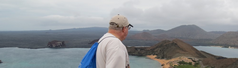
There is one World Heritage Site in the North-Central Rockies forests south of the 50th parallel. Waterton-Glacier International Peace Park, Alberta-Montana, consists of adjoining Canadian and U.S. national parks and was established to highlight the glacial landforms, distinctive climate, physiographic setting, mountain prairie interface, and tri-ocean hydrographic divide of the Crown of the Continent region. Waterton Lakes and Glacier parks are also international biosphere reserves. Glaciation resulted in horn-shaped peaks, U-shaped valleys, hanging valleys, arêtes, cirques, and lakes along with 50-60 small glaciers now in retreat. The area also showcases large animal migration and grizzly bear country. The Lewis Overthrust fault is a large low angle thrust fault, the best displayed in North America. It was folded and uplifted, then pushed eastward on top of younger Cretaceous formations. Displacement was up to 80 km and preserved ancient sediments containing Precambrian stromatolites. The parks are located at the mountain-prairie interface, providing examples of ongoing ecological processes. Ecologically, the mountains also catch Pacific moisture, marking the easternmost occurrence of many species.Another superlative is that the area contains 98 percent of the world’s stock of Westslope cutthroat trout.
Glacier National Park has 740 miles of trails. Some of the major visitor areas are along the Going-to-the-Sun Road, which is a national historic landmark. Lake McDonald Valley (N48˚32’ W114˚0’), on the southwest side of the park at the western end of the Going-to-the-Sun Road, includes a 500-foot-deep lake and is ten miles long. Hanging valleys surrounding the lake descend to the area through waterfalls. The Apgar Visitor Center is located here. Logan Pass (N48˚42’ W113˚43’) is the crest of the Going-to-the-Sun Road, and is noted for fields of wildflowers in the summer. St. Mary Valley (N48˚45’ W113˚26’) is at the east side of the Going-to-the-Sun Road at the mountain-prairie boundary. It includes a ten-mile-long lake.
Along the North Fork Flathead River in the northwest part of the park are Kintia Lake (N48˚50’ W114˚21’) and Bowman Lake (N48˚50’ W114˚12’), which provide tours of fire ecology, a homestead site, and the northern three-toed and black-backed woodpecker. Glacier NP hosts 275 species of birds, 14 of global or continental conservation concern, making it an IBA for species such as the olive-sided flycatcher, Brewer’s sparrow, and Cassin’s finch.
East of the Rockies are three areas off the beaten path. Goat Haunt (N48˚57’ W113˚54’) is reached by water from Waterton Lakes NP or by trail. Many Glacier (N48˚48’ W113˚39’) is considered the heart o the park with active glaciers. There is a hotel on Swiftcurrent Lake. Two Medicine (N48˚29’ W113˚22’) in the southeast is noted for trails, lakes, and waterfalls. The Continental Divide National Scenic Trail connects Goat Haunt, Many Glacier, Two Medicine, and Marias Pass (N48˚19’ W113˚21’) on US 2 on the southern boundary of the park.
Waterton Lakes NP, Alberta, showcases the mountain-prairie interface, since the park extends into the prairie habitat. There are 200 km of trails. The core area is the national park and the proposed buffer zone extends to the Pincher Creek, Crowsnest Pass, and Cardston areas. Along the Entrance Parkway is the Prince of Wales Hotel National Historic Site (N49˚3’ W113˚54’) (operated by Glacier Park, Inc., www.glacierparkinc.com), overlooking Upper and Middle Waterton Lakes. The 1927 hotel was built by the Great Northern Railroad like the sister Glacier National Park hotels. The Entrance Parkway leads to the Waterton Park townsite (N49˚3’ W113˚55’). From Waterton Park, Akamina Parkway leads 16 km to Cameron Lake (N49˚1’ W114˚3’) on the international border and containing subalpine habitats. Along the way is the First Oil Well in Western Canada National Historic Site (N49˚4’ W114˚0’). A third scenic drive in the park is the Red Rock Parkway (N49˚5’ W113˚55’), which connects with the Entrance Parkway. In the northern part of the park on Route 6 is the Bison Paddock (N49˚8’ W113˚54’), where bison can be seen grazing grasslands.
There is one Ramsar site in the North Central Rockies forests. Creston Valley Wildlife Management Area, British Columbia (N49˚6’ W116˚34’) is the most important waterfowl habitat in the province. It is managed by a special authority and extends over 17,000 acres, from the US-Canadian border to Kootenay Lake. It is a critical breeding, staging and wintering area for waterfowl including the tundra swan, white-fronted goose, western grebe, breeding Fosters tern, black tern, and wood duck. The Wildlife Interpretation Centre is at Corn Creek, where there is a trail system leading through the floodplain wetlands along the Kootenai River. Other areas are Duck Lake (N49˚10’ W116˚37’), known for thousands of waterfowl, Six Mile Slough, with ponds and dikes, and Dale Marsh at the US border. Forests are western hemlock, red cedar, and western white pine. The area is on both sides of Route 3 west of Creston. In addition to the Ramsar designation, the site is an Important Bird Area and a Canadian Amphibian and Reptile Area.
There are three Biosphere Reserves in the north central Rockies forests. Coram Experimental Forest Biosphere Reserve, Flathead NF, Montana (N48˚22’ W113˚59’), is located on Emery Ridge east of Martin City on Forest Road 38. Research at this site in Hungry Horse, Montana, focuses on western larch regeneration. The Walk with Larch trail consists of two loops in the old growth forest. The Coram RNA is on lower slopes with old growth western larch, Douglas-fir, and a wet meadow. Nearby Hungry Horse, Montana, hosts the Larix Arboretum (N48˚23’ W114˚3’).
Glacier NP Biosphere Reserve, Montana, is described under the Waterton Glacier International Peace Park world heritage site description. The Great Northern Railway Buildings, Going-to-the-Sun Road, and Lake McDonald Lodge in Glacier NP are National Historic Landmarks and are described below under NHLs. Waterton Lakes NP Biosphere Reserve, Alberta, is also described under the Waterton Glacier International Peace Park world heritage site. Within the park is the Prince of Wales Hotel National Historic Site and First Oil Well in Canada National Historic Site.
There are five National Historic Landmarks in the North Central Rockies forests:
Coeur d’Alene’s Old Mission State Park (Cataldo Mission), Idaho (N47˚33’ W116˚22’), also called the Mission of the Sacred Heart, was used by the Jesuits in the 1850s in their efforts to convert the Coeur d’Alene Indians. It is the oldest building in Idaho. Hand hewn beams are secured with wooden pegs. No nails were used in the construction.
Going-to-the-Sun Road, Glacier National Park, Montana, built between 1922 and 1937, became the model for roads in national parks and public lands, introducing the concept of landscape engineering and a model for innovative road engineering as part of the American park movement. The portion of the road from Apgar (N48˚31’ W113˚59’) to St. Mary (N48˚45’ W113˚26’) is within the NHL district. The road is also a National Civil Engineering Landmark. In addition to the road itself, the district includes the following structures:
- Sprague Creek Culvert (N48˚36’ W113˚53’)
- Snyder Creek Culvert (N48˚37’ W113˚53’)
- Horse Trail Underpass (48-38, 113-51)
- Avalanche Creek Bridge (48-41, 113-49)
- Logan Creek culvert (48-43, 113-46)
- West Side Tunnel (48-45, 113-47)
- Granite Creek (Alder Creek) culvert (48-45, 113-46)
- Haystack Creek culvert (48-44, 113-45)
- Triple Arches (48-43, 113-43)
- East Side Tunnel (48-42, 113-42)
- Siyeh Creek culvert (48-42, 113-40)
- Baring Creek bridge (48-41, 113-36)
- St. Mary River bridge (48-45, 113-27)
- Divide Creek bridge (48-45, 113-26)
Great Northern Railway Buildings, Montana, is a five-property NHL. The railroad chose a distinctive architectural style, the Swiss chalet, for its Glacier NP development. These structures are the largest collection of Swiss chalets in the U.S. The system of buildings was designed to mimic a European-style resort where major resort hotels are linked to backcountry chalets by trails.
Property 1 is the Belton Chalets, West Glacier, Montana (N48˚29’ W113˚59’), is a group of hotel buildings built 1910 to 1911, the first of the Great Northern tourist hotels, and is just outside of Glacier NP. The buildings retain the arts and crafts ambiance of the early 1900 and are still operated as a hotel (www.beltonchalet.com).
Property 2 is the Many Glacier Hotel Historic District, Glacier NP, Montana (N48˚48’ W113˚39’). This building group, constructed in 1915, is a series of chalets up to four stories tall on the shore of Swiftcurrent Lake. It is known as the ‘Gem of the West.’ There are stone foundations and basements with wood frame superstructures. The lobby has four stories of balconies with floor to ceiling logs (www.glacierparkinc.com).
Property 3 is the Granite Park Chalet (N48˚46’ W113˚48’), Glacier NP, Montana, a dormitory and dining hall on the edge of a subalpine meadow below Swiftcurrent Pass. This 1914 structure is accessible via an eight-mile hike on the Highline Trail west of the Continental Divide (www.graniteparkchalet.com).
Property 4 is Sperry Chalet, Glacier NP, Montana (N48˚36’ W113˚47’), a 23-room dormitory and dining hall in a glacial cirque. Built in 1914, this inn is reached via the seven-mile Sperry Trail (www.sperrychalet.com).
Property 5, Two Medicine Chalet, Glacier NP, Montana (N48˚29’ W113˚22’), is now used as a general store. Built in 1914, this structure is an enormous log building originally used as a dining hall.
The Prince of Wales Hotel in Waterton Lakes National Park in Canada was also built by the Great Northern Railway and is a national historic site of Canada.
Lake McDonald Lodge, Glacier NP, Montana (N48˚37’ W113˚52’), built as the Lewis Glacier Hotel, is one of the finest examples of Swiss chalet architecture in the U.S. It opened in 1914 and was intended to be a rival to the Great Northern Railway buildings being built at the same time. In the lodge, the concrete floors are scored with messages in Blackfoot, Chippewa, and Cree languages. The lobby is three stories high with balconies and tall cedar columns extending three stories high. The room is lined with mounted hunting trophies. The lodge is located on the Going-to-the-Sun Road, also a national historic landmark (www.glacierparkinc.com).
Lolo Trail, Clearwater National Forest, Idaho, Lolo National Forest, Montana, and private lands is a site on the Lewis and Clark and Nez Perce National Historic Trails and is believed to provide a landscape substantially similar to that found in 1805. Because the Salmon River Mountains west of Lemhi Pass were impassible and the Salmon River downstream from the pass could not be navigated, Lewis and Clark chose this more northerly Nez Perce hunting trail as their way to the Pacific. The 100-mile, September 11-21, 1805, crossing, in dense brush and snow, proved the most difficult of the transcontinental trip. The return trip in June 1806, also in snow, also was difficult. The trail connects modern day Lolo, Montana (N46˚46’ W114˚5’) with Weippe Prairie, Idaho (N46˚21’ W115˚55’), mostly in the Lolo and Clearwater National Forests. Later the Nez Perce Indians used the trail in their flight from the US Army in 1877. The Lolo Trail area is mostly defined by Forest Highway 500, although the original trail winds north and south of the modern road. The trail passes Lolo Creek Campground, Hungery Creek, Sherman Saddle, Indian Grave Peak, Indian Post Office, Papoose Saddle, and Packer Meadows in the Clearwater NF. Musselshell Meadows Special Area (N46˚21’ W115˚45’) is a traditional Indian camas root gathering area east of Weippe Prairie. From west to east, sites in the Clearwater NF are Musselshell Meadows, Horse Sweat Pass Camp (N46˚25’ W115˚22’), Spirit Revival Ridge Camp (N46˚25’ W115˚19’), Dry Camp (N46˚26’ W115˚16’), Greensward Camp (N46˚27’ W115˚15’), Indian Grave Camp (N46˚30’ W115˚9’), Lonesome Cove Camp (N46˚33’ W114˚59’), Bears Oil and Roots Camp (N46˚35’ W114˚55’), Snowbank Camp (N46˚35’ W114˚49’), and Glade Creek Camp (N46˚37’ W114˚35’). The trail, Lolo Pass, and Musselshell Meadows are sites of the Nez Perce National Historic Park, Lewis and Clark National Historic Trail, and Nez Perce National Historic Trail.
There is one National Natural Landmark in the North Central Rockies forests. Hobo Cedar Grove Botanical Area (N47˚5’ W116˚7’), St. Joe National Forest, Idaho (administered as part of the Idaho Panhandle National Forests), is a 700-acre area containing ten-foot-diameter trees. It is on Forest Road 3357 off of Forest Highway 321 north of Clarkia.
Part B continues with units of the National Forest System