Canadian Aspen Forests and Parklands
This ecoregion is characterized by a vegetation of quaking aspen with balsam poplar. It is the most extensive boreal-grassland transition in the world and is the northernmost breeding area for many warbler species and hosts extenesive waterfowl breeding habitat. As mapped in 2001 and amended in 2017, there are four parts. The first area, described in parts 1 and 2, is centered on Edmonton and drained by the North Saskatchewan River. It extends to the south of Calgary adjacent to the eastern Rocky Mountains. In the 2017 ecoregion map, this ecoregion was reduced and the northwestern portions around Lac La Biche added to the Mid-Canada Boreal Plains forests. Those areas originally classified in NA 802 (2001) and now classified in the Mid-Canada Boreal Plains (2017) are to be published in 2018.
A second northern portion of the Canadian Aspen Forests and Parkland was mapped along the Peace River drainage and includes the area of British Columbia around Dawson Creek, Lesser Slave Lake, and the Peace River corridor to Wood Buffalo National Park. This area, known as the Peace River Parkland, was also merged into the Mid-Canada Boreal Plains in the 2017 ecoregion delineation. Because of its distinctiveness from the boreal forest, in this description the Peace River Parkland is maintained as a separate subregion of the Canadian Aspen Forests and Parklands. Sites in this ecoregion subsection will be published in 2018.
Canadian Aspen Forests and Parklands subsection
There is one Biosphere Reserve in the Canadian Aspen Forests and Parkland ecoregion. Beaver Hills Biosphere Reserve, established in 2016, includes the core areas of Elk Island National Park and Miquelon Lake Provincial Park. The moraine landscape (made of debris deposited and hills formed after the melting or retreat of ancient glaciers) of the Beaver Hills is just east of Edmonton. The Beaver Hills are a mosaic of forest and native wetlands. The extensive natural cover provides optimal habitat for bison, deer, elk and moose, as well as diverse and abundant waterfowl. The biosphere reserve includes the following facilities:
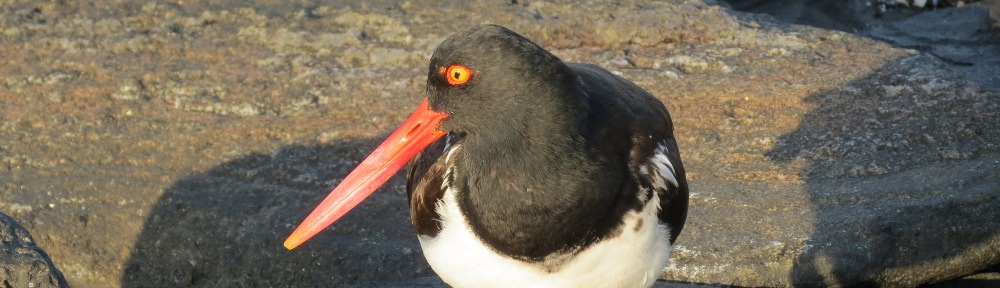
Elk Island National Park is on the Yellowhead Highway (Route 16) east of Edmonton and is a core area of the Beaver Hills Biosphere Reserve. The park was established as a refuge for the plains bison and elk. Elk were in the area at the time of establishment. The bison came in 1907 from Montana. Most of today’s plains bison are descended from this herd. Later introduction and breeding programs were established for the wood bison and trumpeter swan. The fenced 194-km2 park periodically supplies animals to support bison reintroduction programs in the U.S. and Russia. North of Route 16, plains bison are found, while to the south, wood bison herds are maintained. Visitor activities center around the visitor center (N53⁰35’ W112⁰50’), the bison loop drive, which winds through herds of bison (N53⁰36’ W112⁰50’), and Astotin Lake (N53⁰41’ W112⁰50’), where campgrounds and recreational facilities are found. There are 11 trails with a cumulative distance of 80 km which wind among aspen forest, sedge meadows, spruce bogs, and lakes. One of these trails is south of Route 16 and circles Flyingshot Lake (N53⁰33’ W112⁰50’), and others go to Oster Lake (N53⁰38’ W112⁰55’), where there is a walk-in campground.
Miquelon Lake Provincial Park (N53⁰14’ W112⁰54’) is 1,299 ha of aspen hills, ponds, and marshes off Route 833 east of Hay Lake and is a core area of the Beaver Hills Biosphere Reserve. The water features are shallow and saline with emergent vegetation. Trails lead from the visitor center. The lake is an Important Bird Area for breeding California and ring-necked gulls and American wigeon.
Antler Lake Island Natural Area (N53⁰29’ W112⁰59’) is a small 0.65-acre island covered with dense shrubs, birch, poplar, and cattails. It is located east of Uncas.
Beaver Hills Dark Sky Preserve, designated by the Royal Astronomical Society of Canada, includes Elk Island National Park and Cooking Lake-Blackfoot Provincial Recreation Area, both described individually. The total area of the preserve is 293 km2 and this dark sky preserve is the only site in western Canada so designated.
Cooking Lake-Blackfoot Provincial Recreation Area (N53⁰30’ W112⁰50’) is a 97 km2 area east of Edmonton with 85 km of trails for multiple trail uses. The area is noted for trumpeter swans. Activity areas and trailheads are at Blackfoot Lake, Central, Islet Lake, and Waskehegan (headquarters).
North Cooking Lake Natural Area (N53⁰29’ W112⁰59’) is 164 ha on Route 630 at Uncas. Hiking is available in the knob and kettle topography, and vegetation included aspen and willow shrublands in wetlands.
Golden Ranches Conservation Land (N53⁰27’ W112⁰57’) is reached from Range Road 210A north of Route 14. The property is 1,400 acres on Cooking Lake, including 8 km of shoreline. Vegetation is aspen and grassland. This is a property of the Edmonton and Area Land Trust.
Hastings Lake Islands Natural Area (N53⁰25’ W112⁰56’) consists of 5 small islands with an area of 4 ha on the west side of Hastings Lake. The islands are of hardwood forest and are used by colonial nesting birds. The area is off Route 14.
Hicks Conservation Land (N53⁰23’ W112⁰54’) is 149 acres on Range road 204 south of Route 14. This is a property of the Edmonton and Area Land Trust.
Edgar T. Jones Natural Area (N53⁰25’ W112⁰53’) is 92 ha of upland habitat on Hastings Lake, which is a waterfowl area.
Ministik Lake Game Bird Sanctuary (N53⁰20’ W113⁰2’) is 7,349 ha southeast of Edmonton. It includes Ministik Lake, Oliver Lake, Larry Lake, and part of Joseph Lake, along with trails. The shorelines, marshes, islands, and mudflats are an Important Bird Area for dabbling ducks, waterfowl, tundra swans, white pelicans, and double-crested cormorants. Ministik, Joseph, and Oliver Lakes are a designated Important Bird Area.
Ministik Conservation Land (N53⁰17’ W113⁰1’), is 160 acres which adjoins the game bird sanctuary on the south. Trails are accessible from the game bird sanctuary. This is a property of the Edmonton and Area Land Trust.
Parkland Natural Area (N53⁰23’ W112⁰51’) is 250 ha off Route 14 near Lindbrook. The vegetation is aspen and grasslands, rounded hills, and kettle ponds on a moraine.
Strathcona Wilderness Centre (N53⁰32’ W113⁰0’), administered by Strathcona County, is located on Range Road 212 south of Township Road 530 east of Sherwood Park. A 15-km trail system is maintained on the north side of Bennett Lake.
Ukranian Cultural Heritage Village Provincial Historic Site (N53⁰34’ W112⁰48’) is on Route 16, 50 km east of Edmonton east of Elk Island National Park. The living history facility includes 35 structures.
There is a Ramsar and Western Hemisphere Shorebird Reserve Network site in the Canadian Aspen Forests and Parklands ecoregion. Beaverhill Lake Heritage Rangeland and Natural Area, Alberta (N53˚27’ W112˚32’) is a 17,534-ha natural area including a 14,000-ha natural alkaline lake northeast of Tofield and south of the Yellowhead Highway (Route 16) which is shallow throughout, reaching only two to three meters in depth. The shoreline contains mudflats, beaches, and areas of emergent vegetation. The site is known for migratory waterfowl and pelicans and is a site on the Western Hemisphere Shorebird Reserve Network as well as being an Important Bird Area. Among the birds found here are snow geese, greater whitei-fronted geese, mallards, pintails, sandhill cranes, piping plover, and numerous shorebirds including phalarope, sandpiper, dowitcher, and avocet. An area of the south shoreline (N53°22’ W112°31’) and two islands (N53°30’ W112°31’) and (N53°31’ W112°30’), a total of 410 ha, are designated the Beaverhill Natural Area by the province.
There are ten Nationally Designated sites in the Canadian Aspen Forests and Parkland ecoregion subsection.
Fort Augustus and Fort Edmonton National Historic Site (N53⁰43’ W113⁰13’) is the site of rival fur trading posts built by the North West Company and Hudson’s Bay Company in 1795 and 1796 just above the confluence of the North Saskatchewan and Sturgeon River. The site is across the river from the modern-day town of Fort Saskatchewan. No above-ground evidence remains of the sites.
Bar U Ranch National Historic Site, Alberta (N50˚25’ W114˚15’) is on Pekisko Creek on Route 22 south of Longview. Historic ranch buildings including a blacksmith shop, cookhouse, stables, and hog barn commemorate ranching history. Established in 1882, the 148-ha Bar U Ranch site was one of many large ranches that dominated society in the 1890s. A hard winter in 1906 marked the beginning of decline of the large ranch society, but Bar U survived until 1991. It was established as a national historic site to protect the cultural landscape of a large ranch society.
Fort Edmonton III National Historic Site (N53⁰32’ W113⁰30’) is the last site of Fort Edmonton, a Hudson’s Bay Company trading post dating to the 1830s. The site on 97th Avenue is now the location of the Alberta Legislature.
Elk Island National Park is described under Beaver Hills Biosphere Reserve.
Leduc-Woodbend Oilfield National Historic Site, Alberta (N53˚20’ W113˚44’), is the site of a petroleum discovery that revolutionized the Canadian oil industry in 1947. After this discovery, oil production shifted to the north from the Calgary area. The site is 2 km south of Devon on Route 60 just south of Route 19. The visitor center is the Leduc #1 Energy Discovery Centre. The site is interpreted by the Devon/Leduc Oilfield Historical Society.
Red Deer Migratory Bird Sanctuary (N52⁰17’ W113⁰47’) is 129 ha on two oxbow lakes. It is operated by the City of Red Deer as Gaetz Lake Sanctuary. The migratory waterfowl area has five km of trails.
Trans-Canada Trail traverses the Canadian Aspen forest and parklands ecoregion west of Calgary, between Calgary and Edmonton, and northwest and northeast of Edmonton. West of Calgary, trail segments pass through Cochrane (N51⁰1’ W114⁰27’) and Glenbow Ranch Provincial Park (N51⁰10’ W114⁰23’). Trail segments in Calgary pass the Glenmore Reservoir (N50⁰59’ W114⁰7’) and Weaselhead Park (N50⁰59’ W114⁰9’). North of Calgary, the Destiny Trail (N52⁰2’ W113⁰57’) passes sites in Innisfail including the historical village. In Red Deer, the Waskasoo Park Trail system passes the Gaetz Lakes Sanctuary (N52⁰17’ W113⁰47’). The Bluebird Trail passes through Blackfalds (N52⁰23’ W113⁰48’), Lacombe (N52⁰28’ W113⁰44’), and Penoka (N52⁰41’ W113⁰34’). The Wetaskiwin Trail (N52⁰58’ W113⁰23’), Leduc Multi-Way (N53⁰16’ W113⁰32’), and Devon Trail (N53⁰22’ W113⁰43’) are south of Edmonton. West of Wetaskiwin, the Kiskayo Trail encircles Pigeon Lake from Pipestone (N53⁰3’ W113⁰51’), Poplar Bay (N53⁰1’ W114⁰7’), and Mulhurst (N53⁰4’ W114⁰0’).[MCBP] In Edmonton, the River Valley Trail provides 30 km of the Trans-Canada trail from Terwillegar Park (N53⁰29’ W113⁰37’) to the Strathcona Science Provincial Park (N53⁰34’ W113⁰22’). North of Edmonton, the Trans-Canada Trail uses the Strathcona County Trail (N53⁰34’ W113⁰17’) to extend to connect with the Fort Saskatchewan Trail (N53⁰42’ W113⁰15’).
Turner Valley Oilfield National Historic Site (N50⁰40’ W114⁰16’) is the site of oil discoveries in 1914, at the time the largest in the British Commonwealth. The site established Calgary as an oil and gas boomtown. Peak production was in 1936, and the site is still producing.
Turner Valley Gas Plant National Historic Site (N50⁰40’ W114⁰16’) contains 22 buildings from the 1920s to the 1970s associated with processing of petroleum. The site on the north bank of the Sheep River illustrates the evolution of petroleum technology.
Wetaskiwin Court House National Historic Site (N52⁰58’ W113⁰22’) is on 50th Avenue at 47th Street in a park-like setting in Wetaskiwin. The 1909 classical revival structure commemorates the growth of the justice system as Alberta changed from a territory to a province. This involved the creation of judicial districts and legal institutions as the territory shifted to provincial government. The courthouse is typical in design for western Canada.
to be continued