
Natural Areas of the Mojave Desert
Mojave Desert
Ecoregion of the Nearactic Biome Number 1308 on map.
Extent of Mojave Desert: 33 to 38 degrees North; 113 to 119 degrees West
Country (State): United States (Arizona,California,Nevada,Utah).
I. Overview
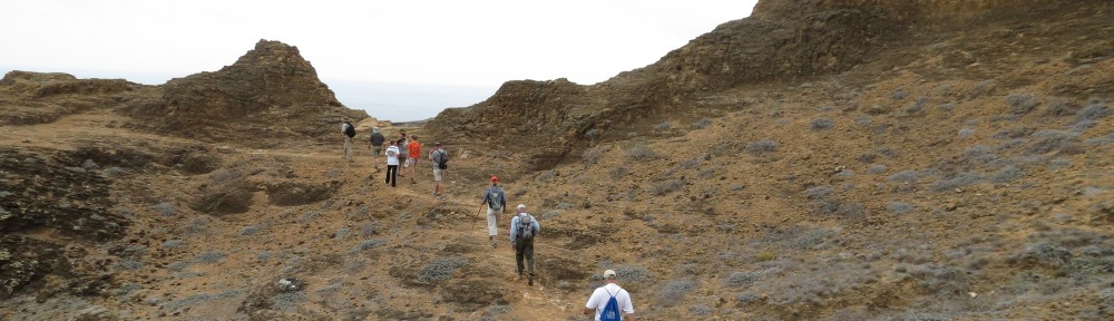
Located adjacent to the crowded southern California Mediterranean ecosystems, the Mojave Desert is filled with military bases and is the site for new construction of renewable energy installations. It is also filled with recreation lands, including national parks and wilderness areas. It is not a barren desert, but is covered with typical vegetation of creosote bush, desert sage, and Joshua tree. Native wildflowers provide displays in the spring. Prior to the current renewable energy boom, the desert was home to mining operations in many areas. After these areas were abandoned in the early 20th century, the area was left alone and not grazed, providing a natural experiment in ecosystem recovery. As expected, soils that are severely disturbed and older soils take a long time to recover, and disturbances in these areas are essentially permanent, especially if the soil is compacted such as through use as a road. Younger soils such as those created from debris flows recover relatively fast and the vegetation returns within 80 to 100 years (Brown 2000a).
Soils in the Mojave Deserthave been found to absorb carbon dioxide at night. The magnitude is as much as a temperate forest. If other deserts also exhibit this phenomenon, the effect could be huge, since 35 percent of the Earth’s land surface is desert or semiarid. However, these findings have not explained where the carbon is going. Some possibilities are to biotic crusts and expanded shrub cover. In addition, it is possible that it is an ephemeral effect, and the carbon could be released during the day, for example (Stone 2008). All of this indicates the many uncertainties in the understanding of the carbon cycle.
One native plant of the Mojave, Nicotiana attenuata, produces a floral nectar high in nicotine. It is pollinated by hawkmoths and hummingbirds. The combination of nicotine and floral scent does not make the plants more attractive to the pollinators, and in fact reduces the time a pollinator spends at each plant. However, this promotes the plant’s interest because pollinators visit more plants and thus pollinate more. In addition, nicotine deters caterpillars and carpenter bees, which would otherwise reduce reproductive success. Thus, the best strategy is to attract a pollinator but then prevent them from loitering (Raguso 2008).
Another plant in the Mojave, Linanthus parryae, tends to flower in blue and white patches across the landscape. For example, one side of a desert wash might be all blue while the other side might be all white. This is currently attributed to natural selection due to local environmental differences; however, in the past, it was attributed to genetic drift, where blue flower seeds happened to land in one place and spread (Pennisi 2007).
Characteristic of the Mojave are dry lakes in the valleys. In wetter years, these areas are briny, supporting microbes that can live in exceptionally high salinity. Most microbes live by reducing sulfur or carbon. However, at Searles Lake and the Trona Pinnacles National Natural Landmark in the northwestern Mojave, the brine is rich in the toxic element arsenic. Microbes have been found to use this element for biological processes in the briny sediments. Under aerobic conditions, arsenic III is oxidized. Under anaerobic conditions in deeper sediments, arsenic V is reduced. This takes the place of sulfate or carbonate reduction in other environments (Oremland et al. 2005).
At the Coso Mountains Wilderness, the Mojave Desert includes a group of volcanoes that last erupted more than 10,000 years ago but overlie large magma chambers. These volcanoes are considered potentially dangerous, but not as immediate a threat as the cascade volcanoes further north (Kerr 1983). Outside of volcanic areas, the desert has been relatively stable and sites such as Devils Hole,Nevada, have precipitated calcium carbonate for the last 500,000 years. There are no apparent depositional hiatuses. This can provide a unique climate record spanning several glacial cycles during the Pleistocene. Evidence from Devils Hole indicates that there are relatively rapid shifts from full-glacial to interglacial climates followed by a gradual return to full glacial conditions. Interglacial climates lasted about 20,000 years (Winograd et al. 1992).
In 1990, the desert tortoise was listed as a threatened species under the Endangered Species Act, causing virtually every project in theMojave Desertto consult with the US Fish and Wildlife Service prior to construction. From the beginning, there were disputes over population counts of the tortoises, which hibernate underground during droughts (Brown 2000b). In the Ivanpah Valley, California, in theMojave Desert, an ideal site for generating solar power also turned out to be an ideal site for desert tortoises, which are an endangered species. Tortoises occur primarily on flats and alluvial fans adjacent to the mountains with soils ranging from sand to sandy-gravel, characterized by scattered shrubs and abundant interspace for growth of herbaceous plants. They occur in creosote bush, alkali sink, and tree yucca (Joshua tree) areas, places that are also ideal for new renewable power plant sites. Desert washes and other areas with deep soil provide sites for the tortoises to burrow and escape the desert heat. The 3,572-acre Ivanpah site, located on federal land to the east of Mojave National Preserve and to the south of Stateline Wilderness Area, was the subject of a Final Environmental Impact Statement (EIS) issued in August 2010. During the EIS process, the expected power output of the project was reduced ten percent due to a redesign that reduced the project footprint by 12 percent and the number of 460-foot power towers from seven to three. A Biological Opinion was issued by the US Fish and Wildlife Service onOctober 1, 2010, and the Bureau of Land Management (BLM) issued its Record of Decision onOctober 7, 2010. A 30-year right-of-way grant was issued to BrightSource Energy.
Consistent with the Biological Opinion, BrightSource proceeded to fence the construction area and remove tortoises for relocation to a nearby site on BLM property. The tortoises were placed in an on-site quarantine area for disease testing. However, construction monitoring of perimeter fence installation around Units 2 and 3 in the winter and spring of 2011 indicated that these portions of the project might contain more desert tortoises than anticipated in the 2010 biological opinion. The BLM requested revised consultation. The revised biological opinion, dated June 10, 2011, reiterated the need to fence the construction area, collect tortoises, and relocate elsewhere. It also required the rearing of young turtles and turtles from eggs until they were a size of 120 mm in length and five years of post-release monitoring. The company was also required to fence I-15 in the translocation area to a standard that would exclude turtles. As compensation for the 3,572 acres of public land lost to the solar facility, the California Energy Commission required BrightSource to acquire and restore good quality desert tortoise habitat at a ratio of 2:1, and to take actions on that newly acquired property to improve habitat quality, which could include restoration of closed roads, tortoise exclusion fencing along I-15 and US 95 and around the towns of Nipton, California, and Primm, Nevada, and elimination of invasive plant species. An interest-bearing account was also established to bankroll a management fund for the new properties.
The project was anticipated to increase the number of common ravens, a potential tortoise predator, at the project site. Brightsource was also therefore required to contribute to a management fund to reduce the numbers of common ravens in the area.
Another Mojave Desert solar project with tortoises present is the K Road Power project, a 350-MW photovoltaic generating station proposed for the Moapa Band of Paiute Indian Reservation on I-15 in Nevada. This is the subject of an EIS completed onMarch 16, 2012. The K Road project would be located on 2,153 acres of reservation land. During an October 2010 desert tortoise survey, up to 103 turtles were estimated to occur on the area to be disturbed. Similar to the Ivanpah project, the March 7, 2012, Biological Opinion requires the tortoises to be relocated and all construction activity to be monitored by desert tortoise biologists. The project includes a 6,000-acre desert tortoise relocation area to the north of the I-15 and an additional 5,000 acres south of I-15 for desert tortoise relocation if needed. The EIS looked at the impacts of an alternative site on the same reservation, but this site was estimated to have the same or greater effects on the desert tortoise
But these projects are not all that is underway in the desert tortoise habitat. To date, 13 solar projects have been approved inCaliforniaandNevada, and more are under development. Another one on I-10 in California, the Palen project, is awaiting a decision by BLM. Under development on the reservation to the south of K Road Project is a concentrating solar project, Moapa Solar. Also to the south ofK Road, another concentrating solar plant is under development on BLM land by BrightSource as the Apex North East Las Vegas project. Power line projects and pipeline projects will also likely have cumulative effects on the tortoise habitat.
Another long-running environmental battle in the Mojave Desert was over the siting of a low level radioactive waste facility. It was proposed to be located at Ward Valley, on I-40 west of Needles, in 1988. However, due to opposition by environmental and tribal groups, the state signed legislation in 2002 preventing the use of theWardValleyfor a nuclear waste facility.
II. Terrestrial Ecoregions of the Neararctic Biome
Deserts & Xeric Shrublands
NA1308, Mojave Desert. Characterized by creosote bush and Joshua trees. Found inArizona,California,Nevada, andUtah.
III. Freshwater Ecoregions
Xeric Freshwaters and Closed Basins
126, Lahontan. This includes closed watersheds in the northernMojave Desert such as Sarcobatus Flat.
128, Death Valley, includes much of theMojave Desert, including the closed basins of Amargosa andMojaveRivers. Large dry lake basins are those of Bristol Lake,Owens Lake,Searles Lake,Rogers Lake,Rosamond Lake, and Soda Lake in the Mojave Desert. There are five endemic fish, 20 endemic mollusks and five endemic aquatic insects.
129, Vegas-Virgin, includes the watersheds of the Meadow Valley Wash, Pahranagat Wash,Virgin River, and White River, all in the Las Vegas area and northward in Arizona, Nevada and Utah. Endemic species are three species of spinedace,Virgin River chub, and Moapa speckled dace.
130, Colorado. The portions of this large ecoregion included in this discussion are the Colorado upstream from Lake Havasu including the major tributaries of the Virgin in the Mojave Desert and the Little Colorado, San Juan, and Green in the Colorado Plateau. Endemic fish are humpback chub, bonytail, and razorback sucker, and near-endemics are Colorado spine dace,Colorado pikeminnow, several suckers, and Apache trout.
IV. World Heritage Site
Grand Canyon National Park, Arizona (site 1). The most spectacular gorge in the world, with two billion years of strata and seven life zones. The park includes the north bank of the Colorado River from Pearce Ferry on Lake Mead to Navajo Bridge, and the south bank from the Hualapai Reservation to the Navajo Reservation. The lower elevations of the park are in the Mojave Desert, the middle-elevations are in the Colorado Plateau, and the high elevations, including the visitor areas at the North Rim and South Rim, are in the Arizona Mountains forests. The North Rim includes the Bright Angel Point area, Point Imperial, Point Sublime, Swamp Point, Toroweap Overlook, and and Cape Royal Overlook areas. The South Rim includes the Grand Canyon Village, Hermits Rest, and Desert View areas. Lipan and Yaki Points along the South Rim are an IBA for raptor migration, with 10,000 birds spotted during fall migration season at each location. Colorado River areas included in the park are Lower Granite Gorge, Middle Granite Gorge, Granite Gorge, and Marble Canyon. Marble Canyon is considered an IBA for California condor and waterfowl migrants. Terrestrial ecoregions NA503, NA1308, and NA1304.
V. Man and the Biosphere Reserve
Mojave and Colorado Desert,California. A multi-unit biosphere reserve including Death Valley National Park, Joshua Tree National Park, Santa Rosa and San Jacinto Mountains National Monument, Anza-Borrego Desert State Park, and Philip L. Boyd Deep Canyon Desert Research Center in Palm Desert, California. The parks and monuments are described in separate entries below. Ecoregion NA1308.
VI. Ramsar Site
Ash Meadows National Wildlife Refuge,Nevada (site 2). Up to 30 spring-fed wetlands provide habitat for 25 endemic species, most famous of which is the Devil’s Hole pupfish. The refuge is an IBA for warblers in migration and southwestern willow flycatcher. Ecoregion NA1308.
VII. National Forest (NF) System
Inyo NF, California and Nevada (site 3). This 1.9-million-acre forest is on the eastern side of the Sierra Nevada, adjoining Yosemite National Park, Kings Canyon National Park, and Sequoia National Park. Includes Ancient Bristlecone Pine Forest, home to the oldest living trees on Earth; Big Pine Canyon, a dramatic glacier carved canyon with Palisades Glacier, the southernmost in the US; Bishop Pass and Treasure Lakes, California Bighorn Sheep Zoological Area, Grays Meadow, June Lake, Kern Wild and Scenic River, Mammoth Lakes, Mono Basin National Scenic Area (see description under WHSRN), Reds Meadow and Devils Postpile, Rock Creek, a glacier-carved valley with 50 lakes, and Whitney Portal. The Long Valley Caldera was the site of a giant eruption 760,000 years ago; ash from the eruption is found as far east as Nebraska. Eruptioins at Obsidian Dome, South Deadman Doe, and Panum Crater were 500 to 800 years ago, creating the youngest mountain range in North America. The area is volcanically active; trees on Horseshoe Lake and Mammoth Mountain were recently killed by high carbon dioxide levels, and Hot Creek Geological Site has geysers and mudpots. Glass Mountain, southeast of Mono Lake, is part of the Mono Hills IBA, and is noted for long-eared owl and northern harrier. Adobe Valley, also southeast of Mono Lake, is a spring-fed valley and IBA for snowy plover, shorebirds, and greater sage grouse. The Valentine Eastern Sierra Reserve of the UC Natural Reserve System is located in Mammoth Lakes. Ansel Adams Wilderness, Boundary Peak Wilderness, Golden Trout Wilderness, Hoover Wilderness, Inyo Mountains Wilderness, John Muir Wilderness, South Sierra Wilderness, and White Mountain Wilderness are included in its boundaries. Ecoregions NA527, 1305, and 1308.
Spring Mountains National Recreation Area,Toiyabe NF, Nevada (site 4). Charleston Peak hosts bristlecone pines and provides scenic views of the surrounding desert. Wilderness areas are La Madre Mountain, Mount Charleston and Rainbow Mountain. The area is an IBA for flammulated owl. Ecoregions NA515 and NA1305.
VIII. National Landscape Conservation System (wilderness areas are in a separate list below)
Beaver Dam Wash National Conservation Area, BLM St. George Field Office,Utah (site 5). This transition between the Mojave Desert and Great Basin, in the southwestern corner of Utah, contains the northernmost stand of tree yuccas, or Joshua trees. The Joshua Tree National Natural Landmark is included in this area. Ecoregion NA1308.
Grand Canyon-Parashant National Monument, BLM, Arizona (site 6 on map). The monument includes overlooks of the western Grand Canyon managed by the National Park Service, including Kelly Point, Twin Point, and Whitman Canyon. The BLM portions of the monument include Grand Wash Cliffs Wilderness, Mount Trumbull Wilderness, Mount Logan Wilderness, and part of Paiute Wilderness. The BLM portion also includes canyons, mountains, and buttes of the Shivwits Plateau and Grand Wash Cliffs, the latter of which is the boundary between theMojave Desert and the Colorado Plateau. Ecoregions NA1304 and NA1308.
Red Cliffs National Conservation Area, BLM St. George Field Office, Utah (site 7). Just to the south of the Pine Valley Mountains of the Dixie NF, this area includes the Cottonwood Canyon and Red Mountain wilderness areas. It is meeting place of three ecoregions (Colorado Plateau, Great Basin, and Mojave Desert) and protects the desert tortoise. Populations here are the densest in its range. Adjacent is Snow Canyon State Park. Ecoregions NA 1304 and 1308.
Red Rock Canyon National Conservation Area, BLM Las Vegas Field Office,Utah (site 8). The edge of theSpring Mountains west of Las Vegas provide the backdrop for this area, which has a 13-mile scenic drive and 30 miles of trails. The area extends from US 95 on the north to State Route 160 on the south. A sandstone escarpment and thickets of Joshua trees characterize the area. The area contains the first documented dinosaur tracksite in Nevada. Trails lead toOak Creek Canyon, Pine Creek Canyon, Ice Box Canyon, First Creek Canyon, Calico Tanks, Keystone Thrust, andTurtlehead Peak. Ecoregion NA1308.
Sloan Canyon National Conservation Area,Nevada (site 9). Located just to the south of Henderson and to the west of Boulder City, the centerpiece is an area of 300 rock art panels. Vegetation is creosote bush and associated species. The North McCullough Wilderness (see) is within the National Conservation Area. Ecoregion NA1308.
IX. National Natural Landmarks (NNLs)
Amboy Crater, BLM Needles Field Office,California (site 10). The recent volcanic cinder cone has a flat crater floor and erupted about 500 years ago. It is about 1,500 feet across. Wildflowers are in the crater floor. Surrounding the crater are 24 square miles of lava flows with lava tubes and spatter cones. Ecoregion NA1308.
Cinder Cones, Mojave National Preserve,California (site 11). The NNL consists of 20 large cinder cones in the Cima Dome area with extensive lava flows. The cones are mostly in the area bordered by I-15, Cima Road, and Kelbacker Road. Ecoregion NA1308. Also see Mojave National Preserve (below).
Grapevine Mesa Joshua Trees, BLM Kingman Field Office,Arizona (site 12). The best display of Joshua trees in theU.S. is to the southwest of Meadview, Arizona. Ecoregion NA1308.
Joshua Tree Area, Beaver Dam Wash NCA,Utah (site 5). See discussion under Beaver Dam Wash unit of National Landscape Conservation System. Ecoregion NA1308.
Mitchell Caverns,California (site 13). Part of Providence Mountains State Recreation Area, the limestone caverns began their formation a million years ago when the area was wetter than today. The rocks themselves are of Pennsylvanian and Permian age (300 million years in age). Ecoregion NA1308.
Rainbow Basin Area of Critical Environmental Concern, BLM Barstow Field Office, California (site 14). This major fossil site contains evidence of insects and Miocene mammals, including horses, camels, mastodons, and saber tooth cats. Ecoregion NA1308.
Timber Mountain Caldera, Nevada National Security Site (Department of Energy), Nevada (site 15). An extensive field 25-km across that erupted 12 million to 10,000 years ago. Ecoregions NA1305 and NA1308.
Trona Pinnacles,BLM Ridgecrest District, California (site 16). These are 500 or so tufa pinnacles in the dry SearlesLake. The pinnacles are in the shape of towers, tombstones, ridges, and cones and are up to 140 feet in height. This area is a mining lease for borax mining but contains spring-fed wetlands that make it part of the North Mojave Dry Lakes IBA. See overview for discussion of arsenic-tolerant microbes. Ecoregion NA1308.
Turtle Mountains Wilderness, BLM Needles Field Office,California (site 17). The area is made up of volcanic peaks in the transition between the Mojave and Sonoran deserts. The volcanic Mopah Range, Horn Peak, Castle Rock, and part of Ward Valley are included in the wilderness. The southern half is Precambrian rocks and the northern half is Tertiary period volcanic rocks. Rocks include chalcedony deposits. Dominant vegetation is creosote bush scrub and palo verde-cactus shrub. Ecoregion NA1308.
Valley of Fire State Park,Nevada (site 18). The NNL designation is because of an outstanding example of thrust faulting. The park contains a six-mile long valley lined with sandstone sculptures, arches, and spires. Notable rock formations are called the Beehives, Atlatl Rock, White Domes, Seven Sisters, and Elephant Rock. There are 225-million-year-old petrified logs and petroglyphs. Ecoregion NA1308.
X. National Park (NP) System
Death Valley NP, California and Nevada (site 19). The largest park in the lower 48 states straddles the Great Basin and Mojave Desert ecoregions. Eureka Dunes NNL is in the Great Basin portion, and 11,000-footTelescope Peak and the Panamint Range is part of the Great Basin montane forests ecoregion. BadwaterBasin is the well-known area 282 feet below sea level. Northern areas of the park have sand dunes and Ubehebe Crater, a volcanic cinder cone that erupted 2,000 years ago when magma mixed with ground water and exploded, leaving a 600-feet deep crater. Trails lead through pinyon-juniper and conifer forests to Wildrose Peak andTelescope Peak on the west side of the park. Part of the Mojave and Colorado Deserts biosphere reserve. Ecoregions NA515, 1305, and 1308
Grand Canyon NP, Arizona (site 1). See description under world heritage sites.
Joshua Tree NP, California (site 20). Although known for the iconic yucca trees, this is also a rock climbing area. Rocks rise from the desert floor in squared columns and pillars. Major points of interest arePark Boulevard, with its rock formations and Ryan Mountain, Hidden Valley and the Wonderland of Rocks, Desert Queen Ranch, Cholla Cactus Garden, and Lost Palms Oasis. The southern parts of the park have cholla cactus and creosote bush as the area grades into the Sonoran Desert. Part of the Mojave and Colorado Deserts biosphere reserve. Ecoregions NA1308 and NA1310.
Lake Mead National Recreation Area,Arizona andNevada (site 21). Lakes Mead (behind Hoover Dam) and Lake Mohave (behind Davis Dam downstream from Hoover Dam) provide the focus for this parkland. Major visitor areas are Cottonwood Cove, Katherine Landing and Willow Beach on Lake Mohave; and Boulder Beach, Callville Bay, Echo Bay, Las Vegas Bay, South Cove, and Temple Bar on Lake Mead. Major Colorado River canyons upstream of Hoover Dam which can be viewed by boat are Boulder Canyon, Virgin Canyon, and Iceberg Canyon. Downstream from Hoover Dam are Nevada Hot Springs and Arizona Hot Springs, which are in scenic canyons with waterfalls. Lake Mohave’s Grapevine Canyon has springs and lush vegetation. The North Shore Road passes two other springs on the Overton Arm of Lake Mead, Rogers and Blue Point. Wilderness areas include Black Canyon, Bridge Canyon, Eldorado, IretebaPeak, Jimbilnan, Muddy Mountains, Nellis Wash, Pinto Valley, and Spirit Mountain (see all). The cliffs along Lake Mead and Lake Mohave are an IBA for raptors. The Catclaw Washes on the eastern slope of the Newberry Mountains in the southern part of the NRA (Spirit Mountain and Nellis Wash Wilderness areas) are an IBA for painopepla. Ecoregion NA1308.
Mojave National Preserve,California (site 11). Mountains with Joshua trees, dunes, and lava flows. Cima Dome rises 1500 feet above the surrounding desert and is covered with Joshua tree forests. The California State University Sweeney Granite Mountains Desert Research Center is located here. The New York Mountains have a botanical island of chaparral in the desert and are part of the East Mojave Peaks IBA, along with the Clark Mountains, also in the preserve. The Kelso Dunes are an active dune system. Cinder Cone National Natural Landmark consists of 20 large cinder cones with extensive lava flows. Cima Dome is a vast Joshua tree woodland, the largest in the world, and is an IBA for gilded flicker, Bendire’s thrasher, LeConte’s thrasher, and crissal thrasher. Piute Spring and Cornfield Spring are part of the East Mojave Springs IBA. Ecoregion NA1308.
XI. Federal Recreation Lakes
Davis Dam and Lake Mohave, Bureau of Reclamation, Arizona-Nevada (site 22). This dam on theColorado River 68 miles downstream from Hoover Dam was constructed to regulate 1.5 million acre-feet of water to Mexico. The dam and reservoir are within the Lake Mead National Recreation Area (see). Ecoregion NA1308.
Hoover Dam and Lake Mead, Bureau of Reclamation, Arizona-Nevada (Site 23). See Lake Mead National Recreation Area in National Park System.
Parker Dam and Lake Havasu, Arizona-California (site 24). This dam on the Colorado River is the diversion point for the Colorado River aqueduct to California and the Hayden-Rhodes, Fannin-McFarland, and Tucson aqueducts of the Central Arizona Project. It is known as the deepest dam in the world, with its base 235 feet below theColorado River bed. The 45-mile long Lake Havasu covers 32 square miles in area. See Havasu NWR. Ecoregions NA 1308 and 1310.
XII. National Trail System
Mount Charleston National Recreation Trail (NRT), Spring Mountains National Recreation Area,Utah (site 25). This eight-mile trail traverses an ancient bristlecone pine forest and offers views of Las Vegas. Ecoregion NA515.
River Mountains Loop NRT, BLM, Lake Mead, City of Henderson, and City of Boulder,Nevada (site 26). This paved 35-mile trail makes a loop between Lake Mead and Las Vegas, connecting Hoover Dam. Ecoregion NA1308.
Twenty Mule Team NRT,California (site 27). In the Rand Mountains, beginning at Borax Bill Park, this trail extends for 12 miles near California City. Ecoregion NA1308.
XIII. National Wild and Scenic River System
Amargosa River, BLM Barstow Field Office,California (site 28). This river flows from Nevada south into Death Valley. The 26-mile section atTecopaBasin has hanging gardens, a slot canyon, and a waterfall. Ecoregion NA1308.
FurtherReading
Brown, Kathryn. 2000a. Ghost Towns Tell Tales of Ecological Boom and Bust. Science 290:35-37.
Brown, Kathryn. 2000b. Ecologists Spar Over Population Counts of Threatened Desert Tortoise. Science 290:36.
Ivanpah Solar Electric: http://www.blm.gov/ca/st/en/prog/energy/fasttrack/ivanpahsolar/fedstatus.html
K Road Power: http://projects2.pirnie.com/MoapaSolar/index.cfm?fuseaction=FEIS
Kerr, Richard A. 1983. Volcanoes to Keep an Eye on. Science 221:634-635.
Mohlenbrock, Robert H. 1984. The Field Guide to U.S.National Forests. Congdon and Weed, Inc.
O’Gara, Geoffrey. 2000. Guide to America’s Outdoors: Far West. National Geographic Society,Washington,DC.
Oremland, Ronald S., Thomas R. Kulp, Jodi Switzer Blum, Shelley E. Hoeft, Shaun Baesman, Laurence G. Miller, and John F. Stolz. 2005. A Microbial Arsenic Cycle in a Salt-Saturated, Extreme Environment. Science 308:1305-1308.
Palen Solar Power: http://www.blm.gov/ca/st/en/prog/energy/fasttrack/palen/fedstatus.html
Pennisi, Elizabeth. 2007. Natural Selection, Not Chance, Paints the Desert Landscape. Science 318:376.
Raguso, Robert A. 2008. The “Invisible Hand” of Floral Chemistry. Science 321:1163-1164.
Stone, Richard. 2008. Have Researchers Discovered a Hidden Loop in the Carbon Cycle? Science 320:1409-1410.
UNESCO-Man and the Biosphere Reserves Directory. http://www.unesco.org/mabdb/br/brdir/directory/database.asp (accessed5/30/11).
White, Mel. 2000. Guide to America’s Outdoors: Southwest. National Geographic Society.
Winograd, Isaac J., Tyler B. Coplen, Jurate M. Landwehr, Alan C. Riggs, Kenneth R. Ludwig, Barney J. Szabo, Peter T. Kolesar, and Kinga M. Revesz. 1992. Continuous 500,000-Year Climate Record from Vein Calcite in Devils Hole, Nevada. Science 258:255-260.
World Heritage List. http://whc.unesco.org/en/list (accessed5/22/11).