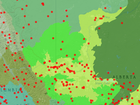
 This ecoregion is found in Alberta and British Columbia. The Peace River parklands were lumped into the Mid-Canadian Boreal Forests ecoregion in the 2017 delineation. These sites were formerly part of the Canadian Aspen Forests and Parklands ecoregion and the separation is maintained here because of their distinctive grassland characteristics and local distinction as the Peace River Parklands.
National Sites in the Peace River Parklands
Dunvegan National Historic Site, Alberta (N55˚55’ W118˚36’) is operated by the province of Alberta as Historic Dunvegan Provincial Park and Historic Site. The North West Company fur trading post of 1805 was taken over by the Hudson’s Bay Company and operated until 1918. It was also an early mission site and a starting point for travel to British Columbia. The 9-ha site includes a historic church and living history interpreters, with riverside walking trails. The location is 26 km south of Fairview on Route 2 at the Peace River.
Fort Fork National Historic Site (N56⁰8’ W117⁰28’) is on the Peace River 10 km upstream from the mouth of the Smoky River. This North West Company Trading Post was established in 1792 and abandoned in 1805. It was the starting point for the Alexander Mackenzie expedition to the Pacific in 1793. The Peace River Wildland Provincial Park is adjacent. There are no facilities.
Saskatoon Lake Migratory Bird Sanctuary (N55⁰13’ W119⁰5’) is 1,149 ha, and Saskatoon Island Provincial Park (N55⁰12’ W119⁰5’) is 101 ha on a peninsula between Saskatoon Lake and Little Lake. The park has camping and 4 km of trails, weaving through a mosaic of forest, wetland, and prairie. Although established to protect Saskatoon berry bushes, the park quickly became known for trumper swan nesting. Both areas are part of the Grande Prairie-Trumpeter Swan Important Bird Area, an important breeding and staging area for trumpeter swans and ducks. Other lakes included in the Important Bird Area are Bear Lake (N55⁰15’ W118⁰59’), Clairmont Lake (N55⁰16’ W118⁰46’), Lac La Glace (N55⁰23’ W119⁰4’), Gummer Lake (N55⁰22’ W119⁰0’), Valhalla Lake (N55⁰23’ W119⁰27’), and Wilken Lake (N55⁰17’ W119⁰20’).
Trans-Canada Trail: Entering the Peace River Parkland, trail segments in the Canadian Aspen forests and parkland include Mirror Landing Trail from Slave Lake (N55⁰18’ W114⁰46’)to Marten Creek (N55⁰30’ W114⁰55’), the Grouard to Peace Trail from Lesser Slave Lake (N55⁰30’ W115⁰26’) to Grouard Mission (N55⁰31’W116⁰9’), and the Friendship Trail from Peace River (N56⁰14’ W117⁰18’) to Grimshaw (N56⁰11’ W117⁰36’). In British Columbia, the trail extends from the Alces River (N56⁰9’ W120⁰3’) to Dawson’s Creek (N55⁰45’ W120⁰9’), where is connects with the Alaska Highway.
Fort Vermilion National Historic Site (N58⁰24’ W116⁰0’) was established on the Peace River in 1828.The 1908 Old Bay House is the only Hudson’s Bay Company factor’s house on the original location in Alberta. The Old Bay House is 2½ stories at the junction of River Road and 45th Street in Fort Vermilion.
Provincial and Local Sites in the Peace River Parklands
Dunvegan Provincial Park is described under Dunvegan National Historic Site. Saskatoon Island Provincial Park is described under National sites in the description of the Saskatoon Lake Migratory Bird Sanctuary.
Beatton River Provincial Park (N56⁰6’ W120⁰23’) is 186 ha at the confluence of the Beatton and Peace Rivers. Amid the old growth cottonwood forest is the site of 1806 Fort D’Epinette, built by the Northwest Company. The park is managed as a day use park.
Big Mountain Creek Provincial Recreation Area (N54⁰54’ W118⁰42’) is a 13-ha group camp 10 km east of Route 40 at the confluence of Big Mountain and Bald Mountain Creeks, providing access to forest trails south of Grande Prairie.
Caribou River Natural Area (N58⁰29’ W115⁰52’) is a 195-ha grassland on the Peace River at the confluence with the Caribou River. The area is accessed from Route 58. The park provides winter range for animals, and is on the migration corridor between the Peace River and Caribou Mountains.
Cecil Lake Ecological Reserve (N56⁰24’ W120⁰31’) is a 129-ha Important Bird Area 20 km northeast of Fort St. John. Aspen, sedge fen, and bog ecosystems are present. The bog forest is of black spruce, Labrador tea, cloudberry, and lichens. Breeding eared grebes and other waterbirds are attracted to the lake.
Child Lake Meadows Natural Area (N58⁰25’ W116⁰32’) is 388 ha south of Route 58 between High Level and Fort Vermilion. Salt meadows are uncommon this far north. The saline soils support aspen and wetlands.
Clayhurst Ecological Reserve, British Columbia (N56⁰8’ W120⁰2’) is 316 ha on the Peace River, adjoining Alberta’s Dunvegan West Wildland Provincial Park. Grassland and aspen grove communities are present.
Demmitt Provincial Recreation Area (N55⁰28’ W119⁰57’) is a 2-ha roadside park on Route 43, 88 km west of Grande Prairie.
Dunvegan West Wildland Provincial Park includes 20,968 ha in 11 units, all along the south bank of the Peace River between Dunvegan and British Columbia. Features include grasslands, aspen forests, cacti, hoodoos, and fossil beds. The park adjoins Silver Valley Ecological Reserve. General locations are as follows:
- Western unit (N56⁰7’ W119⁰53’)
- Pouce Coupe River (N56⁰3’ W119⁰50’)
- Sneddon Creek (N56⁰8’ W119⁰41’)
- Silver Valley (N56⁰11’ W119⁰32’ and N56⁰12’ W119⁰26’)
- Middle unit (N56⁰15’ W119⁰14’)
- Fourth Creek (N56⁰3’ W119⁰1’ south end to N56⁰15’ W118⁰58’ north end)
- Hamelin Creek (N56⁰0’ W118⁰54’)
- Eastern units (N55⁰57’ W118⁰48’ and N55⁰56’ W118⁰43’)
- Ksituan River (N55⁰53’ W118⁰45’)
Queen Elizabeth Provincial Park (N56⁰13’ W117⁰42’) is an 86-ha park west of Grimshaw on Lac Cardinal. The park includes diverse forest habitats, a bird viewing platform, and network of hiking trails. Lac Cardinal is an Important Bird Area, globally significant for staging and molting ducks. Other birds are Canada, greater, white-fronted, and snow geese; tundra and trumpeter swans, red-necked and western grebes, and Barrows goldeneye.
Figure Eight Lake Provincial Recreation Area (N56⁰18’ W117⁰54’) is 90 ha on Route 737 west of Lac Cardinal. The park includes a campground and lakeside recreation.
Frank Lake (N55⁰54’ W116⁰54’) is a small isolated lake 20 km southeast of Nampa. It is not accessible by road. The lake was designated an Important Bird Area because it hosts tundra swans in continentally significant numbers. Also, Canada geese, surf and white-winged scoters, bufflehead, and red-necked grebe are found on the lake.
Greene Valley Provincial Park consists of 3,131 ha along the corridor of the Heart River south of Peace River. The northern end is at Route 2 (N56⁰14’ W117⁰17’) and the southern end (N56⁰4’ W117⁰10’) is along the Heart River. The forested corridor is used by moose and mule deer.
Heart River Dam Provincial Recreation Area (N55⁰41’ W116⁰36’) is an 18-ha campground on a reservoir, surrounded by the Winagami Wildland Provincial Park.
Hilliard’s Bay Provincial Park (N55⁰30’ W116⁰0’) is 2,325 ha on Lesser Slave Lake. There is camping, a sandy beach, and the Boreal Forest Nature Trail. Nesting great horned and great gray owls have been noted in the park. The park is part of the Lesser Slave Lake Important Bird Area (see Lesser Slave Lake Provincial Park).
Kleskun Hill Natural Area (N55⁰16’ W118⁰31’) is a 65-ha tract operated by the County of Grande Prairie No. 1 for camping. The area features hills rising 100 m above the surrounding prairie, with grassland plants, prickly pear cactus, and badlands of clay, sandstone, and coal exposed. The site is the northernmost badland in Alberta. Adjacent is the Kleskun Hill Historical Village, restored to the early 20th century, operated by the Bezanson community. The sites are on Township Road 724 off of Range Road 41 north of Route 43.
Isoegun Lake Provincial Recreation Area (N54ᵒ27’ W116ᵒ49’) is 116 ha 11 km north of Fox Creek. It is operated by the Town of Fox Creek for camping and lakeside recreation.
Kimiwan Lake (N55⁰45’ W116⁰55’) is a 5,176-ha Important Bird Area on Route 2 at McLennan. The lake attracts shorebirds, including pectoral sandpiper and dowitcher, geese, swan, and Franklin’s gull. Habitat is marsh, mudflats, agricultural land, and boreal forest. The Kimiwan Birdwalk Interpretive Center (N55⁰43’ W116⁰55’) is operated by the Kimiwan Lake Naturalists, and includes 12 km of trails. The lake is considered a potential Western Hemisphere Shorebird Reserve Network site.
Kiskatinaw Provincial Park, British Columbia (N55⁰58’ W120⁰34’) is 58 ha on the Kiskatinaw River at the Old Alaska Highway, 28 km north of Dawson Creek. The park includes a 190-foot historic wooden curved tressel, built during World War II with a banked curve.
Kiskatinaw River Provincial Park, British Columbia (N56⁰5’ W120⁰9’) is 154 ha at the confluence with the Peace River. Mule deer may be seen in the grasslands above the Peace River.
Machesis Lake Provincial Recreation Area (N58⁰20’ W116⁰35’) is 78 ha north of the Peace River and west of Fort Vermilion, providing camping and lakeside recreation.
Moberly Lake Provincial Park (N55⁰48’ W121⁰31’) is 98 ha, 25 km northwest of Chetwynd on Route 29. Trails lead through the white spruce and aspen forests.
Moonshine Lake Provincial Park (N55⁰53’ W119⁰13’) is 1,103 ha of boreal mixed wood and wetland complexes on Route 725, north of Route 49 between Rycroft and Dawson Creek. An extensive trail network has been constructed north and west of Moonshine Lake. Jack Bird Pond within the park is noted for waterfowl viewing.
Notikewin Provincial Park (N57⁰14’ W117⁰8’) is 9,697 ha on the Peace River at the confluence with the Notikewin River. Access is via Route 35 at Hawk Hills. The park provides wildlife viewing opportunities.
O’Brien Provincial Park (N55⁰4’ W118⁰49’) is 65 ha on Route 666 at the junction with Route 40. There are large poplars along the Wapiti River and 4 km of trails.
Ole’s Lake Provincial Recreation Area (N56⁰19’ W119⁰54’) is 81 ha on Route 64 just east of British Columbia. The camping and day use area provides habitat for moose, beaver, loon, osprey, and great blue heron.
Otauwau Natural Area (N55⁰11’W114⁰21’) is on Route 2 east of Slave Lake. There are black spruce fens and white spruce uplands. The 256-ha tract is noted as being used for botany research.
Peace River Provincial Recreation Area (N56⁰14’ W117⁰17’) is a 5-ha tract on Route 2 east of Peace River, not open to the public.
Peace River Wildland Provincial Park is a 24,563-ha river corridor park extending along the Peace, Saddle, and Smoky Rivers, providing a corridor for deer, elk, and bear movement. The northeast end is at the Smoky River-Peace River confluence (N56⁰12’ W117⁰18’), the west end is on the Peace River near Dunvegan (N55⁰54’ W118⁰25’), the southwest end is along the Saddle River (N55⁰49’ W118⁰22’), and the south end is along the Smoky River (N55⁰55’ W117⁰31’). The Fort Fork National Historic Site is adjacent to the park on the Peace River 10 km upstream from the mouth of the Smoky River.
Peace River Corridor Provincial Park, British Columbia, is 2,014 ha in three sections along the Peace River east of Fort St. John. The Alces River unit (N56⁰8’ W120⁰3’) provides a scenic viewpoint overlooking the Peace River. The Wak’anaahtaah unit (N56⁰7’ W120⁰6’) provides hoodoos and a rare Lomatium species. The largest section, centered on Raspberry Island (N56⁰6’ W120⁰13’) provides camping and hiking along the river.
East Pine Provincial Park, British Columbia (N55⁰43’ W121⁰14’) is 14 ha, 30 km east of Chetwynd on Route 97. The day use area is at the Pine and Murray Rivers confluence. Balsam poplar and white spruce forest is present.
Pine River Breaks Provincial Park, British Columbia (N55⁰41’W121⁰22’) is 615 ha south of Route 97 between Chetwynd and Dawson Creek. The grasslands on the Pine River are accessible by foot from Sundance Pit Road. Features are eskers, kettles, fossil sites, and limestone cascades used for mineral licks.
Pines Provincial Recreation Area (N54ᵒ28’ W116ᵒ56’) is 19 ha on Route 43. There are no facilities.
Police Point Natural Area (N55⁰34’ W116⁰8’) is 370 ha on Route 750 near the western end of Lesser Slave Lake. The property fronts the Buffalo Bay, part of the South Heart River. Wetlands with black spruce fens, along with uplands with white spruce and aspen, are present.
Rolla Canyon Ecological Reserve, British Columbia (N55⁰53’ W120⁰0’) is 43 ha on the bank of the Pouce Coupe River, accessible by foot only. The reserve is a paleontological site, known for ammonite fossils.
Sand Lake Natural Area (N56⁰10’ W118⁰36’) is 2,844 ha of sand dunes and wetlands under forested ridges. The site is off Route 64 west of Fairview.
Saskatoon Mountain Natural Area (N55⁰13’ W119⁰17’) is 723 ha 30 km west of Grande Prairie and north of Route 43. The mountain rises 150 m above surrounding lands and is noted for aspen, balsam poplar, white spruce, and birch forests with views of the Rocky Mountains.
Shuttler Flats Provincial Recreation Area (N54⁰46’ W119⁰34’) is a 13-ha group use area 70 km from Grande Prairie on Route 666 at Nose Creek.
Silver Valley Ecological Reserve (N56⁰13’ W119⁰29’) is 1,805 ha adjoining Dunvegan West Wildland Provincial Park. The aspen forest includes habitat for 6 plant species found here beyond their normal range.
Simonette River Provincial Recreation Area (N55⁰8’ W118⁰11’) is a 54-ha scenic riverside park with a large sandy beach located 10 km south of Route 43 on Route 734 between Grande Prairie and Valleyview.
Lesser Slave Lake Provincial Park is 7,617 ha on the east shore of Lesser Slave Lake. Within the park, Marten Mountain soars 450 m above the lake. The park is noted for natural white sand beaches, a sand dune complex and beach ridge that is 1,500 years old, and balsam fir and lodgepole pine forests. The park is an Important Bird area for migrating tundra swans, and nesting waterfowl. Common goldeneye, mallard, common merganser, bufflehead, and three species of terns are known to nest, as well as 20 species of warblers. The Boreal Center for Bird Conservation and the Lesser Slave Lake Bird Observatory maintain facilities in the park. In addition, the Trans-Canada Trail traverses the park for 25 km along the shoreline of Lesser Slave Lake. The south end of the park is Devonshire Beach (N55⁰19’ W114⁰46’) and the north end of the park is at the Marten River (N55⁰30’ W114⁰55’).
Lesser Slave Lake Wildland Provincial Park (N55⁰30’ W115⁰30’) is 3,581 ha of moose habitat and bald eagle nesting habitat on the north shore of Lesser Slave Lake. It is part of the Lesser Slave Lake Important Bird Area.
Little Smoky River Provincial Recreation Area (N55⁰27’ W117⁰10’) is 2 ha on Route 49 just south of Route 2A.
Sturgeon Lake Natural Area (N55⁰6’ W117⁰40’) is a 28-ha island used by great blue heron and bald eagle. The lake is west of Valleyview.
Taylor Landing Provincial Park, British Columbia (N56⁰8’ W120⁰40’) is 2 ha on the Peace River on Route 97 south of Fort St. John. The day use area is forested with balsam poplar and trembling aspen.
Fort Vermilion Provincial Recreation Area (N58⁰24’ W116⁰8’) is 5 ha on Route 88 at the Peace River, providing camping opportunities.
Williamson Provincial Park (N55⁰5’ W117⁰34’) is a 17-ha day-use facility on Sturgeon Lake, just north of Route 43.
Winagami Lake Provincial Park (N55⁰37’ W116⁰44’) is a lakeside recreation area and birdwatching area on Township Road 770, with nesting grebes, sandpipers, gulls, and ducks. A trail is on the west shore of the lake.
Winagami Wildland Provincial Park is 12,667 ha in two units. The southern part, in the Heart River valley (N55⁰32’ W116⁰33’) consists of jack pine-dominated sand dunes. The northern part (N55⁰42’ W116⁰38’) surrounds the Heart River dam, and contains the McLennan sloping fen of sphagnum peat, small circular mounds, garter snake hibernacula, and white pelican, heron, and eagle habitat.
Young’s Point Provincial Park (N55⁰8’ W117⁰34’) is 3,202 ha on the north shore of Sturgeon Lake, just off Route 43. There are trails and an observation deck at a beaver pond.