Part K of North Central Rocky Mountain Forests
A temperate Eocene paleontological site, the grand canyon of the Fraser, and extinct volcanoes
The Cariboo Mountains of British Columbia provide the concluding discussion for North Central Rocky Mountain forests.
Tommie Archie Lake Trail (N51⁰56’ W120⁰31’), BC Sites and Trails, is a 1.3-km trail on Pendleton Road north of Wells Gray Provincial Park.
Blue River Black Spruce Provincial Park, British Columbia (N52°8’ W119°16’) is 175 ha on the North Thompson River at the town of Blue River on the Yellowhead Highway (Route 5). Sandbars and meanders on the North Thompson River support the southernmost occurrences of black spruce as well as rare insectivorous plants like sundew.
Blue River Pine Provincial Park, British Columbia (N52°7’ W119°17’), is 26 ha on the Blue River near its confluence with the North Thompson River. It is adjacent to the railway in the town of Blue River on the Yellowhead Highway (Route 5). On sandy soils adjacent to the river is an unusual lodgepole pine-Vaccinium vegetation type.
Bowron Lake Provincial Park, British Columbia, is 149,205 ha east of Wells and is known for a world-class canoe circuit involving 12 lakes, 6 portages for 11 km, and 6 to 10 days. The complete circuit is 116 km, starting and ending at Bowron Lake. The north end of the park is at the Wolverine River headwaters (N53°26’ W121°1’), the northwest end is at Bowron Lake (N53°16’ W121°24’), the southwest end is at the Cariboo River downstream from Cariboo Falls (N53°0’ W121°5’), and the southeast end is at the Cariboo River headwaters (N53°0’ W120°35’). Major points on the canoe circuit are Bowron Lake (N53°15’ W121°24’), the portage of Kibbee Lake (N53°16’ W121°20’), the portage to Indianpoint Lake (N53°16’ W121°16’), the portage of Isaac Lake (N53°18’ W121°11’), two portages around waterfalls along the Isaac River (N53°6’ W120°48’), McLeary Lake (N53°5’ W120°47’), the Cariboo River to Lanezi Lake (N53°4’ W120°51’), Sandy Lake (N53°2’ W121°4’), Unna Lake and the trail to Cariboo Falls (N53°3’ W121°10’), Babcock Lake (N53°5’ W121°11’), Skoi Lake (N53°6’ W121°13’), Spectacle Lakes (N53°7’ W121°13’), Swan Lake (N53°9’ W121°17’), and the Bowron River (N53°12’ W121°19’).
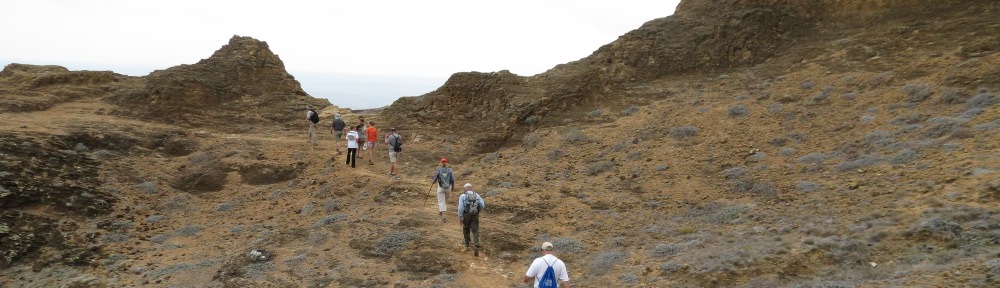
Caligata Lake Provincial Park, British Columbia (N51⁰44’ W119⁰50’) is a 153-ha north-facing cirque basin on Raft Mountain, with a lake, bogs, fens, and floristic diversity. The site is reached by trail from Spahats Creek Road.
Canim Beach Provincial Park, British Columbia (N51⁰49’ W120⁰52’) is a 6-ha pebble beach on a large lake surrounded by Douglas fir forests. It is east of 100-Mile House off of Route 97.
Cariboo Mountains Provincial Park, British Columbia, is 113,470 ha and includes the watersheds of the Matthew River, Mitchell River, and Niagara Creek. It is noted for serrated peaks and glaciers. The northwestern end is west of the Matthew River (N53°1’ W120°59’) and the eastern end is at the headwaters of Niagara Creek (N52°53’ W120°9’). The southern portion extends almost to the Clearwater River (N52°34’ W120°19’) in Wells Gray Provincial Park. Together with Wells Gray and Bowron Lake Provincial Parks, the area is managed for mountain caribou, grizzly bear, and bull trout. The main entrance and activity area is Ghost Lake (N52°56’ W120°52’).
Cariboo River Provincial Park, British Columbia, is a linear park of 3,210 ha extending along the Cariboo River from Kimball Lake (N52°58’ W121°11’) downstream to Cariboo Lake (N52°47’ W121°18’). The river flows through the Quesnel Highlands and the upper end is reached by driving 70 km east of Barkerville on 3100 Road. The lower end at Cariboo Lake is reached by driving 90 km north of Likely on 8400 Road.
Cedar Point Provincial Park, British Columbia (N52°35’ W121°32’) is 8 ha located 6 km south of Lively on Quesnel Lake. Old growth cedar is within the park.
Erg Mountain Provincial Park, British Columbia (N53°34’ W120°55’) is 1,010 ha in size and reached from Route 16 about 5 km west of Crescent Spur. A 7.5-km trail ascends to the peak, climbing 5,000 feet in elevation to reach the alpine area. The park also includes old growth cedar-hemlock forests.
Finn Creek Provincial Park, British Columbia (N51°54’ W119°19’), is 300 ha on the North Thompson River north of Avola and along the Yellowhead Highway (Route 5). A braided creek enters the river at this point, providing a good location for salmon spawning.
Hendrix Creek Falls Trail (N51⁰57’ W120⁰41’), BC Sites and Trails, is a short trail to a 20-m waterfall on Canim-Hendrix Lake Road.
Horsefly Lake Provincial Park, British Columbia (N52°23’ W121°17’) is 150 ha of old growth cedar and Douglas fir on the north shore of Horsefly Lake. The park is reached from 150-Mile House by taking the road to Horsefly and continuing 13 km north. A trail leads to an overlook of the lake. The nearby Horsefly River is known for its paleontological value. The Eocene Epoch lake sediments (50 million years old) contain high resolution fish, insects, plants, pollen and diatoms. Details include color patterns. The flora was temperate, which is unusual for Eocene sites, which tend to be tropical (British Columbia Paleontological Alliance, 2016).
Jackman Flats Provincial Park, British Columbia (N52°56’ W119°23’), is 615 ha on Route 5 north of Valemont. There are 100 sand dunes in this unique ecosystem. Four hiking trails interpret the area.
Mica Mountain Trail (N52⁰6’ W120⁰21’), BC Sites and Trails, is north of Spanish Lake near the western boundary of Wells Gray Provincial Park.
Ptarmigan Creek Provincial Park and Protected Area, British Columbia (N53°29’ W120°53’) is 4,630 ha surrounding the entire watershed of a narrow steep-walled valley. An 11-km trail leads from a trailhead off Route 16 about 5 km west of Crescent Spur.
Pyramid Creek Falls Provincial Park, British Columbia (N52˚21’ W119˚10’), is a 13-ha area surrounding a waterfall that exits a hanging valley and enters the North Thompson River. The waterfall is viewed from Route 5 about 30 km north of Blue River.
Lower Raush Protected Area (N53˚9’ W120˚2’) is 1,280 ha, and Upper Raush Protected Area, British Columbia (N52˚58’ W119˚58’) is 5,580 ha; both parks are along the Raush River, a tributary to the Fraser River south of Route 16 (Yellowhead Highway). Both areas are within a pristine watershed of alpine and subalpine habitats used by the mountain goat and grizzly bear.
Slim Creek Provincial Park, British Columbia (N53°46’ W121°11’) is 500 ha on Route 16 about 110 km east of Prince George. An old growth cedar-hemlock forest is in the Rocky Mountain trench at this point.
Sugarbowl-Grizzly Den Provincial Park and Protected Area, British Columbia, is 24,765 ha at the north end of the North Central Rockies Forests along Route 16. The Grand Canyon of the Fraser River (N53°56’ W121°39’) is at the north end of the park and Grizzly Den, which is part of a loop hike, is at the southern end (N53°44’ W121°33’). Trails also lead to Sugarbowl Mountain (N53°51’ W121°39’).
North Thompson Oxbows East Provincial Park (N52˚29’ W119˚15’), is a 293-ha area along the North Thompson River about 6 km west of Route 5. The park includes floodplain wetlands and old growth hybrid spruce and subalpine fir.
North Thompson Oxbows Manteau Provincial Park, British Columbia (N52˚29’ W119˚19’) is a 515-ha area along the North Thompson River about 10 km west of Route 5. The park includes floodplain wetlands.
Three Sisters Lakes Provincial Park, British Columbia (N53°32’ W122°31’) is 970 ha at the northern end of the north-central Rockies Forests. In addition to three lakes in a circular pattern, there is a canyon along Government Creek.
Mount Tinsdale Ecological Reserve, British Columbia (N53°1’ W121°16’) is 420 ha east of Barkerville but not accessible by road. It protects the alpine summit of Mount Tinsdale in the Quesnel Highlands, with undisturbed subalpine, alpine, and cirque topography.
Wells-Gray Provincial Park, British Columbia, is 541,515 ha, with several extinct volcanoes, 39 waterfalls, large lakes, springs, glaciers, and alpine meadows. The park extends from the Clearwater River near Route 5 (N51˚40’ W120˚4’) north to Mount Sir Wilford Lourier (N52˚53’ W120˚8’), and from Canim Lake in the west (N51˚52’ W120˚37’) to Murtle River (N52˚21’ W119˚29’) in the east. The park includes the entire Clearwater River, Azure River, and Myrtle River watersheds except for the western drainage of the Clearwater (Canim River). The main visitor area is the Clearwater River corridor, which contains a road ending at Clearwater Lake (N52˚8’ W120˚12’). The Clearwater Lake outlet is a waterfall. A boat tour includes Clearwater Lake, which is connected to Azure Lake (N52˚22’ W120˚11’) by a navigable channel. Along the Clearwater River corridor are trails into the backcountry, leading to bluffs, waterfalls including 140-m Helmcken Falls on the Myrtle River (51˚57’ W120˚11’), and volcanic areas such as Spahats Creek waterfall (N51˚44’ W120˚0’) and Trophy Mountain (N51˚49’ W119˚50’), noted for wildflower displays. Pyramid Mountain (N52˚0’ W120˚6’) is a volcano that erupted under a glacier about 10,000 years ago. Kostal Cone (N52˚10’ W119˚57’) erupted about 400 years ago. Murtle Lake (N52˚7’ W119˚39’) is a canoe lake with 100 km of shoreline, accessible from Blue River on Route 5 from the east. Mahood Lake (N51˚53’ W120˚30’) is accessible by road from 100-Mile House on Route 97 from the west. Also accessible from the west is Flourmill Volcano (N52˚3’ W120˚20’), which includes ropy lava flows and an explosion pit accessible by hiking trail. Canim Falls is accessible by trail from the upper end of Canim Lake.
West Twin Provincial Park and Protected Area, British Columbia, is 31,450 ha on both sides of Route 16 west of McBride. It spans the Robson Valley (N53°33’ W120°33’), part of the Rocky Mountain Trench, providing a wildlife migration corridor, and includes the watershed of West Twin Creek to its headwaters (N53°15’ W120°56’). A trail leads from the Goat River (N53°29’ W120°37’) to Boulder Mountain. Another trail leads to the Ozalenka (N53°17’ W120°26’) and Eagle Valley areas with a trailhead on the Dore River at McBride; reservations are needed with the Ozalenka Mountain Club.
Wire Cache Provincial Park, British Columbia (N51°43’ W119°21’), is a 50-ha area of wetlands on the North Thompson River south of Avola. It is across the river from the Yellowhead Highway (Route 5). The park was named for telegraph wire used in the building of the Canadian National Railway, which is also across the river from the park.