Idaho Batholith Section of the South Central Rockies Forests, Idaho and Montana
North America’s former western edge, conservation biology versus restoration ecology
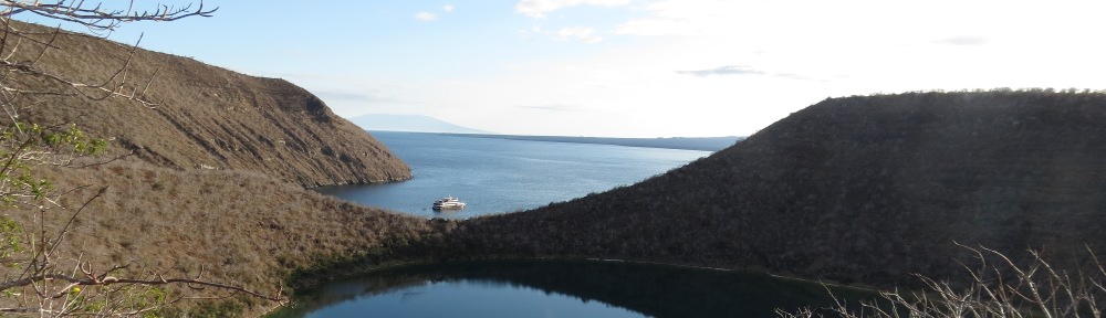
Beaverhead, Boise, Challis, and Lemhi
The ranges to the west of the Greater Yellowstone portion of the South Central Rockies forest have more maritime influence and have a few maritime species such as grand fir. However, overall these are dry forests with open canopy of Douglas-fir, ponderosa pine in the canyons, and a sagebrush-forest interface at lower elevations. The canyons of the Salmon, Middle Fork Salmon, South Fork Salmon, and Payette are hot and dry, with ponderosa pine, sagebrush, and grasses. The Sawtooth Valley in the Sawtooth National Recreation Area is a high glacial drift-filled valley with wet meadows, grasslands, and ponderosa pine. To the east, the Boulder and Pioneer Mountains in the Challis and Sawtooth National Forests are dry and partly wooded mountains with open Douglas-fir and shrubland vegetation. Open canopies of Douglas-fir at higher elevations, and sagebrush-grass vegetation are characteristic of the barren mountains in the Lost River, Lemhi, and the Beaverhead Mountains, included in parts of the Challis, Salmon, and Targhee National Forests (McGrath et al. 2001).
The westernmost part of the area is made up of the Salmon River Mountains, a 100- by 200-mile granite range. The Blue Mountains are believed to have accreted to western North America about 100 million years ago. This was followed by crustal and mantle melting and granite formation. Granite in the southern portions dates to 83 million years ago, and the northern portions date to 70 million years ago. The present-day valley traversed by US 95 and State Route 55 from Boise north to the Salmon River forms the western boundary of the Idaho batholith. This valley follows the Salmon River suture zone, which separates the North American crust to the east from the Blue Mountains, which are a collage of island arc structures. By 51 million years ago, crustal extension produced the Challis volcanic area to the east of the batholith area (Gaschnig et al. 2011). The Salmon River Mountains are unique in that there is not a distinct trend or dominating crest. The easternmost outcrops of the Idaho batholith include the Anaconda and Sapphire blocks. These areas slid off toward the east and consist of batholith, granites, and sediments bulldozed up against their northeast corner (Schmidt and Schmidt 2000).
Mountains of the Montana portion of this ecoregion range from heavily forested to forest grassland mosaic but tend to have a vegetation of subalpine fir, Douglas-fir and ponderosa pine. Prominent ranges in Montana are the Anaconda, Beaverhead, Flint Creek, Garnet, Pioneer, and Sapphire Mountains. The mountains of the Beaverhead National Forest along the southwestern Montana border with Idaho are dry and open canopy to grassland-dominated with limited forest areas (Woods et al. 1999).
In this ecoregion, fire management is a critical land management issue. Following the big burn of 1910 in northern Idaho and northwestern Montana, most forests were subsequently managed for fire suppression. Fuels accumulated, many forests are now perhaps more vulnerable to wildfire than at any time in the past, and wildfires are increasing in frequency and extent. Going forward, to make the transition to more natural fire regimes, which potentially involves forest management and occasional fires, there is a potential tension with watershed disruption. On the one hand, forest management and fire contributes nutrients, wood, and habitat diversity to streams. On the other hand, these disruptions can be detrimental in the short term to water quality and watershed processes, thus harming rare aquatic species. Rieman et al. (2010) describe this as a tension between conservation biology and restoration ecology. Maintenance of ecological processes is needed in some areas, restoration of more natural systems is needed in others, and control to maintain systems in a particular state is needed in still others. Across larger landscapes, there should be room for all three approaches. One such area is the South Fork Boise River basin, in the Boise and Sawtooth National Forests. The South Fork Boise watershed includes a variety of forest types and habitats for native salmonid fishes, along with a range of landscapes from pristine to highly altered. There was no fire in this area for most of the 20th century. Dry and highly altered forests coincide with high road density, and these areas are where watersheds are most highly altered. The focus in these areas can be the restoration of fire regimes through continued or increased management. Where forest landscapes are in good condition, road density is also low and aquatic habitats also tend to be in good condition. Management can focus on wildland fire use and maintenance of aquatic ecological processes (Rieman et al. 2010).
There is one National Historic Landmark in the Idaho Batholith section of the South Central Rockies forests. Lemhi Pass (site 1), Beaverhead National Forest, Montana, and Salmon National Forest, Idaho (N44˚58’ W113˚27’), is the site where, on August 12, 1805, a party of the Lewis and Clark expedition led by Meriwether Lewis stood at the pass, the western boundary of Louisiana, and looked over Spanish territory. It remained the western boundary of the US until 1846. Lewis and his party were the first Americans to cross the Continental Divide. It was near here that the expedition also met up with a band of Shoshoni. By extraordinary luck, the Shoshoni chief was Sacajawea’s brother, who was able to offer supplies and horses. The grade to the pass on the eastern Montana side is gentle, and the elevation is 7,373 feet, making it an obvious lower elevation choice to cross the divide. However, the Salmon River Mountains block the way to the west, making the historic trail off the beaten path of modern transportation. Today the site is 12 miles east of Tendoy, Idaho. The pass is a site on the Lewis and Clark National Historic Trail and is crossed by the Continental Divide National Scenic Trail.
The National Forest System in the Idaho Batholith section of the South Central Rockies forests includes 11 forests, an experimental forest, and a national recreation area. These forests also contain components of the national trails system, wild and scenic rivers, and wilderness areas which are described separately. Beaverhead National Forest (NF), Bitterroot NF, Boise NF, and Challis NF are described in part A. The national forest descriptions continue into part B.
Beaverhead NF, Montana is 2.1 million acres and includes the Beaverhead Mountains along the Idaho-Montana border, the southern slopes of the Anaconda Range, and the Pioneer Mountains in the Idaho batholith region. It also includes the Tobacco Root, Gravelly, and Madison Ranges in the Greater Yellowstone ecosystem. The Continental Divide NST traverses the Idaho-Montana border and the Anaconda Range in the forest.
In the Big Hole Landscape of the forest, the Beaverhead Mountains overlook the Big Hole Valley to the east. This area includes sections of the Nez Perce and Lewis and Clark NHTs and Continental Divide NST, as well as the May Creek NRT. The Lima-Tendoy Landscape includes the Beaverhead Mountains and Tendoy Mountains. In this area the grasslands transition directly to rocky peaks without an intervening band of forest. In the Beaverhead Mountains is Lemhi Pass NHL (N44˚58’ W113˚27’). A loop from the foot of the mountain at Lemhi Pass goes north along Bloody Dick Creek to Reservoir Lake, where a trail leads to the CDNST. Just to the north are Twin Lakes (N45˚25’ W113˚41’), which have a hiking trail along Big Lake Creek. Ajax Lake (N45˚20’ W113˚44’, site 2) in the Beaverhead Mountains is reachable from a three-mile hike from a trailhead on Forest Route 625 southwest of Dillon (Howe 2013). The Continental Divide NST passes by the lake. From Miner Lake on Forest Route 182, a six-mile trail leads to 9,000-foot Heart Lake (N45˚19’ W113˚40’) at the base of Homer Youngs Peak in the Beaverhead Mountains (Howe 2013). Browns Creek (N45˚8’ W113˚15’, site 3) and Deadman Creek (N44˚28’ W112˚51’, site 4) are considered eligible for the wild and scenic river system.
The Pioneer Mountains are a granite block of the Idaho batholith which detached from the main body and moved eastward 70 million years ago. The Elkhorn Hot Springs (N45˚28’ W113˚6’, site 5), located on Forest Highway 73 (Pioneer Mountains National Scenic Byway), is a year-round resort with two soaking pools. Also on the byway are the Crystal Creek area where amethyst crystals may be found, Grand Vista, and Coolidge ghost town silver mines (N45˚30’ W113˚2’, site 6), reached by Forest Road 2455 off of Forest Highway 73. Trails from Mono Creek (N45˚32’ W113˚5’) on Forest Highway 73 lead east to alpine lakes. From Steel Creek (N45˚36’ W113˚20’, site 7) east of Wisdom on the west side of the Pioneer Mountains, a trail leads east ten miles to connect with the Pioneer Loop NRT. On the east side of the Pioneer Mountains, a trailhead at Canyon Creek (N45˚38’ W112˚57’, site 8) provides trails leading west to alpine lakes and the Gold Creek Trail. Skull-Odell RNA (N45˚28’ W113˚13’, site 9) is on a bench between Odell and Table Mountains at elevation 8,000. The RNA has old growth lodgepole pine, whitebark pine, and Engelmann spruce, two patterned fens, and the Skull Creek Meadows. Primrose monkey flower is common in this glaciated area. Canyon Creek (N45˚37’ W112˚58’), Lion Creek (N45˚35’ W112˚58’), and the Wise River (N45˚36’ W113˚6’) are considered eligible for the wild and scenic river system.
Bitterroot NF, Idaho-Montana, is 1.6 million acres. To the east of the Bitterroot Valley are the Sapphire Mountains, which are described here. The forest also includes the Bitterroot Mountains to the west of the Bitterrroot Valley, part of the North Central Rockies ecoregion. The Gold Creek campground (N46˚24’ W113˚54’, site 10) east of Stevensville provides access to the Gold Creek, Burnt Fork, Palisade Mountain, and Easthouse hiking areas. The Black Bear Campground (N46˚10’ W113˚55’, site 11) on State Route 38 is the trailhead for a ten-mile hiking loop to Black Bear Point. Centennial Nature Grove on State Route 38 (N46˚10’ W113˚57’, site 11) is a 200-year-old ponderosa pine forest. Crazy Creek Campground is at Warm Springs Trailhead (N45˚49’ W114˚4’, site 12), which provides access to an extensive hiking area to the south along the Idaho border. The Indian Trees Campground (N45˚45’ W113˚57’, site 12), south of Sula off U.S. Route 93, is a hiking area with access to a segment of the Nez Perce NHT and the Lost Trail Hot Springs soaking pools.
South of Darby, Slate Creek Campground (N45˚42’ W114˚17’, site 13) on Painted Rocks Lake provides access to the Jew Mountain Trail and Little Boulder Trail hiking areas. Further south near the Idaho border is Alta Campground and the Alta Pine Interpretive Site, with an 800-year-old ponderosa pine killed by lightning in 1993. Rooster Comb Loop (N46˚3’ W113˚48’, site 14) climbs to the crest of the Sapphires at Mosquito Meadows. The trailhead is on Forest Highway 75 18 miles south of State Route 38.
There are two Research Natural Areas in the Sapphire Range. Sapphire Divide RNA (N46˚6’ W113˚46’, site 14), Bitterroot and Deerlodge NFs, is southeast of Hamilton along the Sapphire Mountain crest, including Congdon and Fox Peaks and Jerry Lake in the Skalkaho Creek watershed. It contains subalpine larch at timberline. Sawmill Creek RNA (N46˚27’ W113˚53’, site 15) is east of Stevensville off Forest Road 710 in the Sapphire Range. This RNA contains the best remaining grassland in the Bitterroot Valley and a dry conifer forest of ponderosa pine, Douglas-fir, and Rocky Mountain juniper.
Boise Basin Experimental Forest, Idaho (N43˚50’ W115˚50’, site 16) is three tracts of ponderosa-pine forests around Idaho City, 50 miles northeast of Boise. Research on selection silvicultural systems and old growth restoration occurs. The experimental forest includes Bannock Creek RNA (N43˚47’ W115˚45’), a Douglas-fir and ponderosa pine forest at the upper end of Bannock Creek south of Idaho City burned in 1994.
Boise NF, Idaho, is a 2.6-million-acre national forest extending northeast from Boise and including the watersheds of the Boise, Payette, Middle Fork Salmon, and South Fork Salmon. The Rattlesnake Creek/Feather River Management Area is between Anderson Ranch Reservoir and Arrowrock Reservoir in the southern part of the forest. In this area, the South Fork Boise River (N43˚35’ W115˚16’, site 17) is considered eligible for the wild and scenic river system. Near where the South Fork Boise flows into Arrowrock Reservoir, Smith Creek Falls is another scenic highlight (N43˚31’ W115˚41’). Trinity Mountain RNA (N43˚37’ W115˚26’, site 18) is a cirque, lake, and springs, forested with subalpine fir and whitebark pine. Fiddle Lake is within the RNA. The area is reached from Smith Prairie or Anderson Ranch Reservoir.
The Arrowrock Reservoir management area includes the Middle Fork Boise River (N43˚40’ W115˚42’) along Forest Highway 82, which is considered an eligible wild and scenic river, and the William H. Pogue NRT (see). Lucky Peak Nursery (N43˚42’ W115˚58’, site 19) on State Route 21 between Boise and Idaho City provides trees and shrubs for national forest plantings in the area. State Route 21 from Boise to the Stanley Basin is the Ponderosa Pine State Scenic Byway. Just to the north of Boise is the Boise front/Bogus Basin resort management area (N43˚46’ W116˚6’, site 20).
The Upper Boise River, Middle Fork Boise River, and North Fork Boise River Management Areas include both the North Fork Boise River (N43˚49’ W115˚32’) and Middle Fork Boise Rivers, which are considered eligible for the wild and scenic river system. The Atlanta area (N43˚48’ W115˚8’) along the Middle Fork is a mining area and is lined with numerous hot springs. North Fork Boise River RNA (N43˚46’ W115˚37’, site 21) is in a canyon four miles upstream from the confluence with the Middle Fork. There are cliffs and steep canyon slopes, covered with Douglas-fir and ponderosa pine forests. Roaring River RNA (N43˚43’ W115˚28’, site 21) is upstream from the confluence with the Middle Fork Boise River and is forested with Douglas-fir, Idaho goldenrod, and sagebrush.
The Mores Creek Management Area surrounds Idaho City (N43˚50’ W115˚50’, site 22). Mores Creek, considered eligible for the wild and scenic river system, runs along State Route 21 from Mores Creek Summit south to Lucky Peak Lake. To the north of Idaho City, the mining towns of Centerville (N43˚58’ W115˚51’), Pioneerville (N43˚55’ W115˚53’), and Placerville (N43˚57’ W115˚57’) are surrounded by the forest.
The Boise NF includes the Payette River drainage along State Route 55 to the north of Boise. The Harris Creek, Upper South Fork Payette River, Lower South Fork Payette River, Deadwood River, Lower Middle Fork Payette River, and Upper Middle Fork Payette River Management Areas are within this watershed. At Banks on State Route 55 in the forest (N44˚5’ W116˚7’, site 23), the Payette River splits into the North and South Fork. The Middle Fork Payette splits off the South Fork at Garden Valley (N44˚6’ W116˚0’) on the Banks to Lowman Highway. The Deadwood River (N44˚5’ W115˚40’, site 24) splits off the South Fork just west of Lowman. The Deadwood River, Payette River, Middle Fork Payette River, North Fork Payette River, and South Fork Payette River are considered eligible for the wild and scenic river system. State Route 55 in the Payette River valley from Boise north to Payette Lake is a National Scenic Byway. Forest Highway 24 from Banks (SR 55) to Lowman (SR 21) is the Wildlife Canyon State Scenic Byway. Scott Mountain Road (Forest Route 555) begins at Little Falls on the South Fork Payette River west of Lowman (N44˚4’ W115˚46’) and extends north to Deadwood Reservoir (N44˚19’ W115˚40’), where a scenic trail follows the river below the dam.
The North Fork Payette River Management Area is between Banks and Cascade on both sides of State Route 55 and is the western edge of the Idaho Batholith ecoregion. The North Fork Payette Management Area includes High Valley (N44˚13’ W116˚11’, site 25) on Little Squaw Creek, a wildflower viewing area. West Mountain, to the west of SR 55, is the transition between the Idaho Batholith and the Blue Mountains. Dry Buck RNA (N44˚10’ W116˚8’) is a forest of grand fir, hemlock, Douglas-fir, and old growth ponderosa pine along the North Fork Payette River on Route 55. West Mountain borders the west side of Cascade Reservoir. To the east of State Route 55, the Gold Fork River drains into Cascade Reservoir. Needles RNA (N44˚44’ W115˚49’, site 26) is a glacial cirque with subalpine fir and bare rock east of Donnelly at the head of the Gold Fork River.
Hot springs line the banks of the South Fork Payette River. Pine Flats Hot Springs (N44˚4’ W115˚41’, site 24) drips over a waterfall into the South Fork Payette River. Bear Creek RNA (N44˚10’ W115˚12’, site 27) is a ponderosa pine and sagebrush-grass area along Forest Road 524 (South Fork Payette River) near the Sawtooth Wilderness. Downstream, Lowman RNA (N44˚4’ W115˚37’, site 28) is a ponderosa pine forest along State Route 21 south of Lowman burned in 1988. Monumental Creek RNA (N44˚5’ W115˚38’, site 28) is adjacent to the South Fork Payette River west of Lowman and consists of bitterbrush-wheatgrass and ponderosa pine forests. Eggers Creek RNA (N44˚22’ W115˚46’, site 29) is a small watershed of Douglas-fir forest at the north end of Peace Valley north of Silver Hot Springs in the Middle Fork Payette River watershed. The Silver Creek area in the Middle Fork Payette watershed was used for silvicultural research in the past.
Notable scenic high elevation wildflower meadows are at Bear Valley in the Middle Fork Salmon watershed. Bear Valley (N44˚24’ W115˚21’, site 30) is accessed from State Route 21 via the Landmark Stanley Road, which continues on to the Deadwood River (N44˚28’ W115˚35’) and Warm Lake (N44˚39’ W115˚40’). Bear Valley Creek (N44˚24’ W115˚21’) and Elk Creek (N44˚27’ W115˚27’, site 31) are eligible for the wild and scenic river system.
The Warm Lake Management Area is on the South Fork Salmon River, accessible from Forest Highway 22 from Cascade. A notable site is Vulcan Hot Springs (N44˚34’ W115˚42’, site 32) near Stolle Meadows, a wildflower area on the South Fork Salmon. Back Creek RNA (N44˚31’ W115˚43’, site 26) contains streamside meadows and subalpine fir at the head of the South Fork Salmon River.
Also in the South Fork Salmon watershed is Upper Johnson Creek and Lower Johnson Creek Management Areas, which extend south from Yellow Pine, Idaho. Burntlog Creek (N44˚44’ W115˚30’) and Johnson Creek (N44˚50’ W115˚31’, site 33) are considered eligible for the wild and scenic river system. Chilcoot Peak RNA (N44˚47’ W115˚26’) is on the boundary with Frank Church River of No Return Wilderness. It contains three subalpine glaciated basins with lakes and meadows.
Challis NF, Idaho, is 2.5 million acres in the Salmon River Mountains, Pioneer Mountains, Lost River Range, and Lemhi Range of Idaho. The Lost River and Lemhi Ranges are considered by some geologists to be the northernmost of the Great Basin-like isolated mountain ranges.
In the Salmon River Mountains, the Marsh Creek Management area is along State Route 21 west of Stanley. This is an area of glaciated ridges, cirque basins, and alpine lakes. Cape Horn Creek (N44˚24’ W115˚10’, site 34), Beaver Creek, Marsh Creek, and Knapp Creek are important anadromous fish spawning areas in the Middle Fork Salmon drainage. The Cape Horn Guard Station (N44˚22’ W115˚7’) is on the National Register of Historic Places. The Seafoam Management Area is a road corridor and watershed that was excluded from the Frank Church River of No Return Wilderness along the Rapid River and tributaries. There are primitive roads to camping areas. It is accessed via a road along Beaver Creek that extends north from State Route 21 at Cape Horn at the north end of the Sawtooth Range, then proceeds over Vanity Summit into the Seafoam Area (N44˚32’ W115˚4’, site 35).
The Custer Motorway (Forest Road 70) heads west from Challis and climbs Mill Creek Summit before dropping into the Yankee Fork mining area, passing Custer ghost town and Bonanza (N44˚22’ W114˚43’, site 36), managed as part of the Land of the Yankee Fork State Park. Valley Creek (N44˚23’ W115˚2’), Basin Creek (N44˚18’ W114˚53’), Thompson Creek (N44˚18’ W114˚35’), Squaw Creek (N44˚20’ W114˚28’), Bayhorse (N44˚25’ W114˚24’), and Challis Creek (N44˚30’ W114˚29’, site 37) management areas are Salmon River tributary areas managed for fish spawning areas, mining, and recreational uses. Challis Creek drains an alpine glaciated area to the west of US Route 93. Garden Creek (N44˚27’ W114˚23’) is managed as a municipal watershed. Furnace Creek (N44˚46’ W114˚24’, site 38) is an area of vertical headwalls in cirque basins.
Most of the Pioneer Mountains east of the Sawtooth NRA are part of the Challis NF. East of the East Fork of the Salmon River, Herd Creek (N44˚4’ W114˚14’, site 39) is managed as a fish habitat area. The precipitous Pioneer Mountains are the second highest in Idaho. Features are the Copper Basin Flat (N43˚49’ W113˚52’) along the East Fork Big Lost River, Summit Creek (N43˚52’ W114˚13’), and Antelope Creek (N43˚38’ W113˚45’, site 40), which is where the Pioneer Mountains grade into the Snake-Columbia shrub steppe. In the Pioneer Mountains in the Antelope Creek area, Iron Bog RNA (N43˚38’ W113˚46’) is a sphagnum bog in a sagebrush-steppe/Douglas-fir transition area. Smiley Mountain RNA (N43˚42’ W113˚49’, site 41) is an 11,000-foot glaciated area in the Pioneer Mountains containing alpine vegetation and subalpine whitebark pine. Surprise Valley RNA (N43˚48’ W114˚1’, site 42) is a hanging valley 1,000 feet above the nearby Fall Creek drainage, a tributary to the Big Lost River. The RNA includes Standhope Peak, waterfalls, wet meadows, and ponds. To the north of the Pioneer Range, the White Knob Mountain range (N43˚49’ W113˚41’, site 43), with 11,000-foot peaks, fronts Mackay and the Big Lost River Valley.
The Lost River Range, an isolated mountain group to the east of US 93 between Challis and Arco, contains 20 named peaks over 11,000 feet in elevation. On the south end is King Mountain (N43˚47’ W113˚16’, site 44) in the Arco Hills, a hang gliding and paragliding site. The south end of the Lost River range features winding canyons, caves, and limestone ledges. Near Arco Pass is a natural arch (N43˚45’ W113˚16’), and a trail leads to Hidden Mouth Cave (N43˚57’ W113˚26’). The upper reaches of the Pahsimeroi River near Borah Peak, the highest in Idaho, are known as Little Switzerland. The Merriam Lake Basin RNA (N44˚7’ W113˚45’, site 45) is in the Pahsimeroi River headwaters in the Lost River Range near 12,600-foot Borah Peak and is noted for diverse alpine vegetation. Three miles north of Borah Peak is the Mahogany Creek RNA (N44˚11’ W113˚45’), which supports cutleaf mountain mahogany and an unusual stand of limber pine and whitebark pine for this latitude and elevation.
The Challis NF includes the western slopes of the Lemhi Range. The eastern slopes are in the Salmon NF and the southeastern are in the Targhee NF. The headwaters of the Little Lost River are in Sawmill Canyon (N44˚22’ W113˚23’, site 46) in the forest. Meadow Canyon RNA (N44˚14’ W113˚10’, site 47) contains the finest alpine tundra in Idaho. Bell Mountain on the border with the Targhee NF in the RNA is the only known location of three species of columbine in Idaho. Middle Canyon RNA (N43˚54’ W112˚58’, site 48) is located at the southern end of the Lemhi Range where it meets the Snake River Plain. Vegetation ranges from the sagebrush-steppe to juniper and bunchgrass, topping off with an alpine belt of limber pine and mountain mahogany. Sheep Mountain RNA (N44˚23’ W113˚17’) is a 10,000-foot ridge in the Lemhi Range with whitebark pine and alpine vegetation on the boundary between the Challis and Salmon NFs.
[National forest system in Idaho Batholith continues next post]