This area is found in Canada (Alberta) and United States (Montana) and consists of two ecoregions.
- Northern mixed grasslands (NA810)
The northern mixed grasslands of Alberta define an ecotone between the tallgrass prairie and boreal forests with aspen, shrubs, bur oak, and mixed tallgrass and short grass. In the Cypress upland of Alberta, there is montane vegetation of lodgepole pine. The area is a rich waterfowl production area, with glacial pothole lakes. This ecoregion includes glacial terminal moraines, which have a hummocky physiography.
In Devil’s Coulee, Alberta, are late Cretaceous-age hadrosaur eggs. A study of dinosaur eggs and bird eggs based on the eggs at Devil’s Coulee indicated that the greatest similarity was with these types of dinosaurs, adding support to the hypothesis that troodontids and oviraptorids were the ancestors of birds (Grellet-Tinner and Chiappe 2004).
One World Heritage site in the Northern Mixed Grasslandsis Head-Smashed-In Buffalo Jump National Historic Site, Alberta (N49˚42’ W113˚39’), 18 km west of Fort Mcleod on Secondary Route 785 and managed by the province of Alberta. For 6,000 years, this site was used by native peoples to kill bison by driving them over a cliff. V-shaped drive lanes channeled herds to near the cliff, and then a stampede was provoked. Wounded animals at the base of the cliff were killed. Deep layers of bison bones indicate the site was used into the 19th century. Trails and interpretive tours are offered by Blackfoot guides.
There are two nationally designated sites in the Northern Mixed Grasslands. Fort Whoop-Up National Historic Site, in Indian Battle Park, City of Lethbridge, Alberta (N49˚42’ W112˚52’) commemorates the 1869 establishment of a trading post by American fur traders. Because the traders distributed whiskey to the natives, Canada was prompted to establish the Royal Canadian Mounted Police to protect native peoples and bring order to the area. Indian Battle Park is also the location where the Cree and Blackfoot fought in 1870, ending in a Cree defeat.
Stirling National Historic Site, Village of Stirling, Alberta (N49˚30’ W112˚31’) is a self-sufficient Mormon agricultural village established in 1899. Tours are available at the Michelson Farmstead, 1904, a typical farm of the early 20th century.
Provincial and local sites in the Northern Mixed Grasslands ecoregion include natural, paleontological, and reservoir recreation sites.
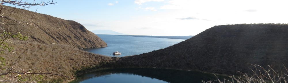
Cypress Hills Interprovincial Park, Alberta-Saskatchewan (N49˚39’ W110˚0’) is a range of hills that rise 600 m above the surrounding prairies; there are 16 trails which wander through a lodgepole pine forest, through Spruce Coulee, and along prairies.
Devil’s Coulee Dinosaur and Heritage Museum, City of Warner, Alberta (N49˚17’ W112˚13’) offers tours to a nearby hadrosaur nest with embryonic dinosaurs, discovered along the Milk River Ridge in 1987. The Royal Tyrell Museum of Paleontology manages the site for public use along with the Devil’s Coulee Cooperating Society.
Oldman River Provincial Recreation Area, Alberta (N49˚43’ W113˚27’) is on the west side of Route 2 just north of Fort Macleod, providing river access and camping.
Park Lake Provincial Park, Alberta (N49˚49’ W112˚55’) is a reservoir recreation site with hiking trails and waterfowl viewing. It is located north of Lethbridge on Range Road 223.
Twin River Heritage Rangeland Natural Area, Alberta (N49˚10’ W112˚20’) is a large hunting area north of Route 501 and west of Route 4 along the Milk River, North Milk River, and Milk River Ridge.
Privately operated sites in the Northern Mixed Grasslands includes the Fort Museum of the North West Mounted Police and First Nations Interpretive Centre, Fort Mcleod, Alberta (N49˚44’ W113˚24’), which commemorates the nearby site of Fort Mcleod and an outpost of the Mounted Police from 1874 to 1878.
Reference
Grellet-Tinner, Gerald and Luis M. Chiappe. 2004. Dinosaur Eggs and Nesting: Implications for Understanding the Origin of Birds. Pages 185-214 In Feathered Dragons: Studies on the Transition from Dinosaurs to Birds. Philip J. Currie, ed. Indiana University Press.
2. Northern short grasslands (NA 811)
This ecoregion includes a broad swath of the Great Plains. Only a small section in Alberta and Montana is described here; the description will be expanded in the future to include areas to the north of the 50th parallel and east of the 110th meridian. This ecoregion is an area of brown glaciated plains with poorly drained lake basins. Some areas are more rolling to hummocky with seasonal pothole lakes, such as the Sweetgrass uplands, a forest grassland complex. Elsewhere the vegetation is dominated by grama-needlegrass-wheatgrass. The shortgrass prarie is the largest grassland ecoregion in North America, notable for its harsh winters, short growing season, severe droughts, and shortgrass vegetation.
Large dams constructed for irrigation storage in this part of the Great Plains have altered spring flood flows downstream from Lake Elwell and Fresno Reservoir. Rood and Mahoney (1995) found that cottonwood seedling recruitment downstream from Tiber Dam (Lake Elwell) has declined since the dam was built. This was attributed to a change in the pattern of water flow downstream. When spring flooding takes place, there is scouring and and gradual flow decline in the floodplain downstream. This creates point and lateral bars which are unvegetated and seedlings can establish themselves. Without flooding, dense grass and shrubs encroach to the water’s edge and the unvegetated bars are not present. Lessia and Miles (1999) found that Russian olive can compete better than cottonwood in this environment and that as old cottonwoods die, they are being replaced by Russian olive.
Another issue with water management in this ecoregion has arisen at Benton Lake National Wildlife Refuge. The natural lake formerly went dry, but today is supplemented by a pump station which captures natural and irrigation drainage from soils that are naturally selenium-rich. The rate of selenium accumulation in sediments is increasing. Selenium will need to be managed to increase the life of the refuge (Zhang and Moore 1997).
There is one site in the Western Hemisphere Shorebird Reserve Network in the northern short grasslands. Benton Lake National Wildlife Refuge (NWR), Montana (N47˚40’ W111˚19’) is a 12,000-acre lake and marsh on the western edge of the Great Plains filled with migratory birds. It is an IBA for shorebirds, ducks and Franklin’s gull. It hosts the largest breeding colony of Franklin’s gulls and white-faced ibis in Montana. During wet years the refuge serves as breeding habitat for ducks, coot, American avocet, and phalarope in addition to other shore birds, and in dry years shorebirds utilize mudflats where the lake dries up. Mixed grass prairie birds are also found here, such as Sprague’s pipit, ferruginous hawk, and upland sandpipers. A prairie marsh auto tour winds through the refuge for nine miles, and the Prairie Marsh Boardwalk is a National Recreation Trail. Originally a Bureau of Reclamation project, the refuge receives supplemental water from Muddy Creek via a pipeline and intake near Power (N47˚41’ W111˚42’).
There are three National Historic Landmarks in the Northern Short Grasslands. Fort Benton Historic District, Montana (N47˚49’ W110˚40’) was the head of steamboat navigation on the Missouri River, 2,300 miles from St. Louis, and is considered the birthplace of Montana. It is the oldest continuously occupied Anglo-American settlement in Montana. It was the eastern terminus of a 600-mile-long wagon road to Walla Walla, Washington, where travelers could transfer to boat traffic on the Columbia River, and the terminus of wagon roads to Fort McLeod, Alberta, 250 miles northwest, and Fort Walsh, Saskatchewan, 130 miles northeast. The fort was established in 1846, initially to serve the fur trade, then entered its period of prominence with the discovery of gold in Helena, Virginia City, and Bannack in the 1860s. The NHL includes historic resources associated with the steamboat era, which lasted from 1860 to 1890. These include:
- Fort Benton site, 1846, abandoned 1874
- Fort Benton Blockhouse, 1856, site of storage of buffalo robes for shipping
- Fort Benton levee, 1860, where ships docked, passengers disembarked, and freight transferred
- Grand Union Hotel, 1862; and Pacific Hotel, 1883
- Fort Benton steel truss bridge, 1888, on State Route 15, which provides views of the upper Missouri largely unchanged since the 1880s
- Fire House and City Hall, 1883 combination building
- House (1) and businesses (5) associated with the steamboat era
Great Falls Portage, Montana is located both upstream and downstream of present-day Great Falls, Montana. The NHL includes the upper and lower campsites and portage routes; the middle portage route has been obliterated by modern-day Malmstrom AFB and the city of Great Falls. The portage lands in the NHL are privately owned. The lower portage campsite is one mile downstream from the mouth of Belt Creek (N47˚37’ W111˚3’). It includes the campsite, Sulphur Spring, which is opposite of the mouth of Belt Creek, the gorge below Morony Dam, and the portage corridor to the east end of Malmstrom AFB (N47˚30’ W111˚9’). The upper portage includes a site on River Drive, south of Great Falls, on the east bank of the Missouri River (N47˚28’ W111˚18’). The portage corridor extends northeast to Mount Olivet Cemetery (N47˚29’ W111˚15’).
C.M. Russell Museum, Great Falls, Montana (N47˚31’ W111˚17’) includes the home and studio of America’s foremost western artist, Charles M. Russell. He first went to Montana four years after Custer’s last stand and was able to witness Montana territory before it was settled. There were Indian tribes pursuing tranditional activities and large herds of buffalo. He recorded his experiences in paintings, and in 1886 had a painting displayed at the St. Louis Art Exposition. After riding the range, he settled in Great Falls in 1900 to paint full time. In the statuary hall of the U.S. Capitol, a statue of Russell represents the state of Montana. The National Historic Landmark house and studio are included in a larger complex called the C.M. Russell Museum, owned by the City of Great Falls.
There is one National Natural Landmarks in the Northern Short Grasslands. Square Butte, Montana (N47˚28’ W110˚14’) is southeast of Fort Benton off State Route 80. This is considered the best example of banded magmatic rock. The 5,700-foot peak juts 2,400 feet from the surrounding plains and has spires and pinnacles. A herd of mountain goats lives on top, which is accessible by a one-mile hike.
There is one unit of the National Landscape Conservation System in the Northern Short Grasslands. Upper Missouri River Breaks National Monument, Montana extends into the area from the east. The visitor center is located t Fort Benton at the west end of the monument. The primary floating access is at Coal Banks (N48˚2’ W110˚14’), off US 87 near Virgelle Ferry.
There is one nationally designated site in the Northern Short Grasslands. Aisinai’pi National Historic Site/Writing-on-Stone Provincial Park, Alberta (N49˚5’ W111˚37’) is the largest concentration of rock carvings and paintings on the Great Plains of North America, with 50 sites protected in the park. The area features unique sandstone formations along the Milk River. Trails lead past hoodoos, and the rock art is only accessible through guided tours.
There are eight Federal and federally licensed reservoirs in the US portion of the Northern Short Grasslands. Five of these are within a 13-mile stretch of the Missouri River downstream of Great Falls and are operated by PPL Montana (there is a pending sale to NorthWestern Energy) as run-of-the-river hydroelectric facilities. These areas are part of the Great Falls Portage National Historic Landmark (see). Black Eagle Dam (N47˚31’ W111˚16’) is two miles northeast of Great Falls and has a generating capacity of 21 MW. The Rivers Edge Trail is maintained along the south shore. The 60-MW Rainbow Dam (N47˚32’ W111˚12’) is six miles northeast of Great Falls. Just below the dam are Rainbow Falls, where the Missouri River drops 47 feet. Cochrane Dam (N47˚33’ W111˚9’) is eight miles northeast of Great Falls and 64 MW in generation capacity. The dam serves as a pedestrian linkage between the north and south shore trails along the reservoir. Ryan Dam (N47˚34’ W111˚7’) is ten miles northeast of Great Falls with 60 MW of generation capacity. A 1913 clubhouse is maintained for public rental. Morony Dam (N47˚35’ W111˚4’) is 48 MW and 15 miles northeast of Great Falls.and
Fresno Dam and Reservoir, Bureau of Reclamation, Montana (N48˚41’ W110˚0’) is part of the Milk River project. The Milk River headwaters are in Glacier National Park. Water is stored at 6,000-acre Fresno Reservoir for use in irrigation downstream for 165 miles along the Milk River between Havre and the Missouri River. The reservoir supports a fishery for walleye, perch, and northern pike.
Fort Shaw Diversion Dam, Bureau of Reclamation, Montana (N47˚31’ W111˚52’) diverts water from the Sun River into the 12-mile-long Fort Shaw Canal.
Tiber Dam and Lake Elwell, Bureau of Reclamation, Montana (N48˚19’ W111˚6’), is southeast of Shelby and provides flood control, recreation, conservation, rural water supply, and hydropower in a 17,700-acre reservoir. The project has the potential to provide irrigation but only 3,000 acres have benefitted from irrigation water availability. Fishing for trout is a major recreation activity. The land around the reservoir is noted for unusual sandstone formations.
The National Trail System in the Northern Short Grasslands includes one National Historic Trail and one National Recreation Trail. Lewis and Clark National Historic Trail, Montana, includes the Lewis and Clark National Historic Trail Visitor Center, administered by the Lewis and Clark NF, located in Great Falls adjacent to Giant Springs State Park. Trail sites in the ecoregion include Great Falls Portage (described above under National Historic Landmarks) and Missouri-Maria’s Confluence, Upper Missouri Breaks National Monument, Montana (N47˚56’ W110˚28’). The confluence represented a key decision point on the upstream journey. Both rivers were similar in size. Lewis and Clark paused at the junction to determine which stream was likely the Missouri and scouted upstream on both rivers. When they came to the Great Falls of the Missouri, they knew that they had correctly chosen the Missouri flowing to the southwest. Had they chosen the Marias River, the expedition might have failed, since they would not have been able to cross the Rockies in time before winter set in, and the Blackfeet Indians would likely have been more hostile than tribes to the southwest.
The National Recreation Trail in the Northern Short Grasslands is Prairie Marsh Boardwalk, Benton Lake NWR, Montana (N47˚41’ W111˚22’), a 0.2-mile walk on the refuge auto tour route.
The National Wildlife Refuge system in the Northern Short Grasslands includes Benton Lake NWR, described under Western Hemisphere Shorebird Reserve Network, and numerous waterfowl production areas (WPAs), listed below. In the I-15 corridor are ten areas. Arod Lakes WPA (Eyraud Lakes), Montana (N47˚59’ W112˚2’) is 800 acres west of Brady and home to nesting American white pelicans, making it an Important Bird Area. Blackhurst WPA, Montana (N48˚49’ W111˚47’) is a 300-acre grassland and wetland area north of Ferdig, which is east of I-15, Exit 379. Brown WPA, Montana (N48˚55’ W111˚51’) is a 260-acre wetland and grassland area northeast of I-15, Exit 389. Brumwell WPA, Montana (N47˚47’ W111˚40’) is 250 acres of wetlands adjacent to I-15 between exits 302 and 313. Cemetary WPA, Montana (N48˚52’ W111˚51’) is a 100-acre wetland area east of I-15, Exit 389. Danbrook WPA, Montana (N48˚59’ W111˚49’) is a 300-acre wetland complex east of I-15 and just south of the US-Canadian border. Dunk WPA, Montana (N48˚56’ W111˚49’) is an 80-acre wetland complex east of I-15 near the Canadian border. Ehli WPA, Montana (N48˚59’ W111˚47’) is a 500-acre wetland and grassland complex on the US-Canada border eight miles east of I-15. Hartelius WPA, Montana (N47˚31’ W111˚31’) is five miles north of Vaughn on Neuman School Road, consisting of 300 acres of wetlands and grassland. Long Lake WPA, Montana (N48˚54’ W111˚50’) is a 600-acre wetland complex in the Willshaw Flats east of I-15 south of the Canadian border.
The remaining five areas are scattered tracts. Big Sag WPA, Montana (N47˚36’ W110˚44’) is 350 acres of wetlands and grasslands in the former spillway channel (the Big Sag) for glacial Lake Great Falls at Highwood. Furnell WPA, Montana (N48˚52’ W111˚18’) consists of 2,000 acres of native grasslands and scattered wetlands at the foot of Gold Butte in the Sweet Grass Hills. Hingham Lake WPA, Montana (N48˚36’ W110˚31’) is two miles northeast of Rudyard off of US Route 2. It consists of 280 acres of wetlands and native grassland. Kingsbury Lake WPA, Montana, (N47˚34’ W110˚21’), consists of a large 1,400-acre brackish wetland and grassland in a 3,700-acre tract southwest of Geraldine off State Route 80. It was part of the spillway for glacial Lake Great Falls when the Missouri River was blocked by a glacier. Peterson WPA, Montana (N48˚51’ W112˚14’) is a 100-acre wetland and grassland complex north of Cut Bank. Savik WPA, Montana (N47˚57’ W112˚19’) is an alkaline wetland and native grassland area on U.S. 89 south of Bynum.
Other federal sites in the Northern Short Grasslands include Kevin Rim, BLM, Montana (N48˚48’ W112˚2’), an escarpment overlooking the Kevin Sunburst Oil Field on I-15, providing habitat for the ferruginous hawk, making it an IBA.
Lonesome Lake Watchable Wildlife Area, BLM Havre Field Office, Montana (N48˚15’ W110˚13’) is 14,500 acres northwest of Big Sandy and contains prairie potholes, shallow lakebed, and shortgrass prairie which attracts shorebirds. It is an IBA for ferruginous hawk, northern harrier, and long-billed curlew. There are also hundreds of stone circle archaeological sites.
Maria’s River, Montana, BLM Havre Field Office, Montana is a canoe river with access points at Sullivan Bridge south of Cut Bank (N48˚29’ W112˚14’), Pugsley Bridge south of Chester (N48˚17’ W111˚3’),and Moffat Bridge south of Chester (N48˚16’ W111˚0’).
The Sweetgrass Hills, BLM Havre Field Office, Montana (N48˚54’ W111˚7’) rise 3,000 feet above the prairie and are an island of mountainous forested habitat for elk and deer.
State and Local sites in the Northern Short Grasslands include natural and cultural sites in Alberta and Montana. First Peoples Buffalo Jump State Park, Montana (N47˚29’ W111˚32’) is a mile-long 200-foot cliff containing 18 feet of compacted buffalo remains at the base. This was the largest bison cliff jump in North America, located north of Ulm and west of Great Falls.
Freezout Lake Wildlife Management Area, Montana (N47˚40’ W112˚3’) is 11,500 acres on US 89 north of Fairfield, managed for waterfowl and raptors. The area is noted for thousands of pintail, tundra swan, snow geese, Franklin’s gull, and shorebirds, making it an IBA.
Fresno Reservoir Wildlife Management Area, Montana (N48˚44’ W110˚9’) is 2,677 acres of native prairie on the western side of the reservoir at the northern entrance of Chain of Lakes Coolee.
Giant Springs State Park, Montana (N47˚32’ W111˚14’) is one of the largest freshwater springs in the country, at 156 MGD. It flows into the Missouri River just east of Great Falls. The park is adjacent to the Lewis and Clark National Historic Trail Interpretive Center.
Kennedy Coulee Ecological Reserve, Alberta (N49˚1’ W110˚44’) is in a remote area along the US-Canadian border in southeastern Alberta, adjoining Milk River Natural Area, east of Aden and west of Wild Horse. It is available for hiking.
Marias River Wildlife Management Area, Montana (N48˚28’ W112˚3’) is 5,845 acres on the Marias River ten miles west of the I-15 crossing, exit 358. It is managed for deer and waterfowl.
Milk River Natural Area, Alberta (N49˚2’ W110˚41’) is a hiking area in badlands along the Milk River. It is in a remote area along the US-Canada border east of Aden and west of Wild Horse.
Onefour Heritage Rangeland Natural Area, Alberta (N49˚8’ W110˚16’along Route 41, N49˚1’ W110˚26’ on the US-Canadian border, and N49˚1’ W110˚49’ west of Kennedy Coulee) is in three units north and west of Wild Horse.
Pakowki Lake Provincial Bird Sanctuary, Alberta (N49˚19’ W110˚57’) is an intermittent playa lake and sand dune-wetland complex on Secondary Route 885 which attracts congregations of waterfowl such as pintail, dowitchers, and stilt sandpiper. It is an Important Bird Area.
Red Rock Coulee Natural Area, Alberta (N49˚39’ W110˚52’) is a hiking and wildlife viewing area off Route 887. Distinctive red rocks litter the area.
References
Lessia, Peter and Scott Miles. 1999. Russian Olive Invasion into Cottonwood Forests Along a Regulated River in North-Central Montana. Canadian Journal of Botany 77:1077-1083.
Rood, Stewart B. and John M. Mahoney. 1995. River Damming and Riparian Cottonwoods Along the Marias River, Montana. Rivers 5:197-207.
Zhang, Yiqiang and Johnnie N. Moore. 1997. Controls on Selenium Distributionin Wetland Sediment, Benton Lake, Montana. Water, Air, and Soil Pollution 97:323-340.