The Eastern Cascades forests ecoregion (NA 512) is mostly to the west of the121st meridian. The sections east of the 121st meridian are described here, with those to the west being a future attraction. The sections below include the southeastern Wenatchee Mountains and Simcoe Mountains of Washington, the eastern extension of the Newberry Volcanics (Paulina Mountains), Fremont Mountains, and Warner Mountains of Oregon; and the Warner Mountains and Modoc Plateau of California.
The National Forest (NF) System in the Eastern Cascades forests consists of five areas:
Deschutes NF, Oregon, is 1.6 million acres. In the eastern areas, Aspen Flat (N43˚34’ W120˚47’) is an oasis of lush greenery rising above the desert. It is a bird watching and wildlife viewing area. Pine Mountain Observatory (N43˚48’ W120˚56’) is an astronomical observatory operated by the University of Oregon as an educational facility, offering public tours and programs using three telescopes, with apertures of 15, 24, and 32 inches. The Oregon High Desert National Recreation Trail (NRT) crosses Pine Mountain, and continues through the forest to Sand Spring and Pilot Butte. Lavacicle Cave Geological Area (N43˚42’ W120˚49’) is a large cave with frozen lava stalagtites.
Fremont NF, Oregon, is 1.2 million acres, including the Crane Mountain and Fremont NRTs and Gearhart Mountain Wilderness, described elsewhere in this section. The eastern part of the forest from Summer Lake south to the California state line and east to the Warner Mountains is managed as the Lakeview Federal Stewardship Unit and has its own special management plan and resource targets. Slide Mountain Geological Area (N42˚41’ W120˚45’) is 720 acres south of Summer Lake and the remnant of a dome-shaped volcano. At some point the entire northern face of the volcano failed, creating an enormous debris slope visible from State Route 31. Augur Creek Research Natural Area (RNA) (N42˚32’ W120˚45’) is 2,170 acres north of Gearhart Mountain Wilderness, set aside for an example of the ponderosa pine-white fir-snowberry association. A second portion of the RNA is on Deadhorse Rim and includes whitebark pine-lodgepole pine communities. The Sycan River is designated as a national wild and scenic river from its headwaters (N42˚39’ W120˚44’) west to the Lake-Klamath County line (N42˚45’ W121˚0’) and into the Winema National Forest. The Sprague River, North Fork (N42˚32’ W120˚49’) is designated as a wild and scenic river from Gearhart Mountain Wilderness downstream 15 miles.
South of Gearhart Mountain, the South Fork Sprague River Special Management Area (N42˚24’ W120˚48’) is 545 acres in a steep basalt canyon with old growth ponderosa pine and other confers. The Chewaucan River is considered eligible for the national wild and scenic river system from its headwaters (N42˚28’ W120˚36’) downstream to the forest boundary at Paisley (N42˚38’ W120˚37’). Vee Pasture RNA (N42˚24’ W120˚51’) is 620 acres of grasslands and low sagebrush scablands on a basalt rim overlooking the South Fork Sprague River, north of State Route 140 at Round Grove. South of State Route 140, Dog Lake Special Management Area (N42˚4’ W120˚43’) is 4,700 acres west of Goose Lake and is a scenic lake surrounded by ponderosa pine, white fir, and aspen. East of US Route 395, Quamasia quamash Botanical Area (N42˚10’ W120˚15’) is 50 acres of camas in the Warner Mountains east of Goose Lake.
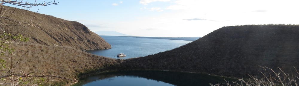
Lassen NF, California, is 1.2 million acres, mostly in the eastern Cascades forests, including Eagle Lake (N40˚42’ W120˚43’), providing lakeside recreation opportunities and a five-mile recreation trail. Eagle Lake is a large alkaline natural lake. It has no outlet. The eastern portions are managed by the Bureau of Land Management as part of the National System of Public Lands. The lake harbors an endemic subspecies of trout and is an Important Bird Area for western and Clark’s grebes, and black tern. The forest is also full of various volcanic features to the east of Lassen Volcano. The Bizz Johnson Trail extends through the forest from Duck Lake (N40˚22’ W121˚0’) through the Susan River canyon (N40˚24’ W120˚49’).
Modoc NF, California, is 1.7 million acres, and includes the Warner Mountains and Modoc Plateau in the map area. The Applegate and Lassen segments of the California National Historic Trail cross the forest. In the Warner Mountains are the Highgrade, Fandango, Lake City, Fitzhugh, and Patterson Management Areas. The Highgrade management area is on the Oregon border and is noted for large stands of aspen and high elevation meadows. Dismal Swamp Botanical Areas (N41˚59’ W120˚10’) is on the Oregon border on Forest Road 48N21 off Forest Highway 2. It contains a birch riparian shrub community. High Grade NRT (see separate description) is located on Forest Road 47N72 off of Forest Highway 9. The Patterson Management Area includes Blue Lake (N41˚9’ W120˚17’). Blue Lake NRT (see separate description) is in the Warner Mountains east of Likely on Forest Road 38N30. A scenic trail to Mill Creek Falls leads from Forest Road 40N45 east of Likely. Raider Basin RNA (N41˚20’ W120˚9’) is 6,100 acres in the Warner Mountains northwest of Eagleville and represents the white fir forest type.
To the west of Goose Lake is the Modoc Plateau, a region of marshy ponds in a high forested steppe. It is an IBA for breeding waterfowl. This area is dominated by Devil’s Garden Management Area, a high plateau of juniper woodlands with sage and grass flats. Devils Garden RNA (N41˚48’ W120˚36’) is 800 acres west of Goose Lake and contains a representative western juniper-sagebrush shrub-steppe community.
West of US Route 395 and south of State Route 299 are the Portugese Ridge and North Adin Management Areas. Higher areas have ponderosa pine, white fir, and incense cedar, and lower ridges have juniper-grass vegetation. A prominent peak is Manzanita Mountain (N41˚17’ W120˚48’).
Along State Route 139 south of Adin is the South Adin Management Area, another ponderosa pine area. There are camp sites along Willow Creek (N41˚1’ W120˚50’).
Snoqualmie NF, Washington, is 1.2 million acres. The portion in the map area is administered by the Okanogan-Wenatchee NF supervisor. The Tieton River Canyon (N46˚42’ W120˚54’) along US Route 12 west of Naches is an IBA for bald and golden eagles. There is a checkerboard pattern of ownership, with the Forest Service, the state (Oak Creek Wildlife Area), and The Nature Conservancy as major landowners. The area features white oak woodlands and ponderosa pine forests inhabited by golden eagle and Rocky Mountain elk. The drive up Windy Pass Mountain on FR 1302 off of US Route 12 (N46˚40’ W120˚57’) provides dramatic views of the area.
Wenatchee NF, Washington, is 1.7 million acres. The Taneum Creek area of the forest south of Cle Elum is in the Eastern Cascades forests ecoregion. Drop Creek proposed RNA (N47˚16’ W120˚32’) is east of Cle Elum on Table Mountain and contains an Engelmann spruce-subalpine fir community.
Recreation lakes in the Eastern Cascades forests includes two sites. French Canyon Dam, Bureau of Reclamation, Washington, (N46˚43’ W120˚48’) is on the North Fork Cowiche Creek west of Tieton. This reregulating dam is at the outlet of the flume from Tieton Diversion Dam. Tieton Diversion Dam, Bureau of Reclamation, Washington (N46˚40’ W121˚0’) is on US 12 in the Snoqualmie NF. This low dam diverts water into the Tieton Main Canal for use in the Yakima irrigation project.
The National Trail System in the eastern Cascades forests includes four sites on the California National Historic Trail (NHT). On the Applegate Trail route of the California Trail to Oregon, Fandango Pass (N41˚48’ W120˚12’), Modoc National Forest, California, is on Forest Highway 9 west of Fort Bidwell. On the Lassen Trail, a southern “shortcut” off of the Applegate Trail to get to California, Conical Rock is on South Fork Pit River just west of US Route 395 (N41˚34’ W120˚26’). Also on the Lassen Trail, Duck Lake, Lassen National Forest (N40˚22’ W121˚0’) is south of State Route 44. On the Nobles Trail, another route to California, the Bridge Creek crossing (N40˚30’ W120˚57’) is about four miles north of State Route 44. The grave of emigrant Nancy Ann Allen is located at the Bridge Creek crossing. The site is marked by the Oregon-California Trails Association (http://www.canvocta.org/allen_grave.htm).
National Recreation Trails in the Eastern Cascades forests ecoregion include seven sites.
Bizz Johnson NRT, National System of Public Lands and Lassen National Forest, California, extends 25 miles from Susanville Train Depot (N40˚25’ W120˚40’) through the Susan River Canyon to Westwood Junction (N40˚26’ W120˚57’), then south to Mason Station Trailhead (N40˚22’ W121˚0’). It is a rail-trail.
Blue Lake NRT, Modoc NF, California (N41˚9’ W120˚17’), is a two-mile trail that encircles 6,000-foot-high Blue Lake in the South Warner Mountains.
Crane Mountain NRT, Fremont NF, Oregon, is 36 miles long and extends from the California state line (N42˚0’ W120˚13’) north to the South Fork Crooked Creek Trailhead on Forest Road 3615 (N42˚19’ W120˚10’), passing 8,300-foot Crane Mountain. The trail is known for wildflowers. It connects with the Fremont NRT at South Fork Crooked Creek Trailhead.
Fremont NRT, Fremont NF, Oregon, is 134 miles long, including 30 miles on top of a 2,000-foot-high fault block known as Winter Ridge. The trail extends from 8,100-foot Yamsay Mountain (N42˚56’ W121˚22’) southeast to Vee Lake (N42˚25’ W120˚10’) north of Lakeview. Trailheads are at Farm Well Horse Camp at the junction of Forest Roads 2916 and 2914 south of Silver Lake (N43˚1’ W120˚58’), Government Harvey Pass (N42˚42’ W120˚48’), Cox Pass on Forest Road 3625 (N42˚23’ W120˚23’), Mill Trailhead on County Road 2-13 (N42˚20’ W120˚15’), and Vee Lake on Forest Road 3615.
High Grade NRT, Modoc NF, California (N41˚57’ W120˚14’) is a five-mile trail passing springs, seeps, and early gold rush and mining heritage. It is located on Forest Road 47N72 off of Forest Highway 9 east of Goose Lake, in the Warner Mountains.
Iron Horse State Park, Washington, is a rail-trail is also the John Wayne Pioneer National Recreation Trail. It extends from Cedar Falls (south of North Bend near Seattle) to Beverly Junction (N46˚49’ W119˚57’) on the Columbia River, passing South Clay Elum (N47˚12’ W120˚56’), Thorp (N47˚3’ W120˚40’), Ellensburg (N47˚0’ W120˚33’), Kittitas (N46˚59’ W120˚25’), and Army West (N46˚57’ W120˚18’) trailheads. Future extensions will be to the Idaho border at Tekoa.
Oregon High Desert NRT, Oregon, extends 800 miles from the Oregon Badlands Wilderness to Lake Owyhee State Park, mostly across the Snake-Columbia shrub-steppe ecoregion. It is a project of the Oregon Natural Desert Association. In the Deschutes NF in the eastern Cascades forest ecoregion, the trail extends from Pine Mountain (N43˚48’ W120˚57’) south to Sand Spring and Pilot Butte (N43˚41’ W120˚49’). In the Fremont NF south of Paisley, the trail follows the Fremont NRT (see description above), from the Chewaucan River (N42˚37’ W120˚36’), ‘to Avery Pass, Myers Meadow, Round Pass, Cox Pass (N42˚23’ W120˚23’), Mill Trailhead (N42˚20’ W120˚15’), South Fork Crooked Creek Trailhead (N42˚19’ W120˚10’), Little Honey Creek, and Abert Rim (N2˚26’ W120˚12’).
The Wild and Scenic River System in the Eastern Cascades forests includes two rivers. Sprague River, North Fork, Fremont NF, Oregon (N42˚32’ W120˚49’). From the Head of the River Spring near Gearheart Mountain Wilderness, the wild river designation extends 15 miles downstream. The river crosses broad high elevation meadows before turning south and entering a steep basalt canyon.
Sycan River, Fremont NF, Oregon (N42˚39’ W120˚44’), begins south of Summer Lake and Slide Mountain. The river flows west and northwest to Sycan Marsh, west of the map area, then south to the Sprague River valley. Sycan Marsh is a sandhill crane and waterfowl area and IBA.
The National Wilderness Preservation System in the Eastern Cascades forests includes two areas. Gearhart Mountain Wilderness, Fremont NF, Oregon, is dominated by the volcanic Gearhart Mountain. It extends from the North Fork Sprague River (N42˚35’ W120˚53’) south to Palisade Rocks (N42˚28’ W120˚49’). There are high meadows, cirques, U-shaped valleys amid a lodgepole pine-ponderosa pine-white fir forest.
South Warner Wilderness, Modoc NF, California, is 18 miles long and eight miles wide, extending from Granger Creek (N41˚28’ W120˚12’) south to near Patterson Meadows (N41˚12’ W120˚12’). Vegetation is mountain meadows, pines, fir, and aspen. There are 77 miles of trails providing the opportunity for five loops. The Summit Trail passes for 22 miles near the major peaks, including Squaw Peak, Warner Peak, Dusenbery Peak, Eagle Peak, and Emerson Peak.
A National Wildlife Refuge (NWR) in the Eastern Cascades forests is Modoc NWR, California (N41˚27’ W120˚32’), a 7,000-acre marsh, wet meadow, and grassland tract on US Route 395 near Alturas, supporting sandhill crane, least bittern, and other migratory waterfowl. It is an IBA.
State and local sites in the Eastern Cascades forests includes the following 20 sites:
Ash Creek Wildlife Area, California (N41˚11’ W121˚0’) is a 14,000-acre area on Route 299 between Bieber and Adin including natural wetlands in the Big Valley, a large valley formed by the Pit River. It is an IBA for sandhill crane, bufflehead, and geese.
Badger Gulch Natural Area Preserve, Washington (N45˚50’ W120˚32’) is a grassland area with oak-pine savanna east of Goldendale along Rock Creek.
Booth State Scenic Corridor, Oregon (N42˚11’ W120˚35’), is a 300-acre old growth ponderosa pine forest on State Route 140 west of Lakeview at Drews Gap.
Brooks Memorial State Park, Washington (N45˚56’ W120˚40’) is 13 miles north of Goldendale on US Route 97, this is a 700-acre hiking park with ponderosa and Oregon pine forests in the Simcoe Mountains.
Chandler State Wayside, Oregon (N42˚25’ W120˚17’) is an 85-acre ponderosa pine forest along Crooked Creek on US Route 395 north of Lakeview.
Cleveland Shrub-Steppe Natural Area Preserve, Washington (N45˚58’ W120˚22’), is a grassland northeast of Goldendale at the margin of the eastern Cascades ecoregion, Oregon white oak, aspen, and ponderosa pine.
Dutch Flat Wildlife Area, California (N41˚16’ W120˚59’), is northwest of Adin.
Fitzhugh Creek Wildlife Area, California (N41˚22’ W120˚23’) is in the Warner Mountains eight miles east of Alturas and U.S. Route 395.
Fort Simcoe State Park, Washington (N46˚20’ W120˚50’) is on the Yakama Indian Reservation. This park preserves an 1850’s-era military installation, located in an old oak grove watered by springs. The mature Oregon white oaks support Lewis’ woodpecker and are an IBA. The site is seven miles west of White Swan.
Goldendale Fish Hatchery Unit, Klickitat Wildlife Area, Washington (N45˚50’ W120˚54’) is a pheasant hunting area, as well as a fish hatchery, four miles west of Goldendale.
Goldendale Observatory State Park, Washington (N45˚50’ W120˚49’) is the nation’s largest public telescope, located on a mountaintop one mile north of Goldendale.
Goose Lake State Recreation Area, Oregon (N42˚0’ W120˚19’) is a lakeside recreation area with a trail on an alkaline lake with no outlet. Goose Lake formerly flowed into the Pit River to the south. Mudflats at the south end on privately owned land in California are an IBA for Canada geese, canvasback, snowy plover, terns, and gulls. The Applegate Trail (see California NHT) passed by the south end of the lake.
Iron Horse State Park, Washington, is a rail-trail also known as the John Wayne Pioneer National Recreation Trail. See description under NRTs.
Modoc Line Rail Trail, Lassen Land and Trails Trust, California, runs 85 miles from Wendell to Likely.
L.T. Murray Wildlife Area, Washington (N47˚1’ W120˚48’) is a 100,000-acre area in three sections. The section south of I-90 and west of Ellensburg is in the eastern Cascades.
Oak Creek Wildlife Area, Oak Creek Unit, Washington (N46˚39’ W120˚47’), is a 46,000-acre area surrounding the intersection of U.S. Route 12 and State Route 410 northwest of Yakima. Areas along the Naches and Tieton Rivers are rock climbing and wildlife watching areas. The Tieton River corridor along US Route 12 west of Naches is an IBA for bald and golden eagles. There is a checkerboard pattern of ownership, with the Forest Service (Snoqualmie National Forest), the state, and The Nature Conservancy as a major landowners.
Oak Creek Wildlife Area, Rock Creek Unit, Washington (N46˚57’ W120˚58’), is an area of state lands interspersed with Snoqualmie NF property in a checkerboard landownership pattern. Wildlife ranges from mountain goats in alpine areas to elk in shrub steppe. The area also features basalt cliffs.
Pine Creek Wildlife Area, California (N41˚26’ W120˚25’) provides deer and antelope range in the Warner Mountains six miles southeast of Alturas on Parker Creek Road.
Silver Creek Wildlife Area, California (N41˚11’ W120˚6’) is located south of Eagleville on Patterson Hill Road in the Warner Mountains.
Willow Creek Wildlife Area, California (N40˚35’ W120˚37’) is a waterfowl area north of Susanville on State Route 139, providing meadows and wetlands.