Sierra Nevada forests (NA527), Part 1A: Plumas Area
Boundary Delineation
Sierra Nevada forests ecoregion is the most diverse temperate coniferous forest on Earth, supporting numerous species of pine and 75 giant sequoia groves. The Sierra Nevada forests are generally found between 35 to 40 degrees north latitude and 117 to 120 degrees west longitude in California and Nevada. The ecoregion is mostly in California with a small area of the Carson Range east of Lake Tahoe in Nevada included with the Sierra Nevada. Although various ecoregion delineation schemes differ in the boundaries of the Sierra Nevada, for the purposes of this discussion the southern boundary is considered to be Walker Pass and the northern boundary is considered to be the escarpment south of Susanville and Lake Almanor which drain to the North Fork Feather River. To the south of Walker Pass, the coniferous forest is sparser and transitions to that of the southern California mountains and foothills. To the north of Susanville and Lake Almanor is Mount Lassen, which is usually considered the southernmost of the Cascade volcanoes and is ecologically associated with the Cascade volcano chain. The eastern and western boundaries are clearer and there is general agreement on them. The western foothills are a chaparral-oak vegetation belt which quickly transitions to grasslands of the Central Valley and the eastern boundary is the Great Basin Desert (north of Independence) or Mojave Desert (Owens Lake and southward).
The ecoregion in this discussion has been further subdivided into four regions.
- Mother Lode. The northern Sierra Nevada is also called the Mother Lode, because it was the site of the gold discoveries which ultimately resulted in California being annexed by the U.S. and becoming a state. The southern portion of Lassen National Forest, Plumas National Forest, Tahoe National Forest, and Eldorado National Forest dominate the Mother Lode. The area extends south to Yosemite National Park area, but Yosemite is discussed separately. The westward-draining rivers are part of the Sacramento-San Joaquin freshwater ecoregion, one of the richest ecoregions west of the Rockies for fish, with 40 natives. It is the southernmost area for five anadromous fish and has five endemic fish genera, as well as a near-endemic salamander.
- Lake Tahoe and Northeastern Sierra (Carson-Truckee-Walker Rivers). The Lake Tahoe Area includes its own national forest area, the Lake Tahoe Basin Management Unit, as well as the Toiyabe National Forest portion in the Sierra Nevada. This area generally drains to the Great Basin through the Truckee, Walker, and Carson Rivers. The Lahontan freshwater ecoregion corresponds to this area.
- Yosemite. The central Sierra Nevada is the Yosemite area, consisting of Yosemite National Park, Sierra National Forest, and Stanislaus National Forest, as well as the Mono Lake and Mammoth Lakes areas to the east of Yosemite. Mono Lake is in the Lahontan freshwater ecoregion, while Mammoth Lakes is in the Owens River drainage and part of the Death Valley freshwater ecoregion. Westward-draining streams are part of the Sacramento-San Joaquin freshwater ecoregion. This includes the Stanislaus, Tuolumne, and Merced Rivers.
- Sequoia. The southern Sierra Nevada includes the dramatic canyons of the Kern River and the tallest peaks culminating in Mount Whitney. This area is dominated by Kings Canyon National Park, Sequoia National Park, Giant Sequoia National Monument, Sequoia National Forest, and the southern portions of Inyo National Forest. Westward-draining streams are part of the Sacramento-San Joaquin freshwater ecoregion, while eastern slopes are part of the Death Valley freshwater ecoregion.
In Part I, the area of the Sierra Nevada forests around the Plumas and Lassen National Forests is discussed. This is the northern Mother Lode, including the Feather and part of the North Fork Yuba River watersheds.
National Forest (NF) System
The National Forest system in the Sierra Nevada forests ecoregion includes nine national forests; the Giant Sequoia National Monument; Kings River Special Management Area; Lake Tahoe Basin Management Unit; Mono Basin National Forest Scenic Area; seven experimental forests, watersheds, and research facilities; and the Pacific Crest National Scenic Trail, administered by the Forest Service. The trail is further described under the National Trails System section. Wilderness areas and national recreation trails within the national forest system are also described separately.
Challenge Experimental Forest
Challenge Experimental Forest (N39º28’ W121º12’) is 3,500 acres of Pacific ponderosa pine forest type between New Bullards Bar and Oroville Reservoirs in the Mother Lode. Experiments center on understory fuel reduction, tree spacing and forest sustainability. The elevation of the forest is about 2,500 feet, with the highest point Pike County Peak, at 3,700 feet. Access is provided by La Porte Road north of Maryville. The experimental forest is adjacent to the settlement of Challenge, which prospered surrounding a lumber mill between 1875 and 1887 (McDonald and Lahore 2013).
Lassen National Forest
Lassen National Forest, California, is 1 million acres, mostly in the eastern Cascades ecoregion. South of Susanville, Diamond Mountain (N40˚19’ W120˚42’) is the northern end of the Sierra Nevada and provides a scenic area overlooking the town. The Homer/Deerheart Scenic Area (N40˚14’ W120˚59’) is an escarpment south of Mountain Meadows Reservoir at the northern edge of the Sierra Nevada and contains three glacial lakes on Keddie Ridge. A hiking trail connects the three lakes.
A portion of the southern portion of Lassen National Forest is administered by the Plumas National Forest. This is known as the Flea Management Area. Paradise Lake (N39º51’ W121º35’) is operated by the Paradise Irrigation District. The dam and portions of the lake are on national forest lands. The lake has a 4.5-mile shoreline trail. To the south of Paradise Lake are two stands of McNab cypress (Hesperocyparis macnabiana) on national forest lands, one north of Magalia Reservoir and the other in the Concow Creek area (Mallek 2009). McNab cypress is a fire-dependent species endemic to California which has cones that only open when burned.
Plumas National Forest
Plumas National Forest, California, is 1.1 million acres. The forest includes the Bucks Lake Wilderness, Middle Fork Feather National Wild and Scenic River, Pacific Crest Trail, and Challenge Experimental Forest, all of which are described separately. The California National Historic Trail, Beckwourth Trail Route, crosses the forest from Beckwourth Pass to Lake Oroville, and is also described separately.
Eastern Escarpment
Washoe pine forests are in the northeastern portion of the forest overlooking the Great Basin, such as along Last Chance Creek. Other forests are of ponderosa pine, Jeffrey pine, and Douglas-fir. Last Chance Creek and the escarpment overlooking the Honey Lake valley (Diamond Mountain) are also known for petroglyph sites. Frenchman Lake (N39º54’ W120º12’), which is on Little Last Chance Creek, a tributary of the Middle Fork Feather River and part of the State Water Project, is in Little Last Chance Canyon north of Hallelujah Junction off of State Route 70. The Little Last Chance Canyon Scenic Area (N39º53’ W120º11’) is on Frenchman Lake Road (Forest Highway 176) downstream from Frenchman Lake. Adams Peak (N39º55’ W120º6’) and Thompson Peak (N40º16’ W120º33’) along the Diamond Mountain crest are maintained as primitive areas.
Beckwourth Area—Upper Reaches of the Middle Fork Feather River
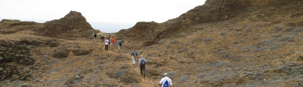
The Lakes Basin Recreation Area (N39º42’ W120º41’) is on Forest Highway 24 between the Mohawk Valley and Sierra City. The glaciated landscape includes U-shaped canyons and glacial moraines. There are 20 lakes connected by hiking trails. Three rustic lodges—Elwell Lakes Lodge, Gold Lake Lodge, and Gray Eagle Lodge—offer accommodations. Frazier Falls (N39º42’ W120º39’) is accessible by a one-half mile hike on County Road 501. Long Lake (N39º42’ W120º41’) is a water supply reservoir for the town of Graeagle. The Red Fir Nature Trail (N39º42’ W120º37’) is a one-mile loop on the road to Mills Peak. Lake Davis (N39º53’ W120º29’), part of the State Water Project, is on Big Grizzly Creek, a tributary to the Middle Fork Feather River. The reservoir is north of Portola, with recreation areas managed by the Plumas National Forest.
South Fork Feather Area
On the South Fork of the Feather River within the Plumas National Forest, the South Feather Water and Power Agency has developed an extensive hydroelectric system. The uppermost facilities on the South Fork Feather River are at Little Grass Valley Reservoir (N39º43’ W121º1’). Downstream, the South Fork Diversion Dam (N39º39’ W121º7’) diverts water via a 2.7-mile tunnel to Sly Creek Reservoir (N39º35’ W121º7’). Sly Creek Reservoir also receives supplemental water from Slate Creek Diversion (N39º37’ W121º3’) via a 2.5-mile tunnel from the Yuba River watershed. Power is generated at the Sly Creek powerhouse and discharges into Lost Creek Reservoir (N39º34’ W121º8’). Lost Creek dam diverts water to the Woodleaf Tunnel which discharges at the Woodleaf Powerhouse on Forbestown Reservoir (N39º33’ W121º12’). From Forbestown, the water enters the Forbestown Power tunnel and discharges from a powerhouse into the reservoir created by Ponderosa Diversion Dam (N39º33’ W121º18’). Water is diverted to Miners Ranch Reservoir and a powerhouse below Oroville Dam outside of the national forest.
Southwest of La Porte, the Valley Creek Botanical Area (N39º40’ W121º2’) is 180 acres of old growth mixed conifers. The Yuba County Water Agency developed the New Bullards Bar Reservoir (N39º24’ W121º8’) on the North Yuba River. The reservoir partially occupies Plumas National Forest lands. The reservoir is part of the Yuba River Development Project. On the upper end of the reservoir on Deadwood Creek (N39º32’ W121º6’) is a hydro plant on Plumas National Forest lands operated by Yuba County Water Agency.
North of La Porte are the remains of gold mining towns, now included in the national forest. St. Louis (N39º42’ W120º56’) and Howland Flat (N39º43’ W120º53’) are on County Road 690. St. Louis was founded in 1852 and once had 900 residents all that remains is a cemetery. Howland Flat was founded in 1850 and had 1,200 residents along with hotels and breweries. Porter Flat (N39º42’ W120º51’) is reached by County Road 800 and was along Canyon Creek on the Tahoe National Forest boundary. Gibsonville (N39º44’ W120º55’) is on County Road 900 and also boasted a hotel, saloon, and bowling alley in the 1850s.
Middle Fork Feather Area
The Feather Falls Scenic Area (N39º39’ W121º17’) is a 5,350-acre area along the lower canyons of the Middle Fork. The largest is Feather Falls on the Fall River, the sixth highest in the U.S. at 640 feet and reached by a National Recreation Trail or by walking upstream from the shoreline of Lake Oroville. There are other waterfalls on the Feather River as well as Bald Rock Canyon. Overlooking the deep canyons of the Middle Fork are granite domes. One such unique batholith is Big Bald Rock (N39º39’ W121º20’), on Bald Rock Road north of Oroville Lake.
South of Quincy on Forest Highway 10 along Hopkins Creek (N39º46’ W120º50’), there is columnar jointing of basalt in hexagonal columns similar to what is visible at Devils Postpile National Monument near Mammoth Lakes further south. Little Volcano (N39º51’ W120º54’) is a dolomite outcrop with a cave and panoramic views on Forest Road 24N13.
North Fork Feather Area
Hydroelectric developments of Pacific Gas & Electric and the City of Santa Clara dominate the drive along State Route 70. A tunnel from Butt Valley Reservoir delivers water to Belden Forebay (N40º5’ W121º9’). Another tunnel delivers water to Rock Creek Reservoir (N39º59’ W121º17’), and subsequent hydroelectric tunnels deliver water to Cresta Reservoir (N39º53’ W121º21’), and Poe Reservoir (N39º50’ W121º26’). The jointly owned reservoirs of the City of Santa Clara and Pacific Gas & Electric (Bucks Lake Hydroelectric Project) include Three Lakes Reservoir (N39º58’ W121º13’), Bucks Lake (N39º54’ W121º12’), Lower Bucks Lake (N39º54’ W121º14’), and Grizzly Forebay (N39º53’ W121º17’). These hydroelectric facilities are also in the North Fork Feather watershed of the Plumas National Forest. On County Road 306 east of Butt Valley Dam are the historic mine site of Swiss Mine (N40º7’ W121º7’) and the gold mining town of Seneca (N40º7’ W121º5’).
The Butterfly Valley Botanical Area (40˚0’ W121˚0’) harbors four species of insectivorous plants in its 500-acre extent, including the California pitcher plant, two species of bladderwort, and sundews. It is also known for a diversity of orchids and lilies. Forest Road 25N12 crosses the botanical area, reached by turning off of State Route 70-89 north of Quincy.
On State Route 89 at Indian Falls is Soda Rock Geological Area (N40˚3’ W120˚58’), a travertine mineral spring. An old growth sugar pine stand (N39º55’ W120º58’) is just south of Quincy off of Forest Road 24N21. The Spanish Creek Mines (N39º57’ W121º2’) are on the Quincy-Oroville Road west of Quincy. North of Spanish Ranch on Forest Road 25N17 is the Bean Hill Mine (N39º58’ W121º5’). Both were hydraulic gold mining operations during the 1850s. Round Valley Reservoir (N40º7’ W120º58’), which is a water supply reservoir for the city of Greenville, includes a nature trail. Long Valley (N40º7’ W121º1’) is a waterfowl nesting area. Mount Hough-Crystal Lake (N40º3’ W120º53’) is a scenic site on County Road 403 north of Quincy. Devils Punch Bowl (N40º1’ W120º48’) is a volcanic crater with a pond on the slopes of Grizzly Peak.
Mud Lake Research Natural Area is in two units, and was established to protect disjunct stands of Baker Cypress, normally found in wetter forests. One stand is on Wheeler Peak (N40˚6’ W120˚42’) and another is six miles north (N40˚11’ W120˚41’). Kettle Rock (N40˚8’ W120˚44’) is maintained as a scenic and geologic site. Antelope Lake (N40º11’ W120º36’) is on Indian Creek, a tributary to the North Fork Feather River. It is reached from Forest Highway 172 (Janesville Grade) off of US Route 395 south of Susanville. It is part of the State Water Project, and recreation areas are managed by the Plumas National Forest. West of Antelope Lake is the Kettle Rock-Taylor Lake area (N40º9’ W120º43’) noted for its scenic views. North of Antelope Lake is the Diamond Mountain Limited Vehicular Access area (N40º15’ W120º37’), established to protect eastside vegetation.
Reservoirs and Hydroelectric Power Projects
This section includes reservoirs federally authorized (hydroelectric projects), reservoirs located on federal lands, and reservoirs constructed by federal agencies. Because of the large number of hydroelectric developments in the Sierra Nevada, reservoirs are listed by river basin.
Feather River, North Fork
Antelope Lake, California State Water Project (N40º11’ W120º36’), is on Indian Creek, a tributary to the North Fork Feather River. Recreation areas are managed by the Plumas National Forest.
Mountain Meadows Reservoir, Pacific Gas & Electric, California (N40˚16’ W120˚57’), is also known as the Hamilton Branch hydroelectric development and is south of Westwood. Power is generated at the Hamilton Powerhouse (N40º16’ W121º5’) on Lake Almanor. It contains 5,000 acres of marsh and is high value waterfowl habitat. It is part of the Lake Almanor Important Bird Area for willow flycatchers and sandhill crane, which use the wet meadows.
Lake Almanor, Pacific Gas & Electric, California (N40º11’ W121º5’), is the major storage reservoir on the North Fork Feather River, extending over 28,000 acres, and is part of the Upper North Fork Feather River project. Water from Lake Almanor is diverted from the Prattville intake (N40º13’ W121º10’) into a tunnel for generation at the Butt Valley Powerhouse (N40º11’ W121º11’), at the upper end of Butt Valley Reservoir. It is part of the Lake Almanor Important Bird Area, hosting the largest population of willow flycatchers in California, along with greater sandhill cranes and several grebe species.
Butt Valley Reservoir, Pacific Gas & Electric, California (N40º7’ W121º8’), occupies 1,600 acres behind a dam on Butt Creek and stores water for release into the North Fork Feather River. Water is diverted through two 1.8-mile tunnels to the Caribou Powerhouses 1 and 2 (N40º5’ W121º9’) on the North Fork Feather River in the Plumas National Forest. The Caribou powerhouses discharge into Belden Forebay.
Belden Forebay, Pacific Gas & Electric, California (N40º5’ W121º9’), is a 42-acre reservoir on the North Fork Feather River in Plumas National Forest. It receives water from the Caribou Powerhouses and generates power at the Oak Flat powerhouse on site, and diverts water through a 6.3-mile tunnel to Belden Powerhouse (N40º0’ W121º15’). Belden Powerhouse is on the North Fork Feather River along State Route 70.
Rock Creek Reservoir, Pacific Gas & Electric, California (N39º59’ W121º17’), is 118 surface acres and receives water from the Belden Powerhouse. It serves as a diversion dam for a 6.5-mile tunnel to Rock Creek Powerhouse (N39º54’ W121º21’). State Route 70 is routed under the electrical switchyard, which tunnels under it. Both the reservoir and powerhouse facilities are along the North Fork Feather River and State Route 70.
Three Lakes, Pacific Gas & Electric, California (N39º58’ W121º13’), store water for delivery to Lower Bucks Lake. The lakes are in the Plumas National Forest and Bucks Lake Wilderness. Water is diverted into a pipeline which ends at Lower Bucks Lake.
Bucks Lake, City of Santa Clara, California (N39º54’ W121º12’) is on Bucks Creek, a tributary to the North Fork Feather River in the Plumas National Forest.
Lower Bucks Lake, City of Santa Clara, California (N39º54’ W121º14’), is on Bucks Creek and stores water for diversion into one of two tunnels. One tunnel ends at Grizzly Creek and the other at Grizzly Powerhouse (N39º53’ W121º17’). Grizzly Powerhouse discharges into Grizzly Forebay. These facilities are within the Plumas National Forest.
Grizzly Forebay, City of Santa Clara, California (N39º53’ W121º17’), is on Grizzly Creek and diverts water into a tunnel for delivery to Bucks Creek Powerhouse (N39º55’ W121º20’), which is on the North Fork Feather River. The reservoir is on Plumas National Forest land.
Cresta Reservoir, Pacific Gas & Electric, California (N39º53’ W121º21’), is a 95-acre reservoir on the North Fork Feather River, which receives water from the Rock Creek Powerhouse. Water is diverted into a four-mile tunnel for generation at Cresta Powerhouse (N39º50’ W121º25’). The powerhouse discharges to Poe Reservoir on the North Fork Feather River. The reservoir is partially on Plumas National Forest land.
Poe Reservoir, Pacific Gas & Electric, California (N39º50’ W121º26’), is 53 acres on the North Fork Feather River in the Plumas National Forest and receives water from Cresta Powerhouse. It diverts water into a 6.3-mile tunnel which ends at Poe Powerhouse (N39º43’ W121º28’) on the upper end of Lake Orovile.
Lake Oroville, California Department of Water Resources (N39º32’ W121º29’), is part of the state water project. The dam is the tallest in the U.S. at 770 feet. The Lake Oroville State Recreation Area surrounds the four major embayments of the reservoir, those along the West Branch Feather River, North Fork Feather River, Middle Fork Feather River, and South Fork Feather River.
(to be continued with hydroelectric projects on South Fork Feather River, trails, wilderness areas, and state and local sites)