Okanagan Dry Forests
Part 2 of an article previously posted on April 2, 2015.
This ecoregion is between the Coast Ranges and North-Central Rocky Mountains and is in the rain shadow of the Coast Ranges. It is drained by the Thompson River and Okanagan Lake. Many areas support grassland and near-desert vegetation, especially in the large river valleys. Vegetation ranges from alpine areas to forest and grassland. In the valley bottoms, grassland and ponderosa pine-bluebrush wheatgrass-sagebrush vegetation is common. In higher areas, lodgepole pine, quaking aspen, white spruce, and Douglas-fir may be found. This is Part 2 of an earlier entry dated April 2, 2015.
Two regions of note are Important Bird Areas. Douglas Plateau (N50°20’ W120°14’) is an area of bunchgrass and marshy lakes that serves as a major migration corridor for waterfowl. Also notable are the sandhill crane, flammulated owl, and burrowing owl. The site is designated an Important Bird Area and is along and to the east of Route 5A between Kamloops and Nicola Lake. South Thompson River is an Important Bird Area between Little Shuswap Lake (N50°50’ W119°41’) and Kamloops Lake (N50°43’ W120°3’). The river is adjacent to the Trans-Canada Highway (Route 1) for most of this length. The river supports wintering trumpeter swan and tundra swan. Banana Island Provincial Park, Pritchard Provincial Park, and Monte Creek Provincial Park are included in the IBA.
This ecoregion’s highlights include unique topography such as a matterhorn at Dunn Peak, waterfalls and natural tunnels at Eaken Creek Canyon, 850-m cliffs at Enderby Cliffs, cliffs and canyons at Lac du Bois, and lava flows at Bonaparte. Emar Lakes features a circular canoe circuit, and Buse Lake is an alkaline water feature attracting American avocet. Important fossil beds are at McAbee. More detailed descriptions of these areas follow. All sites listed are in British Columbia.
Secwepemc Museum and Heritage Park (N50˚41’ W120˚18’) is operated by the Secwepemc Nation (also called Shushwap Nation) off Route 5 on the north side of the South Thompson River in Kamloops. The museum is on the site of a 2,000-year-old winter village and contains ethnobotanical gardens.
Arrowstone Provincial Park (N50°52’ W121°16’) is 6,153-ha of dry grassland and old growth Douglas-fir forest managed as a wilderness area. The watershed of Arrowstone Creek is within the park. Access is via the Battle Creek Forest Road east of Cache Creek.
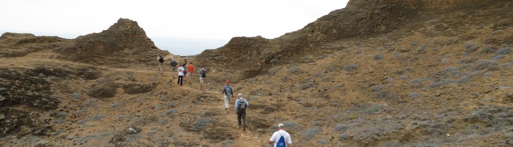
Mount Baldy Trail, Columbia Shuswap Regional District (N50°53’ W119°31’) is west of Sorrento on the Trans-Canada Highway and provides overlooks of Shuswap Lake from a mountain to the south. The trail length is 2.8 km.
Banana Island Provincial Park (N50°44’ W119°46’) is a 10-ha island in the South Thompson River used for waterfowl nesting. Vegetation is ponderosa pine forest. The adjacent river is known for salmon spawning. The park is part of the South Thompson Important Bird Area.
Blind Bay-White Lake Trail System, Columbia Shuswap Regional District (N50°53’ W119°20’) is a recreational trail system between the arms of Shuswap Lake, providing lake overlooks from nearby mountains. Trailheads are at Balmoral and MacArthur Heights.
Buck Hills Road Ecological Reserve (N50˚9’ W118˚59’) is 16 ha, 11 km south of Lumby, and features a stand of western larch along with large weathered granite boulders.
Bonaparte Provincial Park (N51⁰9’ W120⁰29’) is 11,811 ha noted for prominent lava flows south of Bare Lake; these originate from volcanic features at Skoatl Point and Stockton Hill. The park has 50 lakes with wetlands and riparian areas. The park is accessed via Westsyde Road and Jamieson Creek Road north from Kamloops.
Buse Lake Protected Area (N50°37’ W120°2’) is a 228-ha site surrounding an alkaline lake that attracts shorebirds such as the American avocet. To the south, a hiking trail leads to Buse Hill, which features 200-m cliffs.
Campbell-Brown Ecological Reserve (N50˚10’ W119˚22’) is 107 ha along Route 97 south of Vernon, overlooking Kalmalka Lake. It was established to protect a forest transitional between Douglas fir and ponderosa pine.
Kenna Cartwright Nature Park, City of Kamloops (N50˚41’ W120˚2’) is 800 ha on Mount Dufferin, providing panoramic views of the city and the Thompson River valley. There are 41 km of hiking and mountain biking trails.
Chu Chua Cottonwood Provincial Park (N51⁰20’ W120⁰10’) is a large floodplain island in the North Thompson River with old growth cottonwood and other riparian cottonwood-spruce-willow-hazelnut forests about 80 km north of Kamloops. Access is by boat, but the area is near Route 5.
Cougar Canyon Ecological Reserve (N50˚9’ W119˚19’) is a 553-ha canyon with a chain of six lakes formed by glacial meltwater. It is surrounded by Kalamalka Lake Provincial Park. It was established to provide a representative example of an interior Douglas-fir forest ecosystem.
Dewdrop-Rousseau Wildlife Management Area (N50°48’ W120°39’) includes 5,757 ha on the north shore of Kamloops Lake about 25 km west of Kamloops. The area of grasslands and open forests is managed as winter range for mule deer and bighorn sheep. It is adjacent to Lac du Bois Grasslands Protected Area and Tranquille Ecological Reserve on the east and Painted Bluffs Provincial Park on the west.
Lac Du Bois Grasslands Protected Area (N50°46’ W120°28’) is a 15,712-ha area adjacent to the north side of Kamloops. Features are Mara Hill, Wheeler Mountain, Deep Lake, Long Lake, the Tranquille River, and Opax Hill. Four trails with a combined length of 26 km lead to cliffs, canyons, and hoodoos. Also in the protected area are glacial features including hummocky terrain, eskers, and potholes. Vegetation ranges from cactus and sagebrush at lower elevations to ponderosa pines and grassland at higher elevations, to aspen and Douglas-fir at the highest points. Wildflowers such as balsamroot are in flower in early June. Notable wildlife includes bighorn sheep. An adjacent Nature Conservancy Preserve includes 2,342 acres centered on Lac du Boise (N50°48’ W120°27’). McQueen Creek Ecological Reserve (N50°49’ W120°20’) is a 35-ha portion in the northeast area of the Lac du Bois Grasslands Protected Area, protecting a representative middle elevation grassland.
Dunn Peak Protected Area is 19,350 ha between the North Thompson River near Little Fort (N51˚30’ W120˚10’) in the Okanagan dry forests ecoregion and Harper Creek (N51˚29’ W119˚51’) in the North-Central Rockies forest ecoregion. In between is Dunn Peak, a 2,634-m-high matterhorn and the highest peak in the vicinity. Notable features are old growth forests, lakes, tarns, and swamps. Most of the park is wilderness without trails, but the park also includes large islands in the North Thompson River along Route 5.
Eakin Creek Canyon Provincial Park (N51⁰27’ W120⁰14’) is a 10-ha narrow canyon with an 8-m scenic waterfall, natural tunnels, and rock outcrops. In the canyon are large cottonwoods, cedars, and Douglas-fir trees. Access is from Route 24 west of Little Fort.
Eakin Creek Floodplain Provincial Park (N51⁰28’ W120⁰19’) is 126 ha of red cedar, cottonwood, oak fern, and lady fern, along with old-growth Douglas-fir. Talus slopes include ice caves and rock outcrops. The park is accessible via a road off Route 24, 15 km west of Little Fort and the junction with Route 5.
Echo Lake Provincial Park (N50˚12’ W118˚43’) is 154 ha accessed by a 20-km gravel road southeast from Lumby. The park provides lakeside recreation, and there are two cabin resorts in the area. South of Echo Lake is Denison-Bonneau Provincial Park (N50˚9’ W118˚44’), which has no facilities.
Elephant Hill Provincial Park (N50˚45’ W121˚17’) is 995 ha on both sides of Route 97C between Cache Creek and Ashcroft. Elephant Hill to the west of Route 97C and Rattlesnake Hill to the east are grassland areas and some of the driest habitats in the province. Portions of the grasslands were not grazed in the past.
Ellison Provincial Park (N50˚11’ W119˚26’) is 220 ha of rocky headlands on the northeastern shore of Okanagan Lake. There are 6 km of trails within the ponderosa pine-Douglas fir forests and grassland in the Okanagan landscape, along with a campground and lakeside recreation activities.
Emar Lakes Provincial Park (N51⁰29’ W120⁰23’) is 1,604 ha of wilderness lakes, potholes, and wetlands adjacent to Route 24 west of Little Fort. The chain of lakes in the park allows a circular canoe route with short portages. Major lakes are Long Island Lake in the northwest, Emar Lake in the center, and Richard Lake in the north-central portion of the park. The Hudson’s Bay Company Brigade historic trail crosses the park.
Enderby Cliffs Provincial Park (N50˚35’ W119˚4’) is 2,300 ha off of Route 97A at Enderby. The 850-m-high cliffs overlook the Shuswap River in the Okanagan Valley. The Tplaquin Trail leads to the summit via a 6.5-km route.
Epsom Provincial Park (N50˚34’ W121˚18’) is 102 ha adjacent to the Trans-Canada Highway (Route 1) between Ashcroft and Spences Bridge. The site is in the valley of the Thompson River and provides access to the river by crossing a railroad track. Vegetation is sagebrush and grassland, along with cottonwood and willow in riparian areas.
Fintry Provincial Park and Protected Area (N50˚8’ W119˚30’) is 3,500 ha on Westside Road about 35 km north of Kelowna. Included in the park are an early 20th century agricultural estate and a scenic gorge along Shorts Creek. A number of buildings are preserved from the estate, including the manor house, gatekeepers house, packing house, and octagonal barns. The protected area includes waterfalls along the creek and bighorn sheep habitat.
Graystokes Provincial Park is 12,000 ha accessed by unpaved roads south from Lumby or east from Kelowna. The park extends from Harris Lake in the north (N50˚5’ W118˚51’) to Mount Moore in the south (N49˚52’ W118˚50’). Forests are old growth subalpine fir and Engelmann spruce, and the park includes a complex of swamps and meadows.
Greenstone Mountain Provincial Park (N50˚37’ W120˚39’) is 98 ha of high elevation grassland and sagebrush, accessible by road 20 km southwest of Kamloops. The summit provides panoramic views of the Thompson Valley.
Roderick Haig-Brown Provincial Park (N50°55’ W119°38’) is 1,000 ha located 5 km north of Squilax on the Squilax-Anglemont Road. The park is one of the world’s great natural areas, known for the largest sockeye salmon run in North America, with millions of fish in the Adams River. The salmon run is in early October. There are 26 miles of trails, which follow the Adams River and pass rapids and waterfalls.
R.J. Haney Heritage Village, City of Salmon Arm (N50˚42’ W119˚14’), is located at the junction of the Trans-Canada Highway (Route 1) and Route 97B east of Salmon Arm. The 40-acre park includes historic structures such as a 1910 farmhouse.
Hat Creek Ranch Provincial Historic Site (N50°53’ W121°25’) is in Cache Creek on Route 99 just west of Route 97. The living history site has a roadhouse dating to the 1860s and used by gold rush travelers, a native Shuswap village and stagecoach rides.
Herald Provincial Park (N50˚47’ W119˚12’) is 80 ha on the Salmon Arm of Shuswap Lake. There are three campgrounds, and a trail leads to Margaret Falls and a canyon upstream. The park is 14 km from Tappan on the Trans-Canada Highway (Route 1). The park is also the trailhead for the Reinecker Creek Trail of the Columbia Shuswap Regional District, which switchbacks up a mountain to views of Shuswap Lake and offers 20 kms of trails.
High Lakes Basin Provincial Park (51⁰23’ W120⁰25’) is 560 ha of Engelmann spruce-subalpine fir habitat on the Nehalliston Plateau. Features are High Lake and Higher Lake, which have a wild trout population.
Isobel Lake Interpretive Forest, Recreation Sites and Trails BC (N50°51’ W120°25’), is a 2,700-ha tract to the north of Lac du Bois Grasslands Protected Area, operated by School District 73. The area offers lakeside recreation, hiking, and mountain biking. Access is from Lac du Bois Road north of Kamloops.
Lake Le Jeune Provincial Park (N50˚29’ W120˚28’) consists of 180 ha of spruce-fir and riparian habitats on the Coquihalla Highway (Route 5) south of Kamloops. The park provides lakeside recreation and is famous for fighting rainbow trout. The Gus Johnson Trail circles the lake for 8 km, and the park also is trailhead for the 45-km Stake Lake Trail system to the east.
Juniper Creek Provincial Park (N50°47’ W121°5’) is 260 ha on the Trans-Canada Highway (Routes 1-97) 20 km east of Cache Creek. Vegetation is sagebrush, cactus, and juniper. The site provides access to the Thompson River.
Kalamalka Lake Provincial Park (N50˚12’ W119˚15’) is 4,200 ha of grassland and ponderosa pine forests on the east side of Kalamalka Lake. There are unique cliff and wetland habitats. Located off Route 6 at Coldstream, the park is noted for wildflowers.
Kekuli Bay Provincial Park (N50˚11’ W119˚20’) is a campground and lakeside recreation park on a 57-ha site on the west side of Kalamalka Lake. It is adjacent to Route 97 and a railroad.
Kingfisher Creek Provincial Park and Ecological Reserve (N50˚48’ W118˚47’) is 1,900 ha of subalpine parkland at the transition between the drier Okanagan region and wetter North-Central Rockies. It is accessible by foot and is 14 km east of Sicamous.
Kingfisher Interpretive Centre (N50°36’ W118°50’) is a non-profit salmon hatchery and environmental education center on Mabel Lake Road 25 km east of Enderby.
Lily Pad Lake Ecological Reserve (N50˚8’ W118˚58’) is an undisturbed highland lake and bog about 12.5 km south of Lumby.
Truman Dagnus Locheed Provincial Park (N50˚13’ W119˚22’) is a small undeveloped park in the Okanagan Landing area of the city of Vernon, overlooking Okanagan Lake.