The National Trail System in the North Central Rockies forests include three national scenic trails (NSTs) and two national historic trails (NHTs). There are 45 National Recreation Trails.
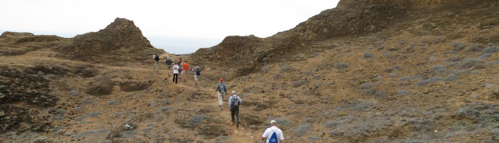
The Continental Divide NST traverses the North Central Rockies forests with sections maintained by the Deerlodge National Forest (NF), Helena NF, Lewis and Clark NF, Blackfeet Indian Reservation (N48˚7’ W113˚15’), and Glacier NP. Key sites in the Deerlodge NF are Pipestone Pass south of Butte (N45˚51’ W112˚26’), Homestake Exit on I-90 (N45˚55’ W112˚25’), Our Lady of the Rockies (N46˚0’ W112˚27’), Konda Trailhead off of I-15 on Forest Road 9422 (N46˚7’ W112˚29’), Champion Pass (N46˚14’ W112˚35’), and Thunderbolt Mountain (N46˚20’ W112˚27’). In the Helena NF are MacDonald Pass on US 12 (N46˚33’ W112˚19’), Priest Pass (N46˚37’ W112˚18’), Rogers Pass on State Route 200 (N47˚5’ W112˚22’), Lewis and Clark Pass (N47˚9’ W112˚26’), and The trail continues north into the Scapegoat Wilderness (see), then briefly exits the wilderness at South Fork Sun River in the Lewis and Clark NF (N47˚30’ W112˚54’). It then enters the Bob Marshall Wilderness (see) and exits at Badger Pass (N48˚8’ W113˚3’) and Muskrat Pass (N48˚9’ W113˚6’). Heading north in the Lewis and Clark NF, it passes North Badger Creek (N48˚15’ W113˚8’) and enters Glacier NP at Marias Pass on US Route 2 (N48˚19’ W113˚21’). Heading north in Glacier NP, the trail passes Railroad Creek (N48˚24’ W113˚17’) and enters the Blackfeet Indian Reservation at East Glacier (N48˚27’ W113˚15’). The trail returns to Glacier NP and passes Two Medicine Lake (N48˚29’ W113˚21’), Pitamaken Pass (N48˚31’ W113˚37’), Triple Divide Peak (N48˚34’ W113˚31’), Virginia Falls (N48˚40’ W113˚37’), Granite Park Chalet (N48˚46’ W113˚46’), and Fifty Mountain (N48˚51’ W113˚52’), before ending at Waterton Lake (N49˚0’ W113˚54’).
The Lewis and Clark NHT sites in the North Central Rockies forests at Lolo Pass, Lolo Trail, Weippe Prairie, Canoe Camp, and Lewis and Clark Long Camp are described under the Nez Perce National Historical Park. One trail site not part of the park is Lewis and Clark Pass, Helena National Forest, Montana (N47˚9’ W112˚26’), which was crossed by the Lewis party (not the Clark party, which crossed at a different pass) on the return trip from Oregon. The pass is on a trail following a short cut from Travelers Rest to Great Falls which follows the Blackfoot River. It is reached by taking Forest Highway 293 north to Alice Creek station, then a one-mile hike along the Continental Divide National Scenic Trail.
Nez Perce NHT, Idaho and Montana, includes sites associated with the flight of the Nez Perce from Idaho. In the North Central Rockies forests are Dunwell’s Ferry (N46˚24’ W116˚11’), Weippe (described under Nez Perce National Historical Park (NPNHP), Heart of the Monster (described under NPNHP), Southern Nez Perce Trail at Stites (N46˚5′ W115˚59’), Clearwater Battlefield and Kooskia Attack (N46˚8’ W115˚59’), the attack on Chief Looking Glass’s Camp (described under NPNHP), Powell Ranger Station—a traditional fishing spot in Clearwater NF(N46˚51’ W114˚43’), Packer Meadows for camas gathering in Clearwater NF (N46˚38’ W114˚33’), Lolo Hot Springs (N46˚44’ W114˚32’), and Fort Fizzle in Lolo NF (N46˚45’ W114˚10’), where the army failed to stop the tribe when they went around a barricade.
Pacific Northwest NST (PNT) passes through Glacier NP, Flathead National Wild and Scenic River, Flathead NF, Kootenai NF, Lake Kookanusa, Kaniksu NF, and Colville NF in the North Central Rockies forests ecoregion. The current route is mapped at the Pacific Northwest Trail Association website (www.pnt.org). The Glacier National Park segment was designated as a National Recreation Trail (NRT). From east to west, this segment passes Waterton Lake (48˚59’ W113˚54’), Brown Pass (48˚53’ W113˚52’), and Kintla Lake (N48˚57’ W114˚20’). In the Flathead NF, the trail passes Thoma Lookout (N48˚57’ W114˚33’) and Tuchuck Mountain (N48˚58’ W114˚40’).
In the Kootenai NF, the PNT passes Weasel Meadow (N48˚59’ W114˚43’), Mount Wam (N48˚57’ W114˚49’), Poorman Mountain (N48˚59’ W114˚55’), Bluebird Basin (N48˚57’ W114˚56’), and Mount Barnaby (N48˚55’ W114˚56’), then descends to the town of Eureka and Lake Kookanoosa (N48˚54’ W115˚10’). West of Lake Kookanoosa, the trail climbs Webb Mountain and passes Thirsty Mountain (N48˚49’ W115˚23’), Purcell Summit, Mount Henry (N48˚53’ W115˚31’), Fish Lakes (N48˚52’ W115˚35’), Yaak River (N48˚54’ W115˚40’), Garver Mountain (N48˚56’ 115˚48’), Pete Creek Meadows (N48˚58’ W115˚50’), and Northwest Peak (N48˚58’ W115˚58’).
In the Kaniksu NF, the PNT passes Canuck Peak (N48˚56’ W116˚1’), enters Idaho near Canuck Pass, Ruby Ridge (N48˚55’ W116˚6’), Moyie River (N48˚55’ W116˚11’), Bussard Mountain (N48˚54’ W116˚14’), and Brush Lake (N48˚54’ W116˚20’), then crosses the Kootenai River (N48˚54’ W116˚24’).
West of the Kootenai River, the PNT climbs to Parker Peak (N48˚52’ W116˚35’)on the Selkirk Crest and continues across Long Mountain (N48˚50’ W116˚37’) and Pyramid Pass (N48˚49’ W116˚37’), then descends to Lion Creek (N48˚46’ W116˚41’) before leaving the national forest. The trail crosses Lookout Mountain (N48˚46’ W116˚46’) on Idaho state lands, then reenters the national forest at Upper Priest Lake (N48˚47’ W116˚53’) before entering Washington and the Salmo Priest Wilderness, where the trail passes Shedroof Mountain (N48˚56’ W117˚3’) and Crowell Ridge (N48˚54’ W117˚11’).
In the Colville NF, the PNT passes Boundary Dam at Metaline Falls (N48˚51’ W117˚22’), Beaver Mountain, and Abercrombie Mountain (N48˚55’ W117˚27’), before dropping into Northport on the Columbia River (N48˚55’ W117˚47’). The trail reenters the Colville NF and passes Elbow Lake (N48˚57’ W117˚59’) and Pierre Creek before exiting the North Central Rockies ecoregion at the Kettle River (N48˚55’ W118˚12’).
The Trans-Canada Trail is a national trail effort across Canada. In the North Central Rockies forests, the trail has been completed across British Columbia, mostly using old railroad lines. From west to east, the trail passes Paulson (N49˚12’ W118˚7’), Castlegar (N49˚19’ W117˚40’), Trail (N49˚6’ W117˚43’), Salmo (N49˚11’ W117˚11’), Nelson (N49˚29’ W117˚16’), Gray Creek Pass (N49˚37’ W116˚39’), Kimberley (N49˚39’ W115˚58’), Cranbrook (N49˚32’ W115˚45’), Elko (N49˚18’ W115˚7’), Fernie (N49˚31’ W115˚4’), and Sparwood (N49˚44’ W114˚54’) before passing into Alberta at the Upper Elk River area (N50˚1’ W114˚55’). The 25-mile section from Kimberley to Cranbrook is known as the North Star Rails to Trail.
National Recreation Trails
Through the efforts of the Forest Service, numerous national recreation trails (NRTs) have been designated in the national forest lands of the northern Rockies ecosystem. There is also a trail managed by the Bureau of Land Mangement. The following list is by mountain range.
Along the Continental Divide
In the easternmost ranges along the Continental Divide, Haystack Mountain NRT, Deerlodge NF, Montana (N46˚9’ W112˚20’) begins at the end of Forest Road 1538 four miles north of the Elk Park Exit on I-15. The 3.6-mile trail provides views of the Boulder River Valley. Mount Helena Ridge NRT, Helena NF, Montana (N46˚35’ W112˚4’) is a six-mile trail that begins in Mount Helena City Park and ends at Park City Trailhead in Helena NF.
In the Whitefish and Salish Ranges and Southward Extensions
In the Whitefish Range, Danny On Memorial NRT, Flathead NF, Montana (N48˚29’ W114˚21’) is located at Big Mountain Ski Resort north of Whitefish off of US Route 93. The trail leads four miles from the base of the chairlift to the summit of Big Mountain, where there is an environmental education center. Hikers can ride to the summit and hike down, or plan a route with loops involving other trails. Ralph L. Thayer Memorial NRT, Flathead NF, Montana, follows the crest of the Whitefish Range for 17 miles, providing views of the Flathead Valley and Glacier NP. The south trailhead is at Werner Peak (N48˚35’ W114˚26’) and the north trailhead is at Red Meadow Lake (N48˚45’ W114˚36’). Whitefish Divide/Smoky Range NRT, Flathead NF, Montana, follows the crest of the Smoky Range for 11 miles, beginning on Forest Road 316 (Canyon Creek Road ) (N48˚31’ W114˚19’) and ending at Forest Road 803 (N48˚34’ W114˚13’). Both forest roads intersect North Fork Road north of Columbia Falls.
In the Swan Range, Holland Falls NRT, Flathead NF, Montana (N47˚27’ W113˚35’) is a 1.5-mile, 750-foot climb to a waterfall. It begins on Forest Road 44 at Holland Lake, east of State Route 83 and north of Seeley Lake. Morrell Falls NRT, Lolo NF, Montana (N47˚18’ W113˚28’), is a 2.5-mile trail north of Seeley Lake on Forest Road 4353.
In the Salish Range, Blacktail-Wild Bill NRT, Flathead NF, Montana, is west of Lakeside (US Route 93) on Flathead Lake. It begins off of Forest Road 917 near Blacktail Mountain (N47˚59’ W114˚22’) and ends along Wild Bill Creek on Forest Road 213 (N48˚2’ W114˚26’). It is 12 miles in length.
In the Garnet Range, Garnet Winter NRT, BLM, Montana, is a snowmobile route following existing roads closed in winter, extending from Greenough on State Route 200 (N46˚55’ W113˚26’) south to near Garnet Ghost Town, with 30 miles of trails.
In the Purcell Mountains and Southward Extensions
In the Purcell Mountains, Little North Fork NRT, Kootenai NF, Montana (N48˚45’ W115˚22’) is a one-fourth-mile trail to a 50-foot water fall in a rainforest gorge on the west side of Lake Koocanusa. Pulpit Mountain NRT, Kootenai NF, Montana (N48˚32’ W115˚47’) is a five-mile trail in the Purcell Mountains accessed seven miles east of Troy off of a Forest Service road. Skyline NRT, Kootenai NF, Montana extends 22 miles in the Purcell Mountains from the West Fork Quartz Creek trailhead (N48˚29’ W115˚39’) to the junction of Yaak River and Seventeen Mile Roads (N48˚41’ W115˚50’), passing Quartz Mountain, Skyline Mountain, and Arbo Mountain. Vinal Creek Trail #9/Purcell Summit NRT, Kootenai NF, Montana (N48˚52’ W115˚35’) is a 25-mile trail that passes Turner Falls on the way to Mount Henry lookout tower.
In the Cabinet Mountains, Baldy Lookout-Lake Trail, Lolo NF (N47˚37’ W114˚50’), is north of Plains, Montana off of Forest Highway 1025; this three-mile trail passes Baldy Mountain and ends at Baldy Lake.
In the Coeur d’Alene Mountains, Caribou Ridge NRT, Coeur d’Alene NF, Idaho (N47˚36’ W116˚40’) extends from a trailhead on Forest Road 438 off of State Route 97 to Mount Coeur d’Alene. The five-mile trail gains 1,100 feet in elevation. Nearby, Mineral Ridge NRT, BLM, Idaho, is a three-mile nature trail located three miles south of I-90 on State Route 97. Mineral Ridge overlooks Lake Coeur d’Alene; the trail connects Beauty Bay on Lake Coeur d’Alene with Forest Road 1575 in the Coeur d’Alene National Forest.
North of I-90, English Point NRT, Coeur d’Alene NF, Idaho (N47˚47’ W116˚’) is on Hayden Lake just north of Coeur d’Alene and includes two loops for a total of six miles. Chilco Mountain NRT, Coeur d’Alene and Kaniksu NFs, Idaho (N47˚54’ W116˚31’) is reached via US Route 95 and Bunco Road (Forest Road 332). It follows the ridgetop of Chilco Mountain for six miles. Coeur d’Alene River NRT, Coeur d’Alene NF, Idaho (southeast end N47˚53’ W116˚8’ and northwest end N47˚58’ W116˚13’) follows the North Fork Coeur d’Alene River past Cathedral Rocks for 15 miles. Independence Creek NRT, Coeur d’Alene NF, Idaho, is 13 miles, extending from the confluence of Independence Creek with Teepee Creek on Forest Highway 6310 (N47˚53’ W116˚13’) west to Weber Saddle on Forest Road 322 (N47˚54’ W116˚25’) southeast of Lakeview. Jackass Ridge Snowmobile NRT, Coeur d’Alene NF, Idaho, is a complex of trails on forest roads extending for 31 miles between Kellogg (N47˚34’ W116˚4’), Osburn, Twomile Saddle, and Dobson Pass (N47˚32’ W115˚53’). Trout Creek Loop NRT, Coeur d’Alene and Kaniksu NFs, Idaho-Montana, is 22 miles, beginning west of Trout Creek on Forest Road 214 (N47˚48’ W115˚43’) and climbing to a cirque at the state line at Ninety Three Mile Lake (N47˚46’ W115˚50’) in the Coeur d’Alene Mountains, before looping back to the trailhead. The Coeur d’Alene Mountains continue east into Montana. Iron Mountain-Cascade Falls NRT, Lolo NF, Montana (N47˚18’ W114˚49’), is a one-mile trail is at Cascade Campground on State Route 135 (St. Regis-Paradise National Scenic Byway). The Iron Mountain Trail continues southward after the falls.
In the St. Joe Mountains, Big Creek NRTs, St. Joe NF, Idaho (N47˚21’ W116˚7’) are 16 miles of interconnected trails between the St. Joe River and the Coeur d’Alene divide. Trails include Big Creek, East Fork Big Creek, Cabin Ridge, Daugherty Hill, Bronson Meadows, Elsie Peak, the Coeur d’Alene Divide, and Wallace St. Joe Divide. Trailheads are along Forest Highway 537 and Forest Road 1970, both north of the St. Joe River (Forest Highway 50). Nelson Ridge NRT, St. Joe NF, Idaho, extends nine miles from Forest Highway 50 just east of Avery on the St. Joe River (N47˚15’ W115˚47’) to Squaw Creek on the North Fork St. Joe River.
In the Palouse Corridor of the Clearwater Mountains, administered by the Nez Perce-Clearwater forest supervisor, White Pine NRT, St. Joe NF, Idaho (N47˚1’ W116˚40’) is on the White Pine Scenic Byway (State Route 6) east of Potlatch. South of the town of Elk River, Elk Creek Falls NRT, St. Joe NF, Idaho (N46˚44’ W116˚10’) is off of State Route 8 and Forest Road 1452B. A two-mile trail leads to three falls which drop a total of 140’ into a canyon with columnar basalt formations. Idaho Giant Cedar NRT, St. Joe NF, Idaho (N46˚53’ W116˚7’) is one-half mile long and is reached from Forest Highway 382 and Forest Road 4652 north of Elk River. The state champion giant cedar is 18’ in diameter.
In the Clearwater Mountains south of the St. Joe River, Marble Creek NRT, St. Joe NF, Idaho, is a trail system extending for 27 miles, beginning at Marble Creek (N47˚7’ W116˚5’) on Forest Highway 321 south of Forest Highway 50, and passing Delaney Creek, Grandmother Mountain, Mark Butte, Orphan Point, Breezy Point, and Lookout Mountain.
In the Lochsa River corridor along US Route 12 in the Clearwater Mountains, Colgate Licks Nature NRT, Clearwater NF, Idaho (N46˚28’ W114˚56’), extends for one mile on US 12 at Westover Campground, passing lodgepole and ponderosa pine forests and open meadows with warm springs. Lochsa River Historic NRT, Clearwater NF, Idaho, extends for 16 miles uphill and parallel to US 12 from Split Creek (N46˚14’ W115˚25’) upstream to Boulder Flat (N46˚20’ W115˚19’). Major Fenn NRT, Clearwater NF, Idaho (N46˚14’ W115˚29’), is a one-half mile nature trail at a picnic area on US Route 12 on the Lochsa River.
In the Selway River area of the Clearwater Mountains south of US Route 12, Anderson Butte NRT, Nez Perce NF, Idaho, is a 15-mile trail following ridgetops four miles east of Elk City beginning on Forest Road 1809 (N45˚51’ W115˚23’) and extending north to Forest Highway 443 (N45˚59’ W115˚25’) near Horse Ridge. The trail includes forest and open meadows. East Boyd-Glover Roundtop NRT, Nez Perce NF, Idaho, is 23 miles, beginning at the Boyd Campground (N46˚5’ W115˚27’) on the Selway River, climbing Roundtop (N46˚8’ W115˚23’), and descending to Glover Campground (N46˚4’ W115˚22’), also on the Selway River on Forest Road 223. Meadow Creek NRT, Nez Perce NF, Idaho, begins at a trailhead near Selway Falls (N46˚2’ W115˚17’); the trail follows Meadow Creek 15 miles south to the Meadow Creek Guard Station (N45˚33’ W115˚14’).
In the Bitterroot Mountains, Blue Mountain NRT, Lolo NF, Montana, is a nine-mile equestrian and hiking trail beginning just west of Missoula on US Routes 12-93 (N46˚50’ W114˚5’) and ending at Blue Mountain fire lookout (N46˚49’ W114˚11’). Also, the Blue Mountain Nature Trail NRT, Lolo NF, Montana, is a one-half mile trail at the same location. Skookum Butte NRT, Clearwater and Lolo NFs, Idaho and Montana (N46˚40’ W114˚23’), is a 1.7-mile hike along the Idaho-Montana line to overlooks of Lolo Creek and the Graves Range. It is accessed from Forest Highway 451 off of US Route 12 about 11 miles west of Lolo. Stateline NRT, Clearwater, Lolo and St. Joe NFs, Idaho-Montana is an 18-mile hike along the crest of the Bitterroots southwest of Superior, Montana. Diamond Lake Campground (N47˚9’ W115˚10’), reached via Forest Roads 342 and 7843, provides one access. Other access points, all south of Superior on I-90, are Forest Highway 342 (N47˚9’ W115˚13’), Missoula Lake on Forest Highway 320 (N47˚4’ W115˚7’), and Hoodoo Pass on Forest Highway 250 (N46˚59’ W115˚2’). South of Missoula, Como Lake Loop NRT, Bitterroot NF, Montana (N46˚3’ W114˚16’) is a seven-mile loop trail in the Bitterroot National Forest west of US Route 93 north of Darby.
Selkirk Range
The Selkirk Range includes mountains in the northern Idaho Pandhandle and northeastern Washington. In Idaho, Chipmunk Rapids NRT, Kaniksu NF, Idaho (N48˚26’ W116˚55’) is off of State Route 57 south of Priest Rapids Lake. It is a 10-mile ski trail. Hanna Flats NRT, Idaho, is on Forest Road 313 west of the Priest Lake airstrip in Hanna Flats Botanical Area (N48˚34’ W116˚59’). The Hanna Flats NRT winds four miles among old growth western red cedar and rare ferns. Lakeshore NRT, Kaniksu NF, Idaho, follows the western shore of Priest Lake from Beaver Creek (N48˚44’ W116˚52’) south to Reeder Bay (N48˚39’ W116˚53’). It passes near Bottle and Teepee Creek RNAs.
In the Washington portion of the Selkirk Range, Pass Creek-Grassy Top NRT, Colville and Kaniksu National Forests, Washington (N48˚48’ W117˚8’) follows the ridge south from Pass Creek Pass for eight miles to Grassy Top, which features meadows on a 6,000-foot mountain. It is accessed from Forest Road 22 from Sullivan Lake. Shedroof Divide NRT, Salmo Priest Wilderness and Colville NF, Washington extends along the ridge from Pass Creek Pass (N48˚48’ W117˚8’) north 22 miles to the Salmo Trailhead (N48˚57’ W117˚4’).Sullivan Lake NRT, Colville NF, Washington (N48˚49’ W117˚17’) is a four-mile trail on the eastern side of Sullivan Lake, connecting two campgrounds and offering bighorn sheep viewing opportunities.
To be continued with wild and scenic rivers, wilderness areas, and refuges