Part B National Forest System I
The National Forest system in the North Central Rockies forests ecoregion includes 17 areas, including three experimental forests, a tree nursery, a national recreation area, and 13 national forests. Coram Experimental Forest, Montana, was previously described under biosphere reserves. National forests are described in parts B, C, and D of the North Central Rockies posts.
National Forests of the Continental Divide, Swan, and Mission Ranges
Deerlodge NF, Montana, is 1.2 million acres and includes the southernmost portions in the North Central Rockies forests. The Continental Divide NST traverses the eastern Anaconda Range and almost encircles Butte to the south, east, and north within the forest. The Upper Clark Fork landscape area of the forest surrounds Butte. Thompson Park (N45-53 W112-28) on State Route 2 south of Butte is managed as a municipal park. Also south of Butte is the Basin Creek Reservoir municipal watershed area including Basin Creek RNA (N45˚49’ W112˚32’) on the Continental Divide south of Butte in the Boulder Batholith. It contains granite outcrops, small summits and swales. Sedges and willows dominate the basin.
In Jefferson River landscape area are Hells Canyon (N45˚41’ W112˚25’), Highland Mountains (N45˚43’ W112˚29’), Upper Whitetail Park, Mountain, and Reservoir (N46˚5’ W112˚17’), and the Bull Mountains (N46˚6’ W112˚4) of the Boulder Batholith. Dry Mountain RNA (N45˚58’ W112˚13’) is in the Boulder Batholith east of Butte. It contains old growth Douglas-fir and grassland-steppe vegetation north of Pipestone Hot Springs. Lost Park RNA (N46˚1’ W112˚17’), also in the Boulder Batholith north of Pipestone Hot Springs, is an undisturbed subalpine wetland with willow-sedge riparian areas, grassland, and subalpine fir.
In the Boulder River landscape are two RNAs. Bernice RNA N46˚15’ W112˚28’ is west of I-15, exit 151, on a north-facing slope overlooking the Boulder River and contains old growth Douglas-fir, spruce/northern twinflower, and scattered aspen. Thunderbolt Mountain RNA N46˚20’ W112˚26’ is on the Continental Divide north of I-15, Exit 151 and consists of a drier subalpine forest of lodgepole pine, subalpine fir, along with wet meadows and bogs. This landscape also includes the Kit Carson Peak area (N46˚11’ W112˚30’) and the Little Boulder River watershed (N46˚10’ W112˚30’).
The southwestern portion of the Elkhorn Mountains including the area around Elkhorn State Park (N46˚16’ W111˚57’) are also in the Deerlodge NF. The Elkhorn Mountains portion of the forest is within the Elkhorn Cooperative Management Area, a wildlife management area which contains hiking opportunities. The CMA also includes part of the Deerlodge NF and BLM lands.
To the north of the Deerlodge along the Continental Divide is the Helena NF, Montana, which is 975,000 acres and includes areas west of the Missouri River that are in the North Central Rockies forests. The southern approaches to the Scapegoat Wilderness are in the forest. South of Helena is the Elkhorn Cooperative Management Area, a wildlife management area which contains hiking opportunities. The CMA also includes part of the Deerlodge NF and BLM lands. Within the Elkhorn area is Crow Creek Falls (N46˚20’ W111˚48’), reached by a hike beginning on Forest Road 424 in the southern part of the area. Another hike within the CMA is the Eagle Trail, a 3.5-mile loop from the Eagle Guard Station (N46˚19’ W111˚45’). The Mount Helena NRT begins in a city park and extends through the forest. The Continental Divide NST extends through the forest from north to south from the Scapegoat Wilderness boundary (N47˚10’ W112˚33’) south to Lewis and Clark Pass (N47˚9’ W112˚26’), Rogers Pass (N47˚5’ W112˚22’), MacDonald Pass (N46˚33’ W112˚9’), and the Deerlodge NF boundary (N46˚20’ W112˚29’). Indian Meadows RNA (N47˚6’ W112˚36’) is north of Lincoln and contains fens, ponds, and marshes on a glaciated bench forested with Douglas fir and spruce. Red Mountain RNA (N47˚7’ W112˚44’) contains alpine tundra and lodgepole pine, with fellfields and stone strip patterning.
Lewis and Clark NF, Montana, is 1.8 million acres and includes areas west of the Missouri River in the North Central Rockies forest ecoregion, known as the Rocky Mountain division of the forest. The area is mostly forested but about 15 percent of the area is mountain meadows or rocky peaks. The mountain ranges consist of high elevation parallel limestone reefs separated by deep valleys. At the North End geographic unit of the forest along US Route 2, the Summit Campground (N48˚19’ W113˚21’) serves as the trailhead for an extensive hiking area, including the Two Medicine-Elk Calf loop trail (N48˚17’ W113˚15’) and the Continental Divide NST. The Walling Reef RNA (N48˚6’ W112˚47’) includes this area and part of the Bob Marshall Wilderness. The Blackleaf-Dupuyer Geographic Unit includes Volcano Reef (N48˚2’ W112˚42’) and trailheads accessing the Bob Marshall wilderness through the North Fork Dupuyer and Blackleaf Creek. There is winter range for elk, bighorn sheep, and mule deer. The Teton Geographic Unit includes the watersheds of the North, South, Middle, and West Forks of the Teton River. The Teton Pass Ski area (N47˚56’ W112˚48’) and the Blacktail-South Fork NRT and Jones Creek NRTs are in this area. Rocky Mountain at 9,392 feet, is the highest point and is reachable from Our Lake. Fossils of seashells, corals, and tubeworms are evident in the limestone rocks which are 70 to 100 million years in age (Howe 2013). The South Fork Teton Trailhead (N47˚51′ W112˚47′) is the beginning of the trail to Our Lake. Heading south from the same area on Forest Route 109 is the South Fork Teton-Blacktail NRT, which crosses the Deep Creek-Reservoir North Geographic Unit and ends at the North Fork Sun River (N47˚37′ W112˚46′).
Along the North Fork Sun River is the Sun Canyon Geographic Unit which contains the Gibson Dam reclamation facilities (N47˚36’ W112˚48’) and trailheads. South of the reservoir, the Lange Creek Trail leads south to the Patricks Basin (N47˚33’ W112˚50’) and Renshaw Geographic Unit, home to the Sun River elk herd. Benchmark-Willow Geographic Unit contains an airfield (N47˚29’ W112˚52’) along Wood Creek.
At the south end of the Rocky Mountain portion, the Elk Creek Geographic Area contains Cataract Falls (N47˚19’ W112˚36’) and provides access to the Scapegoat Wilderness over Elk Pass. The Falls Creek Geographic Unit (N47˚15’ W112˚29’) also provides wilderness access via Falls Creek and the Dearborn River, which flows through the forest in a scenic gorge at Devils Glen (N47˚15’ W112˚34’).
Wagner Basin RNA (N47-37, W112-43) is 965 acres just north of the Sun River Diversion Dam on the Rocky Mountain Front. The RNA contains a limestone spring known for wildflowers, limestone spires, cliffs, and talus slopes. Wildlife includes bighorn sheep and grizzly.
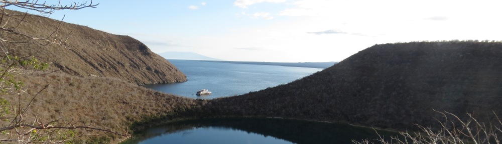
Flathead NF, Montana is 2.4 million acres including the Great Bear and Bob Marshall wildernesses, described separately. There are 2,100 miles of trails, including a Pacific Northwest National Scenic Trail segment. There are six geographic areas used to describe the forest.
Hungry Horse Geographic Area includes lands draining to the Hungry Horse Reservoir and South Fork Flathead River downstream of the dam. Coram Experimental Forest and parts of the Great Bear Wilderness (both described separately) are in this geographic area. In the Hungry Horse Reservoir area are reservoir recreation areas. The Jewell Basin Hiking Area (south end N48˚5′ W113˚53′, north end N48˚12′ W113˚55′) is between Flathead Lake and Hungry Horse Reservoir in the Swan Range. Numerous lakes and Mount Aeneas are found here. Aeneas Creek (N48˚8’ W113˚51’W) is eligible for the national wild and scenic river system.
Middle Fork Geographic Area. Parts of the Great Bear Wilderness and Bob Marshall Wilderness (both described separately) are in this geographic area, which is along US Route 2 east of Kalispell and south of Glacier NP. Nyack Flats (N48˚27’ W113˚49’) is a wide floodplain opening in the canyon of the Middle Fork noted for lush vegetation.
North Fork Geographic Area includes national forest lands in the North Fork Flathead watershed. Tuchuk RNA (N48˚56’ W114˚38’) is 2,000 acres in the Tuchuk Creek watershed on the slopes of Review Mountain with whitebark pine, subalpine fir, larch, and wet meadows. Forest trails 23 and 113 traverse the area, which is west of Glacier NP near the Canadian border. The Yakinikak Cave system (N48˚56’ W114˚32’) is along Forest Road 114 and accessible by permit. Yakinikak Creek (N48˚55’ W114˚36’) and Nokio Creek (N48˚56’ W114˚42’), a tributary of Yakinikak Creek, are eligible for the national wild and scenic river system. The Pacific Northwest National Scenic Trail traverses this portion of the forest, passing Thoma Lookout and Tuchuck Mountain.
In the Salish Mountains Geographic Area, LeBeau RNA (N48˚35′ W114˚44′) is 5,700 acres in the Flathead and Kootenai National Forests west of Upper Stillwater Lake and Olney on US Route 93. It contains Ketowke Mountain, seven ponds, fens, montane and subalpine forests, wetlands, and rocklands. LeBeau Creek (N48˚36’ W114˚41’) is considered eligible for the national wild and scenic river system. To the south, Miller Creek Research Demonstration Forest (N48˚31’ W114˚42’) is 5,000 acres for the study of prescribed fire and forest regeneration. Little Bitterroot RNA (N48˚0′ W114˚43′) is a 200-acre isolated tract of the Flathead NF at the Hidden Lakes area on the Little Bitterroot River south of US Route 2. There is a narrow canyon with rock cliffs and Douglas-fir forest. Logan Creek is eligible for the national wild and scenic river system from its headwaters (N48˚15’ W114˚41’) to its confluence with the Stillwater River (N48˚29’ W114˚32’) near US Route 93.
South Fork Geographic Area is upstream of Hungry Horse Reservoir and includes the South Fork Flathead River watershed. The Bob Marshall Wilderness is mostly within this geographic area. The entire Spotted Bear River is eligible for the national wild and scenic river system, including portions within the wilderness areas. Fens along the Spotted Bear River harbor rare plants. Limestone walls are visible from the Spotted Bear River along Forest Trail 83 (N47˚54’ W113˚16’) and Forest Road 568 (N47˚56’ W113˚20’), and Forest Road 2826 along the South Fork Flathead River (Spotted Bear Mountain, N47˚53’ W113˚25’). The portion of Spotted Bear River outside the wilderness areas extends from the Great Bear Wilderness boundary (N47˚54’ W113˚14’) to the South Fork Flathead River (N47˚55’ W113˚32’).
Swan Valley Geographic Area. The Bigfork Glacial Grooves (N48˚1’ W114˚2’) were formed when the Swan Valley Glacier collided with a larger ice sheet flowing from the north and was forced to change direction. They are up to two miles long and 900 feet deep. The Condon Creek Botanical Area (N47˚35’ W113˚42’) contains 15 ponds, most of which support water howellia, a federally threatened aquatic plant. East Shore RNA (N48˚1′ W114˚2′) is montane coniferous forest of Douglas-fir and grand fir with talus and rockfields just north of Woods Bay and east of Flathead Lake. Swan River RNA (N47˚52′ W113˚52′) contains an unusual raised peatland along with wetlands in a forest of western red cedar and grand fir, just south of Swan River NWR.
Rattlesnake National Recreation Area, Montana, is 60,000 acres and contains 73 miles of trails just north of Missoula. Trails lead to Stuart Peak (N47˚0′ W113˚55′), Sheep Mountain (N46˚57′ W113˚48′), and along Rattlesnake Creek. Shoofly Meadows RNA (N47˚0’ W113˚46’) contains wetlands, sphagnum bogs, and peat soil forests on the East Fork Rattlesnake Creek.
National Forests of the Purcell-Cabinet Ranges
Kootenai NF, Montana, is 1.8 million acres in the northwestern corner of Montana and a small section in Idaho, including the Purcell Mountains, Salish Mountains, and Cabinet Mountains. Administered as part of the forest are the Clark Fork River watershed portions of the Kaniksu NF in Montana; this portion of the forest is described under the Clark Geographic area of the Kaniksu NF (see). The Pacific Northwest National Scenic Trail crosses the forest, passing Weasel Meadow, Mount Wam, Ten Lakes Scenic Area, Kootenai Lake, Webb Mountain, Purcell Summit, Mount Henry, Fish Lakes, Upper Ford Yaak River, Garver Mountain, Pole Creek Meadows, and Northwest Peak.
The Bull Geographic Area includes areas below Kootenai Falls including the Lake Creek watershed and Bull Lake. Star Creek drops over a series of waterfalls before entering the Kootenai River opposite of the Yaak River confluence. This is the Star Creek Canyon Geological Area (N48˚33’ W115˚59’). The Callahan Historical Mining and Logging District Historic Area, Idaho-Montana, includes 3,000 acres along Callahan Creek (N48˚37’ W115˚54’), South Callahan Creek (N48˚24’ W116˚6’), and Glad Creek west of Troy on U.S. Route 2, including a railroad running along the creek. Halverson Face Botanical Area (N48˚20’ W116˚2’) protects northern beechfern on north-facing weeping rock walls, on Forest Road 473 along Halverson Creek. Spar Springs Geological Area (N48˚17’ W115˚54’) contains seeps which flow at the rate of 60 to 80 cubic feet per second and are the outlet for Spar Lake, which does not have a surface stream flowing from it. Bad Medicine Zoological Area (N48˚14’ W115˚52’) is 2,000 acres of vertical cliffs to the west of Bull Lake which are used by nesting peregrine falcon. The area also has sensitive plant species.
At the upper end of Bull Lake, there are three special areas along Ross Creek. Ross Falls Geological Area (N48˚12’ W115˚53’) is a waterfall in a narrow gorge. Upstream, Ross Creek Scenic Area (N48˚12’ W115˚55’) has a one-mile, two-loop nature trail passing eight-foot-diameter, 175-foot-high cedars. The cedar grove continues westward in Lower Ross Creek RNA (N48˚12’ W115˚57’), which has 1,874 acres of large, mature western cedars up to 1,000 years old in age. The area is off State Route 56 four miles west of Bull Lake. East of State Route 56, Doonan Peak RNA (N48˚18’ W115˚46’) is a 504-acre glacial cirque at the head of Madge Creek adjacent to the western edge of the Cabinet Mountains Wilderness. It is an area of hybrid western larch and alpine larch. The Spar Lake Campground is the trailhead for the hike to Spar Peak (N48˚13’ W115˚59’).
In the Fisher River Geographic Area is Wolf-Weigel RNA (N48˚29′, W114˚59′), south of Trego on Wolf Creek Road at the junction of Wolf and Weigel Creeks. The 250-acre area contains a waterfall and wetlands in a subalpine fir forest. The Cody Lakes Botanical and Zoological Area (N48˚19’ W115˚14’) is a series of three small lakes with calcareous-loving shrubs and sedges. These provide habitat for the northern bog lemming. Near US Route 2 along the Fisher River is the Kenelty Caves Geological Area (N48˚3’ W115˚21’). The caves formed in Cambrian-aged limestone. On the eastern portion of the forest on an isolated national forest land tract, Barnum Wetland Botanical Area (N48˚7’ W115˚4’) is a marsh and wetland meadow supporting sedges, rushes, and pink spirea.
In the Koocanusa Geographic Area, Montana State Route 37 between Libby and Eureka is the Lake Koocanusa Scenic Byway. The road is 67 miles and follows a narrow gorge; bighorn sheep can be seen on rock outcrops. There are five geological areas, a botanical area, a recreational area, a historical area, and a research natural area. Pinkham Falls Geological Area (N48˚50’ W115˚9’) is on Pinkham Creek Road. The north-flowing creek abruptly drops over a waterfall and turns into a west-flowing canyon. A trail leads downstream from the falls to Camp 32. Stone Hill Recreational and Geological Area (N48˚47’ W115˚17’) is a rock climbing area. The steep valley walls were glacially scoured due to a restriction in the valley along Lake Koocanusa. The area is accessible from State Route 37. At nearby Sutton Falls Geological Area (N48˚46’ W115˚16’), a spring melt waterfall drops over 100 feet. At Tenmile Talus Geological Area (N48˚38’ W115˚8’), a notch in the divide between Pinkham Creek and Tenmile Creek was caused by glacial meltwater flows. Downstream, Tenmile Falls Geological Area (N48˚37’ W115˚10’) is a series of waterfalls in a steep-walled canyon. Little North Fork Falls Recreational Area (N48˚45’ W115˚22’) is a recreational area along Big Creek on the west side of Lake Koocanusa. Barron Creek Historical Area (N48˚31’ W115˚18’),also on the west side is an early homestead site on the Kootenai River.
To the west of the lake, Upper Big Creek Riparian Ecosystem Botanical Area (N48˚37’ W115˚28’) is a former 3,000-acre glacial lake bed between Lawrence Mountain and Lost Soul Mountain. It is now a lodgepole pine forest. Big Creek RNA (N48˚44’ W115˚20’) is 200 acres on the west side of Lake Koocanusa with a Douglas-fir-dwarf huckleberry habitat. Big Creek (N48˚45’ W115˚23’) and eight tributaries—Little North Fork Big Creek (N48˚45’ W115˚22’), South Fork Big Creek (N48˚43’ W115˚29’), North Fork Big Creek (N48˚47’ W115˚32’), Good Creek (N48˚47’ W115˚28’), Copeland Creek (N48˚44’ W115˚32’), Lookout Creek (N48˚41’ W115˚29’), East Fork Lookout Creek (N48˚41’ W115˚27’), and unnamed tributary to Lookout Creek (N48˚39’ W115˚28’)—are all eligible for the national wild and scenic river system.
In the Libby Geographic Area is Norman Parmenter RNA (N48˚23’ W115˚41), west of Libby between Norman Mountain and Parmenter Creek. The 1,300-acre area contains Douglas-fir forest and black cottonwood riparian forest on the creek. South of Libby, Tepee Lake Botanical Area (N48˚10’ W115˚24’), located east of US Route 2, is a floating sphagnum fen with sundews and other fen plants. West of Route 2, Libby Gold Panning Recreation Area (N48˚7’ W115˚32’) is on Libby Creek near Howard Lake Campground. Southwest of Libby, Flower Lake Botanical Area (N48˚21’ W115˚38’) is a floating sphagnum fen with low pH surface water, supporting boreal toad, sundew, watershield, creeping sedge, and pod grass. Northwest of Libby, the Bitterroot Point Botanical Area (N48˚27’ W115˚40’) supports bitterroot flowers on shallow rocky ledges overlooking the Kootenai River near U.S. Route 2. The flowers are on south-facing slopes of Flagstaff Mountain east of Kootenai Falls near Hunter Gulch. Kootenai Falls Historic Area (N48˚27’ W115˚46’) is along U.S. Route 2 where historic period activities such as railroading, a Chinese settlement, homesteading, and placer mining took place. The Kootenai River from Jennings (N48˚22’ W115˚21’) downstream to Leonia on the Idaho border (N48˚37’ W116˚3’) is eligible for the national wild and scenic rivers system. Its tributaries downstream from Libby, Quartz Creek (N48˚28’ W115˚39’) and West Fork Quartz Creek (N48˚31’ W115˚41’) are also eligible. North of Libby, the East Fork Pipe Creek Geological Area (N48˚40’ W115˚34’) has unusual adjacent notches created by outflow from glacial lakes on the South Fork Big Creek. The area now drains south to the Kootenai River near Libby instead of east via Big Creek. Huson Peak RNA (N48˚33’ W115˚44’) is north of the Kootenai River and contains a healthy stand of whitebark pine, used for seed collecting for research on white pine blister rust resistance. It is 1,700 acres including Huson Peak, O’Brien Mountain, and Quartz Mountain.
In the Tobacco River Geographic Area is Ten Lakes Scenic Area (N48˚58’ W114˚56’), east of Eureka in the Galton Range, extending over 15,000 acres. There are 89 miles of trails in this alpine glaciated area, 20 miles east of US Route 93 off of Forest Roads 114 and 319. There are three geological areas, five botanical areas, and one research natural area in this watershed of the forest. Hamilton Gorge Geological Area (N48˚42’ W115˚1’) was an outlet for glacial meltwaters; on the west side of the canyon is an esker formed by meltwaters. Therriault Pass Geological Area (N48˚55’ W114˚53’) is a U-shaped feature in Gibraltar Ridge, visible from US 93. Ice backed up to the west from a glacial lobe and gouged the notch. The Tobacco River tributaries Grave Creek (N48˚52’ W114˚49’), Stahl Creek (N48˚55’ W114˚49’), Clarence Creek (N48˚56’ W114˚49’), and Blue Sky Creek (N48˚53’ W114˚44’) in the Whitefish Range are all eligible for the national wild and scenic rivers system.
The 494 Road Bedrock Meadow Botanical Area (N48˚37’ W115˚4’) is on the west side of a peak in the Salish Mountains and provides habitat for Nevada bitterroot and Harkness’ linanthus. Swamp Mountain Meadows Botanical Area (N48˚35’ W114˚58’) includes two five-acre grassy openings on an east-facing ridge with unique plants. Rocky Fivemile Forest Botanical Area (N48˚33’ W115˚3’) is at the headwaters of Lake Creek. Rock outcrops in a spruce-fir forest host lichens and between the rock outcrops are wetlands. Rock crevasses contain rare arctic-alpine species.
Along US Route 93 south of Fortine, the campground at Dickey Lake provides access to a 14-mile trail to Mount Marston (N48˚46’ W114˚47’), offering panoramic views from a lookout tower. The Ant Flat Interpretive Center (N48˚43’ W114˚53’) is a historic ranger station. Hidden Lake Botanical Area (N48˚40’ W114˚47’) is near Stryker on US Route 93. This is an area of orchids amid three lakes and two swampy areas. Lower Sunday Creek Ecosystem Botanical Area (N48˚38’ W114˚45’) is a riparian forest with old growth western cedar and skunk cabbage. There is a waterfall within the area, which is south of Stryker off US Route 93. LeBeau RNA (N48˚35′ W114˚44′) is 5,700 acres in the Flathead and Kootenai National Forests west of Upper Stillwater Lake and Olney on US Route 93. It contains Ketowke Mountain, seven ponds, fens, montane and subalpine forests, wetlands, and rocklands.
Along Lake Koocanusa, Gateway Prairie Botanical Area (N49˚0’ W115˚8’) is a 2,000-acre grassland, with plants disjunct from the Palouse Prairie ecoregion. Rexford Hoodoos Geological Area (N48˚54’ W115˚9’) includes erosional remnants of a drumlin on the Tobacco River embayment of Lake Koocanusa.
The Yaak River Geographic Area contains diverse botanical, geological, historical, recreational, and scenic areas. The Yaak River from the East Fork Yaak River (N48˚57’ W115˚37’) downstream to its confluence with the Kootenai River (N48˚34’ W115˚59’) is eligible for the wild and scenic river system. On the lower Yaak River is Yaak Falls Recreational Area (N48˚39’ W115˚53’), a waterfall adjacent to the Yaak Highway. The Yahk Mining District Historical Area (N48˚42’ W115˚53’) protects 200 features dating to the 1890s north of Fourth of July Creek, destroyed by the Big Burn of 1910. Between the confluence of Spread Creek downstream to the confluence with Otis Creek and the Yaak River, northern beechfern is common. This is the Spread Otis Creeks Botanical Area (N48˚49’ W115˚52’). Just to the east along the Yaak River, the Pete Creek Botanical Area (N48˚51’ W115˚46’) is a five-mile reach of Pete Creek with northern beechfern growing in an old growth red cedar forest. Further upstream on Pete Creek, Pete Creek Meadows RNA (N48˚58’ W115˚50’), is a 155-acre series of wet meadows with sedges and subalpine fir.
Vinal Lake Botanical Area (N48˚51’ W115˚39’) is a glacial lake perched above the Yaak River surrounded by a moist forest. Hoskins Lake RNA (N48˚53’ W115˚38’) is 380 acres of Douglas-fir, western larch, Engelmann spruce, and red cedar with fens and wet meadows on Hoskins Lake, a tributary of the Yaak River. The lakes are separated from the Yaak River by two steep knobs. Vinal Creek (N48˚52’ W115˚38’) and its tributary Turner Creek (N48˚52’ W115˚34’) are eligible for the national wild and scenic river system. Along the creeks are old growth western larch and cedar, Turner Falls, and Vinal Creek National Recreation Trail, part of the Pacific Northwest National Scenic Trail. The Wood Creek Larch Scenic Area (N48˚58’ W115˚37’) is further upstream along the Yaak River, protecting an old growth western larch stand.
The West Fork confluences with the Yaak River after flowing over two waterfalls. These falls are in the Lower West Fork Yaak Falls Geological Area (N48˚56’ W115˚42’). Upstream of the falls, French Creek joins the Yaak River. The French Creek Cedars Botanical Area (N48˚55’ W115˚45’) is an old growth cedar and larch grove with 500-year-old trees exceeding 50 inches diameter at breast height. At the headwaters of the West Fork Yaak River and Spread Creeks is the Northwest Peak Scenic Area (N48˚57’ W115˚58’), a 13,000-acre area of alpine lakes and open stands of cold-habitat trees in glaciated basins. Included are Rocky Candy Mountain in the Kootenai NF and Northwest Peak in the Kaniksu NF. The West Fork Yaak River from its confluence with the Yaak (N48˚55’ W115˚40’) upstream to the Canadian border (N49˚0’ W115˚46’) is eligible for the wild and scenic river system.
In the South Fork Yaak River watershed are Kelsey Creek Botanical Area (N48˚46’ W115˚38’), habitat for rare moonwort species, and Lost Horse Fen Botanical Area (N48˚45’ W115˚35’), a large floating sphagnum mat with unique cliffs and outcrops above it, harboring rare species at the base of Pink Mountain.
Lolo NF, Montana is 2.1 million acres in western Montana along both sides of I-90 at Missoula. It is influenced by maritime climates, producing wet western red cedar bottoms as well as typical northern forests of larch and whitebark pine. It extends cross several mountain ranges including the Cabinets and Bitterroots and Mission Ranges, but is included here for geographic convenience, since it is south of the Kootenai and Flathead forests.
I-90 leads through much of the forest west of Missoula. The Nine Mile Remount Depot Visitor Center (N47˚4’ W114˚24’) was the site of breeding mules for firefighting duty since the 1930s. The Grand Menard Discovery Trail is a two-mile loop nearby on Forest Highway 476 north of Exit 82 on I-90. The Petty Creek Bighorn Sheep Viewing Site (N46˚57’ W114˚26’) is on Forest Highway 489 south of I-90, Exit 77. Petty Creek RNA (N46˚51’ W114˚25’) is off Forest Highway 489 between I-90, Exit 77, and US Route 12, on the East Fork of Petty Creek and contains a Douglas-fir and grand-fir forest. The Route of the Hiawatha Rail Trail begins at Pearson, Idaho (N47˚21’ W115˚44’) and extends 15 miles to East Portal, Montana (N47˚24’ W115˚38’) in the Lolo NF. The railroad made a broad loop to gain elevation to cross the pass between Montana and Idaho. The bicycle trail includes seven high tressels and the 1.6-mile St. Paul Pass Tunnel. Savenac Historic Tree Nursery, at Exit 16 on I-90, established in 1907, is now an arboretum and visitor center which also interprets the Big Burn of 1910 (N47˚23’ W115˚24’).
The Blue Mountain trail system (46˚50’ W114˚5’) is two miles southwest of Missoula off of U.S. Route 93, with 41 miles of trails. Along US Route 12 southwest of Missoula is the Lolo Peak Trail (N46˚43’ W114˚11’), which is reached via Forest Road 612 south of US 12. The trail leads four miles south from FR 612 to Carlton Lake in the Bitterroot NF and on the edge of the Selway-Bitterroot Wilderness. The trail is known for views of the Missoula and Bitterroot Valleys. Along the trail is Carlton Ridge RNA (N46˚41’ W114˚11’). An extensive alpine larch grove, along with western larch, is found here.
The Lolo NF extends downstream along the Clark Fork to Thompson Falls. Ferry Landing RNA (N47˚20’ W114˚53’) is on State Route 135 on the Clark Fork River east of St. Regis. The site shows evidence of repeated scouring by floods from glacial lake Missoula and is forested scree of ponderosa pine and Douglas-fir. Along State Route 200 eight miles east of Thompson Falls is the Koo-Koo-Sint Bighorn Sheep Viewing Site (N47˚35’ W115˚10’). Barktable Ridge RNA (N47˚41’ W115˚8’) is an old growth mountain hemlock forest in the Thompson River watershed north of Thompson Falls.
Sheep Mountain Bog RNA (N46˚57’ W113˚47’) is northeast of Missoula in a cirque at the base of Sheep Mountain. This wet sphagnum bog has 11,500-year-old peat deposits. Pyramid Peak RNA (N47˚15’ W113˚24’) borders the Bob Marshall Wilderness and contains Douglas fir-globe huckleberry plant types. There is a snow avalanche track.
National Forest System description continues in Part C