Great Basin Shrub-Steppe, Northern Portion, Part II, Natural Sites

Natural Sites of the Great Basin Shrub-Steppe

Bonneville, Lahontan, and Bannock

B.     Natural Sites

There are two Western Hemisphere Shorebird Reserve Network sites in the Great Basin shrub-steppe.  Great Salt Lake, Utah (62), supports 400,000 acres of wetlands, which in turn supports five million migratory birds of 250 species.  At current elevation the lake is 1,700 square miles in area, extending 75 miles by 28 miles.  Islands in the lake, many mountainous, include Antelope Island State Park (see below under state and local sites), Stansbury, Fremont, Carrington, Gunnison, Dolphin, and Badger.  Bird, Egg, and White Rock islands support rookeries.  The Great Salt Lake Shorelands Preserve (63), latitude 41˚ 2’N, longitude 112˚ 2’W, of the Nature Conservancy and the Utah Reclamation Mitigation and Conservation Commission extends 11 miles between Farmington and the Antelope Island Causeway.  There are four Important Bird Areas (IBAs) corresponding to different arms of the lake, which have different salinities and are different waterfowl and shorebird habitats.  Farmington Bay is the southeastern part between Antelope Island and Salt Lake City.  Ogden Bay is a northeastern area.  The south arm is Gilbert Bay, and the north arm is Gunnison Bay. These are Important Bird Areas (IBAs) for American avocet, black-necked stilt, California gull, eared grebes, Wilson’s phalaropes and other waterfowl.

The other Western Hemisphere Shorebird Reserve Network site is American Falls Reservoir/Springfield Bottoms, Bureau of Reclamation, Idaho (64), 42˚ 51’ N, 112˚ 50’ W.  At 56,000 acres, this is one of the largest irrigation reservoirs, storing 1.7 million acre-feet of water as part of the Minidoka Project. A visitor center is at the dam, and a fish hatchery with nature trail along the Snake River (Idaho Department of Fish and Game) is below the dam.  The reservoir is an IBA for the California gull and waterbirds.  Fort Hall National Historic Landmark (described above) is at the upper end on the Snake River opposite McTucker Island.  The Fort Hall (Springfield) Bottoms are a waterfowl feeding ground fed by up to 50 cool, clear springs.  The Sterling Wildlife Management Area on the reservoir is 3,600 acres covering a seven-mile stretch of the northern shoreline.  It contains 1,500 acres of wetlands and is itself an IBA for waterbirds and shorebirds.

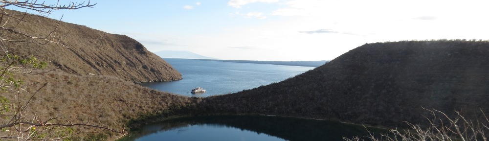
National Natural Landmarks in the Great Basin are the City of Rocks National Reserve, Idaho (65), 42˚4’N, 113˚ 43’ W, which was previously described under National Historic Landmarks, and Ruby Lake National Wildlife Refuge, Nevada (66), 40˚10’ N, 115˚ 29’ W.  Over 200 springs at the base of the Ruby Mountains create Ruby Marsh, the largest and finest natural wetland in Nevada, protecting the greater sandhill crane and the trumpeter swan and hosting the largest nesting population of canvasback ducks west of the Mississippi River.

National Forest (NF) System lands in the Great Basin shrub-steppe are mostly on the mountain peaks.  Forests with areas in the Great Basin are Caribou NF, Humboldt NF, Sawtooth NF, and Wasatch NF.  There is also the Curlew National Grassland administered by the Forest Service.

The Great Basin portion of the Caribou NF consists of four units in southeastern Idaho administered by the Westside Ranger District.  The area south of Pocatello in the Bannock Range (67), centered on 42˚44’ N, 112˚ 24’ W, is dominated by Scout Mountain and contains the Cherry Springs Nature Area, with trails along riparian meadows.  The willow and dogwood thickets of Mink Creek and Cherry Springs are an IBA for sharp-tailed grouse, pinon jay, and juniper titmouse.  The Crestline Trail crosses this area.  In the Elkhorn Mountains (68), 42˚ 22’ N, 112˚19’W, west of I-15 and north of Malad City, is the Wright’s Creek National Recreation Trail (see below).  In the Portneuf Range (69), 42˚ 48’ N, 112˚ 9’W) east of Pocatello is the Pebble Creek Ski Resort and a hiking area around Inkom Pass.  On the Idaho-Utah state line east of I-15 are the Bannock Range with the Oxford Mountain area (70), 42˚ 16’ N, 112 ˚ 6’ W, which is a steep ridge covered with pine and fir and cut by scenic canyons, along with the Malad Range with Weston Canyon, Idaho (70), 42 ˚ 7’ N, 112 ˚ 6’ W, and Clarkston Mountain in Utah (41 ˚ 57’ N, 112 ˚ 8’ W).

Curlew National Grassland, Idaho (71), 42 ˚ 5’ N, 112 ˚ 42’ W is administered as part of the Westside Ranger District of the Caribou NF and consists of three land areas to the north and south of Holbrook, Idaho.  The grassland is noted as habitat for sage grouse and sharptailed grouse and is part of the Raft River/Curlew Valley IBA for greater sage grouse and Ferruginous hawk.  Sweeten Pond provides a waterfowl area.  The grassland is crossed by the Hudspeth cutoff of the California Trail, and a short section of the historic trail can be hiked.

Humboldt NF, Nevada, is in northeastern Nevada.  Three land areas of this forest are in the northern Great Basin shrub-steppe.  The high peaks of these areas are in a separate ecoregion, Great Basin Montane, described previously.  The Jarbridge and Mountain City Ranger Districts (72), centered on 41 ˚ 47’ N, 115 ˚ 39’ W, administer one contiguous unit north of Elko on the Idaho state line.  This area rises 4,000 feet above the Snake River Plain to the north and contains numerous peaks over 10,000 feet in elevation.  Vegetation ranges from sagebrush to alpine meadows and pine forests.  The area is noted for sculptured rock formations and golden eagles.  The Ruby Mountains Ranger District (73), centered on 40 ˚ 38’ N, 115 ˚ 26’ W, is located east and south of Elko.  Known for spring wildflowers, this area contains glaciated Lamoille Canyon, the Yosemite of Nevada, and glacial lakes and cirques.  Vegetation ranges from sagebrush to pine forests on rocky peaks.  The Santa Rosa Ranger District (74), 41 ˚ 40’ N, 117 ˚ 33’ W, is located north of Winnemucca and is noted for the scenic drive between Paradise Valley and Hinkey Summit.  The drive features unusual stone pillars and wildflowers at the summit.  Four wilderness areas, East Humboldts, Jarbridge, Ruby Mountains, and Santa Rosa-Paradise Peak are within the map area.

Sawtooth NF is in southeastern Idaho and northwestern Utah.  The portions in the Great Basin are administered as the Minidoka Ranger District, and there are five distinct divisions, all south of the Snake River.  These ranges capture snow and support a diverse plant community of sagebrush, juniper, aspen, lodgepole pine, and fir.  They are known for wildflower displays in the late summer.  The five divisions are:

Albion Division, Idaho (75), 42˚ 18’ N, 113˚ 40’ W, is located between Burley, Idaho and the City of Rocks National Reserve.  It is known for the Mount Harrison Research Natural Area and Botanical Special Interest Area.  This high altitude mountain contains a lake in a glacial cirque.  Lake Cleveland campground is on the glacial lake.  The tall forb community between 6,300 and 11,000 feet in elevation provides a wildflower display in the summer of geranium, yarrow, lupine, and daisies.  Rare plants include an Indian paintbrush.  The 26-mile Skyline Trail connects Mount Harrison with 10,000-foot Cache Peak and City of Rocks.

Black Pine Division, Idaho (76), 42 ˚ 7’ N, 113 ˚ 7’ W, includes the Black Pine Mountains and canyons, and is located to the west of I-84, north of Utah Route 42, and east of Idaho Route 81.  This area is part of the Raft River/Curlew Valley IBA for greater sage grouse and ferruginous hawk.

Cassia Division, Idaho (77), 42˚ 11’ N, 114˚ 17’ W, located southeast of Twin Falls, is called the South Hills and contains desert canyons.  Rock Creek Canyon road winds through volcanic ash that is eroded into hoodoos and pinnacles.  Prominent ridges are Hudson Ridge, Cottonwood Ridge, and Deadline Ridge.  The area is part of the South Hills IBA for northern goshawk, sharp-tailed grouse, sage grouse, and the endemic South Hills crossbill.

Raft River Division, Utah (78), 41˚ 54’ N, 113˚ 26’ W, includes the Raft River Mountains of northwestern Utah, which extend east-west just south of the Idaho state line and west of Utah Route 30.  The Bally Mountains and Dove Creek Mountains are also included in the forest boundary.

Sublette Division, Idaho (79), 42˚ 18’ N, 112˚ 56’ W, includes much of the Sublette Range and numerous deep canyons to the north of I-84 and west of Idaho Route 37.  Two of the larger canyons are North Heglar Canyon and Flint Canyon.  Summit Springs and Sublett Creek are sites on the Hudspeth Cutoff, California National Historic Trail.  This area is part of the Raft River/Curlew Valley IBA for greater sage grouse and Ferruginous hawk.

Wasatch NF, Utah, located mostly in the Wasatch and Uinta Mountains ecoregion, contains two land areas west of Salt Lake City in the Great Basin shrub-steppe ecoregion.  One area (80) is centered on 40˚ 28’ N, 112˚ 38’ W, contains Deseret Peak Wilderness (see).  The other area (81), located at coordinates 40˚ 0’ N, 112˚ 28’ W, includes part of the Sheeprock Mountains, West Tintic Mountains, and Red Pine Mountain.

The National Landscape Conservation System in the Great Basin shrub-steppe consists of wilderness areas, which are described separately below, and the Black Rock Desert-High Rock Canyon Emigrant Trails National Conservation Area (BRDHRCET NCA), Nevada (82).  Known mostly for the Burning Man Festival, held in the Black Rock Desert Playa, this immense area preserves the longest remnants of historic trails to California and Oregon.  From Rye Patch Reservoir (see) on the east, the Applegate Trail extends west to Willow Springs, Antelope Pass, Kamma Pass, and Rabbithole Spring, where the Nobles Trail heads southwest.  The Applegate Trail continues west to Black Rock Springs, Double Hot Springs, Lassen/Clapper Burial Site, and Fly Canyon Wagon Slide to High Rock Canyon.  High Rock Canyon is an IBA for nesting raptors and swallows, while nearby High Rock Lake is known for nesting waterfowl and sage grouse.  Other features are the Hanging Rock Petrified Forest and Soldier Meadows, located near High Rock Canyon.  Soldier Meadows is a complex of hot springs harboring desert dace, four endemic springsnails, and basalt cinquefoil.  Wilderness areas within or partly within the NCA are Black Rock Desert, Calico Mountains, East Fork High Rock Canyon, High Rock Canyon, High Rock Lake, Little High Rock Canyon, and Pahute Peak (see separate descriptions).

National Park Systems lands in the northern Great Basin shrub-steppe are the City of Rocks National Preserve and Golden Spike National Historic Site.  Both were previously described under cultural sites, although the City of Rocks is a National Natural Landmark also.

Federal reservoirs which provide recreation in the Great Basin shrub-steppe are managed by the Bureau of Indian Affairs and Bureau of Reclamation.  In addition, there are federally licensed hydroelectric reservoirs operated by others which are described in this section.  These reservoirs are found in four freshwater ecoregions which overlap with the Great Basin shrub-steppe terrestrial ecoregion: Bonneville, Columbia Unglaciated, Lahontan, and Upper Snake. Bonneville and Lahontan are former glacial-era lake basins.  The boundary between the Columbia Unglaciated and Upper Snake freshwater ecoregions is Shoshone Falls, Idaho.

In the Upper Snake River ecoregion is the American Falls Reservoir, Bureau of Reclamation, Idaho, previously described under the Western Hemisphere Shorebird Reserve Network.  Also in the Upper Snake River ecoregion on the Blackfoot River is Blackfoot Reservoir, Bureau of Indian Affairs (BIA), Idaho (83), 42˚ 54’ N, 111˚ 36’ W, an 18,600-acre reservoir providing irrigation for the Fort Hall Indian Reservation of the Shoshone-Bannock tribes to the west.  The reservoir’s Gull Island is an IBA for American white pelican and California gull.  Islands provide nesting for pelicans, cormorants, and gulls.  Waterfowl also use the reservoir.  The Blackfoot River canyon downstream on BLM lands is habitat for the golden eagle, falcons, and great horned owls.

Ririe Reservoir, Bureau of Reclamation, Idaho (84), 43˚ 34’ N, 111˚ 44’ W, is also in the Upper Snake freshwater ecoregion.  The Ririe Project, 15 miles northeast of Idaho Falls, provides flood control and irrigation as well as reservoir recreation.  The reservoir is in a canyon carved by Willow Creek.  Mitigation for the project led to the purchase of the Tex Creek Wildlife Management Area (WMA), 29,000 acres of bitterbrush shrub-steppe big game habitat in the southern and southeastern part of the reservoir, and Cartier Slough WMA, a waterfowl area on Henry’s Fork west of Rexburg.  Tex Creek WMA (43˚ 26’ N, 111˚ 39’ W) is an area of deep canyons and is an IBA for the sharp-tailed grouse and greater sage grouse.  It is located on the upper end of Ririe Reservoir, along Grays Lake outlet, and along Tex Creek between Ririe Reservoir and Caribou National Forest.

Wild Horse Reservoir, Bureau of Indian Affairs and Shoshone-Paiute Tribes, Nevada (85), 41˚ 41’ N, 115˚ 51’ W, is an irrigation reservoir on the Owyhee River within the Columbia Unglaciated freshwater ecoregion constructed by the BIA.  Recreation is managed by the Bureau of Land Management and Wild Horse State Recreation Area.

In the Bonneville freshwater ecoregion is Hyrum Reservoir, Bureau of Reclamation, Utah (86), 41˚ 47’ N, 111˚ 52’ W, located between Logan and Brigham City.  This dam on the Little Bear River stores water for irrigation in the Cache Valley.  Recreation is managed as Hyrum State Park.   Newton Reservoir, Bureau of Reclamation, Utah (87), 41˚ 54’ N, 111˚ 59’ W, impounds Clarkston Creek near the Idaho State Line and also stores water for irrigation in the Cache Valley.   Also near Newton is the federally licensed Cutler Reservoir, operated by Rocky Mountain Power (Pacificorp), Utah (88), on the Bear River at 41˚ 50’ N 112˚0’ W.  Lowland riparian areas serve as an alternate habitat when the Great Salt Lake experiences high water.  It is an IBA for white-faced ibis, American avocet, and American white pelican.  Some Cutler reservoir areas are managed by the state as Bud Phelps Wildlife Management area and by the Bridgerland Audubon Society.

Upstream on the Bear River in Idaho are three privately managed hydroelectric reservoirs.  Soda Springs Reservoir (often mapped as Alexander Reservoir), (89), 42˚ 39’ N, 111˚ 40’ W, federally licensed and managed by Rocky Mountain Power (Pacificorp), provides reservoir recreation opportunities along U.S. Route 30 just west of Soda Springs.  Grace Dam (90), 42˚ 35’N, 111˚ 44’ W, on Route 34, also provides whitewater recreation downstream in the Black Canyon of the Bear River.  Water is diverted to the canyon mouth in the Gentile Valley, where power facilities are located.   Oneida Reservoir (42-17 N, 111-45 W), the lowermost hydroelectric dam on the Bear River in Idaho managed by Rocky Mountain Power, is north of Preston, Idaho in the Oneida Narrows canyon off of Route 36 and also provides reservoir recreation.

Arthur V. Watkins Dam and Willard Bay Reservoir, Bureau of Reclamation, Utah(92), 41˚ 22’ N, 112˚ 6’ W, impounds the Weber River arm of Great Salt Lake, storing water as part of the Weber Basin Project.  Recreation is managed as Willard Bay State Park (see).

In the Lahontan freshwater ecoregion on the Humboldt River is Rye Patch Reservoir, Bureau of Reclamation, Nevada (93), 40˚ 31’ N, 118˚ 19’ W.  Located 22 miles upstream from Lovelock, this 11,000-acre reservoir provides irrigation storage before the Humboldt River evaporates in the desert just downstream.

The National Trail System in the Great Basin consists of two National Recreation Trails (NRTs) in addition to the California, Oregon, and Pony Express National Historic Trails described earlier.  Wetland Wonders NRT, Bear River Migratory Bird Refuge, Utah (92), 41˚ 30’ N, 112˚ 4’ W, is a one-half mile paved accessible trail adjacent to the Wildlife Education Center in Brigham City. 

Wright’s Creek National Recreation Trail, Caribou NF, Idaho (68), 42˚ 20’ N, 112˚ 19’ W, runs for 12 miles through a roadless area in the Elkhorn Mountains west of I-15.  From Summit Campground in the southeast, the trail climbs Elkhorn Peak (9,000 feet) and ends in west-draining Reed Canyon.

There are 12 federally-designated Wilderness Areas in the Great Basin shrub-steppe.

Becky Peak Wilderness, BLM, Nevada (94), 40.0˚ N, 114.6˚ W, consists of desert brush, grass, pinyon-juniper, and bristlecone pine in the Schell Creek Range, located to the east of US 93 and Lages Station.  Features are Becky Peak and a number of spring-fed canyons.

Black Rock Desert Wilderness, BLM, Nevada (95), 41˚ 15’ N, 118˚ 43’ W is located mostly north of the BRDHRCET NCA.  This 314,800-acre wilderness includes the eastern arm of the dry lakebed of Lake Lahontan.  The ancient lake shoreline has been the site of paleontological discoveries including remains of a wooly mammoth and sabre toothed tiger.  It is mostly flat except for Elephant and Pinto Mountains.  In wet years, the Quinn River flows through the wilderness and evaporates in the salt flats.

Calico Mountains Wilderness, BRDHRCET NCA, Nevada (96), 41˚ 4’ N, 119˚ 14’ W, is a 65,000-acre sagebrush-covered wilderness is the southern portion of the Calico Mountains, including Division Peak, South Donnelly Peak, Morman Dan Peak, Copper Canyon, and Petrified Canyon.

Cedar Mountain Wilderness, BLM Salt Lake Field Office, Utah (97), 40.6˚ N, 112.9˚ W, is a 99,400-acre wilderness including the 30-mile long Cedar Mountains, sagebrush-grassland, juniper woodlands, and limestone outcrop.  Hastings Pass is a site along the Hastings Cutoff of the California Trail.  The route was pioneered by Kit Carson and used by the Donner Party and other trail travelers.

Deseret Peak Wilderness, Wasatch NF, Utah (80), 40.5˚ N, 112.6˚ W, is noted for steep canyons and rocky peaks in a juniper- and sagebrush-covered landscape.  Highest elevations have patches of fir and aspen.  There are 14 miles of trails.  Geographic features include the Stansbury Mountains, Indian Hickman Canyon, Antelope Canyon, and South Willow Canyon.

Goshute Canyon Wilderness, BLM, Nevada (98), 40.1˚ N, 114.9˚ W, is found in the Cherry Creek Range and includes massive white limestone cliffs, pinyon juniper, and bristlecone pine with aspens and cottonwood in drainages.  Features are Log Canyon, Currie Summit, and Goshute Cave and Canyon.   The location is west of US 93 at Lages Station, Nevada.

East Humboldts Wilderness, Humboldt NF, Nevada (99), 40.9˚ N, 115.1˚ W, is dominated by the 11,000-foot peaks Hole in the Mountain and Humboldt Peak.  This wilderness features six named lakes—Birdeye, Boulder, Greys, Smith, Steele, and Winchell.  Vegetation ranges from grasses and sagebrush to mountain mahogany, limber pine, and aspen.  Substantial geographical features are Boulder Creek, Lizzie’s Chimney Rock, Greys Creek, and Trout Creek.  It is located between I-80, US 93, and State Route 229.

High Rock Lake Wilderness, BRDHRCET NCA, Nevada (100), 41˚ 13’ N, 119˚ 14’ W, includes the generally dry High Rock Lake and Applegate Trail, along with the sagebrush-covered northern Calico Mountains.  A rock slide 14,000 years before present filled Box Canyon and formed the lake, which now drains through Fly Canyon to the north.  Fly Canyon is noted for its potholes or scour holes.

North Jackson Mountains Wilderness, Nevada (101), 41˚ 21’ N, 118˚ 28’ W, includes Parrot Peak and Deer Creek Peak within its 23,400-acre boundary, and is vegetated with sagebrush and junipers.

South Jackson Mountains Wilderness, Nevada (95), 41˚12’ N, 118˚ 33’ W, includes King Lear Peak, Navajo Peak, Hobo Canyon, Bliss Canyon, and McGill Canyon within its 54,500-acre sagebrush-covered area.

Jarbridge Wilderness, Humboldt NF, Nevada (102), 41.8˚ N 115.4˚ W, contains eight peaks over 10,000 feet which rise 4,000 feet from surrounding valleys in this 111,000-acre wilderness.  The area receives seven to eight feet of snow annually.  There are 125 miles of trails.  Substantial portions of the Marys River, Willow Creek, Jarbridge River, Camp Creek, Cottonwood Creek, and Canyon Creek are in the Great Basin shrub-steppe ecoregion.  The area is an IBA for montane birds such as blue grouse, red crossbill, and Cassin’s finch.

Pahute Peak Wilderness, BRDHRCET NCA, Nevada (96), 41˚ 16’ N, 119˚ 1’ W, is a 56,900-acre area which includes the central Black Rock Range.  Features include Pahute Peak, Little Big Mountain, Indian Creek, and badlands.  Vegetation is aspen, mountain mahogany, white bark pine on the north face of the peak; otherwise it is sagebrush.

There are three National Wildlife Refuge (NWR) system areas in the northern Great Basin shrub-steppe.  Bear River Migratory Bird Refuge, Utah (92), 41˚ 31’ N, 112˚ 22’W, is located two miles west of Brigham City on the Great Salt Lake.  The refuge contains wet meadows and mud flats.  Priority species are cinnamon teal, white-faced ibis, and Franklin’s gull.  The refuge contains the largest colony of white-faced ibis in North America and is an IBA.

Grays Lake NWR, Idaho (103), 43˚ 4’ N, 111˚ 26’ W, is the largest hardstem bulrush marsh in the world, set aside as a nesting and feeding area for waterfowl and is an IBA.  Ducks include mallard, teal, canvasback, lesser scaup, and redhead.  It is noted for nesting trumpeter swans and the largest nesting population of sandhill cranes in the world (200 nesting pairs).  It was also the home of a short-lived effort to establish an alternative whooping crane flock, now discontinued.   Water levels are controlled by the water rights of the Fort Hall Indian Reservation; the Grays Lake Outlet drains to Ririe Reservoir (see).

Oxford Slough Waterfowl Production Area, Idaho (104), 42˚ 15’ N, 112˚ 0’ W, is located south of Swan Lake off U.S. Route 91 and is an IBA of marshes and meadows, providing a nesting area for redhead ducks, white-faced ibis, Franklin’s gull, trumpeter swan, and common loon.

Other notable federal sites in the Great Basin shrub-steppe are listed below.

Bilk Creek Mountains and Montana Mountains, BLM, Nevada (105), 41˚ 46’ N, 118˚ 12’W, are two north-south mountain ranges on either side of Kings River Valley.  The area is an IBA because of a high density of sage grouse.

Bowen Canyon Bald Eagle Sanctuary, BLM, Idaho (106), 42.6˚ N, 112.8˚ W, is an IBA providing roosting habitat for eagles using American Falls Reservoir ten miles away.

Devil’s Playground, BLM, Utah (107), 41˚ 31’ N, 113˚ 40’W, is an area of granite rock weathered into bizarre shapes, including tunnels and arches, accessible off Emigrant Pass Road off Route 30 in the Bovine Mountains.

Mary’s River, BLM, Nevada (108), centered on 41˚ 24’ N, 115˚ 14’ W, is a 50-mile-long riparian area extending north from I-80 at exit 333.  The river serves as a bird migration corridor and is an IBA for Lewis’s woodpecker, red-naped sapsucker, and Bullock’s oriole.

Twomile Creek on Battle Mountain, BLM, Oregon (109), 42˚ 05’ N, 117˚ 38’ W, is located to the northwest of the Fort McDermitt Indian Reservation  and east of US Route 95.  It is a glacial cirque with mountain mohagany, designated an IBA for black-throated gray warbler, blue-gray gnatcatcher, and Nashville warbler.

Utah Lake Wetland Preserve, Utah Reclamation Mitigation and Conservation Commission, Utah (110), 40˚ 0’ N, 111˚ 54’ W, is located on Goshen Bay and Benjamin Slough of Utah Lake.  This area of extensive mudflats and wet meadows is an IBA.  u

Goshute Mountains, BLM, Nevada (111), 40˚ 24’ N, 114˚ 13’ W, funnel up to 20,000 raptors through passes in the fall migration; a good viewing point is from Alternate U.S. Route 93, 25 miles south of Wendover, Utah.  Hawkwatch International staffs a viewing area on the ridgetop, accessible via a 2.5-mile, 1,800-foot climb on a trail.  The area is an IBA.

Maple Grove Hot Springs, BLM, Idaho (91), 42˚ 20’ N, 111˚ 43’ W, is located north of Oneida Reservoir on the Bear River off of State Route 34 north of Preston; the spring water is 172˚ F.

Raft River Valley, BLM, Idaho (112), 42˚ 10’ N, 113˚ 20’ W, extends from the City of Rocks downstream to I-84; this area between the Black Pine Mountains and the Jim Sage Mountains is an IBA for ferruginous hawks.

Sierra Army Depot, California (113), 40˚ 12’ N, 120˚ 15’ W, is on Honey Lake, a transition area between the Great Basin and Sierra Nevada.  It supports shorebirds, gulls, terns, burrowing owl, and sage grouse and is an IBA.

South Shore Ecological Preserve, Utah Reclamation Mitigation and Conservation Commission, Utah (114), 40˚ 48’ N, 112˚ 7’ W, is an undisturbed remnant of the Jordan River delta on Great Salt Lake and is a joint project of the commission and the National Audubon Society.

Notable state and local sites in the Great Basin Shrub:

Antelope Island State Park, Utah (115), 40˚ 57’ N, 112˚ 13’ W, is a 28,000-acre mountainous island located in Great Salt Lake.  There is a hiking trail network and a herd of bison.  Access is from a causeway leading west from Exit 332 on I-15.

Blackfoot River Wildlife Management Area, Idaho (116), 42˚ 50’ N, 111˚ 20’ W, is located in the Rasmussen Valley upstream from Blackfoot Reservoir and provides waterfowl and big game habitat.

Castle Rocks State Park, Idaho (65), 42.1˚ N, 113.7˚ W, is northeast of  City of Rocks National Reserve, and includes a pinyon pine forest, pictographs, wetlands, and rock formations.

Doyle Wildlife Area, California (113), 40˚ 6’ N, 120˚ 6’ W, is a 10,000-acre management area located on Long Valley Creek adjacent to US Route 395 south of Sierra Army Depot.

Flight Park State Recreation Area, Utah (117), 40˚ 26’ N, 111˚ 53’ W, is a unique park on I-15 north of Lehi, used as a training site for paragliding and hang gliding.

Franklin Lake Wildlife Management Area, Nevada (118), 40˚ 21’ N, 115˚ 24’ W, is five miles north of Ruby Lake NWR; this area of wetlands is an IBA for waterbirds, terns, sage grouse, and sage sparrow.

Hyrum State Park, Utah (86) is a reservoir recreation area located on the Bureau of Reclamation’s Hyrum Reservoir (see).

Portneuf Wildlife Management Area, Idaho (69), 42˚ 43’ N, 112˚ 10’ W, is 16 miles southeast of Pocatello on I-15 and provides habitat for golden eagles.

Rye Patch State Recreation Area, Nevada (93), 40˚ 31’N, 118˚ 19’ W, is a reservoir recreation area that includes both the federal Rye Patch Reservoir (see) and the smaller Pitt-Taylor Reservoirs.

South Fork State Recreation Area, Nevada (120), 40˚ 41’ N, 115˚ 46’ W, is seven miles south of Elko on the former property of the Tomera Ranch dating from 1867.  This reservoir was constructed on the South Fork Humboldt River by the Nevada Department of Conservation and Natural Resources.

Tex Creek Wildlife Management Area, Idaho (84), 43˚ 26’ N, 111˚ 39’W.  See Ririe Reservoir under federal recreation lake descriptions.

Utah Lake State Park, Utah (121), 40˚ 11’ N, 111˚ 43’ W. This lake recreation area is located where the Provo River enters Utah Lake, a large freshwater lake first described by the Dominguez-Escalante expedition in 1776.  Provo Bay has emergent vegetation and is an IBA for shorebirds and waterfowl.

Wild Horse State Recreation Area, Nevada (85), 41˚ 41’ N, 115˚ 51’ W.  This reservoir recreation area is located on the Bureau of Indian Affair’s Wild Horse Reservoir (see listing under federal recreation lake descriptions).

Willard Bay State Park, Utah (92), 41˚ 22’ N, 112˚ 6’W.  This is a reservoir recreation area created by the Bureau of Reclamation’s Arthur V. Watkins Dam (see listing under federal recreation lake descriptions).  It is a wildlife watching area for nesting eagles.

Notable private sites in the Great Basin shrub-steppe:

Boyd Ranch, Nevada (122), 40˚ 55’ N, 115˚ 28’ W. A rich riparian wetland along the Humboldt River, Lamoille Creek, and Rabbit Creek near Elko is under conservation easement of the American Land Conservancy and provides hay meadows used by egrets and black-crowned night herons and is an IBA.  The area is privately owned.

Formation Springs Preserve, The Nature Conservancy, Idaho (89), 42˚ 42’ N, 111˚ 33’ W.  On Route 34 north of Soda Springs is an area of terraced mineral pools used by waterfowl along with cave features.

Niter Ice Cave, Grace, Idaho (90), 42 ˚ 32’ N, 111 ˚ 44’W.  This walk-in lava tube is located three miles south of Grace on Route 34.

Stockton Bar, Utah (119), 40˚ 28’ N, 112˚ 22’ W, is a well-preserved sandbar remnant of the Lake Bonneville shoreline that can be seen off of Route 36 between Tooele and Stockton.

VI.                   Freshwater Ecoregions

The following freshwater ecoregions overlap with the north portion of the Great Basin shrub steppe and are useful in describing the subregions of the Great Basin.  The freshwater ecoregions are based on drainage areas and aquatic biodiversity.

Bonneville, found in Idaho, Nevada, Utah, and Wyoming, includes the drainages of the former Bonneville Lake.   The Bear River and Bear Lake, Utah Lake, and Great Salt Lake all support endemic fish.  The Pequop Mountains of northeastern Nevada are the western boundary.

Lahontan, which is found in California, Nevada, and Oregon, includes the drainage areas of the former ice age lake.  Water bodies include Humboldt River, Eagle Lake (California), and Pyramid Lake in the map area.  There are three endemic fish genera, and the endemic cui-ui fish in Pyramid Lake.

Columbia Unglaciated, which is found in parts of Idaho, Nevada, Oregon, and Washington, includes the Columbia River from the Dalles Dam to the Snake confluence, the Snake River upstream to Shoshone Falls, the Deschutes River, John Day River, Owyhee River, Bruneau River, Boise River, Salmon River, Clearwater River, and Palouse River.  The endemic fish genus Oregonichthys is found in the ecoregion.

Upper Snake, which is found in Idaho, Utah, and Wyoming, begins at Shoshone Falls near Twin Falls, Idaho. The falls are a barrier to fish movement.  Only 35 percent of the fish above Shoshone Falls are shared with the lower Snake.  There is also high freshwater mollusk endemism.

VII.                 References

Boffey, Philip M.  1968.  Nerve Gas:  Dugway Accident Linked to Utah Sheep Kill.  Science 162:1460-1464.

Grebenkemper, John, Kristin Johnson, and Adela Morris.  2012.  Locating the Grave of John Snyder. Overland Journal (Quarterly Journal of the Oregon-California Trails Association) 30(3):92-108 (Fall 2012).

Rhode, David, Ted Goebbel, Kelly E. Graf, Bryan S. Hockett, Kevin T. Jones, David B. Madsen, Charles G. Oviatt, and Dave N. Schmitt.  2005.  Late Pleistocene-Early Holocene Human Occupation and Change in the Bonneville Basin, Utah-Nevada.  Pages 211-230 In Joel L. Pedersen and Carol Merritt Dehler, eds.  Interior Western United States:  Geological Society of America Field Guide 6.

US Department of the Interior, National Park Service, 2010.  Utah—Crossroads of the West.  National Historic Trails Auto Tour Interpretive Guide.    NPS Intermountain Region.


Great Basin Shrub-Steppe, Northern Portion, Part I


Cultural Landscapes

Montane Forests and Cultural Landscapes of the Great Basin

Montane Forests and the Cultural Landscape of the Desert

Ice Age Lakes, Historic Trails, and Nevada’s Yosemite

I. Map Focus Area: 40 to 43 degrees North, 111 to 121 degrees West

II. Countries and Subdivisions (States):  United States (California, Idaho, Nevada, Oregon, Utah)

III.  Overview

The most important event influencing the northeastern Great Basin in the map area was the prehistoric presence of Lake Bonneville and Lake Lahontan.  Lake Bonneville occupied the eastern portion, and Great Salt Lake is its remnant.  Lake Lahontan occupied the western portion, and the Humboldt River and Carson River sink (south of the map area) is its remnant.  At about 15,000 years Before Present (BP), Lake Bonneville reached its highstand of 1552 m elevation and was a trout-filled cold water body.  The fluctuations of the lake influenced much of the area.  During the highstand, Lake Bonneville overflowed to the north into the Snake River basin.  However, at 14,500 BP, an alluvial dam at Zenda, Idaho (site 1 on map, south of Downey on US 91), collapsed, producing a massive flood.  The peak discharge into the Snake River, one million cubic feet per second, was the equivalent of all the world’s rivers combined.  Within a year the lake stabilized at 1,444 m when the water erosive force met bedrock at Red Rock Pass, Idaho, near Downey on US 91.  However, increasing aridity caused the lake to continue to decline in elevation to where it reached the current level of Great Salt Lake by 11,300 BP.  This level was accompanied by a massive die-off of fresh water fish.  There have been other fluctuations, but the lake has always returned back to Great Salt Lake levels (Rhode et al. 2005).

For emigrants to California in the 1840s and 1850s, perhaps the most arduous portion of the trip was across the Great Basin desert of northern Utah and Nevada.  Today a number of sites commemorate the historic trails; many are on public land and can be visited.  A more detailed listing is described under the California National Historic Trail entry.  The Pony Express also crossed the Great Basin desert, as did the transcontinental railroad.  Both are commemorated by remnants which can be visited.  In 1846, California-bound immigrants known as the Reed-Donner party left the established California Trail at Fort Bridger, Wyoming and attempted the Hastings Cutoff.  The Donner party encountered a two-week delay in the Wasatch Mountains and was already very late in the year when they entered today’s Nevada to the west of the Great Salt Lake.  On the first week of October, they arrived at a sharp bend in the Humboldt River known today as Iron Point (site 2).  It was most expedient at that point to drive the oxen up a steep hill which provided a shortcut and connected back with the river valley.  The last of the party to attempt the hill were wagons driven by John Snyder and Milford Elliott, driving the wagon of James Reed.  When their cattle became entangled, the men started to quarrel, which led to the stabbing death of Snyder by Reed (Grebenkemper, Johnson, and Morris 2012).

The Great Basin shrub-steppe ecoregion in Utah and Nevada extends from Great Salt Lake in the east to the Sierra in the west.  Habitats in Utah are dominated by barren salt deserts containing playas, salt flats, mud flats, and saline lakes.  Around the perimeters of the salt deserts are shadscale-greasewood areas.  Mountainous areas south of Great Salt Lake support woodlands with forests in the highest elevations.  There are wetter areas draining the west side of the Wasatch Mountains, and this is where the population centers such as Salt Lake City are located.  Extensive areas of wetlands adjoin the eastern Great Salt Lake.  Habitats in eastern Nevada are many of the same as in Utah, but as the land continues west into the Humboldt River drainage things get even hotter and drier.  Marshes, remnant lakes, and playas remain from the Pleistocene-age Lake Lahontan.  Other portions of the former lakebed are dominated by salt-tolerant shrubs.  Sagebrush is on the slopes and low mountains.  Uplands in the Lahontan area support grasses and pinyon-juniper vegetation.

The Great Basin shrub-steppe ecoregion includes a portion of southeastern Idaho south of the Snake River.  In this area the Great Basin is a high plateau overlooking the Snake River plain.  The Idaho areas are less arid than the portions of the Great Basin in Nevada and Utah and tend to be dominated by sagebrush grassland at lower elevations, with mountain big sagebrush, small areas of juniper and woodland of aspen, Douglas-fir, and lodgepole pine at higher elevations.  The Idaho portions tend to be less arid than the Snake River Plain to the north.  The mountains tend to have more woodland than the rest of the Great Basin, and a number of areas have been designated as national forests.  The perennial water source in the Great Basin in this area is the Bear River, which flows north through the Wyoming shrub-steppe into Idaho.  Originally, the Bear River flowed northward to the Snake.  However, about 140,000 years ago lava flows north of Soda Springs (site 3) blocked the water and it diverted south to the Great Salt Lake.

One of the most infamous environmental incidents in the Great Basin occurred in 1968 at Skull Valley, Utah (site 4).  As described in Science at the time, “nine months ago, some 6,000 sheep grazing in Skull Valley, Utah, were killed or sickened by a mysterious ailment that attacked the central nervous system.”  The agent proved to be VX, a type of nerve gas that was apparently being tested just to the west at Dugway Proving Grounds.  The sheep likely ingested the nerve agent by eating contaminated vegetation.   A Utah senator disclosed that nerve agents had been used in the area at the time the sheep were killed (Boffey 1968).  There were concerns that such open-air testing could lead to adverse human health effects. The timing of the incident and accompanying outrage added fuel to the birth of the environmental movement.

Another incident in environmental history in the Great Basin also occurred during the 1960s.  There were plans to raise the height of American Falls dam to store more irrigation water.  However, the higher water would flood the Fort Hall bottoms and the project was opposed by the Shoshone-Bannock Tribe, which controlled the south side of the bottoms (Nelson 1968).  The dam was reconstructed with the same pool.

IV.               Great Basin Montane Forests

Isolated high mountains in eastern and northern Nevada are delineated as a separate ecoregion, the Great Basin montane forests (NA 515), part of the temperate coniferous forests of the Neararctic (NA) Biome.   This ecoregion is found on isolated ranges rising high out of the Great Basin desert—Ruby, Jarbridge, Independence, and Santa Rosa.  Montane vegetation is organized in life zones based on elevation gradients.  From the valley upward, these zones include shrub-steppe, pinyon-juniper, douglas fir, and high elevation woodlands.  High elevation woodlands include montane white fir, limber pine, and bristlecone pine.  Aspens are on moist slopes and high meadows.  The Ruby Mountains exhibit evidence of extensive glaciation and have some remnant alpine tundra.  The ecoregion has high genetic variation in conifers due to isolation, and high beta biodiversity due to a mosaic of forest and woodland types.  This resulted in it being split from the Great Basin shrub-steppe ecoregion by the World Wildlife Fund- Nature Conservancy ecoregions project.

The Ruby, Jarbridge, Independence, and Santa Rosa mountain areas (sites 6, 7, 8, and 9 on the map) are mostly contained within the boundaries of the Humboldt National Forest (NF), Nevada.  Three units of this forest are in the northern Great Basin montane forests ecoregion.  The Jarbridge and Mountain City Ranger Districts are located north of Elko on the Idaho state line.  This area rises 4,000 feet above the Snake River Plain to the north and contains numerous peaks over 10,000 feet in elevation.  Vegetation ranges from sagebrush to alpine meadows and pine forests.  The area is noted for sculptured rock formations and golden eagles.  The Ruby Mountains Ranger District is located east and south of Elko.  Known for spring wildflowers, this area contains glaciated Lamoille Canyon, called the “Yosemite of Nevada,” and glacial lakes and cirques.  Vegetation ranges from sagebrush to pine forests on rocky peaks.  The Santa Rosa Ranger District is located north of Winnemucca and is noted for the scenic drive between Paradise Valley and Hinkey Summit.  The drive features unusual stone pillars and wildflowers at the summit.  Four wilderness areas—East Humboldts, Jarbridge, Ruby Mountains, and Santa Rosa-Paradise Peak (see descriptions below)—are within the forest in the map area.

The National Trail System in the Great Basin montane forests is represented by the Ruby Crest National Recreation Trail (NRT), Ruby Mountains Wilderness, Humboldt NF, Nevada (6).   The Ruby Crest National Recreation Trail extends for 33 miles south from Lamoille Canyon to the road at Harrison Pass, traversing a mountain crest that is more than 6,000 feet higher than surrounding valleys.

The Wilderness Act-designated areas in the Great Basin montane forests include the Jarbridge, Ruby Mountains, and Santa Rosa-Paradise Peak areas, all administered by the Humboldt NF.  The Jarbridge Wilderness, Humboldt NF, Nevada (7), surrounds eight peaks over 10,000 feet which rise 4,000 feet from surrounding valleys.  The area receives seven to eight feet of snow annually.  Marys River Peak, Divide Peak, Gods Pocket Peak, Cougar Peak, Prospect Peak, Fox Creek Peak, Jarbridge Peak, and the Matterhorn are in the wilderness.

The Ruby Mountains Wilderness, Humboldt NF, Nevada (6), is noted for glacial features.  The northern part of this 93,000-acre wilderness surrounds Lamoille Canyon, Nevada’s Yosemite.  The canyon is U-shaped, with hanging valleys, a sign of glaciation.  The walls and hanging valleys are within the wilderness area, while State Route 227 from Elko dead ends at the upper end of the canyon.  The northernmost peak in the wilderness is Soldier Peak, one of ten peaks exceeding 11,000 feet in elevation, and the southernmost peak is Green Mountain.  South of Lamoille are glacial lake basins, meadows, and a grassy ridge for more than 20 miles.  The Ruby Crest National Recreation Trail (see description above) is within the wilderness.  Fauna includes mule deer, mountain goats, Lahontan cutthroat trout, and Himalayan snowcocks, which were introduced in the 1960s and are reproducing.  The wilderness is an IBA for three species of rosy finch and the Himalayan snowcock.

The Santa Rosa-Paradise Peak Wilderness, Humboldt NF, Nevada (9), is located east of US 95 at Orovada, Nevada.  This is a remote area of rugged granite peaks, basins with wildflowers, and aspen pockets.  Trails lead to rock outcroppings and wildflowers.  Features include Buffalo Canyon, Falls Canyon, Paradise Peak, Santa Rosa Peak, Sawtooth Mountain, and Rebel Creek.

V.                 Great Basin Shrub-Steppe

The lower elevation portion of the northern Great Basin are considered Deserts and Xeric Shrublands of the Neararctic Biome.  The Great Basin shrub-steppe ecoregion (NA1305) extends across California, Idaho, Nevada, Oregon, and Utah.  This map includes the northern part of this ecoregion.  Prominent geographic features in this ecoregion are the Great Salt Lake, Utah Lake, and Great Salt Lake Desert in Utah; the Bannock Range, Curlew Valley, and Blackfoot Range in Idaho; and the Humboldt River, Black Rock Desert, and Pyramid Lake in Nevada. This is an area of precipitous north-south mountain ranges rising thousands of feet above intervening valleys.  There are about 100 internal drainage areas, although some of the Idaho portion drains to the Snake River via the Raft and Blackfoot Rivers.  The distinctive vegetation is sagebrush, saltbrush, and winterfat, with some areas of shadscale.  Introduced annuals such as cheatgrass and Russian thistle have replaced native grasses or spread between sagebrush where there were no grasses before.

A.     Cultural Sites

National Historic Landmarks in the Great Basin shrub-steppe are associated with aboriginal history, settlement by early pioneers including the Mormans, and mining history.  Danger Cave, a Utah State Park undeveloped property, Utah (10), is a solution cave in the Silver Island Range formed by glacial Lake Bonneville.  The cave provided good human habitat once it receded.  Evidence of human use dates back more than 10,000 years, making it the most important archaeological site in the Great Basin.  A small spring-fed wetland provides water, and the cave provided shelter.  The site was occupied from 9,500 BCE to 500 CE.    Archaeological finds are that from 9,500 BCE to 9000 BCE, crude chipped stone artifacts were present.  From 9,000 to 8,000 BCE, milling stones, basketry, and notched projectiles were found.  Also found are leather scraps, pieces of string, fabric, and basket fragments.  Bone and wood tools such as knives, weapons, and are present.  Another NHL, Leonard Rockshelter, Nevada (11), is in the West Humboldt Range and provides a continuum of cultural occupations from 6710 BC to 1400 AD along the shore of ancient Lake Lahontan.

City of Rocks National Reserve, Idaho (12), jointly administered by the National Park Service and Idaho Department of Parks and Recreation, contains monolithic landforms created by the exfoliation of granite plutons.  It is a NHL because it was a major landmark for immigrants on the California Trail, some of whom inscribed their signatures in 1850 on Register Rock. Early emigrants thought the rocks resembled a city skyline.  It is a National Natural Landmark as the best example of bornhardts—weather-resistant rock left standing after erosion of surrounding rocks.  The preserve contains the largest pinyon pine forest in Idaho and also an aspen grove.  Rock climbing is available on spires up to 600 feet tall, along with birding, 22 miles of hiking trails, and a natural arch.  The reserve is an Important Bird Area (IBA) for long-billed curlew, greater sage grouse, and burrowing owl.

Fort Hall, American Falls Reservoir and Fort Hall Indian Reservation (Shoshone-Bannock Tribe), Idaho (13) was a fur trade outpost dating to 1834 and the most important trading post in the Snake River Valley, established by Americans in disputed territory.  It was also associated with overland migration as a stop on the Oregon and California Trails.  Although the exact site cannot be located, the general vicinity containing the site is a joint management responsibility of the Bureau of Reclamation and the Bureau of Indian Affairs.

Fort Ruby, Ruby Lake National Wildlife Refuge, Nevada (14) was a log structure built to protect the Overland Mail route from Paiute Indians from 1862 to 1869.  The refuge also includes the Ruby Valley Pony Express Station.

Fort Douglas, University of Utah, Salt Lake City, Utah (15), consists of over 100 original buildings; the Stillwell Field Parade Ground and the bandstand are preserved as residential housing and other buildings for the University of Utah.  The Fort Douglas Museum, operated by the Utah National Guard, is also in three buildings.  The fort dates to 1862 and originally served to protect overland mail routes.  Troops from the fort participated in the 1863 Bear River Massacre (see), the northern Plains Indian campaigns, the Spanish American War and world wars in the 20th century.  Buildings date to 1875 and are considered the finest surviving examples of quartermaster gothic architecture.  Fort Douglas was turned over to the University of Utah in 1993.  The university added additional buildings for student housing and the 2002 Winter Olympic Games.

The Bear River Massacre Site, owned by the Lemhi-Shoshone Nation, Idaho (16), is on US 91 northwest of Preston.  The site commemorates the attack on a Shoshone Village during the Civil War by the U.S. Army from Fort Douglas (see).  In January 1863 at 1 a.m. over 300 people were killed in one of the bloodiest encounters in the West.  The Shoshone had resisted settlement of the Cache Valley.

There are four NHLs associated with the Morman settlement of today’s Utah.  A fifth NHL, Emigration Canyon, is mostly in the Wasatch and Uinta Mountains ecoregion and was described under that entry.  This Is the Place Heritage Park, Utah, is a historic site and living history area at the mouth of Emigration Canyon, and a site on the Morman Pioneer National Historic Trail.

The Beehive House and Lion House, Salt Lake City, Utah (15) were family residences of Brigham Young; both are a national historic landmark because they are closely associated with western expansion and settlement.  The Beehive House was built in 1852 and served as Utah’s executive mansion from 1852 to 1855.  The Lion House, built in 1856, housed an additional 12 wives.

Council Hall (Old Salt Lake City Hall), Utah (15) served as a municipal building and Utah Territorial Capitol from 1866 to 1896.  It was the site of the 1872 constitutional convention to establish the state of Deseret; this initiative was not accepted by the US Congress.  The building was the focal point for confrontations between Federal officials and Morman leaders.

Reed O. Smoot House, Provo, Utah (54) was built in 1892 when Smoot was already a US Senator.  This property is linked with early Utah’s political and religious history.  A senior member of the Mormon hierarchy, Smoot was elected senator.  Because of his involvement in the church, a national campaign to unseat him was launched in 1904 to 1907, but the Senate refused to remove him. In the Senate in the early 20th century, he was a proponent of reduced spending, lower taxes, and high tariffs.  He lost in 1932 with the democratic landslide.

Temple Square, Salt Lake City, Utah (15) consists of four structures which make up a National Historic Landmark district; all are associated with the history of the Mormons.  The Salt Lake Temple was built between 1853 and 1893.  The Salt Lake Tabernacle was built 1864-1867 as a conference center, and the Salt Lake Assembly Hall was built in 1877.  The Tabernacle’s unsupported roof dome is believed to be one of the largest in the world.  The Seagull Monument, built in 1913, commemorates the legend that the harvest in 1848 was saved by native seagulls, who ate crickets infesting the crops.

Mining history is represented by the Bingham Canyon Mine (Kennecott Copper Mine), Rio Tinto Corporation Kennecott Utah Copper Division, Utah (17).   The rich copper deposit in the Oquirrh Mountains has been mined since 1906, creating the world’s largest copper mine.  The pit is over ¾ mile deep, 2.5 miles wide, and 1,900 feet in area.  Low concentration copper ore is ground up and mixed with chemicals.  Copper-bearing minerals float to the top.  These minerals are then melted to burn off impurities and poured into copper anodes.  The final step is electrolysis to create pure copper at the cathodes.  A visitor center is on Route 111.  Over time, selenium and other metals leached from the mine have polluted the Great Salt Lake and contaminated groundwater in the area.

A national park system cultural site in the Great Basin is the Golden Spike National Historic Site, Utah (18).  Preserved is a difficult area of railroad construction in the Promontory Mountains north of the Great Salt Lake, as well as the site where the Central Pacific and Union Pacific Railroads met to create the transcontinental railroad.

The California and Pony Express National Historic Trails have a number of designated sites in the Great Basin, listed below are those north of the 40th parallel:

The California National Historic Trail crosses Idaho, Nevada, and Utah.  The main trail and four cutoffs, often originating as short cuts, are in the Great Basin shrub-steppe.

Main trail route:

  • Soda Springs, Idaho (3).  Travelers stopped here for hot carbonated water.  Several springs and trail ruts can be seen at the upper end of Alexander Reservoir on Soda Creek.
  • Sheep Rock, Idaho (3).  Located at the northernmost tip of the Wasatch Mountains, this was the point where the Bidwell-Bartleson Party headed south to California and the Hudspeth Cutoff headed west.  The main Oregon-California trail headed northwest.
  • Fort Hall, Idaho (13).  This was one of the most important Oregon-California trail landmarks.  See Fort Hall NHL
  • American Falls, Idaho (5).  This landmark is now under American Falls Reservoir.
  • Massacre Rocks, Idaho (19).  Today a state park, the trail went between rock formations that were only wide enough for one wagon.  I-86 now passes through the trail route.  Although no massacre took place at the site, immigrants feared massacres when the trail closed in and visibility was low.
  • Register Rock, Idaho (19).  Immigrants wrote their names on this large boulder just west of Massacre Rocks.
  • Coldwater Hill, Idaho (19).  This landmark is today a rest area on I-86, milepost 19.
  • Raft River Crossing, Idaho (19).  On the plateau above the river crossing is the Parting of the Ways, where the Oregon Trail headed west along the Snake River and the California trail turned southwest into the desert.
  • City of Rocks, Idaho (12).  See City of Rocks National Reserve NHL.
  • Granite Pass, Idaho (20).  This was the boundary with Mexico in 1840 when the trail first opened.
  • Goose Creek, Nevada-Utah (21).  The trail followed this creek for 20 miles to Little Goose Creek Canyon in Nevada.
  • Record Bluff, Nevada (21).  This rock formation is along Goose Creek.
  • Rock Spring, Nevada (22).  The welcome sight of a spring issued from a cliff.
  • Thousand Springs Valley, Nevada (23).  Numerous hot, cold, and mineral springs are found in this desert valley.
  • Humboldt Wells, Nevada (24).  Just north of today’s city of Wells, this marshy area is the source of the Humboldt River, which the trail followed until it evaporated in the desert several hundred miles to the west.
  • Carlin Canyon, Nevada (25).  At this site, there were rock walls lining the river, causing the wagons to ford the river four times.  During high water, the route was difficult and a bypass was used.  One river bend is now avoided by a tunnel on I-80.
  • Gravelly Ford, Nevada (26).  West of Carlin Canyon, the trail climbed Emigrant Pass (now also used by I-80) before turning south and following Emigrant Canyon to the Humboldt River at this point.  From the ford westward, alternate trail routes were on the north side and south side of the Humboldt River.  Emigrant graves are found at this site two miles east of Beowawe.
  • Iron Point, Nevada (2).  This prominent river bend in Nevada east of Golconda was the site of an argument within the Donner-Reed party that resulted in a fatality.  See description in the Great Basin overview.  Wagons went up a hill to avoid a sharp river bend and extra mileage.  Later there were clashes with the Western Shoshone tribe.

Hudspeth Cutoff

  • Summit Springs, Idaho and Sublett Creek Canyon, Idaho (27).  These areas are located adjacent to each other in the Sawtooth National Forest, Sublette Division.

Salt Lake Cutoff

  • Haight Creek, Utah (28).  Located south of Shepard Lane and west of I-15 in Farmington, this creek and watering stop is preserved as an urban nature park.
  • Hampton Ford and Stage Stop, Utah (29).  Located at the Bear River crossing just west of Collinston, Utah, this site is also known as the Bear River Hotel.
  • Rocky Ford, Utah (30).  The crossing of the Malad River was a difficult one, and this provided a firm bottom for the crossing.  The crossing is on private property west of I-15 river crossing near Plymouth, Utah.  The crossing was first used by the Bidwell-Bartleson Party.
  • Pilot Springs, Utah (31).  Located in Curlew Valley southeast of the junction of Routes 30 and 42.
  • Raft River Narrows, Idaho (32).  Located at the south end of the Jim Sage Mountains, this provided a trail passage between two ridges.

Hastings Cutoff

  • Bensons Mill, Utah (33).  Located in Stansbury Park, this Mormon site was mentioned by California Trail travelers.
  • Timpie Point, Utah (34).  The trail went around the northern edge of the Stansbury Range at the edge of the Great Salt Lake.  After this point, wagons turned south to take advantage of springs on the west side of the Stansburys.
  • Spring at Dell Ranch, Utah (35).  On the west side of the Stansbury Range.
  • Rock Ledge Overlook, Utah (35). On the west side of the Stansbury Range.
  • Hope Wells, Utah (36).  This was where the trail turned west from the Stansbury Range and the trek across the arid Skull Valley began.  Later this site would be settled by Polynesian members of the Mormon Church and inhabited as the town of Iosepa between 1889 and 1917, when it was abandoned.
  • Redlum Spring, Utah (37).  This brackish waterhole in the Cedar Mountains was the last water hole for 65 miles across the Great Salt Lake Desert.
  • Hastings Pass, Utah (38).  The lowest point in the Cedar Mountains was the crossing point above Redlum Spring.
  • Grayback Hills, Utah (38).  This was a steep saddle in the Salt Lake Desert.
  • Floating Island, Utah (39).  This isolated peak rises out of the flat salt lake desert and appears to float on hot air above the flats.
  • Playa Wagon Tracks, Utah (40).  These are located to the east of Donner Spring.
  • Donner Spring, Utah (40).  Located at the foot of Pilot Peak, this was the first fresh water for 65 miles since leaving Redlum Spring.
  • Halls Spring, Utah (40).  This is another spring at the foot of Pilot Peak.
  • Pilot Peak, Nevada (41).  This trail landmark was used to navigate across the Salt Lake Desert.
  • Bidwell Pass, Nevada (41).  Located on the state line just south of Pilot Peak.
  • Silver Zone Pass, Nevada (42).  Located in the Toano Mountains, now crossed by I-80.
  • Big Springs, Nevada (43).  Located in the Goshute Valley at the east side of the Pequop Mountains
  • Flowery Lake Springs, Nevada (44).  Located in the Goshute Valley at the east side of the Pequop Mountains.
  • Mound Springs, Nevada (45).  Located in the Independence Valley on the east side of the Spruce Mountain Ridge.
  • Warm Springs, Nevada (46).  Located in the Clover Valley on the east side of the East Humboldt Range.
  • Sulphur Hot Springs, Nevada (47).  Located on the east side of the Ruby Mountains in Ruby Valley.
  • Cave Creek, Nevada (48).  Located on the east side of the Ruby Mountains in the present-day Ruby Lake National Wildlife Refuge.
  • South Fork of Humboldt River Gorge Overlook, Nevada (49).  The Hastings Cutoff went through this deep canyon just south of Elko.

Applegate Trail

This alternate route to California and Oregon began at the upper end of today’s Rye Patch Reservoir on the Humboldt River.  The sites in the Great Basin are all protected in the Black Rock Desert-High Rock Canyon Emigrant Trails National Conservation Area (BRD-HRCETNCA, see)

  • Willow Springs, BRD-HRCETNCA,Nevada (50).  This was the first reliable spring heading west from the Humboldt River.
  • Antelope Springs, BRD-HRCETNCA, Nevada (50).
  • Antelope Pass, BRD-HRCETNCA, Nevada (50).
  • Kamma Pass, BRD-HRCETNCA, Nevada (51).
  • Rabbithole Spring, BRD-HRCETNCA, Nevada (51).
  • Black Rock Springs, BRD-HRCETNCA, Nevada.  Located at the base of the prominent Black Rock (52).
  • Double Hot Springs, BRD-HRCETNCA, Nevada (53).  The water is 140 to 200 degrees and dangerous for swimming.

Oregon National Historic Trail, Idaho.  The following sites are in the Great Basin shrub-steppe and are described under the California NHT entry:

  • Soda Springs, Idaho (3)
  • Sheep Rock, Idaho (3)
  • Fort Hall, Idaho (13); See Fort Hall NHL
  • American Falls, Idaho (5)(now under American Falls Reservoir)
  • Massacre Rocks, Idaho (19)
  • Register Rock, Idaho (19)
  • Coldwater Hill, Idaho (19)
  • Raft River Crossing, Idaho (19) (California Trail junction).

Pony Express National Historic Trail, Nevada-Utah.  The following sites are located in the Great Basin in the map area (north of 40th parallel):

  • Salt Lake House, Utah (15).  This was located at 143 South Main Street in Salt Lake City.
  • Traders Rest Station, Utah (54).  Located just north of 7200 South street.
  • Rockwell’s Station, Utah (54).  Located just south of today’s Utah State Prison at Porter Rockwell’s Hot Springs and Brewery.  Rockwell was the bodyguard of Joseph Smith and Brigham Young.
  • Indian Ford, Utah (54).  The trail crossed the Jordan River at Lehi, Utah.
  • Dugout, Utah (55).  This was a pass between the Utah Valley and Cedar Valley.
  • Camp Floyd/Stagecoach Inn State Park and Museum, Utah (56).  The military post was established by President James Buchanan in 1858 to monitor Morman activities.  The inn served the military post and was also a stop on the Overland Stage Route and Pony Express.  It is a site on the Pony Express NHT.
  • Pass/East Rush Valley Station, Utah (57).
  • Faust’s Station, Utah (58).
  • Point Lookout Station, Utah (59).  This provides a view into the western desert.
  • Simpson Springs, Utah (60).  This was a dependable desert spring.  The trail dips south of the map area at this point.
  • Canyon Station, Utah (61).
  • Deep Creek Station, Utah (61).  This was the last of the stations in Utah at present-day Ibapah.  The trail dips south of the map area until Fort Ruby, Nevada.
  • Ruby Valley Station, Nevada (14).  See Fort Ruby National Historic Landmark.  The trail dips south of the map area after crossing the Overland Pass at the south end of the Ruby Mountains.

To be continued with natural sites.


Wasatch, Uinta, and Bear River Mountains

Numbers on map correspond to locations described in text

Soft-bodied fossils, tree clones, and the California Trail

Map Focus Area: 40 to 43 degrees North, 110 to 112 degrees East

Countries and Subdivisions (States):  United States (Idaho, Utah, Wyoming)

This post includes the Uinta Mountains, northern Wasatch Mountains, and adjoining high plateaus to the east.  The World Wildlife Fund ecoregions are Colorado Plateau shrub-steppe (NA1304), Wasatch and Uinta montane forests (NA 530), and Wyoming Basin shrub-steppe (NA 1313).

I.  Wasatch and Uinta Montane Forests (NA 530)

The Wasatch and Uinta montane forests are found in southeastern Idaho, central and northern Utah, and southwestern Wyoming.  A forest of conifers is found along the north-south trending Wasatch and the east-west trending Uinta Mountains, but the diagnostic species is probably Gambel oak.  Conifers include ponderosa pine, Douglas-fir, subalpine fir, lodgepole pine, and Englemann spruce.  Forests of oak and evergreens line the canyons and peaks of the Wasatch Mountains east of the Great Salt Lake and Utah Lake.  Above 11,000 feet, mostly in the Uinta Mountains, is an extensive area of alpine meadows, rockland, and talus slopes which was glaciated.  From 10,000 to 11,000 feet in the Uinta range is a subalpine forest zone, with glaciated basins, deep canyons, and lakes.  Below the 10,000 foot elevation in the Uinta range is a zone of Douglas-fir, ponderosa pine, lodgepole pine, and aspen parkland.  This is also an area of rugged terrain and deep canyons.  The Wasatch forested area is actually fairly small, consisting of Douglas-fir and aspen parkland.  Most of the Wasatch consists of semiarid foothills with pinyon-juniper, sagebrush, mountain mahogany, and Gambel oak.  There are also extensive wide deep valleys east of the Wasatch front where sagebrush grows.  This includes areas around the Strawberry Reservoir (see), Deer Creek Lake (see), Rockport Lake (see), the Weber River near Morgan, Pineview Reservoir (see), and Sheep Creek. Other similar montane valleys are south of the map area in central and southern Utah.

Only rarely are soft parts of animals fossilized.  There are about 50 known Cambrian soft body localities, the most famous of which is the Burgess Shale in Yoho National Park in British Columbia.  There are three sites in Utah.  In the Wellsville Mountains Wilderness (see) is a 513-million-year-old rock formation, the Langston Formation, which contains arthopods, algae, and jellyfish (University of Kansas 2008).

The characteristic aspen parklands of the high elevations in the Wasatch Mountains are noted for fall color.  Although widely distributed through the Rocky Mountain region, it is in the Wasatch that the aspen has achieved near-immortality.  This is of interest because botanists rarely observe successful seedling establishment in this region.  Seedlings typically wither and die before their roots reach a reliable water supply in this drought-stricken area.  To answer the question on why aspen is so abundant, botanists studied aspen stands in the Wasatch Mountains.  Like many hardwoods, aspens have the ability to sprout from roots and produce clonal individuals.  In fact, aspens are able to create entire ‘forests.’  One aspen clone was found to cover 43 ha and contain more than 47,000 individual stems.  Clones like this could be as much as 10,000 years old.  Clonal reproduction is thought to be more common in arid environments (Mitton and Grant 1996).

There is one National Historic Landmark in the Wasatch and Uinta montane forests.  Emigration Canyon, Utah (site 1 on map), was the original route used by pioneers entering Utah.  The eight-mile traverse through the canyon was first attempted by the Donner Party in 1846.  They were trying the unblazed Hastings Cutoff of the California Trail as a shortcut.  The route from Fort Bridger, Wyoming, to the Salt Lake Valley proved exceptionally difficult, because it required building a new wagon road where one did not exist across a series of canyons and mountain summits.  After entering present-day Utah, roads needed to be blazed through Echo Canyon, Hogback Summit, East Canyon, Little Emigration Canyon, Big Mountain Pass, Little Mountain Summit, and finally Emigration Canyon.  The Donner Party found Emigration Canyon strangled with underbrush and also had to make 18 creek crossings in six miles.  At the lower end of the canyon, the thick brush and a limestone wall proved too great a blockage, and the party turned to the south and laboriously pulled wagons over Donner Hill.  The obstacles along the Hastings Route were great, and resulted in a 17-day delay in the already late and ill-fated trip to California.  A year later, a Mormon survey party leading Brigham Young had greater manpower and was able to open a road around the limestone obstacle and reach the valley.  The day the Mormons made it to Salt Lake Valley, July 24, 1847, is commemorated in Utah, and a state park marks the entry to the valley.  The present-day eight-mile road through the privately owned canyon is popular with bicyclists; historic markers are at Donner Hill and Little Mountain Summit.  At This Is the Place State Heritage Park, a 60-foot monument honors the pioneers and living history exhibits may be viewed.  The canyon is a site along the California National Historic Trail, Mormon Pioneer National Historic Trail, and Pony Express National Historic Trail.

There is also one National Natural Landmark in the Wasatch and Uinta montane forests.  Neffs Cave, Wasatch National Forest, Utah (2), is on the north side of Mount Olympus outside of Salt Lake City. The cave actually consists of a series of extremely steep vertical shafts dropping 1,163 feet.  The cave has flowstone, stalactites, and speleothems.

There are four National Forests (NFs) in the northern Wasatch and Uinta montane forests, Ashley, Cache, Uinta, and Wasatch.  The Ashley NF, Utah-Wyoming (3), includes the High Uintas Wilderness (see).  Areas outside of the wilderness area within the map area include Whiterocks River, Moon Lake (see under federal recreation lakes), Rock Creek, Timber Canyon, Strawberry Peak, Long Ridge, Rhoades Canyon, Yellowstone River, Hells Canyon, Uinta Canyon, and Tamarack Lake.  The Highline Trail continues east of the High Uintas Wilderness and connects with Utah Route 44 east of the map area.  The trail extends 90 miles from Mirror Lake to Chepeta Lake in the map area.  Rock Creek Canyon Road (Forest Route 134) is a notable scenic drive which provides access to Upper Stillwater Dam (see), the largest roller-compacted concrete dam in the world.

Cache NF, Idaho-Utah (4) includes the entire mountain range north of Salt Lake City.  The Idaho portion of the Bear River Range, although originally designated as part of the Cache NF, is now administered as part of Caribou NF.  It is described under this entry because it is ecologically part of the Wasatch Mountains.  Mount Naomi and Wellsville Mountain wilderness areas (see) are located in this NF.  US 89 north of Logan is the Logan Canyon National Scenic Byway, through mile-deep Logan Canyon and passing Wind Cave (actually a triple arch in the China Wall limestone formation), the Jardine Juniper (3,000-year-old Rocky Mountain juniper), Logan Cave, Ricks Spring, Hidden Spring, and a record-sized limber pine (22 feet in circumference).  Also on the byway is Beaver Mountain Ski Resort.  A large fossil boulder in the canyon contains marine worm traces.  Tony Grove Lake in Logan Canyon has a boardwalk and trail for wildflower viewing. Branching south off of US 89 before Logan Canyon is Route 101 and the Hardware Ranch Scenic Backway.  This 25-mile loop off of US 89 passes the Hardware Ranch Game Management Area, which supports 700 elk, and sinkholes. Route 39 from Ogden to Woodruff is the Ogden River National Scenic Byway, and it passes Power Mountain and Snowbasin ski resorts.  The Bonneville Shoreline Trail (see under state and local sites) traverses the western edge of the forest.  Minnetonka Cave in St. Charles Canyon west of St. Charles, Idaho, is a lighted cavern one-half mile long.  The cavern entrance is at elevation 7,700.  In Bloomington Canyon west of Bloomington, Idaho is an ice cave at Bloomington Lake and one of the largest Englemann spruce trees in the world.   The area has a north-facing headwall which limits snowmelt.  There are two species of rare plants.  Bloomington Lake is a 10-acre glaciated lake reached by a one-half mile hike.  The Highline Trail extends from Beaver Creek Campground near the Utah line 55 miles north to US 30 west of Soda Springs, Idaho.

Uinta National Forest, Utah (5) includes the Lone Peak and Mount Timpanogos Wildernesses (see) and the Timpanagos Cave National Monument (see).  The Alpine Loop Scenic Backway (State Route 92) extends from American Fork to Provo Canyon and passes Timpanagos Cave, the Mount Timpanagos National Recreation Trail trailhead, and ski areas.  Cascade Springs Scenic Backway (Forest Road 114) intersects Route 92 and connects with Wasatch Mountain State Park (see).  Along the way is Cascade Springs National Recreation Trail, which has boardwalks and trails for wildflower viewing.  Forest Road 58 is a scenic drive east of Springville, following the Right Fork Hobble Creek, then turning south and connecting with Diamond Fork Canyon and Forest Road 29, ending north of the former site of Thistle on US Routes 6-89.  In 1983, a landslide dammed the Spanish Fork River and destroyed the town.  Provo Canyon National Scenic Byway (US 189) passes Bridal Veil Falls.  Current Creek and Strawberry Reservoirs (see under Federal Recreation Lakes) are in the southeastern part of the forest in the map area.  The watershed upstream of Strawberry Reservoir is an IBA for the greater sage grouse.  The Bonneville Shoreline Trail (see under state and local sites) traverses the western edge of the forest.

Wasatch National Forest, Utah-Wyoming (6) includes Deseret Peak, High Uintas, Lone Peak, Mount Olympus, and Twin Peaks wildernesses (see all).  The forest also contains Neffs Cave NHL (described above).  Route 190 from Holladay to Brighton Resort is the Big Cottonwood Canyon National Scenic Byway.  Route 210 from Sandy to Albion Basin is the Little Cottonwood Canyon National Scenic Byway.  Both Big and Little Cottonwood Canyons are U-shaped valleys and were carved by glaciers.  Albion Basin at the end of Route 210 is a wetland area at 9,500 feet known for wildflowers.  The Mirror Lake National Scenic Byway is Route 150 from Kamas to Wyoming and includes the Duchesne Tunnel, which diverts water from the Duchesne River to the Provo River, the Kamas Fish Hatchery, Smooth Rock Falls, Slate Gorge, Provo River Falls, and Bald Mountain Pass.  Branching off of Route 150 is the North Slope Scenic Backway, which involves Forest Routes 58, 73, and 72 to China Meadows, Stateline Reservoir, and Mountain View, Wyoming, a distance of 38 miles.  The Bountiful-Farmington Loop Scenic Backway connects the two towns and provides outstanding views to the west of Great Salt Lake in its 24-mile gravel course.  The Silver Meadow area on Route 35 east of Francis is a wildflower viewing area. West of Salt Lake City, the South Willow Scenic Backway provides an eight-mile access route to the Deseret Peak Wilderness.  The Bonneville Shoreline Trail (see under state and local sites) traverses the area of the forest to the east of Salt Lake City and Draper. Wasatch NF administers recreation sites on the Meeks Cabin and State Line Reservoirs (see).

There is one National Park System unit, in addition to the three National Historic Trails, that cross the Wasatch and Uinta montane forests.  Timpanagos Cave National Monument, Utah (2) was discovered in 1887.  The underground park is a series of three caves connected by manmade tunnels, reached by a 1.5-mile trail climbing 1,000 feet in elevation.  The caves are known for helictites, which are spiral worm-like formations.

The National Trail System in the Wasatch and Uinta montane forests consists of National Historic Trails (NHTs) and National Recreation Trails (NRTs).  Sites on the California NHT in the Wasatch and Uinta montane forests are Big Mountain Pass and East Canyon State Park, Utah (7), which are connected by a bicycle and hiking trail which follows the original trail from Little Dell Reservoir on Route 65 to Big Mountain Pass.  An additional trail extends from Big Mountain Pass through Little Emigration Canyon to Mormon Flat.  Another site, Little Mountain Summit, Utah, was described earlier under Emigration Canyon NHL.

Sites on the Mormon Pioneer NHT in the Wasatch and Uinta montane forests are listed below:

  • Echo Canyon (8) was a narrow canyon which impressed the emigrants with its echos.  The Mormons later constructed breastworks to guard against a rumored federal invasion of Utah.  There is a Visitor Center in the canyon on I-80.
  • Weber River Crossing (8), at the mouth of Echo Canyon, was where a note was left advising the Donner-Reed party not to go through Weber Canyon, prompting the party to blaze the trail from Henifer southwest to Salt Lake City that was later followed by the Mormon pioneers.
  • Hogback Summit and Ruts (9) was the point west of Henefer where the pioneers first spotted the Wasatch Range which they would have to cross.
  • East Canyon State Park (see description under California NHT).
  • Mormon Flat (see description under California NHT)
  • Little Emigration Canyon (see description under California NHT-Big Mountain Pass and East Canyon SP)
  • Big Mountain Pass (see California NHT)
  • Little Mountain Summit (see Emigration Canyon NHL)
  • Emigration Canyon (see description under NHL)
  • Donner Hill (see description under NHL-Emigration Canyon)
  • This Is the Place State Heritage Park (see description under NHL-Emigration Canyon)

Sites on the Pony Express NHT in the Wasatch and Uinta montane forests are the following:

  • Big Mountain Pass, Utah (see California NHT-East Canyon SP)
  • Little Mountain Summit, Utah (see Emigration Canyon NHL)
  • Weber Station, Utah (8) was located at the base of a ravine under red bluffs; to the west was a bridge over the Weber River.

National Recreation Trails in the Wasatch and Uinta montane forests are listed below:

  • Bald Mountain NRT, Uinta NF, Utah (10) is a two-mile high elevation trail (11,000 feet) off of Route 150 offering views of Mirror Lake and the High Uintas.  The trailhead is just south of Bald Mountain Pass.
  • Bicentennial NRT, Weber County North Fork Park, Utah (11) is a six-mile mountain bike and snowshoe trail located east of Mount Willard and north of North Ogden.
  • Cascade Springs NRT, Uinta NF, Utah (2) is a 0.9-mile nature trail with boardwalks crossing wetlands.
  • Highline NRT, Cache NF (administered by Caribou NF), Idaho (4), is a 55-mile-long trail following the crest of the Wasatch Range from Bear Lake north to Soda Springs.
  • Historic Union Pacific Rail State Park and NRT, Utah (12), is a linear park extending 28 miles from Park City to Echo Reservoir.
  • Naomi Peak NRT, Mount Naomi Wilderness and Cache NF, Utah (13), is a nine-mile trail ending at the highest point in the Mount Naomi Wilderness at 9,980 feet.  It is known for its wildflower meadows.
  • Mount Timpanagos NRT, Mount Timpanagos Wilderness and Uinta NF, Utah (14), is an 18-mile hiking trail.

There are 15 Federal Recreation Lakes in the Wasatch and Uinta montane forests, 12 of which are associated with capturing and managing water for use on the Wasatch front from Provo north to Logan.  Meeks Cabin and Stateline provide irrigation water for the Lyman, Wyoming area, and Moon Lake provides water for the Duchesne area of Utah.

  • East Canyon Reservoir, Bureau of Reclamation, Utah (7), is ten miles southeast of Morgan on East Canyon Creek; this reservoir is part of the Weber Basin Project.  Recreation is managed by East Canyon State Park.
  • Causey Reservoir, Bureau of Reclamation, Utah (15), is 11 miles upstream from Huntsville on the South Fork Ogden River in the Cache NF; this is part of the Ogden River Project, providing irrigation to the Huntsville-Eden communities.
  • Current Creek Reservoir, Bureau of Reclamation, Utah (16), is in the Uinta National Forest south of Route 35; the dam diverts Current Creek and five tributaries into the Strawberry Aqueduct.  It is part of the Central Utah Project—Bonneville group.
  • Deer Creek Reservoir, Bureau of Reclamation, Utah (17), in the Uinta NF 16 miles northeast of Provo, is the main reservoir of the Provo River Project, which provides irrigation and municipal water supply to the Salt Lake valley.  Components include the 42-mile Salt Lake Aqueduct, Duchesne Diversion Dam, Weber Provo Diversion Dam, and Murdock Diversion Dam.  The Deer Creek State Park is a reservoir recreation area on the project lands.
  • Echo Reservoir, Bureau of Reclamation, Utah (9) is one mile upstream of Echo on the Weber River, and is part of the Weber Basin Project.
  • Hyrum Reservoir, Bureau of Reclamation, Utah (18), is in the town of Hyrum City.  This dam on the Little Bear River stores water for irrigation in the Cache Valley.  Recreation is managed as Hyrum State Park.
  • Jordanelle Reservoir, Bureau of Reclamation, Utah (19), is a storage reservoir south of Heber City, part of the Central Utah Project-Bonneville Unit.  It stores water from the Strawberry diversions.  Jordanelle State Park is a reservoir recreation area and bird watching area with boardwalks on wetlands.
  • Lost Creek Reservoir, Bureau of Reclamation, Utah (20), is ten miles northeast of Croyden on I-84, part of the Weber Basin Project.
  • Meeks Cabin Reservoir, Bureau of Reclamation, Utah-Wyoming (21), is in the Wasatch NF on Blacks Fork Creek (tributary of Green River), and is part of the Lyman Project.
  • Moon Lake Reservoir, Bureau of Reclamation, Utah (22), is in the Ashley National Forest south of the High Uintas Wilderness.  It provides irrigation to the Colorado Plateau area to the south.
  • Pineview Reservoir, Bureau of Reclamation, Utah (23), is in the Cache National Forest seven miles east of Ogden at the east end of Ogden Canyon; the reservoir provides water supply as part of the Ogden River Project.
  • Stateline Reservoir, Bureau of Reclamation, Utah (24), is in the Wasatch NF on the East Fork of Smith’s Fork of the Green River.  It is one-half mile south of the Wyoming state line at 9,000 feet elevation.  It is part of the Lyman Project.
  • Strawberry Reservoir and Soldier Creek Dam, Bureau of Reclamation, Utah (25), is in the Uinta National Forest.  It provides storage for interbasin transfer to the west of the Wasatch Mountains.  Flows of Rock Creek and eight tributaries of the Duchesne River are diverted into Strawberry Reservoir.  It is part of the Central Utah Project-Bonneville Unit.
  • Upper Stillwater Reservoir, Bureau of Reclamation, Utah (26), is in the Ashley NF on Rock Creek.  This reservoir is the beginning of the Strawberry Aqueduct.  It is part of the Central Utah Project—Bonneville Unit.
  • Wanship Dam and Rockport Reservoir, Bureau of Reclamation, Utah (27), on the Weber River, is part of the Weber Basin Project.  Recreation is managed as Rockport Lake State Park.

There are seven National Wilderness areas in the Wasatch and Uinta montane forests:

High Uintas Wilderness, Ashley and Wasatch NFs, Utah (28) is a vast area covering 456,700 acres and extending for 60 miles east to west; it is one of the premier wilderness areas of the U.S., featuring glacial basins, meadows, and canyons in an alpine setting.  There are 545 miles of trails.  Southern drainage off the high peaks is into the Duchesne, Lake Fork, and Uinta Rivers, while northern drainage is into the Bear River, Blacks Fork and Henrys Fork.  Prominent geographic features are Kings Peak, Flat Top Mountain, North Burro Peak, Thompson Peak, Granddaddy Mountain, Mansfield Meadows, Joulious Park, Deadhorse Park, Beaver Parks, Brown Duck Basin, and Squaw Basin.

Lone Peak Wilderness, Uinta and Wasatch NFs, Utah (2) comprises 39,100 acres east of the cities of Alpine and Draper.  Features are Little Matterhorn, Lone Peak, Dry Creek Canyon, Box Elder Peak, and Bells Canyon.  The northern boundary is Little Cottonwood Creek (Route 210) and the southern boundary is American Fork Canyon (Routes 92 and 144).  There are 46 miles of trails.  It is noted for colorful bands of rock formations, small lakes and a vegetation cover of fir, aspen, shrubs, and grass.

Mount Naomi Wilderness, Cache NF, Utah (13), is a 44,500-acre area on the Idaho border and west of US 89 north of Logan, Utah.  There are deep scenic canyons, mountain meadows known for wildflower displays, and 65 miles of trails.  Geographic features include Cherry Peak, Smithfield Canyon, The Grotto, Mount Elmer, Cottonwood Canyon, Birch Canyon, Hyde Park Canyon, Green Canyon, and Mount Jardine.

Mount Olympus Wilderness, Wasatch National Forest, Utah (29), is adjacent to the city of Holladay, Utah, and bordered by Route 190 on the south and Mill Creek Canyon Road on the north.  The urban recreation area has 42 miles of trails.  Sagebrush and grass are on lower slopes, which grade to a fir forest and then bare rocky ridges.  Elevations range from 5,000 to 10,000 feet.  Geographic features include alpine cirques, Mount Olympus, Hobbs Peak, Mount Raymond, Neffs Canyon, and Big Cottonwood Canyon.  Neffs Cave NHL (see) is within the wilderness.

Mount Timpanogos Wilderness, Uinta NF, Utah (14), is a 10,500-acre area north of Provo accessible from Route 92 on the north and east and US 189 on the south.  Features are waterfalls, wildflowers and wildlife viewing for Rocky Mountain goat which can be seen from 17 miles of trails.  The Timp Trail from Aspen Picnic Area passes a glacier, Emerald Lake, and the summit of Mount Timpanogos.  Vegetation is aspen, fir, oak, and maple. Other geographic features include Woolly Hole, Giant Staircase, Timpanogos Basin, Big Provo Cirque, and Cascade Cirque.

Twin Peaks Wilderness, Wasatch NF, Utah (29), is between Big Cottonwood Creek Canyon (Route 190) and Little Cottonwood Creek Canyon (Route 210).  This wilderness has alpine cirques and exposed rocky ridges along with oak/maple and grass vegetation in lower elevations.  Notable geographic features are Storm Mountain, Twin Peaks, Dromedary Peak, and Superior Peak.  There are ten miles of trails.

Wellsville Mountain Wilderness, Cache NF, Utah (30), is a precipitous range 14 miles long just north of Brigham City.  This wilderness encompasses 21,000 acres of the Wellsville Mountains, including Wellsville Cone, Mendon Peak, Black Peak, and Deep Canyon.  There are 17 miles of trails.  The mountain range is known for the presence of Cambrian-aged fossils that show preservation of soft tissues.

Notable state and local sites in the Wasatch and Uinta montane forests are listed below:

  • Bonneville Shoreline Trail, Bonneville Shoreline Trail Coalition, Utah, is managed by a nonprofit organization that works with the Forest Service, city, and county governments to construct a trail along the east bench of glacial Lake Bonneville.  Sections in Salt Lake City, Draper, Sandy, and Provo are completed.
  • East Canyon State Park, Utah (7) is a reservoir recreation area on the Bureau of Reclamation’s East Canyon Reservoir (see) and a site along the California NHT (see California NHT-Big Mountain Pass).
  • Deer Creek State Park, Utah (17) is on the Bureau of Reclamation’s Deer Creek Reservoir and provides reservoir recreation opportunities.
  • G.K. Gilbert Geologic View Park, Salt Lake County, Utah (29), is at the junction of Wasatch Boulevard and South Little Cottonwood Road (Route 209, 9400 South) east of Sandy.  This park provides views of rock formations, the Wasatch Fault, and the glacially formed Little Cottonwood Canyon.  The glaciers in Little Cottonwood Canyon extended into Lake Bonneville from 30,000 to 10,000 years ago.
  • Hardware Ranch Game Management Area, Utah (18), is on Route 101 east of Hyrum and supports 700 wintering elk.
  • Historic Union Pacific Rail Trail State Park, Utah (12).  See listing under National Trail System.
  • Hyrum State Park, Utah (18) is a reservoir recreation area on the Bureau of Reclamation’s Hyrum Reservoir.
  • Jordanelle State Park, Utah (19) is on the Bureau of Reclamation’s Jordanelle Reservoir, providing reservoir recreation and bird-watching.  The Perimeter Trail follows the east side of the reservoir.  The Rock Cliff area has wetlands and riverine habitats.
  • Midway Hot Pots, Utah (17) is northwest of the town of Midway on Homestead Lane (Route 222) and is a series of natural hot springs.
  • Rockport State Park, Utah (27) provides reservoir recreation on the Bureau of Reclamation’s Wanship Dam and Rockport Reservoir.
  • Wasatch Mountain State Park, Utah (17) is northwest of Heber City.  This 23,000-acre state park has 59 miles of trails, a historic homestead at Huber Grove, and a 130-year-old apple orchard.  Trail concentrations are in Dutch Hollow and the Visitor Center area.

Private sites of note in the Wasatch and Uinta montane forests include the Strawberry River Preserve (25), operated by The Nature Conservancy, Utah.  An 18-mile riparian corridor downstream from Strawberry Reservoir (Soldier Creek Dam) offers scenic trails.

II.               Colorado Plateau shrublands (NA 1304)

The Colorado Plateau shrublands ecoregion of Utah is a high elevation semiarid plateau noted for its canyons carved in sandstone.  Vegetation is pinyon-juniper with some lodgepole pine and aspen at higher elevations.  From the Starvation Reservoir upstream is an area of benchlands and canyonlands along the Strawberry and Duchesne Rivers.  Only a small portion of the Colorado Plateau is on this map, in the southeastern corner.  There are two Federal reservoirs in the Colorado Plateau shrublands, Midview and Starvation.  Midview Reservoir (Lake Boreham), Bureau of Reclamation, Utah (31) is an irrigation storage water receiving water from Moon Lake upstream (see).  Starvation Reservoir, Bureau of Reclamation, Utah (32), is four miles northwest of Duchesne on Route 311.  This reservoir stores water from the Strawberry and Duchesne Rivers for irrigation.  The nearby Knight Diversion Dam on the Duchesne River delivers water to the Starvation Reservoir.  Starvation Reservoir State Park, Utah (32) manages recreation on the federal reservoir.

III.  Wyoming Basin shrub-steppe (NA 1313)

The Wyoming Basin shrub-steppe of southeastern Idaho, northeastern Utah, and Wyoming is high open arid country vegetated with sagebrush, wheatgrass, and fescue, found in this map area north of the Uintas and including the upper Bear River and Green River.  It is noted for remnant white-tailed prairie dog colonies.  Wet, flat valleys are found at a number of places in this ecoregion.  They are maintained as wetlands due to a high water table and have vegetation of willow-alder, cottonwood, sedges, and rushes.  Large areas of wet valleys are north of Bear Lake in Idaho, along the Bear River Valley in Utah and Wyoming, around Pinedale and the upper Green River in Wyoming, and along Blacks Fork in Wyoming.  Isolated dry mountain ranges are found in western Wyoming in the area around Fossil Butte NM.  East of the isolated dry mountains are areas of more rolling sagebrush steppe and salt desert shrub basins, consisting of playas and sand dunes and vegetated by shadscale, greasewood, and saltbush.

The National Park System in the Wyoming Basin shrub-steppe consists of one national monument and three National Historic Trails.  Fossil Butte National Monument, Wyoming (33) rises dramatically from surrounding terrain in the Bear Mountains along Twin Creek.  Fossil Butte contains fossil-bearing formations near its top levels.  The Green River formation preserves a remarkable assemblage of plants, insects, reptiles, fish, and mammals from the 60 to 38 million-year-ago Paleogene period.  The monument is known for its fish fossils, many of which are found in one layer only 14 inches thick.  Many of the genera found are now restricted to the tropics.  Stingrays, gars, and paddlefish are also found here.  Stingrays, gars, and paddlefish are also found here.  Stingrays, gars, and paddlefish are also found here, as are turtles and crocodile fossils.  The area was a subtropical lake surrounded by palms, oaks, maples, and ferns at that time.  Many fossils are fully articulated.  The oldest known bat fossils have also been found here.  Other primitive herbivores and carnivore mammal species were also fossilized (McGrew and Casilliano 1975).  The monument’s terrestrial habitats preserve ungrazed sagebrush steppe.

There is one Federal recreation lake in Wyoming Basin shrub-steppe.  Fontenelle Reservoir, Bureau of Reclamation, Wyoming (34) is on US 189 south of LaBarge.  This 20-mile-long reservoir is at an elevation of 6,500 feet.  It is the centerpiece of the Bureau of Reclamation’s Seedskadee irrigation project.  Recreation areas are managed by BLM.  It is part of the Seekskadee Important Bird Area, which extends along the Green River from Big Piney south to I-80.

The National Trail System in the Wyoming Basin shrub-steppe includes the California, Mormon Pioneer, and Oregon NHTs.  The California and Oregon trails are discussed together.  On the main stem of the California and Oregon NHTs, sites in the Wyoming shrub-steppe in the map area include :

  • Church Butte, Wyoming (35), is a 100-foot-tall sandstone formation located beside the trail ten miles southwest of Granger on Black’s Fork Road.
  • Name Rock, Wyoming (36) is a low sandstone bluff on the Black’s Fork ten miles southwest of Church Butte and 1.5 miles north of I-80, exit 48 (no road access to the site).  There are 20 inscriptions written in tar on the rock.
  • Fort Bridger State Historic Site, Wyoming (36) was established in 1843 by Jim Bridger as a stop on the Oregon and California Trails.
  • The West End of the Bear River Divide segment, Wyoming (37) is a 31-mile-long drivable segment between US 189 and Wyoming Route 89, proceeding up Little Muddy Creek, across the Bear River Divide, and down Bridger Creek to the Bear River valley.
  • West End Sublette cutoff, Wyoming (38) is a trail junction, which is also the present-day junction of US 30 and Route 89.
  • Thomas Fork Crossing, Thomas Fork unit of Bear Lake National Wildlife Refuge, Idaho (39) was a toll crossing on the Oregon Trail.
  • Big Hill, Idaho (39) was west of the Thomas Fork Crossing in today’s Sheep Creek Hills; this was known as the steepest ascent on the entire Oregon Trail.
  • Smith’s Trading Post, Idaho (39) was located where the trail descends into the Bear Valley.  The trading post was established by Mountain Man Peg Leg Smith in 1848 and served gold rush pioneers.

On the California NHT, Hastings Cutoff, sites in the Wyoming shrub-steppe include Bear River Crossing and The Needles.  Bear River Crossing, Wyoming (40), was located at today’s Route 150 crossing of the Bear River south of Evanston.  The Needles, Wyoming (41) is a rock formation overlooking Coyote Creek just east of the Utah border.

On the Mormon Pioneer NHT, sites in the Wyoming Basin shrub-steppe include:

  • Church Butte, Wyoming (35) (see California and Oregon NHT)
  • Fort Bridger, Wyoming (36) (see California and Oregon NHT)
  • Muddy Creek Camp, Wyoming (42) was an 1847 campsite later used by 70,000 Mormon pioneers, other emigrants, a Pony Express Station, and an army camp.
  • Bear River Crossing,Wyoming  (40), Wyoming (see California NHT, Hastings cutoff)
  • The Needles, Wyoming (41) (see California NHT, Hastings Cutoff)
  • Yellow Creek Camp, Utah (41), was a Mormon pioneer camp just west of the confluence of Yellow Creek and Coyote Creeks.
  • Emigrant Springs, Utah (41) was just west of Yellow Creek Camp.
  • Cache Cave, Utah (43) was a landmark at the head of Echo Canyon.

On the Pony Express NHT, sites in Wyoming Basin shrub-steppe include:

  • Church Butte, Wyoming (35) (see California and Oregon NHT)
  • Fort Bridger, Wyoming (36) (see California and Oregon NHT)
  • Bear River Crossing, Wyoming (40) (see California NHT, Hastings Cutoff)
  • The Needles, Wyoming (41) (see California NHT, Hastings Cutoff)

There are four National Wildlife Refuges (NWRs) in the Wyoming Basin shrub-steppe.  At Bear Lake NWR, Idaho (44), Stewart Dam on the Bear River diverts water to Bear Lake for storage.  The refuge, on the northern side of the lake, includes the inlet where the water flows into Bear Lake and the outlet where water is released back into the Bear River.  The refuge includes 16,000 acres of marsh, a remnant of the Dingle Swamp which formerly controlled the overflow of Bear Lake into the Bear River in extremely wet years.  The refuge is an IBA for a large concentration of nesting colonial waterbirds.   Nearby is the Thomas Fork Unit of the refuge, located on US Route 30 at the Idaho-Wyoming state line.  This area supports breeding sandhill cranes and provides stream habitat for the Bonneville cutthroat trout.  Thomas Fork is the site of a toll crossing on the Oregon Trail.

Cokeville Meadows NWR, Wyoming (45) is located where the Bear River flows north along the Utah-Wyoming border north of Evanston, Wyoming.  At this point, the river moisture creates a complex association of irrigated meadows, wetlands, and grass uplands.  This topography supports the highest density of nesting waterfowl in Wyoming, including the white-faced ibis and black tern.  A 20-mile section of the Bear River riparian areas is preserved in the 9,000 acres of Cokeville Meadows along US Route 30.

Seedskadee NWR, Wyoming (34) consists of riparian and upland habitats downstream from Fontenelle Dam.  It was established as mitigation for the Fontenelle and Flaming Gorge reservoir projects.  The majority of the refuge is east of the map area.

Other federal sites in Wyoming Basin shrub-steppe are listed below:

Names Hill, BLM and State of Wyoming (46) is six miles south of LaBarge on US 189.  This site on the Sublette Cutoff of the Oregon and California trails was a location where emigrants carved their names.  The earliest carving (other than petroglyphs) is dated to 1822, and the mountain man Jim Bridger carved his name on the rock in 1844.

Woodruff Wildlife Management Area, Utah (47) is an area of mixed federal and state lands on the Wyoming state line.  The 4,000-acre sagebrush and grassland habitat is noted for sage grouse, golden eagle, and antelope.

State and local sites in Wyoming Basin shrub-steppe are listed below:

  • Bear Lake State Park, Idaho (48), consists of two units, one at the Utah state line and one at the Bear Lake NWR causeway.  This provides water recreation opportunities.
  • Bear Lake State Park, Utah (48) consists of seven state-managed water recreation sites on this 71,000-acre natural lake.  The lake receives water diverted from the Bear River, where it is stored for release downstream for irrigation (see Bear Lake NWR description for water operations).
  • Bear River State Park, Wyoming (49) is connected to the Evanston greenbelt by trails.  The park contains a herd of bison.
  • Fort Bridger State Historic Site, Wyoming (36).  See description under California and Oregon NHTs.
  • Names Hill State Historic Site, Wyoming (46).  See description under other federal sites.
  • Piedmont Charcoal Kilns State Historic Site, Wyoming (40) is the site of three limestone charcoal kilns which remain from an operation that provided charcoal to the Union Pacific railroad as it was constructed across Utah.


Further Reading

McGrew, Paul O. and Michael Casilliano.  1975.  Fossil Butte:  The Geologic History of Fossil Butte National Monument and Fossil Basin.  National Park Service Occasional Paper No. 3.

Mitton, Jeffry B. and Michael C. Grant.  1996.  Genetic Variation and the Natural History of Quaking Aspen.  BioScience 46:25-31.

University of Kansas.  2008.  Utah’s Cambrian Life website http://kumip.ku.edu/cambrianlife) .  Department of Invertebrate Paleontology, University of Kansas Natural History Museum (Accessed April 8, 2013).

U.S. Department of the Interior, National Park Service, Intermountain Region.  2010.  Utah—Crossroads of the West.  National Historic Trails Auto Tour Interpretive Guide. 


Mongolian Grasslands, Jehol Fossil Beds, and Daurian Flora, Part 3: Grasslands

Temperate Grasslands,  Savannas, and Shrublands

  1. Daurian forest-steppe (PA804).  This mostly grassland area supports scattered forests of birch and willow.  Found in the East Aimag, Khentii Aimag, and Zabaykalsky Krai in the map area.  There are three Ramsar sites, one of which is also a Biosphere Reserve.  The Khurkh-Kuiten River Valley, Khentii Aimag (24) is a Ramsar site which consists of lakes along a river valley, providing crane and stork habitat as well as an Important Bird Area (IBA) for lesser white-fronted goose and imperial eagle.  The Torey Lakes Ramsar Site and Daursky Biosphere Reserve, Zabaykalsky Krai (25) contains steppe, rivers, and islands which support 90 species of breeding birds and 42 mammals.  The lakes are an IBA for Baer’s pochard and Siberian crane. The area also supports patches of Pinus sylvestris forest.  In addition to the Daursky Biosphere Reserve, the Mongol Daguur (Mongolian Dauria) Strictly Protected Area, East Aimag (26), is also a Biosphere Reserve.  This area is across the border from the Russian Daursky Biosphere Reserve.  It is a low mountainous area with grasslands and numerous lakes, ponds, and wetlands supporting migratory birds.  It is an IBA for six species of crane, the swan goose, and waterbirds and is also habitat for the Daurian hedgehog.  Forests of willow, birch, and aspen are also present.

Other sites in the Daurian forest-steppe:

Argun’ River, Zabaykalsky Krai (27). The area along the river is an IBA for Baer’s pochard and Siberian crane.

Oglogchin Kherem (Almsgivers Wall), Khentii Aimag, Mongolia (28).  This eighth-century site has 60 ancient graves and a rock with script carved on it.

Onon-Balj National Conservation Park, Khentii Aimag, Mongolia (23).   The confluence of the Onon and Balj Rivers contains lakes, steppe, and willow groves.  This area is considered the birthplace of Genghis Khan.  The park is an IBA for the swan goose, Baikal teal, Pallas’s fish eagle.  Mammals include Daurian ground squirrel, grey wolf, and raccoon dog.  Rare fish in the rivers include eastern brook lamprey and Amur sturgeon.

Turgen Tsagaan, Zegst, and Tuulaitiyn Burd Lakes, East Aimag (29).  Grassland, rolling hills, and small lakes in the Ulz River valley are an IBA for the white-naped crane, Siberian crane, and hooded crane.  Mammals include Mongolian gazelle and Siberian marmot.

Ugtam Mountain Nature Reserve, East Aimag (30).  Small lakes in the Ulz River valley are present, along with mountain steppe, forest-steppe, and grassland.  The area is an IBA for the swan goose, saker falcon, and lesser kestrel.  Other species are red deer, wild boar, and Mongolian gazelle.


  1. Mongolian-Manchurian grassland (PA813).  Flat to rolling grasslands provide habitat for wild ungulates and are used for sheep and goat grazing.  Grassland tours can be arranged.  This vast ecoregion is found in the East Aimag, East Gobi Aimag, Hebei Province, Inner Mongolia Autonomous Region, Khentii Aimag, Liaoning Province, Shanxi Province, and Sukhbaatar Aimag in the map area.  World Heritage Sites in the ecoregion are the Great Wall, Xanadu, and the Yungang Grottoes.  The Great Wall in the grasslands is found in Hebei Province, Inner Mongolia Autonomous Region, and Shanxi Province.  The world’s largest military structure was built from 220 BC to 1600 AD and served a single strategic purpose for 2,000 years.  The section at Desheng Bao (31) contains historic forts and scenic ruins. Xanadu, found in the Inner Mongolia Autonomous Region (32), was the capital city of Kublai Khan, designed in 1256 and planned using feng shui principles.  It was abandoned in 1430.  It was an important stop on the silk route and was visited by Marco Polo who wrote about the wonders of the city.  The ruins of temples, palaces, tombs and the Tiefangan Canal can be seen.  Yungang Grottoes, Shanxi (33) is a world heritage site dating to the fifth and sixth centuries; the 252 caves at this site contain 51,000 statues and are the outstanding achievement of Bhuddist art.  In adition to grottoes, the area has a castle, defense wall, and beacon tower from the Ming dynasty.

There are three Ramsar sites in the Mongolian grassland (PA 813) ecoregion, Buir Lake, Dalai Lake, and Ganga Lakes.  Buir Lake, East Aimag, Mongolia (34) is a wet grassland, wetland, aquatic and sand dune reserve which is habitat for 236 birds and is an IBA for Oriental stork, swan goose, and Baikal teal. Dalai (Hulun) Lake National Nature Reserve, Hulun-Buir, Inner Mongolia Autonomous Region (35), is a 740,000-ha grassland, wetland, and aquatic reserve supports 284 bird species and 30 fish at the largest lake in the map area.  The area is also a biosphere reserve and important bird area for the swan goose, ducks, and eagles. Ganga Lakes Natural Monument Area, Sukhbaatar Aimag, Mongolia (36), contains wetlands, steppe, and sand dunes, and is an important bird area for white-naped crane, swan goose, and great bustard.  Nearby Dariganga is grassland with volcanic craters and sand dunes.  The Khurgiin Khundii valley contains stone statues from the 13th or 14th century.

There are four Biosphere Reserves in the Mongolian grassland (PA 813) ecoregion, East Mongol, Mongol Dauria, Saihan Wula, and Xilin Gol.  Mongol Daguur (Mongolian Dauria) Strictly Protected Area, East Aimag (26), is across the border from the Russian Daursky Biosphere Reserve.  It is a low mountainous area with grasslands and numerous lakes, ponds, and wetlands supporting migratory birds.  It is an IBA for six species of crane, the swan goose, and waterbirds and is also habitat for the Daurian hedgehog.  Khukh Lake on the Teel River in the southern part of the area is an IBA for swan goose, white-naped crane, and hooded crane.  Forests of willow, birch, and aspen are also present.  Saihan Wula (Sovereign Mountains) Biosphere Reserve, Chifeng, Inner Mongolia Autonomous Region (38), is an area of mountain forests and grasslands.  The biosphere reserve focuses on the issues of desertification, including drought and soil erosion.  It is an IBA for swan goose, eagles, and great bustard.  Xilin Gol Nature Reserve, Xilingol League, Inner Mongolia Autonomous Region (39), is 600 km north of Beijing and was established to focus on sustainable grassland use.  The area also contains wetlands and is an IBA for the swan goose and great bustard.

Also in the Mongolian Grasslands ecoregion is the Hexigten Geopark, Chifeng, Inner Mongolia (8).  The eight scenic areas making up the geopark are the Arshihaty granite forest, Qing Mountain granite features, the Dali Lake volcanic landform (also an Important Bird Area), the Huanggang Quaternary glacial vestige area, the Reshuitang thermal spring, the Pingding Mountain cirque, the Xilamulun River, and Hunshandak sand dunes.

Other sites in the Mongolian Grasslands (PA 813):

Bayan Obo Nature Reserve, Chifeng city, Inner Mongolia (9).  This area of grassland and shrubland is an IBA for the great bustard, cranes, and Oriental white stork, swan goose, eagles, swans, and cranes.

Caimu Mountain Nature Reserve, Xilingol League, Inner Mongolia (40).  An area of forest and grassland contains wetlands and sand dunes, this area is an IBA for swan goose, Formosan duck, and great bustard.

Dali Lake Nature Reserve, Chifeng, Inner Mongolia (41).  Part of the Hexigten Geopark, this area of grassland, wetlands, and sand dunes is an IBA for the Oriental white stork, eagles, swans, and cranes.

Damoqi area, Baotou, Inner Mongolia (42). The desert grasslands north of Baotou and adjoining the Mongolian border are an IBA for the great bustard and lesser kestrel.

Hasuhai Nature Reserve, Ordos, Inner Mongolia (43).  This area of reeds and marshes along the floodplain of the Yellow River is an IBA for the Baer’s pochard.

Honggolj Nature Reserve, Hulun-Buir, Inner Mongolia (21).  This grassland and pine forest area is an IBA for the great bustard.

Hui River Nature Reserve, Hulun-Buir, Inner Mongolia (44).  The 120,000-ha protected area along a grassland river contains shallow marshes and ponds with reeds.  It is an IBA for swan goose, eagles, and cranes.

Huret area, Hulun-Buir, Inner Mongolia (45).  This area of grasslands and wetlands along the Argun River at the Russian border is an IBA for the swan goose and cranes.

Inner Mongolia Grassland Ecosystem Research Station, Xilingol League, Inner Mongolia (46).  This site of the Chinese Academy of Sciences focuses on long-term monitoring, biodiversity, and grassland ecosystem management.

Khar Yamant Nature Reserve, Sukhbaatar Aimag, Mongolia (47).  The valley of the Kherlin River provides riparian habitat used by thousands of waterbirds, and the area is an IBA for the swan goose, falcated duck and saker falcon.  Mammals include Siberian roe deer and red deer.  The reserve also contains mountains and cliffs.

Kherlen Bar Khot, East Aimag, Mongolia (48).  This area is the remains of a 12th century city.

Maikhant Mountain, Khentii Aimag, Mongolia (49).  Mountain hot and rocky hills are an IBA for saker falcon, lesser kestrel, and white-naped crane.  Mammals include argali (mountain sheep) and red deer.

Nomrog Strictly Protected Area, East Aimag, Mongolia (50).  At the edge of the steppe, these mountain foothills support grassland and birch forest.  The area is an IBA for swan goose, saker falcon, great bustard, white-naped crane and common pheasant.  Mammals include Eurasian otter, European elk, and brown bear.

Qagan Lake Nature Reserve, Wilingol League, Inner Mongolia (51).  Two linked lakes are an IBA for the swan goose and white-naped crane.

Sangiin Dalai Lake, East Aimag, Mongolia (52).  This is a spring-fed salt lake with vegetated sand dunes (Vangiin Tsagaan Uul) nearby.

Shaazan Lake, East Aimag, Mongolia (53).  A small lake in the Kherlan River valley attracts Demoiselle cranes which congregate near wheat fields and along the river.  The area is an IBA for cranes and the swan goose.  Mammals include the Siberian marmot and Asian badger.

Tashgain Tavan Lakes, East Aimag, Mongolia (54).  A depression containing wetlands located southeast of Buir Lake is an IBA for the swan goose, white-naped crane, hooded crane, and great bustard.

Toson Khulstai Strictly Protected Area, East Aimag, Mongolia (55).  This area protects white-tailed gazelle.

Tsengeleg Lakes, East Aimag, Mongolia (56).  Several steppe lakes are an IBA for the swan goose, white-naped crane, and great bustard.

Tsonjiin Chuluu, East Gobi Aimag, Mongolia (57).  This rock formation gives the appearance of organ pipes.

Ulgai Wetland Nature Reserve, Xilingol League, Inner Mongolia (58).    This area along the Ulgai River contains grassland and wetlands and is an IBA for the swan goose, great bustard, and cranes.

Wudang Lamasery, Ordos, Inner Mongolia (59).  This Buddhist monastery has Qing murals.

 Montane Grasslands and  Shrublands

  1. Ordos Plateau Steppe (PA1013) contains scrub vegetation with some desertification from heavy grazing.  Found in Ordos and Hohhot cities, Inner Mongolia Autonomous Region in the map area, the following sites are of note:

Hasuhai Nature Reserve, Ordos, Inner Mongolia (43).  This area of reeds and marshes along the floodplain of the Yellow River is an IBA for the Baer’s pochard.

Resonant Sand Gorge, Ordos city, Inner Mongolia (60).  This is a precipitous gorge south of Baotou.

 Deserts and Xeric Shrublands

  1. Alashan Plateau (PA 1302).  A short rainy season in the summer supports shrub vegetation.  The area is known for wild Bactrian camels.  Found in the East Gobi Aimag in the map area.  The following site is of note:

Khamaryn Khiid, East Gobi Aimag, Mongolia (61).  This is the site of a Tibetan Buddhist monastery in the desert.

  1. Eastern Gobi Desert (PA1314).  The desert has a vegetation of drought-adapted shrubs of Caragana.  Found in the East Gobi Aimag and Inner Mongolia Autonomous Region in the map area.  The following two sites are of note:

Damoqi area, Baotou city, Inner Mongolia (42). The desert grasslands north of Baotou and adjoining the Mongolian border are an IBA for the great bustard and lesser kestrel.

Senjit Khad, East Gobi Aimag, Mongolia (67).  This is a natural arch and other rock formations.

Freshwater Ecoregions of the World

Northern Asia Region, Temperate Upland Rivers

618, Argun.  Includes the Kherlen River drainage of the map area,  East, Khentii, Sukhbaatar aimags and Hulun-Buir area of Inner Mongolia.

619, Shilka (Amur).  Includes the Onon River watershed of East and Khentii aimags, and Zabaykalsky Krai.

Northern Asia Region, Xeric Freshwaters and Closed Basins

621, Inner Mongolia Endorheic Basins.  Includes portions of Xilingol League, East Gobi, East Aimag, and Sukhbaatar.

Northern Asia Region, Temperate Floodplain Rivers and Wetlands

620, Songhua Jiang.  Includes the Hulun Buir and Hinggan League area of Inner Mongolia on the map.

635. Huang He Great Bend.  Includes Inner Mongolia and Shanxi provinces on map.

636.  Lower Huang He.  Includes Beijing and Tianjin municipalities and Hebei provinces on map.


Marine Ecoregions of the World

Temperate Northern Pacific Realm, Cold Temperate Northwest Pacific Province

50. Yellow Sea.  This ecoregion includes Bo Gulf on map.  Chrysanthemum (Juhua) Island is also shown on the map.


Mongolian Grasslands, Jehol Fossil Beds, and Daurian Flora, Part 2: Forests

Overview of the Natural Landscape

The focus area between 40 degrees and 50 degrees latitude makes the transition between warm temperate deciduous forests in the southeast and dry grasslands and boreal forests in the northwest. The dense human population has impacted this landscape for thousands of years, but many valuable near-natural landscapes remain.  This transition area has resulted in the assemblage of boreal, temperate forest, and grassland species known as the Daurian flora.

The extensive grasslands are managed by three countries, China, Mongolia, and Russia.  A study in the 1990s of pasture degradation found that the pasture degradation was worst in Inner Mongolia and Russia and the pasture was in better condition in Mongolia.  This was believed to be due to the assignment of individual allocations, which led to the year-round grazing of animals in one spot.  This low-mobility system creates pressure on the steppe vegetation and topsoil  (Sneath 1998).

China has embraced the geopark concept and has established one park in the map area.  The Hexigten Geopark consists of eight units representing different geological features at the southern edge of the Greater Hinggan Range.  The three countries have established biosphere reserves and Ramsar sites that are representative of the range of habitats.

A road project across Mongolia, the Millennium Highway (Asian Highway 32) would bisect the migration corridor of the Mongolian gazelle, the last great migratory gathering of hoofed mammals in Asia.  Because of concerns about disruptions, environmental groups recommend that the road be constructed in a way to avoid this migratory corridor (http://www.wcs.org/saving-wildlife/hoofed-mammals.aspx).

 Terrestrial Ecoregions

In the area of the map coverage, there are 11 ecoregions of the Paleoarctic (PA) Biome asI delineated by the World Wildlife Fund.  These are described below, along with important sites found in each area.  The forested ecoregions are in Part 2, while the grassland and deserts are in Part 3.

Temperate Broadleaf and Mixed Forests

Central China loess plateau mixed forest (PA 411).  This ecoregion developed on wind-blown loess 200 m thick and is a transition from the deciduous temperate forests to the steppes and deserts to the north and west.  The forest is mostly degraded due to land use practices, but forest reserves have relic habitat.  The forest is a mixed broadleaf deciduous forest of oak, birch, maple, and linden. There are four world heritage localities and one geopark in this ecoregion, which is found in Beijing Municipality, Hebei Province, Inner Mongolia Autonomous Region, and Liaoning Province in the map area.

World Heritage Sites in the Central China loess plateau are the Great Wall, Eastern Qing Tombs, Ming Tombs, and Mountain Resort.  The Great Wall, actually not one wall but many, is found in Beijing Municipality, Hebei Province, Inner Mongolia Autonomous Region, Liaoning Province, and Shanxi Province in the map area.  The world’s largest military structure was built from 220 BC to 1600 AD and served a single strategic purpose for 2,000 years.  Most visited is the Badaling section (1), 70 km northwest of Beijing.  Here the wall is six meters wide and brick.  Sections in Mutianyu (2), Juyongguan (3), Simatai (4), Jinshanling (4), and Huanghua (2) may also be visited.  The Simatai section has watchtowers, plunges, and ascents, along with internal obstacle walls.  The Jinshanling section has 24 watchtowers and is undeveloped (Harper 2011).

The Eastern Qing Tombs and Ming Tombs are part of the Imperial Tombs multi-unit World Heritage Site.  The world heritage unit is composed of 14 sites, two of which are in the map area.  These tombs are sacred cultural landscapes, a testimony to a cultural and architectural tradition that for 500 years dominated eastern Asia.  The imposing mausolea were an affirmation of authority.  Ming tombs attempted to achieve a harmony with a natural site, consistent with principles of Confucianism and Taoism.  The desired location offered a mountain to the north, a lower elevation landscape to the south, and must be framed to the east and west by hills.   One waterway needs to be featured.  Buildings are constructed along a main access raod several km in length and secondary ways to lead to other mausolea.  The Eastern Qing Tombs complex, Zunhua, Hebei (6), stretches over 80 square km and is the largest mausoleum complex in China.  Each tomb has a spirit way, palaces, and offering kitchens.  They date from the 1600s to 1900s.  The Ming Tombs are in Beijing Municipality (5).  Located in the Changping District northwest of Beijing, this site was chosen for tombs based on feng shui principles by the third Ming Dynasty emperor.  A seven-km road, the spirit way, leads to the complex where 13 Ming emperors are buried, dating from the 1400s to 1600s.

The Mountain Resort and Its Outlying Temples is a World Heritage Site in Chengde, Hebei (7), built from 1703 to 1792.  This vast complex of palaces and ceremonial buildings was the escape from the summer heat for rulers of China.  It was designed during the Qing dynasty to be a harmonious landscape of lakes, pastures, and forests.

Hexigten Geopark, Chifeng Prefecture, Inner Mongolia (8), is part of the Global Network of Geoparks.  The eight scenic areas making up the geopark are the Arshihaty granite forest, Qing Mountain granite features, the Dali Lake volcanic landform (also an Important Bird Area, or IBA), the Huanggang Quaternary glacial vestige area, the Reshuitang thermal spring, the Pingding Mountain cirque, the Xilamulun River, and Hunshandak sand dunes.

Other sites of ecological interest or scientific interest in the Central China loess plateau shown on the map are listed below.

Bayan Obo Nature Reserve, Chifeng city, Inner Mongolia (9).  This area of grassland and shrubland is an Important Bird Area (IBA) for the great bustard, cranes, and Oriental white stork.

Beijing Forest Ecosystem Research Station, Beijing City (10). This is a research site for warm temperate forest ecosystems.

Dongling Mountain, Beijing City (10).  This area west of Beijing is an IBA for the brown-eared pheasant and grey-sided thrush.

Dongwanzi, Hebei (11).  Site of a 2.5 billion year old seafloor spreading deposit, suggesting plate tectonics is an ancient phenomenon on Earth (see overview).

Fengning Autonomous County, Hebei (62).  Site of discovery of a primitive bird (see overview).

Guanting Reservoir, Beijing city (12).  The wetlands around the reservoir northwest of Beijing are an IBA for the Oriental white stork and waterbirds.

Jianchang, Liaoning (63). Site of the discovery of fossil pterosaurs (see overview)

Jixian, Hebei (64).  Site of 1.7 billion year old multicellular organisms (see overview).

Miyun Reservoir, Beijing Municipality (13).  The wetlands around the reservoir are used by ducks during the fall and spring migrations, resulting in the designation of this area as an IBA.

Nincheng County, Inner Mongolia (14).  Site of fossil insect deposits (see overview).

Pingquan County, Hebei (15).  Site of fossil insect deposits (see overview).

Song Mountain Nature Reserve, Beijing City (16).  This area northwest of Beijing is an IBA for the imperial eagle.

Wangyedian Nature Reserve, Chifeng, Inner Mongolia (17).  This area is an IBA for the grey-sided thrush, as well as the leopard.

Xiaowutai Mountain Nature Reserve, Hebei (18).  This forested area is an IBA for the brown-eared pheasant.

Huang He Plain mixed forests (PA 424) are only in the southeastern corner of the map area.  This mostly deciduous forest area is characterized by oak, elm, pistachio, and      pines.  Only the northern edge of this ecoregion extends into the map area.  It is found in Beijing Municipality, Hebei Province, and Tianjin Municipality in the map area.  The Shanhaiguan section (19) of the Great Wall is where the wall meets the sea, and tourists hike to Jiao Mountain, the first high peak near the sea.

Manchurian mixed forests (PA 426) are mixed broadleaf and pine forests of Korean pine, fir, spruce, oaks, ash, birch, tilia, maple, and walnut, found in the southern and eastern Greater Hinggan Mountains, mostly to the east of the map area.  They are found in the Inner Mongolia Autonomous Region in the map area.

Northeast China Plain deciduous forests (PA430) are a mixture of hardwoods and conifers, including oaks, maples, elm, ash, and pine.  This ecoregion is mostly to the east of the map area, occupying the low-lying basin extending north from the Bo Sea along the Liao River.  The ecoregion is found in Inner Mongolia and Liaoning in the southeastern corner of the map area.

Sites of ecological and scientific interest in the Northeast China Plain deciduous forests are listed below:

Lingyuan, Liaoning (66).  Fossil beds.

Longtan Reservoir, Liaoning (20).  This IBA provides wetland habitat for Oriental white stork, black-faced spoonbill, and Baer’s pochard (a duck).

Shangyuan, Beipiao, Liaoning (65).  Site of a fossil insect deposit (see overview).

Temperate Coniferous Forests 

Da Hinggan-Dzhagdy Mountains conifer forests (PA505) are characterized by a unique flora (Daurian) of larch, oak, hazel, alder, birch, poplar, and elm, found in this mountain area in the northeast corner of the map.  The mountains are the southern limit of wolverines, lynx, and elk.  The Greater Hinggan Mountains divide the Manchurian plain from the Mongolian plateau and are found in the Inner Mongolia Autonomous Region in the map area.  Within this ecoregion, the Honggolj Nature Reserve, Hulun-Buir, Inner Mongolia (21), is a grassland and pine forest area and an IBA for the great bustard.

 Boreal Forests/Taiga

Trans-Baikal conifer forests (PA 609) are found in the East Aimag, Khentii Aimag, and Zabaykalsky Krai in the map area.  Forests of larch and pine are adjacent to Lake Baikal.  The southern slopes have steppe, and there is permafrost over a wide area.  There is one biosphere reserve in the map area, the Sokhondinskiy Nature Reserve, Zabaykalsky Krai (22).  This 347,000-ha area preserves an isolated mountain, Sokhondo, at the boundaries of the Siberian taiga and Mongolian steppe.  Altitudinal vegetation belts with steppe, taiga, alpine meadows, and high mountain tundra are present.  Another site of ecological interest in the Trans-Baikal conifer forests is the Onon-Balj National Conservation Park, Khentii Aimag, Mongolia (23).   The confluence of the Onon and Balj Rivers contains lakes, steppe, and willow groves.  The park is an IBA for the swan goose, Baikal teal, Pallas’s fish eagle.  Mammals include Daurian ground squirrel, grey wolf, and raccoon dog.  Rare fish in the rivers include eastern brook lamprey and Amur sturgeon.


Mongolian Grasslands, Jehol Fossil Beds, and Daurian Flora, Part I: Jehol

Dinosaurs and feathers, the home of Genghis Khan, and Xanadu

I. Map Focus Area: 40 to 50 degrees North; 110 to 121 degrees East

II. Countries and Subdivisions (Provinces, States, Regions, or Districts):  China (Beijing Municipality, Hebei, Inner Mongolia, Liaoning, Shanxi, Tianjin Municipality), Mongolia (East Aimag , East Gobi, Khentii, Sukhbaatar), Russia (Zabaykalsky Krai). The large prefecture-level and province-sized subdivisions of Inner Mongolia found in the map area, from north to south, are Hulun-Buir, Hinggan League, Xilingol League, Tongliao, Chifeng, Ulanqab, Hohhot, Baotou, and Ordos

III.  Xanadu:  Overview of the Cultural Landscape

In Xanadu did Kubla Khan

A stately pleasure-dome decree…

The Mongolian grasslands were the home of Kublai Khan’s famous city of Xanadu and the domain of Genghis Khan, who at the time of his death 800 years ago had the largest contiguous empire, stretching from the Caspian Sea to the Pacific.  The location of Khan’s burial site is believed to be in Khentii province, in the western mountains.  The Kherlen river valley, shown in the northern part of the map, is considered the homeland of the Mongol people (Steeds 2012).  Most of this map area is grassland and associated with the lifestyle of pastoralists.  However, the southeastern portion to the north and east of Beijing was formerly forested and reflects a heavily farmed landscape.  This northern edge of the forests was the site of imperial tombs just to the north of Beijing and the Mountain Resort of emperors.  The Great Wall was built along this northern forest edge as a protective barrier from the tribes to the north.


IV. Dinosaurs and Feathers:  Overview of the Paleontological Landscape

The Jehol fossil beds of western Liaoning Province and adjoining Hebei and Inner Mongolia have provided an extraordinary series of discoveries in the last 20 years.  During the early Cretaceous (about 125 million years ago), millions of dinosaurs, mammals, fish, insects, and plants died suddenly and left high-resolution remains showing details such as feathers and minute insect mouthparts.  The sudden episodes were apparently related to volcanic eruptions, which buried the animals and plants quickly before they could deteriorate (Wang 1998).  The time period of the preservation, at the time when mammals, birds, and flowering plants were evolving, is of great scientific interest.  So far the fossil beds have yielded 60 species of plants, 1,000 species of invertebrates, and 140 species of vertebrates.  The most important discoveries are of feathered dinosaurs, birds, and pterosaurs (Benton et al. 2008).  The preserved organisms were both freshwater and terrestrial.  Some of the discoveries are described below.

The dinosaur origin of feathers, in dispute until the 1990s, was confirmed by finds in Liaoning.  The earliest feather-bearing dinosaurs found were turkey-sized and predatory (Gibbons 1998, Gibbons 1996).  The dinosaur Microraptor was found with four feathered ‘wings,’ and provided important confirmation that birds originated from a dromaeosaurid branch of dinosaurs (Benton et al. 2008).  A dinosaur, Anchiornis, was found with fossil feathers in Jianchang County, Liaoning.  Researchers were able to find evidence of color-imparting melanosomes from the feathers, which in turn allowed the reconstruction of feather colors.  Quanguo Li et al. (2010) report that they were able to map color patterns in Anchiornis, which could not fly.  The dinosaur had a red crown and black and white limb feathers, giving it an appearance much like a modern bird.  The fact that the dinosaur could not fly indicates that feathers evolved for a different purpose, such as display or sexual selection.  As a result of discoveries in northeast China, we know that the majority of theropod dinosaurs had feathers, and that some could fly or were gliders.  A large number of fossil birds are known from the fossil beds.  One discovery was of a bird with seeds in its stomach (Benton et al. 2008).

There is also evidence of the evolution of feathers from early Creteceous fossil beds in Fengning Autonomous County in Hebei.  A fossil bird, Protopteryx, had feathers with characteristics in between scales and feathers, providing fossil evidence for the origin of feathers from elongated scales (Fucheng Zhang and Zhonghe Zhou 2000).

Pterosaurs, a group of flying reptiles that lived during the Jurassic and Cretaceous, are also represented in fossil discoveries from Liaoning.  A female Darwinopterus was found in Linglongta, Jianchang County, western Liaoning.  The female had an egg, and further examination confirmed that pterosaurs were different than birds.  The egg had a soft, parchment-like shell, unlike bird eggs, and would probably have been buried in a nest.  Their young were highly precocious and required little parental care, more like reptiles (Junchang Lu et al. 2011).  This was the first pterosaur egg found.

Ge Sun et al. (2002 and 1998) described a plant found in the fossil beds of Lingyuan, Liaoning.  Archaefructus is believed to be an aquatic plant because of its thin stems and preservation in association with fish.  Complete plants from roots to shoots exist.  The plant superficially resembles seed ferns but it has female structures that are carpels, and stamens have bilateral symmetry.  The plant lacked sepals and petals, suggesting that these structures had not yet evolved.  Because it is the earliest fossil plant known with the beginnings of angiosperm flower structure, it is believed to be related to all known flowering plants.

Also found in western Liaoning are fossil Brachycera flies, which are known to be important flower visitors.  During the late Jurassic, they underwent a diversification to 46 genera, perhaps reflecting a simultaneous evolution of early flowers (Dong Ren 1998).

The lakes where so many species were preserved were surrounded by conifers, ginkgos, and seed ferns, with few flowering plants.  Prior to the flowering plants, there is evidence of insect pollination of gymnosperms and seed ferns, which does not occur today.  This evidence is the presence of extinct genera of scorpionflies which are found throughout the northeast China fossil beds, including in Hebei (Pingquan Co.), Inner Mongolia (Ningcheng Co.) and Liaoning (Beipaio City).  Modern scorpionflies are minor predators or feed on carrion and are not known as floral visitors.  However, these gymnosperm-visiting species had elongate tubular tongues and likely fed on pollination drop secretions. They were present for 62 million years during the Jurassic and Cretaceous, becoming extinct when flowering plants became more dominant in terrestrial ecosystems (Dong Ren et al. 2009).  One group of scorpionflies evolved to mimic ginkgo leaves (Wang et al. 2012); they became extinct before the widespread appearance of flowering plants.

Mammals of the age of dinosaurs were thought to be small primitive creatures.  However, discoveries in northeast China paint a different picture.  One 164-million-year-old skeleton, found in Nincheng County, Chifeng Prefecture, Inner Mongolia, is from an animal with a beaver-like tail and seal-like teeth, suggesting an aquatic lifestyle.  Hair and webbed feet were also preserved.  The morphologically advanced mammal was contemporaneous with pterosaurs.  (Martin 2006; Qiang Ji et al 2006).

Another mammal fossil, Sinodelphys, from Lingyuan, Liaoning, has characteristics that define it as closely related to marsupials.  However, these skeletal remains are 50 million years older than all other known marsupials.  Grasping feet suggest that the animal was a tree climber (Zhe-Xi Lou et al. 2003).  Living marsupials are restricted to Australia and South America, with the exception of the opossum, which recently immigrated to North America.    Two early mammals, Sinodelphys and Eomaia, one a possible ancestor of marsupials and the other a possible ancestor of placentals, are found in the same geological layer in China.  These are the oldest of their type of mammal known.  This dates the split between the two types of mammals to 125 million years ago.  The habitat preference for trees may also be related to the divergence between the two types of mammals, but further evidence is needed to confirm this (Cifelli and Davis 2003).  Placental mammals later diversified mostly in North America during the Cretaceous, while marsupials diversified in Asia during the same time period.

More ancient rocks to the west of Liaoning in Hebei have also been the site of important discoveries.  Zhu Shixing and Chen Huneng (1995) reported that hundreds of fossils shaped like leaves were found in rocks more than 1.7 billion years old.  These were interpreted as algal in origin, perhaps similar to today’s brown algae.  Finally, a 2.5-billion-year-old rock formation of pillow lavas near Dongwanzi in Hebei appears to be an ancient ocean spreading center, suggesting that continental drift processes were in operation earlier than had been thought (McKusky et al. 2001; Reed 2001).


Abell, Robin and 27 others.  2008.  Freshwater Ecoregions of the World:  A New Map of Biogeographic Units for Freshwater Biodiversity Conservation.  Bioscience 58:403-414.

Benton, Michael J., Zhou Zhonghe, Patrick J. Orr, Zhang Fucheng and Stuart L. Kearns.  2008.  The Remarkable Fossils from the Early Cretaceous Jehol Biota of China and How They Have Changed Our Knowledge of Mesozoic Life.  Proceedings of the Geologists Association 119:209-228.  Accessed 11/20/2012 at http://palaeo.gly.bris.ac.uk/melanosomes/jehol.html

BirdLife International.  2012.  BirdLife’s Online World Bird Database.  Accessed December 20, 2012, at www.birdlife.org

Cifelli, Richard L. and Brian M. Davis.  2003.  Marsupial Origins.  Science 302:1899-1900.

Ge Sun, Qiang Ji, David L. Dilcher, Shaolin Zheng, Kevin C. Nixon, and Xinfu Wang.  2002.  Archaefructaceae, a New Basal Angiosperm Family.  Science 296:899-904.

Ge Sun, David L. Dilcher, Shaoling Zheng, and Zhekun Zhou.  1998.  In Search of the First Flower:  A Jurassic Angiosperm, Archaefructus, from Northeast China.  Science 282:1692-1695.

Gibbons, Ann.  1998.  Dinosaur Fossils, in Fine Feather, Show Link to Birds.  Science 280:2051.

Gibbons, Ann.  1996.  Early Birds Rise from China Fossil Beds.  Science 274:1083.

Gibbons, Ann.  1996.  New Feathered Fossil Brings Dinosaurs and Birds Closer.  Science 274:720-721.

Global Network of National Geoparks.  www.globalgeopark.org (accessed 12/20/12).

Harper, Damian et al.  2011. China.  Lonely Planet.

Junchang Lu, David M. Unwin, D. Charles Deeming, Xingsheng Jin, Yongqing Liu, and Qiang Ji.  2011.  An Egg-Adult Association, Gender, and Reproduction in Pterosaurs.  Science 331:321-324.

Kohn, Michael.  2008.  Mongolia.  Lonely Planet.

Martin, Thomas. 2006.  Early Mammalian Evolutionary Experiments.  Science 311:1109-1110.

McKusky, Timothy M., Jiang-Hai Li, and Robert D. Tucker.  2001.  The Archean Dongwanzi Ophiolite Complex, North China Craton:  2.505-Billion-Year-Old Oceanic Crust and Mantle.  Science 292:1142-1145.

Normile, Dennis.  2000.  New Feathered Dino Firms Up Bird Links.  Science 288:1721.

Olson, David M., et al., 2001.  Terrestrial Ecoregions of the World:  A New Map of Life on Earth.  BioScience 51:933-938.

Qiang Ji, Zhe-Xi Luo, Chong-Xi Yuan, and Alan R. Tabrum.  2006.  A Swimming Mammaliaform from the Middle Jurassic and Ecomorphological Diversification of Early Mammals.  Science 311:1123-1126.

Quanguo Li, Ke-Qin Gao, Jakob Vinther, Matthew D. Shawkey, Julia A. Clarke, Liliana D’Alba, Qingjin Meng, Derek E.G. Briggs, and Richard O. Prum.  2010.  Plumage Color Patterns of an Extinct Dinosaur.  Science 327:1369-1372.

Reed, Christina.  2001.  The Oldest Ophiolite.  Geotimes, July.  Accessed 12/17/2012 at www.geotimes.org/july01/oldest_ophiolite.html

Dong Ren, Conrad C. Labandeira, Jorge A. Santiago-Blay, Alexandr Rasnitsyn, ChungKun Shih, Alexei Bashkuev, M. Amelia V. Logan, Carol L. Hotton, and David Dilcher.  2009.  A Probable Pollination Mode Before Angiosperms:  Eurasian Long-Proboscid Scorpionflies.  Science 320:840-847.

Dong Ren.  1998.  Flower-Associated Brachycera Flies as Fossil Evidence for Jurassic Angiosperm Origins.  Science 280:85-88.

Zhu Shixing and Chen Huineng.  1995.  Megascopic Multicellular Organisms from the 1700-Million-Year-Old Tuanshanzi Formation in the Jixian Area, North China.  Science 270:620-622.

Sneath, David.  1998.  State Policy and Pasture Degradation in Inner Asia.  Science 281:1147-1148.

Spalding, Mark D. and 14 others.  2007.   Marine Ecoregions of the World:  A Bioregionalization of Coastal and Shelf Areas.  Bioscience 57:573-583.

Steeds, Oliver.  2012.  The Hidden Grave of History’s Greatest Warrior.  Newsweek, December 10, 2012, pp. 24-28.

World Heritage List.  http://whc.unesco.org/en/list (accessed11/6/10) and World Heritage Tentative Lists (http://whc.unesco.org/en/tentativelists/5318/).

UNESCO-MAB Biosphere Reserve Directory.  http://www.unesco.org/mabdb/br/brdir/directory/database.asp (accessed11/6/10).

Wang, Justin. 1998.  Scientists Flock to Explore China’s ‘Site of the Century.’  Science 279:1626-1627.

Yongjie Wang, Conrad C. Labandeira, Chungkun Shih, Chen Wang, Yunyun Zhao, and Dong Ren.  2012.  Jurassic Mimicry Between a Hangingfly and a Ginkgo from China.  Proceedings of the National Academy of Sciences Early Edition, November 26, 2012 (www.pnas.org/cgi/doi/10.1073/pnas.1205517109).

Fucheng Zhang and Zhonghe Zhou.  2000.  A Primitive Enantiornithine Bird and the Origin of Feathers.  Science 290:1955-1959.

Zhe-Xi Luo, Qiang Ji, John R. Wible, and Chong-Xi Yuan.  2003.  An Early Cretaceous Tribosphenic Mammal and Metatherian Evolution.  Science 302:1934-1940.

Zhu Shixing and Chen Huineng.  1995.  Microscopic Multicellular Organisms from the 1700-Million-Year-Old Tuanshanzi Formation in the Jixian Area, North China.  Science 270:620-622.


Gulf of St. Lawrence and Bay of Fundy

Where the Appalachians Meet the Sea

Map boundaries: 40 to 50 degrees North; 55 to 66 degrees West

Countries: Canada (New Brunswick (part), Newfoundland and Labrador (part), Nova Scotia (part), Prince Edward Island, Quebec (part); France (St.-Pierre and Miquelon).

Overview

The map area includes the Canadian provinces bordering the Gulf of St. Lawrence—New Brunswick, Newfoundland and Labrador, Nova Scotia, Prince Edward Island, and Quebec—and the French islands of St.-Pierre and Miquelon. Islands within or bordering the Gulf of St. Lawrence include Anticosti Island, Cape Breton, Magdelan Islands, Newfoundland, Prince Edward Island, Miscou, and Lameque. Also included are the shallow banks and islands off the Atlantic Coast, including Browns Bank, Sable Island Bank, Banquereau, and St. Pierre Bank. Ecologically, this is the transition from deciduous hardwood forests to boreal forests. Because the area is mountainous, tundra is found at some higher elevations. The numerous sandy beaches interspersed with rocky headlands provide scenery and seabird breeding areas. Historically, this region was the site of early British and French settlement in North America, with historic sites commemorating intact examples of early villages and the removal of the Acadians from Nova Scotia and New Brunswick. Geologically, this northernmost extension of the Appalachian Mountains is a geologic Galapagos, with oceanic crust rocks that provide evidence of continental drift, a coal age forest containing fossils of the earliest reptiles, and the world’s highest tides in the Bay of Fundy. Continue reading

Valdes and the Patagonian Coast

A Marine Mammal Area of Global Significance

Map of the Month: Valdes, Patagonian Coast and Patagonian Shelf

Map boundaries: 40 to 50 degrees South; 55 to 66 degrees West

Country: Argentina (The map area includes the administrative part of Buenos Aires province in Patagonia, coastal Rio Negro and Chubut provinces, and Cape Blanco of Santa Cruz province)

Overview

Although inland areas of Patagonia are known for being semiarid and cold, the Patagonian coast is a site of global significance for conservation of marine mammals. Tourism centers around the Valdes Peninsula of Chubut, which harbors thousands of sea lions, killer whales, right whales, southern elephant seals, and fur seals. Other sites along the coast are nesting sites for penguins. Fossils may be found in cliff faces along coastal Rio Negro. The most important fossil finds in Patagonia, including dinosaurs, are displayed in a museum in Trelew. The area is also noted for its human communities, including Welsh settlements along the Rio Chubut. Continue reading

Aral Sea (former) and Golden Age Lake (future)

Map of the Month: Aral Sea, Golden Age Lake, and Irgiz-Turgay Basin

Map boundaries: 40 to 50 degrees North; 55 to 66 degrees East

Countries: Kazakhstan (Aktobe, Atyrau, Karagandy, Kostanay, Kyzylorda, and Mangystau), Russia (Baykonur), Turkmenistan (Ahal, Balkan, Dashoguz, and Lebap), and Uzbekistan (Bukhara, Karakalpakstan Republic, Samarqand, and Xorezm)

Overview

The central Asian desert landscapes covered by this map area are drained by streams which flow into closed basins. The fate of two bodies of water and two rivers depend on decisions being made by three countries—Turkmenistan, Uzbekistan, and Kazakhstan. The Aral River is shrinking due to diversion of its two sources of water—the Syr and Amu rivers. The area of the formerly freshwater to brackish “sea” shown on most maps is now inaccurate. Most of the water from the Amu River in Turkmenistan is diverted for irrigation. The drainage is collected in a series of canals and ultimately flows to the site of the former Kara Salt Lake, or to Sarykamish Lake, also in Turkmenistan. The Kara Salt Lake has been renamed Golden Age Lake in anticipation of it successfully collecting the drainage water. The Amu River no longer flows into the Aral Sea in Karakalpakstan. The irrigation around Dashoguz has saturated the ground and brought salt to the surface throughout the region. Numerous saline lakes have formed from the saturated ground. It is hoped that the drainage scheme will cause the water table to drop, allowing for reclamation of saline soils. Continue reading